Topics (318k) Articles (329k) Users (387) Discussions (237) Comments (383) Files (10k) New article

The Institut für Meereskunde Kiel, or the Institute of Oceanography Kiel, is a research institution located in Kiel, Germany. It is part of the University of Kiel (Christian-Albrechts-Universität zu Kiel) and focuses on various aspects of ocean research, including marine biology, oceanography, marine geology, and climate science. The institute conducts interdisciplinary research on the dynamics of marine and coastal ecosystems, ocean-atmosphere interactions, and the impact of human activities on marine environments.
The Index to Marine & Lacustrine Geological Samples (IMLGS) is a comprehensive database that catalogs geological samples collected from marine and lacustrine (lake) environments. It serves as a resource for researchers, scientists, and institutions involved in the study of Earth sciences, specifically in the areas of geology, oceanography, and related fields. The database provides information about various types of geological samples, including sediment cores, rock samples, and other materials collected from water bodies.
IMBER (Integrated Marine Biogeochemistry and Ecosystem Research) is a global research program that focuses on understanding the interactions between marine biogeochemical processes and marine ecosystems. Established under the umbrella of the International Geosphere-Biosphere Programme (IGBP) and the Scientific Committee on Oceanic Research (SCOR), IMBER aims to improve our knowledge of how climate change, human activities, and natural processes affect ocean ecosystems and biogeochemical cycles.
Hotspot Ecosystems Research on the Margins of European Seas (HERMES) is a scientific project and initiative focusing on the study of marine ecosystems, particularly those in the marginal areas of European seas. The project aims to understand the ecological dynamics and biodiversity in these regions, which often experience unique environmental pressures and exhibit rich biological diversity. HERMES typically involves multidisciplinary research, integrating marine biology, ecology, oceanography, and geology to explore the interactions among organisms and their environments.
The "Hotspot Ecosystem Research and Man's Impact on European Seas" (HERMIONE) project was a significant research initiative focused on the study of deep-sea ecosystems in European waters. Being part of the EU's Seventh Framework Programme, the project aimed to assess the biological, geological, and physical aspects of deep-sea environments, particularly those that are at risk from human activities like fishing, pollution, and climate change.
A high-capacity oceanographic lithium battery pack is a specialized battery system designed for use in oceanographic research and marine applications. These battery packs are typically used to power various instruments, sensors, and equipment deployed in underwater environments for extended periods. Key features and aspects include: 1. **High Capacity**: These battery packs have a high energy density, meaning they can store a significant amount of energy relative to their weight and size, allowing for longer operational times between recharges.
High-nutrient, low-chlorophyll (HNLC) regions refer to ocean areas that have an abundance of essential nutrients, such as nitrogen, phosphorus, and iron, but exhibit low concentrations of chlorophyll-a, a pigment associated with phytoplankton growth. Chlorophyll-a is commonly used as an indicator of phytoplankton biomass in marine ecosystems.
The Hellenic Trench is a deep oceanic trench located in the Eastern Mediterranean Sea, off the coast of Greece. It is part of the complex tectonic boundary between the African and Eurasian tectonic plates. The trench is characterized by significant geological activity, including earthquakes and volcanic activity, as a result of the subduction of the African Plate beneath the Eurasian Plate.
The Hawaiian Trough, also known as the Hawaiian-Emperor Seamount Chain, is a submerged region in the Pacific Ocean associated with the Hawaiian Islands and the volcanic activity that has shaped them. It is part of a larger geological feature known as the Hawaiian-Emperor seamount chain, which comprises a series of islands and underwater mountains formed by the movement of the Pacific tectonic plate over a hot spot in the Earth's mantle.
The haline contraction coefficient, often denoted as \(\beta\), is a parameter used in oceanography to quantify how the density of seawater changes with variations in salinity at a constant temperature and pressure. Specifically, it measures the change in density per unit change in salinity.
The Hadley cell is a large-scale atmospheric circulation pattern that occurs in the tropics. It is named after the British meteorologist George Hadley, who described it in the 18th century. The Hadley cell is characterized by the following features: 1. **Warm Air Rising**: Near the equator, intense solar heating warms the surface air, causing it to rise. As air rises, it cools and expands, leading to the formation of clouds and precipitation.
The Great Salinity Anomaly (GSA) refers to a significant and unusual event that characterized a large influx of freshwater into the North Atlantic Ocean, particularly in the late 20th century, primarily during the 1970s and 1980s. This freshwater influx was notable for its impact on ocean circulation patterns, climate, and marine ecosystems.
Good Hope Jet refers to a regional airline based in South Africa, primarily operating domestic routes within the country and to neighboring destinations. The airline began operations in 2021, focusing on providing affordable air travel options for passengers. It aims to enhance connectivity and accessibility, particularly in regions that may not be serviced by larger carriers.
The Global Ocean Ship-based Hydrographic Investigations Program (GO-SHIP) is an international initiative that aims to improve the understanding of ocean properties and dynamics through systematic and standardized ship-based measurements. GO-SHIP is primarily focused on conducting hydrographic surveys, which involve the collection of data on physical, chemical, and biological properties of the ocean.
The Global Ocean Observing System (GOOS) is an international initiative that aims to provide comprehensive, systematic, and sustained observations of the world's oceans. This initiative is vital for understanding the complex processes of the ocean, which plays a crucial role in the Earth's climate system, weather patterns, and ecological health. Key objectives and components of GOOS include: 1. **Data Collection**: GOOS gathers data on physical, chemical, biological, and geological parameters of the ocean.
Global Ocean Ecosystem Dynamics (GLOBEC) refers to a research initiative and program focused on understanding the interactions between ocean ecosystems and their dynamics on a global scale. The initiative was aimed at improving our understanding of how environmental changes, including climate variability and anthropogenic influences, affect marine ecosystems and their resources.
The Global Historical Climatology Network (GHCN) is a comprehensive dataset that provides long-term historical climate data, primarily focusing on temperature and precipitation records. It is maintained by the National Oceanic and Atmospheric Administration (NOAA) and is part of the National Climatic Data Center (NCDC). The GHCN integrates data from thousands of weather stations around the world, some of which have been in operation for over a century.
The Global Drifter Program (GDP) is an international oceanographic initiative aimed at studying and monitoring ocean currents and related environmental conditions. It involves the deployment of drifting buoys, known as drifters, that float on the ocean's surface and are equipped with sensors to collect data on temperature, salinity, atmospheric pressure, and other oceanographic parameters.
The General Bathymetric Chart of the Oceans (GEBCO) is a comprehensive global database that provides detailed information about the underwater topography of the world's oceans. It is specifically focused on mapping the ocean floor and creating detailed bathymetric maps, which depict the depth and shape of underwater features.
The Forel-Ule scale is a system used to classify the color of water, particularly in lakes and other bodies of freshwater. It was developed in the late 19th century by the Swiss scientist François Forel and further refined by the German chemist Otto Ule.
Pinned article: Introduction to the OurBigBook Project
Welcome to the OurBigBook Project! Our goal is to create the perfect publishing platform for STEM subjects, and get university-level students to write the best free STEM tutorials ever.
Everyone is welcome to create an account and play with the site: ourbigbook.com/go/register. We belive that students themselves can write amazing tutorials, but teachers are welcome too. You can write about anything you want, it doesn't have to be STEM or even educational. Silly test content is very welcome and you won't be penalized in any way. Just keep it legal!
Intro to OurBigBook
. Source. We have two killer features:
- topics: topics group articles by different users with the same title, e.g. here is the topic for the "Fundamental Theorem of Calculus" ourbigbook.com/go/topic/fundamental-theorem-of-calculusArticles of different users are sorted by upvote within each article page. This feature is a bit like:
- a Wikipedia where each user can have their own version of each article
- a Q&A website like Stack Overflow, where multiple people can give their views on a given topic, and the best ones are sorted by upvote. Except you don't need to wait for someone to ask first, and any topic goes, no matter how narrow or broad
This feature makes it possible for readers to find better explanations of any topic created by other writers. And it allows writers to create an explanation in a place that readers might actually find it.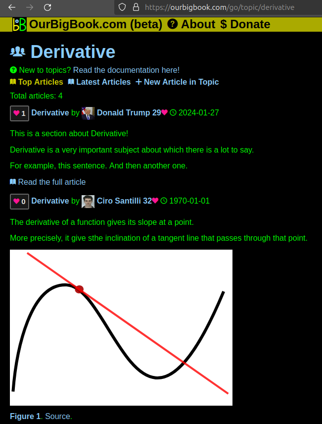
Figure 1. Screenshot of the "Derivative" topic page. View it live at: ourbigbook.com/go/topic/derivativeVideo 2. OurBigBook Web topics demo. Source. - local editing: you can store all your personal knowledge base content locally in a plaintext markup format that can be edited locally and published either:This way you can be sure that even if OurBigBook.com were to go down one day (which we have no plans to do as it is quite cheap to host!), your content will still be perfectly readable as a static site.
- to OurBigBook.com to get awesome multi-user features like topics and likes
- as HTML files to a static website, which you can host yourself for free on many external providers like GitHub Pages, and remain in full control

Figure 2. You can publish local OurBigBook lightweight markup files to either OurBigBook.com or as a static website.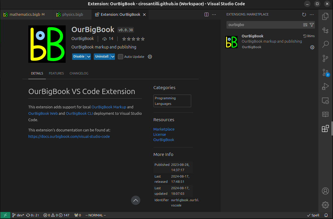
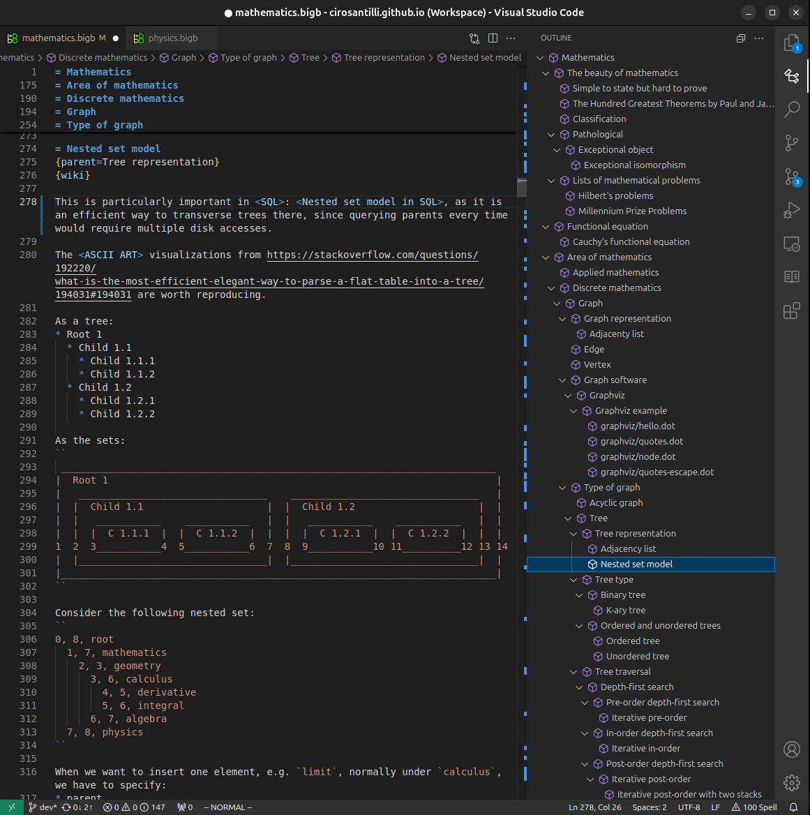
Figure 3. Visual Studio Code extension installation.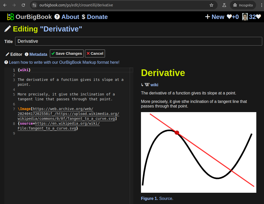
Figure 5. . You can also edit articles on the Web editor without installing anything locally. Video 3. Edit locally and publish demo. Source. This shows editing OurBigBook Markup and publishing it using the Visual Studio Code extension. 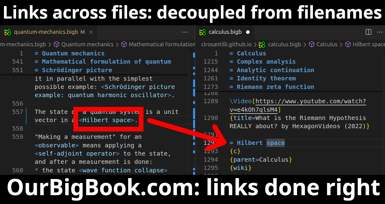
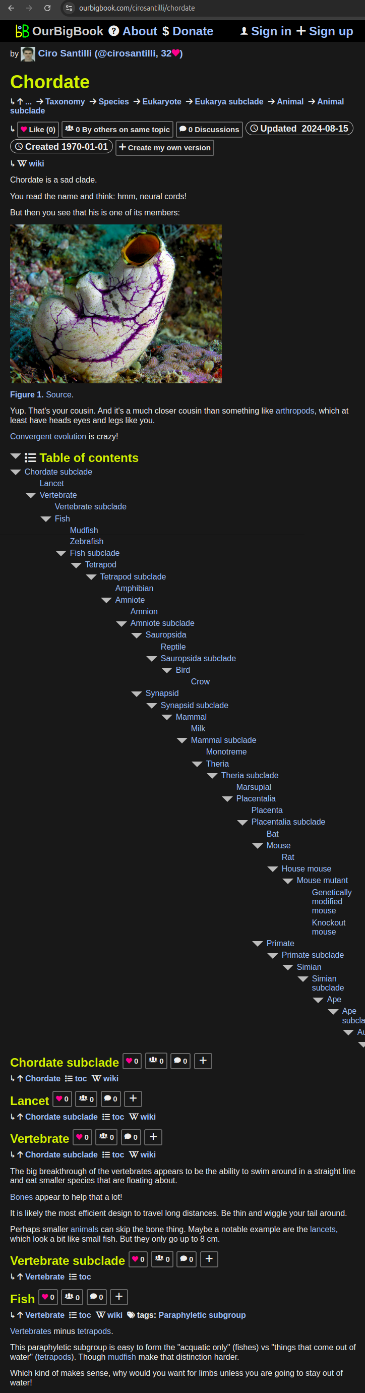
- Infinitely deep tables of contents:
All our software is open source and hosted at: github.com/ourbigbook/ourbigbook
Further documentation can be found at: docs.ourbigbook.com
Feel free to reach our to us for any help or suggestions: docs.ourbigbook.com/#contact