Topics (318k) Articles (329k) Users (387) Discussions (237) Comments (383) Files (10k) New article

Contour currents, also known as contourite currents, are oceanic currents that flow along the contour lines of the seabed, often influenced by the topography of the ocean floor. These currents are typically found on continental slopes and deep-sea regions and play a significant role in redistributing sediments and influencing the geological characteristics of the seafloor.
The continental rise is a submerged landform that marks the transition between the continental shelf and the deep ocean floor. It is typically found beyond the continental slope and consists of a gradual incline formed by sediment deposition from the continental shelf. Here's a more detailed breakdown of its features: 1. **Location**: The continental rise is located at the base of the continental slope, where the steep descent of the slope ends and the seafloor gradually flattens, leading into the abyssal plain.
The Cobb–Eickelberg Seamount chain is an underwater volcanic mountain range located in the Pacific Ocean, off the coast of the northwestern United States, particularly near the state of Washington. This seamount chain is part of the larger system of seamounts and volcanic features that are associated with hotspot volcanic activity, which occurs as tectonic plates move over stationary magma plumes in the Earth's mantle.
The Coastal Zone Color Scanner (CZCS) was an Earth-observing satellite instrument developed for the purpose of monitoring and measuring ocean color, which reflects the concentration of phytoplankton, suspended sediments, and dissolved organic materials in coastal waters. Launched on the Nimbus-7 satellite by NASA in 1978, the CZCS was one of the first instruments specifically designed to quantify the optical properties of the ocean.
The Club of Rome is a global think tank and organization established in 1968 that focuses on critical global issues, particularly those related to economic development, environmental sustainability, and social challenges. Founded by a group of international scientists, policymakers, and business leaders, the Club aims to promote a broader understanding of the complexities of global challenges and the interdependence of social, economic, and ecological systems.
Climate inertia refers to the delayed response of the climate system to changes in greenhouse gas concentrations and other influencing factors. This concept highlights that even after mitigating emissions or making changes to reduce anthropogenic impacts, the climate may continue to exhibit significant effects due to pre-existing conditions and processes. There are a few key aspects to understand about climate inertia: 1. **Thermal Inertia**: The oceans, which absorb a significant amount of heat, have a high thermal inertia.
The Central Basin Spreading Center (CBSC) is a geologically significant feature located in the Pacific Ocean, specifically in the central part of the basin of the East Pacific Rise. It is a segment of the mid-ocean ridge system where tectonic plates are diverging, allowing magma to rise from the mantle and create new oceanic crust as it cools.
As of my last knowledge update in October 2023, there is no widely recognized organization specifically named "Centers for Space Oceanography.
The Carbonate Compensation Depth (CCD) is the ocean depth at which the rate of carbonate accumulation equals the rate of carbonate dissolution. Below this depth, the conditions in the ocean become more acidic due to an increase in the partial pressure of carbon dioxide (pCO2), which leads to the dissolution of calcium carbonate (CaCO3) materials such as shells and sediments.
The term "Canfield Ocean" refers to a prehistoric ocean that existed during the late Proterozoic era, specifically around 800 to 600 million years ago. It is named after the geologist Edward Canfield, who proposed the hypothesis based on studies of sedimentary rocks and geochemical evidence. The Canfield Ocean is significant because it represents a time in Earth's history when the ocean was characterized by low levels of oxygen, leading to unique anoxic conditions that affected biological and chemical processes.
Cache Creek Ocean does not appear to be a widely recognized term or concept in publicly available information as of my last knowledge update in October 2023. It's possible that it could refer to a specific location, project, or concept that is either niche or emerging. If you are referring to a specific ecological area, project, or possibly a metaphorical concept, please provide more context or details.
A cabled observatory refers to a type of underwater scientific research facility that is permanently connected to the surface or to a support vessel via cable systems. These observatories are designed to monitor and study various oceanographic, geological, and biological processes in real-time. The cables typically provide power, data transmission, and communication capabilities, allowing for continuous operation of sensors and instruments over extended periods without the need for frequent maintenance or retrieval.
Cabbeling is a process in oceanography that refers to the mixing of two bodies of water with different temperatures and salinities, resulting in a decrease in density. When these waters mix, the combined water mass can become denser than either of the original water masses, even if they have lower temperature or salinity. This phenomenon is especially significant in the study of thermohaline circulation and other ocean dynamics.
CSIRO Oceans and Atmosphere is a research division of the Commonwealth Scientific and Industrial Research Organisation (CSIRO), Australia’s national science agency. This division focuses on understanding and managing the oceans, atmosphere, and climatic systems. Its primary goals include studying marine ecosystems, climate change impacts, ocean circulation, and atmospheric processes.
CLIWOC stands for "Climate of the World Ocean." It is a project that aims to gather, preserve, and analyze historical weather data from ship logs dating back to the 18th and 19th centuries. The primary goal of CLIWOC is to improve our understanding of historical climate variability and change by providing access to previously underutilized weather observations recorded by sailors during their voyages.
The Bureau of Oceans and International Environmental and Scientific Affairs (OES) is a division of the U.S. Department of State. Its primary focus is to address global challenges related to oceans, the environment, and scientific issues. The bureau plays a crucial role in promoting U.S. interests in these areas by engaging in international negotiations, developing policies, and collaborating with other countries and international organizations.
The British Oceanographic Data Centre (BODC) is an organization that specializes in the management and dissemination of oceanographic data. Established in 1969 and based in Liverpool, England, BODC serves as the UK's national data center for oceanographic data and is part of the Natural Environment Research Council (NERC).
The British Mid-Ocean Ridge Initiative is a collaborative scientific program aimed at studying and understanding the complex geological and biological systems of mid-ocean ridges. Mid-ocean ridges are underwater mountain ranges formed by tectonic plate movements, and they play a crucial role in plate tectonics and the overall health of the Earth's oceans. The initiative typically involves researchers from various institutions and countries, focusing on aspects such as geology, biology, biogeochemistry, and the ecosystem dynamics of these unique environments.
The British Columbia Shore Station Oceanographic Program (BCSSOP) is a research initiative focused on monitoring and studying the oceanographic conditions along the coast of British Columbia, Canada. Established to enhance understanding of marine ecosystems and their responses to environmental changes, the program collects data on various oceanographic variables, including temperature, salinity, currents, and biological productivity. The BCSSOP typically involves a network of shore-based monitoring stations that provide continuous or periodic data collection.
Bottom water refers to the colder, denser water that resides at the bottom of a body of water, such as an ocean, sea, or lake. This water is generally characterized by its lower temperature and higher salinity compared to surface water. In oceanography, the term is often used to describe water that is found in deep ocean basins, particularly in the context of thermohaline circulation, where differences in temperature and salinity drive water movement.
Pinned article: Introduction to the OurBigBook Project
Welcome to the OurBigBook Project! Our goal is to create the perfect publishing platform for STEM subjects, and get university-level students to write the best free STEM tutorials ever.
Everyone is welcome to create an account and play with the site: ourbigbook.com/go/register. We belive that students themselves can write amazing tutorials, but teachers are welcome too. You can write about anything you want, it doesn't have to be STEM or even educational. Silly test content is very welcome and you won't be penalized in any way. Just keep it legal!
Intro to OurBigBook
. Source. We have two killer features:
- topics: topics group articles by different users with the same title, e.g. here is the topic for the "Fundamental Theorem of Calculus" ourbigbook.com/go/topic/fundamental-theorem-of-calculusArticles of different users are sorted by upvote within each article page. This feature is a bit like:
- a Wikipedia where each user can have their own version of each article
- a Q&A website like Stack Overflow, where multiple people can give their views on a given topic, and the best ones are sorted by upvote. Except you don't need to wait for someone to ask first, and any topic goes, no matter how narrow or broad
This feature makes it possible for readers to find better explanations of any topic created by other writers. And it allows writers to create an explanation in a place that readers might actually find it.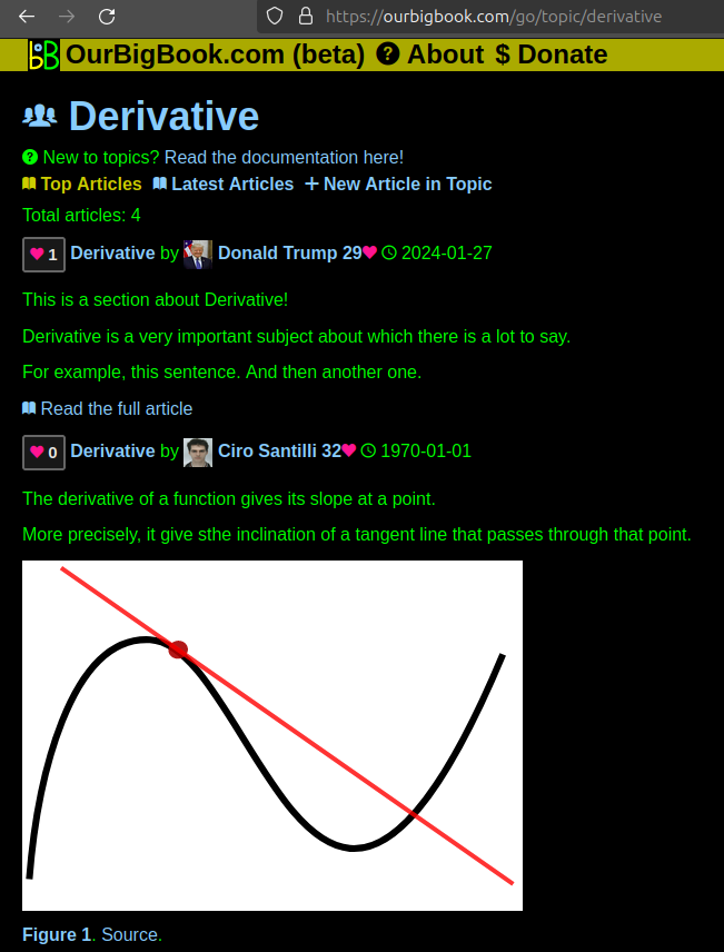
Figure 1. Screenshot of the "Derivative" topic page. View it live at: ourbigbook.com/go/topic/derivativeVideo 2. OurBigBook Web topics demo. Source. - local editing: you can store all your personal knowledge base content locally in a plaintext markup format that can be edited locally and published either:This way you can be sure that even if OurBigBook.com were to go down one day (which we have no plans to do as it is quite cheap to host!), your content will still be perfectly readable as a static site.
- to OurBigBook.com to get awesome multi-user features like topics and likes
- as HTML files to a static website, which you can host yourself for free on many external providers like GitHub Pages, and remain in full control

Figure 2. You can publish local OurBigBook lightweight markup files to either OurBigBook.com or as a static website.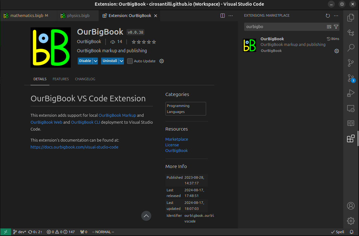
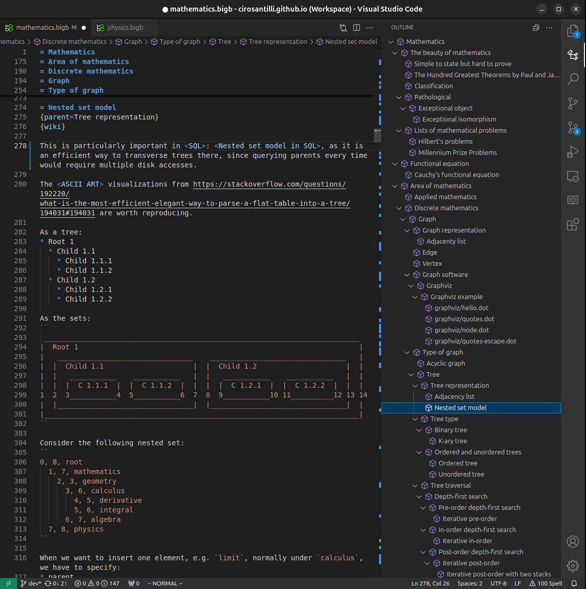
Figure 3. Visual Studio Code extension installation.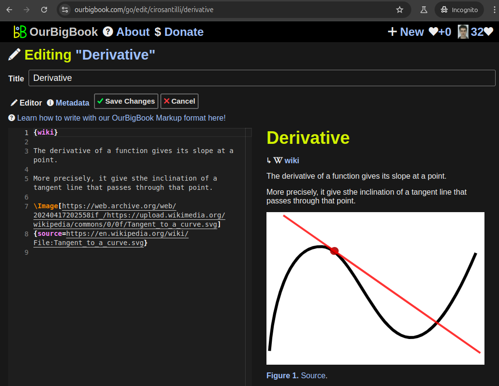
Figure 5. . You can also edit articles on the Web editor without installing anything locally. Video 3. Edit locally and publish demo. Source. This shows editing OurBigBook Markup and publishing it using the Visual Studio Code extension. 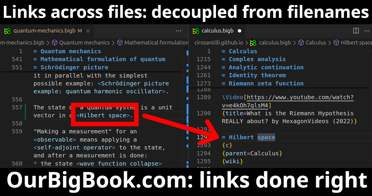
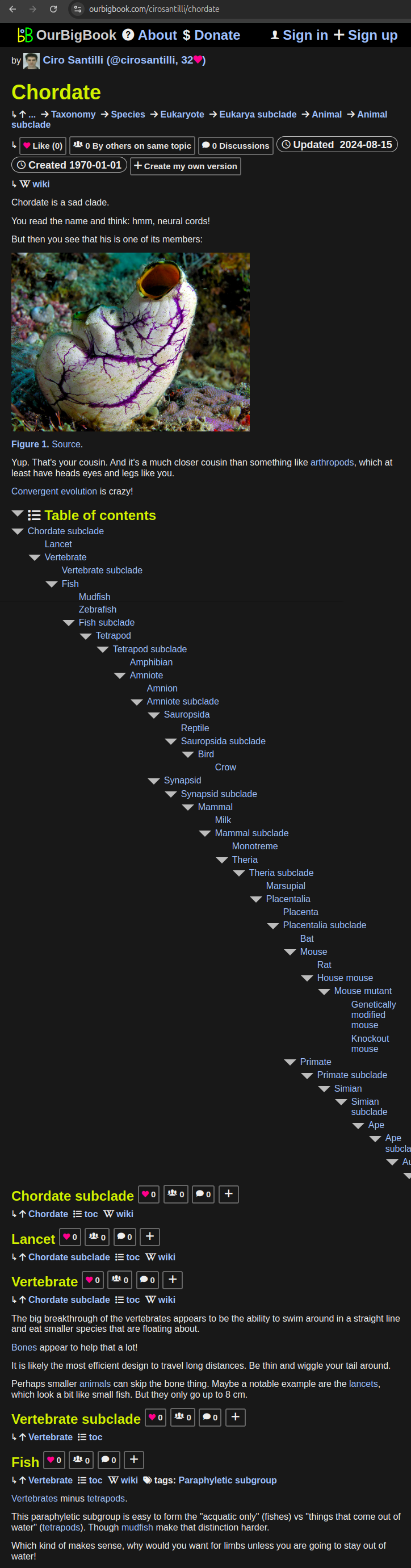
- Infinitely deep tables of contents:
All our software is open source and hosted at: github.com/ourbigbook/ourbigbook
Further documentation can be found at: docs.ourbigbook.com
Feel free to reach our to us for any help or suggestions: docs.ourbigbook.com/#contact