Topics (349k) Articles (361k) Users (402) Discussions (237) Comments (383) Files (12k) New article

The term "apparent place" can refer to different concepts depending on the context, particularly in astronomy and navigation. Here are a couple of interpretations: 1. **Astronomy**: In celestial mechanics, the "apparent place" of a celestial body is its position as observed from Earth, taking into account the effects of atmospheric refraction and other observational factors. This is in contrast to the "true place," which refers to the actual position of the celestial body in space without those distortions.
The annual cycle of sea level height refers to the seasonal fluctuations in sea level that occur due to a variety of factors, including temperature, precipitation, and wind patterns. Here are some key components that contribute to this cycle: 1. **Thermal Expansion**: Sea water expands as it warms. During warmer months, typically around summer in each hemisphere, sea surface temperatures rise, leading to thermal expansion and a slight increase in sea level.
Angular eccentricity, often used in the context of conic sections, refers to a measure of how much an orbit deviates from being circular. In the case of an ellipse, the eccentricity (denoted as \( e \)) is defined mathematically as the ratio of the distance between the foci of the ellipse to the length of its major axis.
3D scanning is a technology that captures the physical dimensions and appearance of a real-world object or environment and converts it into a digital 3D model. This process involves using various techniques and devices to gather data about the shape, size, and texture of the object being scanned.
Surveying instruments are tools and devices used by surveyors and engineers to measure distances, angles, and elevations, as well as to map and analyze land and structures. These instruments are crucial for establishing precise measurements to ensure accuracy in construction, land development, and various types of civil engineering projects. Here are some common types of surveying instruments: 1. **Theodolite**: A precision instrument for measuring horizontal and vertical angles.
Surveying and geodesy are both essential fields in mapping and understanding the Earth's surface, and they rely heavily on markers for precision and accuracy. ### Surveying Surveying is the science and art of determining the relative positions of points on the Earth's surface. It involves measuring distances, angles, and elevations to create maps, establish land boundaries, and set out construction projects.
The Struve Geodetic Arc is a significant historical geodetic survey that was conducted in the 19th century, primarily to measure a degree of the meridian arc (the measurement of the Earth's curvature) across several countries in Eastern Europe and Scandinavia. The arc stretches approximately 2,820 kilometers (about 1,750 miles) from Hammerfest in Norway to the Black Sea port of Sulina in Romania.
In geography, meridians are imaginary lines that run from the North Pole to the South Pole, forming a grid on the Earth's surface. They are part of a coordinate system used to specify locations in terms of longitude. Each meridian is defined by its longitude, which is measured in degrees east or west of the Prime Meridian, which is at 0 degrees longitude and runs through Greenwich, England.
The concept of Hollow Earth refers to a theoretical idea that suggests the Earth is entirely or largely hollow and may contain subterranean civilizations or vast internal spaces. Historical beliefs about Hollow Earth varied, with some ancient cultures proposing that the Earth had internal cavities or tunnels.
The Global Positioning System (GPS) is a satellite-based navigation system that allows users to determine their exact location (latitude, longitude, and altitude) anywhere on Earth, at any time, and under any weather conditions. It was developed by the United States Department of Defense and became fully operational in the 1990s. **Key components of GPS include:** 1.
Geographic coordinate systems (GCS) are systems used to identify locations on the Earth's surface using a coordinate system. These systems express the position of a point as a set of numerical coordinates, typically in the form of latitude and longitude. Each point on the Earth's surface can be described using these coordinates, which represent angular measurements: 1. **Latitude**: This measures how far north or south a point is from the Equator.
Geodetic surveys are a type of surveying that focuses on measuring large areas of the Earth's surface, taking into account the curvature of the Earth. Unlike traditional land surveys, which often deal with small plots of land, geodetic surveys are designed to gather precise measurements over extensive distances. Key aspects of geodetic surveys include: 1. **Earth's Shape**: The Earth is not a perfect sphere; its shape is more accurately described as an oblate spheroid.
Geodetic satellites are specialized satellites used in the field of geodesy, which is the science of measuring and understanding the Earth's geometric shape, orientation in space, and gravitational field. These satellites play a crucial role in the precise measurement and monitoring of various geophysical phenomena, including plate tectonics, sea level rise, and Earth’s crust movements.
Geodetic datums are reference frameworks used to measure the geographic coordinates (latitude, longitude, and elevation) of points on the Earth's surface. They provide a standard way to relate the positions of features on the Earth to a specific coordinate system and enable accurate mapping, navigation, and geographic information systems (GIS). ### Key Components of Geodetic Datums: 1. **Reference Ellipsoid**: This is a mathematically defined surface that approximates the shape of the Earth.
Geodesy organizations are institutions or associations dedicated to the study and application of geodesy, which is the science of measuring and understanding the Earth's geometric shape, orientation in space, and gravity field. These organizations often focus on various aspects such as satellite positioning, GPS technology, mapping, and earth observation. Geodesy organizations can vary widely in their scope and activities.
Geodesists are professionals who specialize in geodesy, which is the science of measuring and understanding the Earth's geometric shape, orientation in space, gravitational field, and how these properties change over time. Geodesists use various techniques and technologies, including satellite positioning systems (such as GPS), traditional surveying methods, and remote sensing, to acquire precise measurements related to the Earth's surface and its dynamics.
Frames of reference are the conceptual structures or systems used to measure and describe the position, motion, and dynamics of objects. These frames can be thought of as coordinate systems or perspectives from which observations are made and laws of physics are applied. In physics, a frame of reference typically includes: 1. **Reference Point**: A specific location or position used as a baseline for measuring the position or motion of other objects. 2. **Coordinate System**: A way to represent the spatial dimensions (e.
Pinned article: Introduction to the OurBigBook Project
Welcome to the OurBigBook Project! Our goal is to create the perfect publishing platform for STEM subjects, and get university-level students to write the best free STEM tutorials ever.
Everyone is welcome to create an account and play with the site: ourbigbook.com/go/register. We belive that students themselves can write amazing tutorials, but teachers are welcome too. You can write about anything you want, it doesn't have to be STEM or even educational. Silly test content is very welcome and you won't be penalized in any way. Just keep it legal!
Intro to OurBigBook
. Source. We have two killer features:
- topics: topics group articles by different users with the same title, e.g. here is the topic for the "Fundamental Theorem of Calculus" ourbigbook.com/go/topic/fundamental-theorem-of-calculusArticles of different users are sorted by upvote within each article page. This feature is a bit like:
- a Wikipedia where each user can have their own version of each article
- a Q&A website like Stack Overflow, where multiple people can give their views on a given topic, and the best ones are sorted by upvote. Except you don't need to wait for someone to ask first, and any topic goes, no matter how narrow or broad
This feature makes it possible for readers to find better explanations of any topic created by other writers. And it allows writers to create an explanation in a place that readers might actually find it.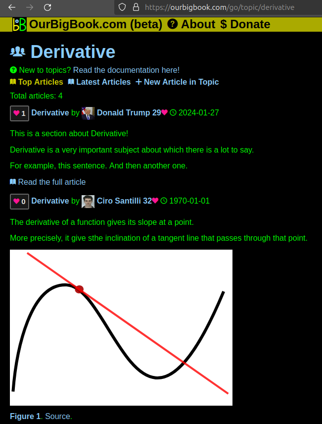
Figure 1. Screenshot of the "Derivative" topic page. View it live at: ourbigbook.com/go/topic/derivativeVideo 2. OurBigBook Web topics demo. Source. - local editing: you can store all your personal knowledge base content locally in a plaintext markup format that can be edited locally and published either:This way you can be sure that even if OurBigBook.com were to go down one day (which we have no plans to do as it is quite cheap to host!), your content will still be perfectly readable as a static site.
- to OurBigBook.com to get awesome multi-user features like topics and likes
- as HTML files to a static website, which you can host yourself for free on many external providers like GitHub Pages, and remain in full control

Figure 2. You can publish local OurBigBook lightweight markup files to either OurBigBook.com or as a static website.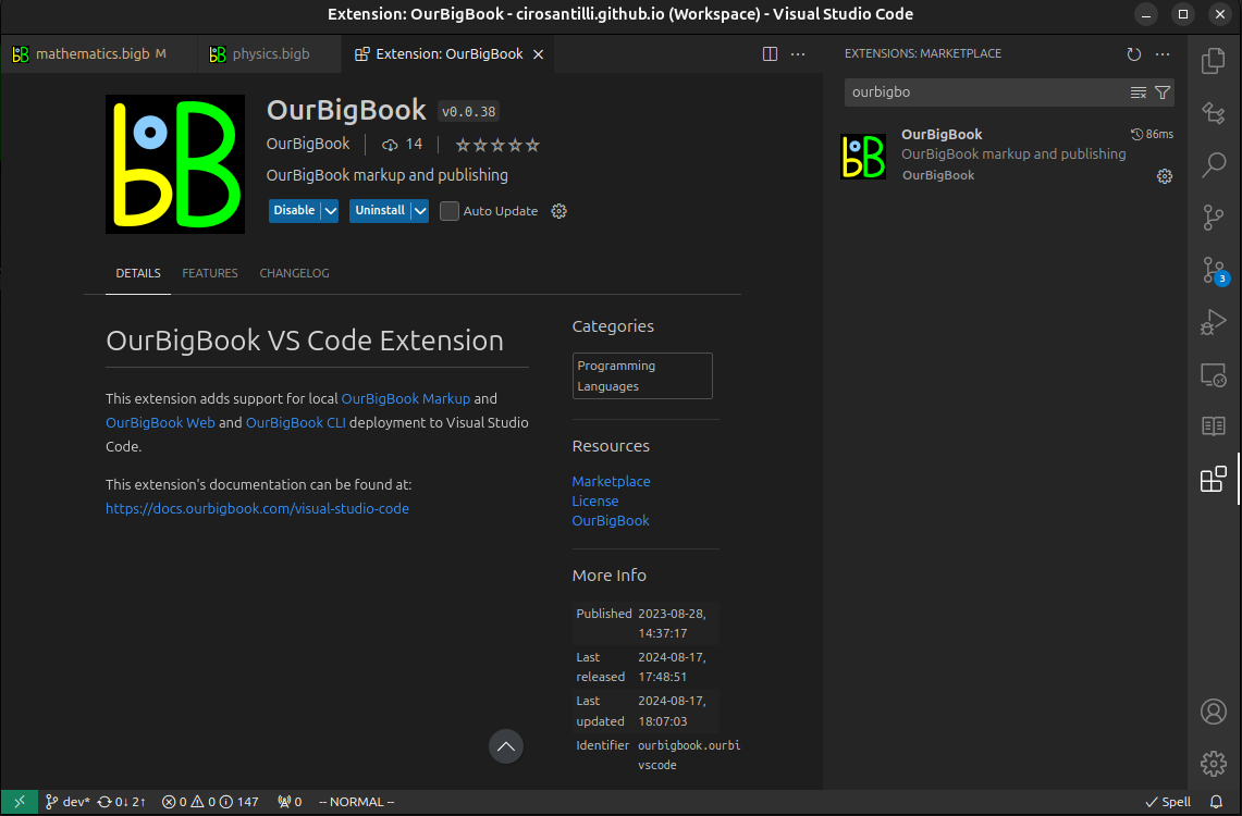
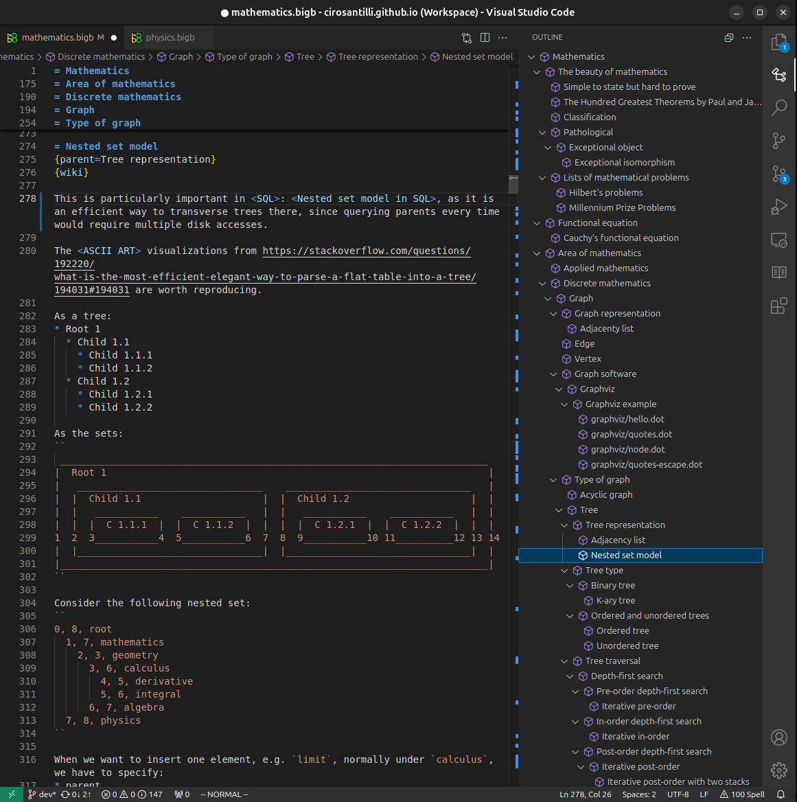
Figure 3. Visual Studio Code extension installation.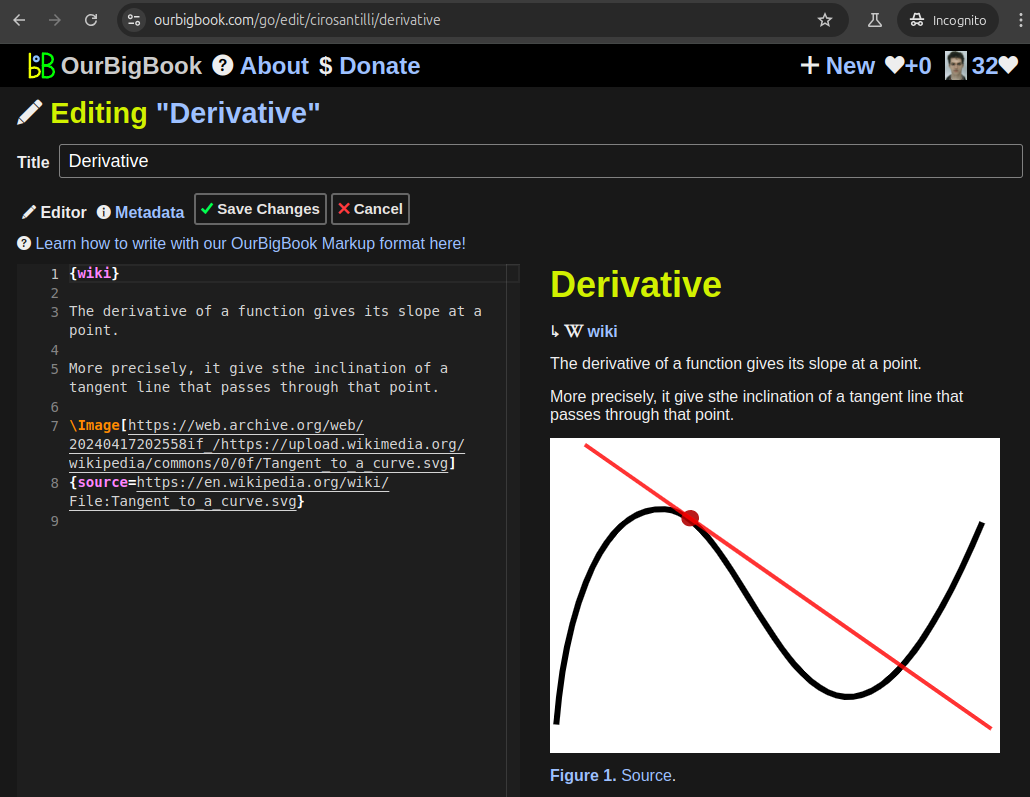
Figure 5. . You can also edit articles on the Web editor without installing anything locally. Video 3. Edit locally and publish demo. Source. This shows editing OurBigBook Markup and publishing it using the Visual Studio Code extension. 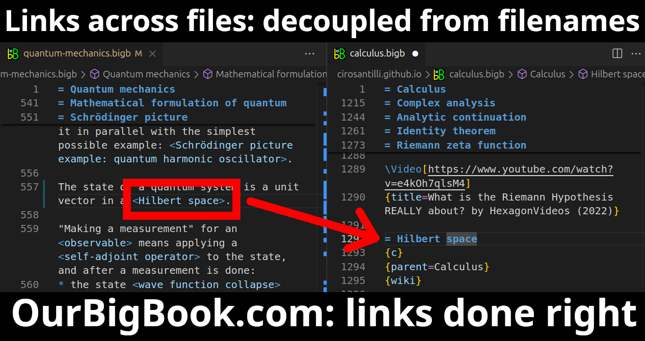
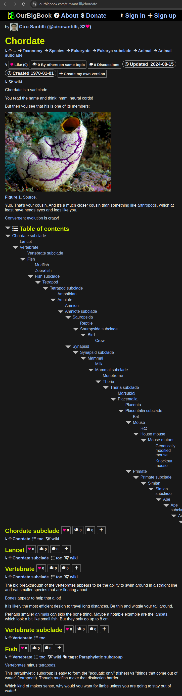
- Infinitely deep tables of contents:
All our software is open source and hosted at: github.com/ourbigbook/ourbigbook
Further documentation can be found at: docs.ourbigbook.com
Feel free to reach our to us for any help or suggestions: docs.ourbigbook.com/#contact