Topics (349k) Articles (361k) Users (400) Discussions (237) Comments (383) Files (12k) New article

The gravity of Earth, often referred to as gravitational acceleration, is the force exerted by Earth's mass that attracts objects towards its center. It is commonly denoted by the symbol \( g \) and has an average value of approximately \( 9.81 \, \text{m/s}^2 \) (meters per second squared) at the surface of the Earth. This means that in the absence of air resistance, an object falling freely towards Earth will accelerate at this rate.
Gravity gradiometry is a measurement technique used to detect and quantify variations in the gravitational field of the Earth or other celestial bodies. It does this by measuring the gradient or change in gravitational acceleration over a specific distance, rather than measuring gravitational acceleration at a single point. ### Key Concepts: 1. **Gravity Gradient**: The gravitational field is not uniform; it varies with location due to differences in geological structures, such as mountains, valleys, and different densities of rocks and sediments.
A gravity anomaly is a measurement of the difference between the observed gravitational field of the Earth at a specific location and the expected gravitational field, which is typically calculated based on a model of the Earth's shape and mass distribution. Gravity anomalies can provide valuable insights into geological structures and variations in subsurface density. They are instrumental in fields like geophysics, geology, and natural resource exploration.
The gravitational force of the Moon is significantly weaker than that of the Earth due to its smaller mass. The Moon's gravitational acceleration is approximately \(1.625 \, \text{m/s}^2\), which is about one-sixth that of Earth's gravitational acceleration (approximately \(9.81 \, \text{m/s}^2\)). This difference in gravitational pull is why objects on the Moon weigh much less than they do on Earth.
Gravimetry is a scientific technique used to measure the gravitational force or gravitational field strength of an object or location. It is based on the principle that the gravitational attraction of a body is dependent on its mass and distance from other masses. Gravimetry is widely applied in various fields, including geophysics, geology, environmental studies, and resource exploration. The primary objective of gravimetry is to determine variations in the gravitational field caused by changes in the distribution of mass under the Earth's surface.
Geopositioning refers to the process of determining the geographical position of an object or person in relation to the Earth’s surface. This can involve using various technologies and methods to pinpoint the coordinates (latitude, longitude, and sometimes altitude) of a particular location. Geopositioning is widely used in fields such as navigation, mapping, spatial analysis, environmental monitoring, and personal location services.
Geomatics is an interdisciplinary field that combines various techniques and technologies for collecting, analyzing, managing, and interpreting spatial and geographic data. It integrates elements from geography, surveying, cartography, remote sensing, geographic information systems (GIS), and global positioning systems (GPS). Key components of geomatics include: 1. **Surveying**: The process of measuring distances, angles, and elevations to determine the relative position of points on the Earth's surface.
The geoid is an equipotential surface that represents the mean sea level of the Earth's oceans, extended under the continents. It is a crucial concept in geophysics and is used to understand Earth's shape and gravity field. Unlike a geometric shape, such as a sphere or an ellipsoid, the geoid is an irregular surface resulting from variations in gravitational pull caused by factors like the distribution of mass within the Earth and the topography of the land and ocean floors.
The term "geographical pole" refers to the two points on the Earth's surface where its axis of rotation intersects the surface. These points are known as the North Pole and the South Pole. 1. **North Pole**: Located at 90 degrees north latitude, the North Pole is the northernmost point on Earth. It lies in the Arctic Ocean and is covered by sea ice for much of the year.
Geographical distance refers to the physical space between two points on Earth's surface. It is usually measured in units such as kilometers or miles. Geographical distance can be calculated using a variety of methods, including: 1. **Euclidean Distance**: This method measures the shortest straight-line distance between two points, often used in a Cartesian coordinate system.
A Geographic Coordinate System (GCS) is a system used to determine the position of a point on the Earth's surface using a coordinate system that is based on the Earth's shape. It provides a spatial reference framework by specifying the location of a point in terms of its latitude and longitude. ### Key Components of a Geographic Coordinate System: 1. **Latitude**: This measures how far north or south a point is from the equator, which is designated as 0° latitude.
Geographic coordinate conversion refers to the process of transforming coordinates from one geographic coordinate system to another. Geographic coordinates describe a point's location on the Earth's surface, typically in terms of latitude and longitude. However, these coordinates can be represented in different systems, formats, or projections, and conversion may be necessary for various applications, such as mapping, navigation, or geographic information systems (GIS).
Geodynamics is the branch of geoscience that studies the processes and forces that shape the Earth's structure and behavior over geological timescales. It focuses on understanding the dynamics of the Earth's interior, including the movement of tectonic plates, the behavior of mantle convection, and the mechanisms of earthquakes and volcanic activity.
Geodetic coordinates refer to a system of geographical coordinates that define a specific point on the Earth's surface. These coordinates are typically described using three dimensions: latitude, longitude, and elevation (or altitude). 1. **Latitude**: This measures the distance north or south of the Equator. It is expressed in degrees, ranging from 0° at the Equator to 90° at the poles (North or South).
Geodetic astronomy is a branch of astronomy that involves the measurement of astronomical positions and their application to geodesy, which is the science concerned with the size and shape of the Earth, as well as its gravitational field. The primary objective of geodetic astronomy is to determine precise locations on the Earth’s surface in relation to celestial bodies, and to improve the understanding of the Earth's shape, dimensions, and orientation in space.
The Geodetic Reference System 1980 (GRS80) is a geodetic reference system that defines the shape and size of the Earth and serves as the basis for creating the reference frame associated with the Global Positioning System (GPS) and other geospatial applications. It was established in 1980 as an update to earlier geodetic systems.
As of my last knowledge update in October 2023, "Geodat" can refer to various concepts or companies related to geospatial data, geographical information systems (GIS), or data management concerning geography. However, without specific context, it may also refer to a software application, a dataset, or a business related to geographic data analysis.
The General Levelling of France, known as "Nivellement Général de la France," is a comprehensive geodetic survey that was completed in the 19th century. Its main purpose was to precisely determine the elevation of various points across France in relation to a fixed reference point, primarily to understand the topography of the country better and to aid in engineering and construction projects. The project began in 1792 and continued under various administrations until the mid-19th century.
A Gaussian grid is a type of numerical grid used in various fields, especially in computational physics and chemistry, for the representation of functions and the numerical integration of equations. It is particularly useful for multi-dimensional integration and for solving partial differential equations in a compact and efficient manner. The defining characteristic of a Gaussian grid is that the points are distributed according to a Gaussian weight function.
Pinned article: Introduction to the OurBigBook Project
Welcome to the OurBigBook Project! Our goal is to create the perfect publishing platform for STEM subjects, and get university-level students to write the best free STEM tutorials ever.
Everyone is welcome to create an account and play with the site: ourbigbook.com/go/register. We belive that students themselves can write amazing tutorials, but teachers are welcome too. You can write about anything you want, it doesn't have to be STEM or even educational. Silly test content is very welcome and you won't be penalized in any way. Just keep it legal!
Intro to OurBigBook
. Source. We have two killer features:
- topics: topics group articles by different users with the same title, e.g. here is the topic for the "Fundamental Theorem of Calculus" ourbigbook.com/go/topic/fundamental-theorem-of-calculusArticles of different users are sorted by upvote within each article page. This feature is a bit like:
- a Wikipedia where each user can have their own version of each article
- a Q&A website like Stack Overflow, where multiple people can give their views on a given topic, and the best ones are sorted by upvote. Except you don't need to wait for someone to ask first, and any topic goes, no matter how narrow or broad
This feature makes it possible for readers to find better explanations of any topic created by other writers. And it allows writers to create an explanation in a place that readers might actually find it.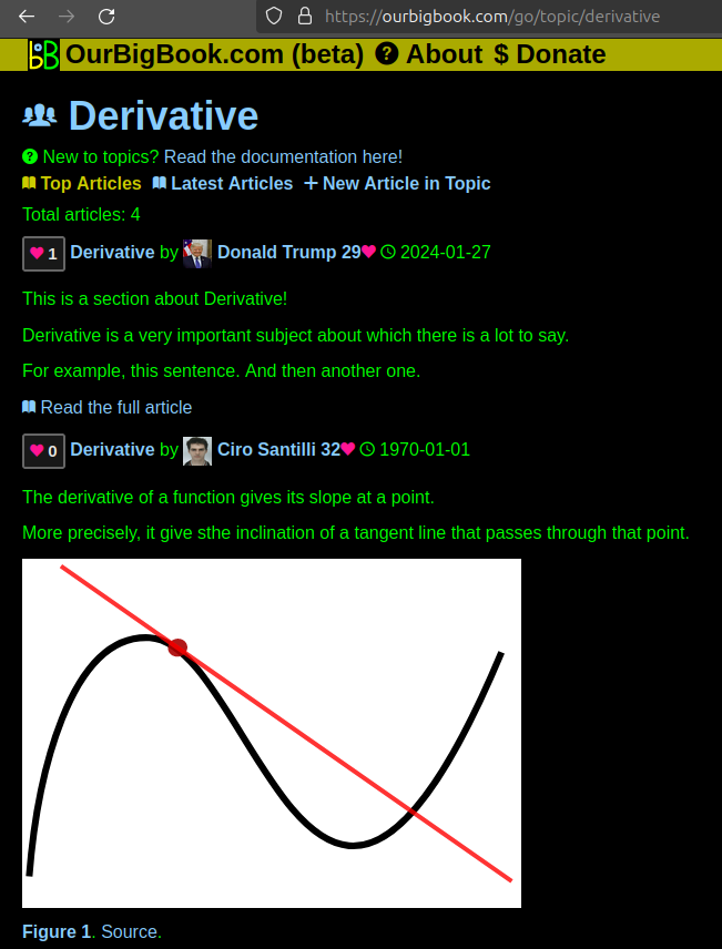
Figure 1. Screenshot of the "Derivative" topic page. View it live at: ourbigbook.com/go/topic/derivativeVideo 2. OurBigBook Web topics demo. Source. - local editing: you can store all your personal knowledge base content locally in a plaintext markup format that can be edited locally and published either:This way you can be sure that even if OurBigBook.com were to go down one day (which we have no plans to do as it is quite cheap to host!), your content will still be perfectly readable as a static site.
- to OurBigBook.com to get awesome multi-user features like topics and likes
- as HTML files to a static website, which you can host yourself for free on many external providers like GitHub Pages, and remain in full control

Figure 2. You can publish local OurBigBook lightweight markup files to either OurBigBook.com or as a static website.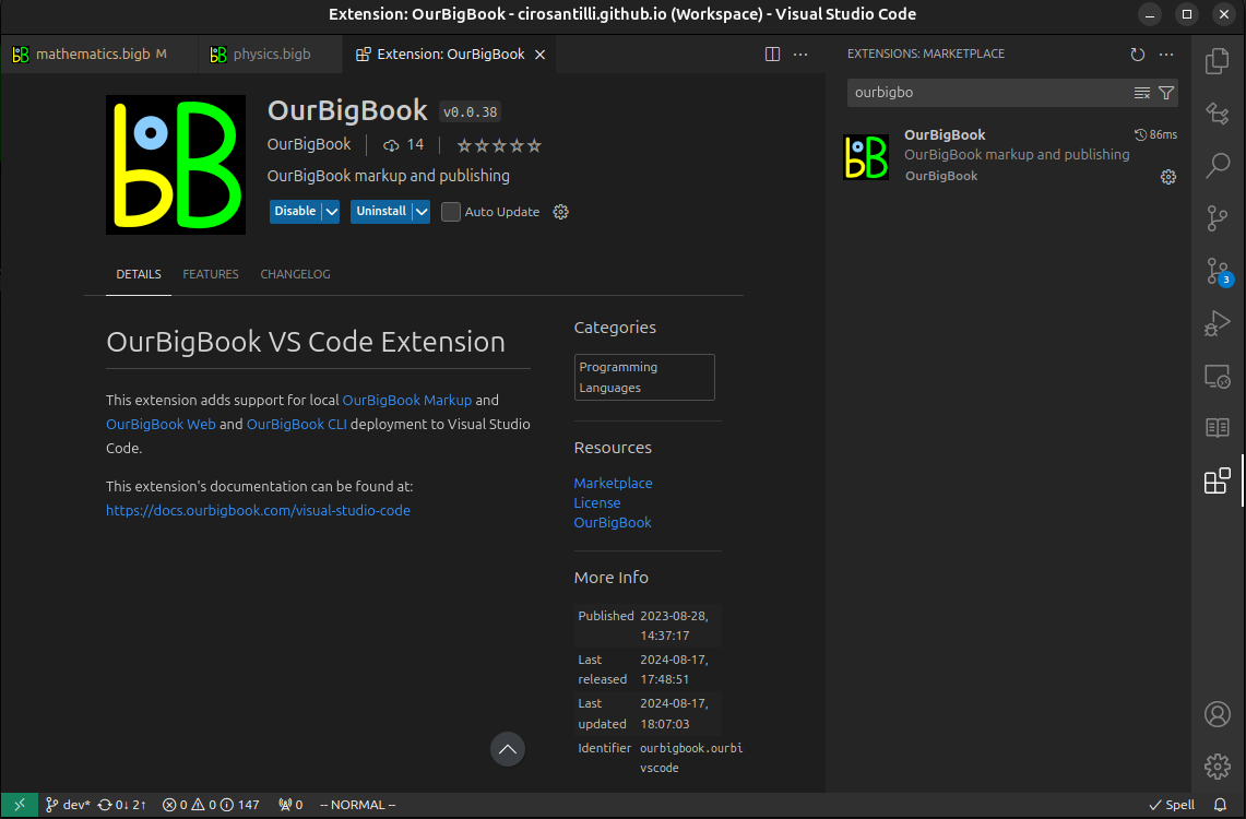
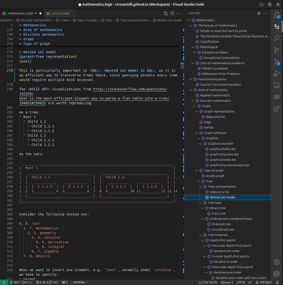
Figure 3. Visual Studio Code extension installation.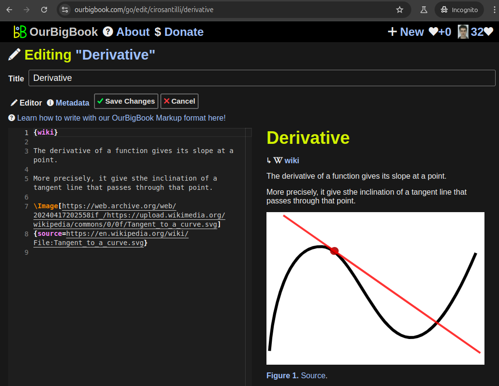
Figure 5. . You can also edit articles on the Web editor without installing anything locally. Video 3. Edit locally and publish demo. Source. This shows editing OurBigBook Markup and publishing it using the Visual Studio Code extension. 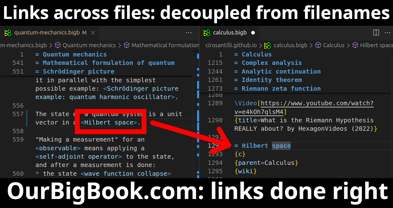
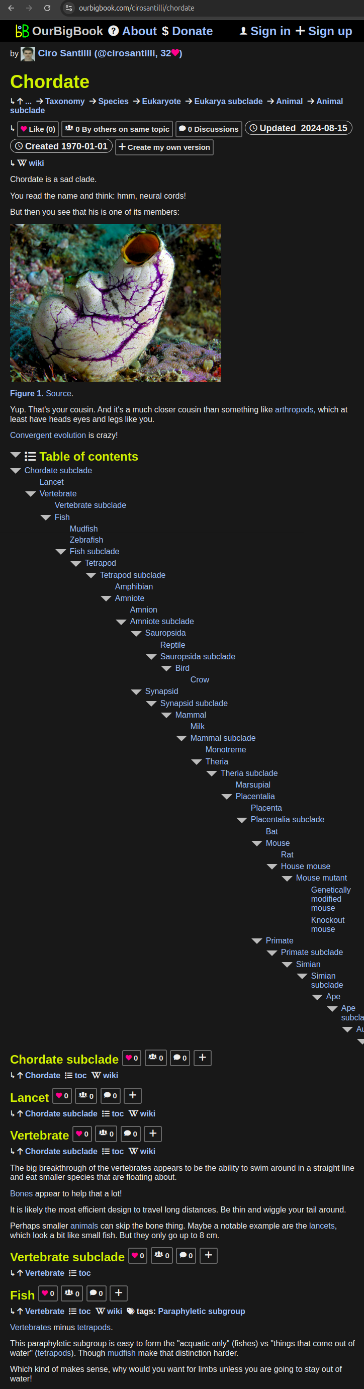
- Infinitely deep tables of contents:
All our software is open source and hosted at: github.com/ourbigbook/ourbigbook
Further documentation can be found at: docs.ourbigbook.com
Feel free to reach our to us for any help or suggestions: docs.ourbigbook.com/#contact