Topics (318k) Articles (329k) Users (396) Discussions (237) Comments (383) Files (10k) New article

The continental shelf is a submerged extension of a continent, characterized by shallow waters surrounding the coast. It generally extends from the shoreline to the continental slope, where the seabed drops off to deeper oceanic depths. The continental shelf typically has a gentle slope and is rich in marine resources, including fish, oil, gas, and minerals.
Conservative temperature is a thermodynamic property used in oceanography and marine sciences to quantify the thermal state of seawater while accounting for the effects of pressure and salinity. Unlike traditional temperature measurements, which typically reflect the specific energy content of water, conservative temperature provides a measure that is more related to the potential temperature available to the water when it is brought to the surface under the same pressure conditions.
A cold core ring is a type of oceanic eddy characterized by its cold, dense water at its center, which is surrounded by warmer water. These features typically form in oceanic regions, often in response to the dynamics of ocean currents and temperature gradients. Cold core rings are commonly associated with the North Atlantic Ocean, particularly near the Gulf Stream, where they can separate from the main current and become isolated entities that drift in the surrounding waters.
Coastal upwelling in the South Eastern Arabian Sea is a phenomenon characterized by the rising of deeper, colder, and nutrient-rich water to the surface along the coast. This process is driven primarily by wind patterns and ocean currents. Here's a more detailed explanation of the dynamics and significance of this phenomenon: ### Mechanism of Upwelling 1. **Wind Patterns**: The South Eastern Arabian Sea is affected by the monsoon winds, particularly during the southwest monsoon season (June to September).
Coastal morphodynamics is the study of the processes and interactions that shape coastal landforms and environments over time. It combines aspects of geology, oceanography, sedimentology, and environmental science to understand how various factors influence coastal landscapes, including waves, tides, currents, and human activities. Key elements of coastal morphodynamics include: 1. **Sediment Transport**: The movement of sediments along the coast due to wave action, currents, and wind.
A chemocline is a layer in a body of water where there is a rapid change in chemical properties, particularly the concentration of substances such as nutrients, dissolved oxygen, or salinity. This concept is often associated with the vertical structure of lakes or oceans. In aquatic systems, the chemocline typically separates different water masses, often correlating with other physical gradients, such as temperature (thermocline) or salinity (halocline).
Boundary currents are ocean currents that flow along the edges of ocean basins, typically along continental margins. They are generally influenced by factors such as the Earth's rotation (Coriolis effect), wind patterns, temperature and salinity gradients, and the shape of the coastline. There are two main types of boundary currents: 1. **Western Boundary Currents**: These currents flow along the western edges of ocean basins and are typically characterized by being warm, fast, and narrow.
The Black Sea undersea river is a unique underwater feature located in the Black Sea that is characterized by the presence of a submerged river system. It was first discovered in the late 1990s and is notable for its distinct characteristics, including a significant flow of freshwater and sediment being transported on the seabed, resembling a river. This underwater river is formed by dense, cold water that flows along the seafloor, creating a river-like channel as it moves.
Bioturbation refers to the process by which organisms rework and disturb sediment or soil through their activities. This phenomenon is commonly observed in various environments, particularly in marine and terrestrial ecosystems. In marine environments, organisms such as burrowing worms, crustaceans, and mollusks disturb the seafloor, altering sediment structure and composition. In terrestrial ecosystems, earthworms, insects, and other organisms mix and aerate soil, which can enhance nutrient cycling and influence plant growth.
Biogeography is the study of the geographic distribution of living organisms, both plants and animals, across different regions of the world and the factors that influence these distributions. It combines aspects of biology, ecology, geography, and geology to understand how species and ecosystems are distributed in space and time. Key aspects of biogeography include: 1. **Species Distribution**: Understanding where different species are found and the ecological and evolutionary reasons behind these patterns.
The Bermuda Atlantic Time-series Study (BATS) is a long-term oceanographic research program that has been monitoring the physical, chemical, and biological properties of the ocean in the Sargasso Sea, located in the North Atlantic Ocean, near Bermuda. The study began in 1988 and aims to provide valuable insights into ocean circulation, climatic variability, and marine ecosystems.
A barrier island is a coastal landform that is typically a narrow strip of land situated parallel to the mainland coast, separated from it by a lagoon, bay, or estuary. These islands serve several important ecological and protective functions: 1. **Protection**: Barrier islands act as a buffer against storm surges and high waves, protecting the mainland from coastal erosion and flooding during severe weather events, such as hurricanes.
Baroclinic instability is a phenomenon in ocean and atmospheric dynamics that occurs due to the interaction between density variations and the shear of velocity in different layers of fluid. In the ocean, baroclinic conditions exist when there is a vertical density gradient, typically due to temperature (thermocline) and salinity (halocline) differences. This gradient causes the density of seawater to vary with depth, leading to differing pressure fields at different depths.
The Barents Sea Opening refers to a specific event in the context of international relations, particularly related to energy resources in the Arctic region. It often pertains to the exploration and exploitation of oil and gas reserves in the Barents Sea, which is located north of Norway and Russia. In recent years, there has been increasing interest in the Barents Sea due to its potential hydrocarbon resources, especially as melting ice from climate change opens up new areas for exploration.
The Atlantic Equatorial Mode (AEM) is a climate phenomenon that refers to the variability in sea surface temperatures and atmospheric conditions over the equatorial Atlantic Ocean. It plays a significant role in influencing weather patterns and climate variability in the surrounding regions, including North America, South America, and Africa. The AEM is characterized by fluctuations in sea surface temperatures along the equatorial Atlantic, which can affect the strength and position of the trade winds, precipitation patterns, and storm activity in the tropics.
Argo is a global ocean observational program that aims to measure the temperature and salinity of the upper layers of the world's oceans. Launched in the early 2000s, the Argo program utilizes a fleet of autonomous floating devices known as Argo floats. These floats are equipped with sensors and can dive to depths of around 2000 meters (about 6,600 feet) to collect data on ocean properties.
An archipelagic apron is a geological term that refers to a specific type of underwater landform found in archipelagic regions, where a series of islands are grouped closely together. This landform is characterized by a broad, gently sloping area that extends seaward from the islands, often consisting of accumulated sediment, rocks, and organic material.
Antarctic Bottom Water (ABW) is a deep ocean water mass that forms in the Southern Ocean around Antarctica. It is characterized by its cold temperature and high salinity, making it one of the densest water masses in the world's oceans. ABW is formed primarily through processes of sea ice formation and the cooling of surface waters near the Antarctic continent.
The Antarctic Circumpolar Wave (ACW) is a large-scale oceanic and atmospheric phenomenon that circulates around Antarctica in a wave-like manner, influencing the climate and oceanographic conditions in the Southern Ocean. It is characterized by oscillating patterns in sea surface temperature, sea level pressure, and other oceanic and atmospheric variables. The ACW is typically associated with the Antarctic Circumpolar Current (ACC), which flows around Antarctica and is the world's strongest ocean current.
The Angola–Benguela Front, also known as the Angola-Benguela Current or Angola-Benguela Front, is an oceanographic feature in the South Atlantic Ocean off the coast of southwestern Africa. It marks the boundary between the warm, tropical waters of the Angola Current, which flows south along the Angolan coastline, and the cooler, nutrient-rich waters of the Benguela Current, which originates from the Antarctic region and moves northward along the coast of Namibia and South Africa.
Pinned article: Introduction to the OurBigBook Project
Welcome to the OurBigBook Project! Our goal is to create the perfect publishing platform for STEM subjects, and get university-level students to write the best free STEM tutorials ever.
Everyone is welcome to create an account and play with the site: ourbigbook.com/go/register. We belive that students themselves can write amazing tutorials, but teachers are welcome too. You can write about anything you want, it doesn't have to be STEM or even educational. Silly test content is very welcome and you won't be penalized in any way. Just keep it legal!
Intro to OurBigBook
. Source. We have two killer features:
- topics: topics group articles by different users with the same title, e.g. here is the topic for the "Fundamental Theorem of Calculus" ourbigbook.com/go/topic/fundamental-theorem-of-calculusArticles of different users are sorted by upvote within each article page. This feature is a bit like:
- a Wikipedia where each user can have their own version of each article
- a Q&A website like Stack Overflow, where multiple people can give their views on a given topic, and the best ones are sorted by upvote. Except you don't need to wait for someone to ask first, and any topic goes, no matter how narrow or broad
This feature makes it possible for readers to find better explanations of any topic created by other writers. And it allows writers to create an explanation in a place that readers might actually find it.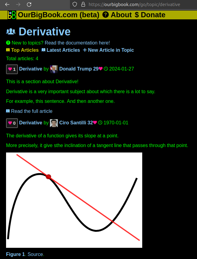
Figure 1. Screenshot of the "Derivative" topic page. View it live at: ourbigbook.com/go/topic/derivativeVideo 2. OurBigBook Web topics demo. Source. - local editing: you can store all your personal knowledge base content locally in a plaintext markup format that can be edited locally and published either:This way you can be sure that even if OurBigBook.com were to go down one day (which we have no plans to do as it is quite cheap to host!), your content will still be perfectly readable as a static site.
- to OurBigBook.com to get awesome multi-user features like topics and likes
- as HTML files to a static website, which you can host yourself for free on many external providers like GitHub Pages, and remain in full control

Figure 2. You can publish local OurBigBook lightweight markup files to either OurBigBook.com or as a static website.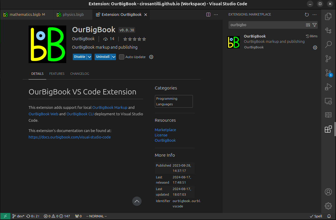
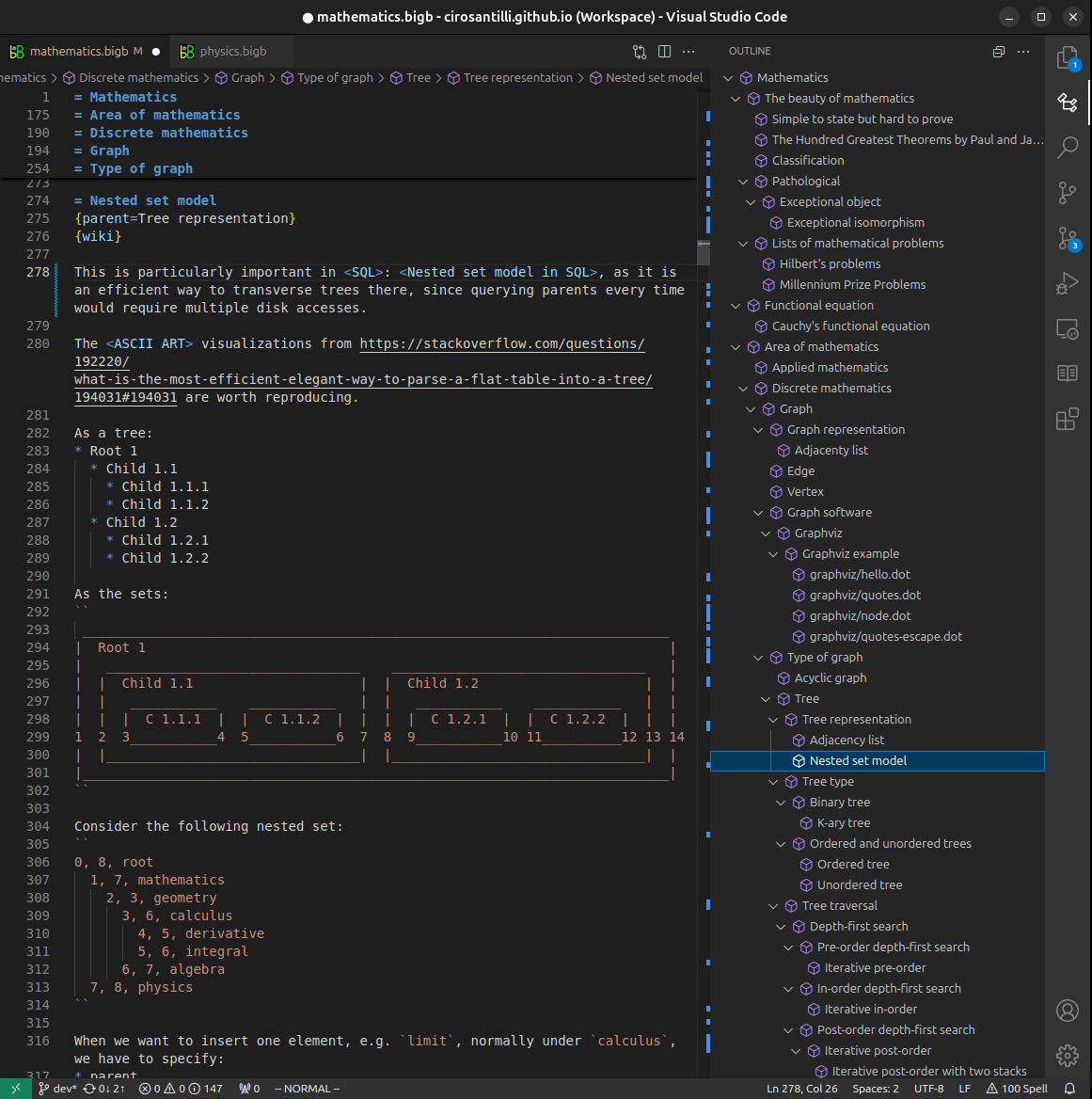
Figure 3. Visual Studio Code extension installation.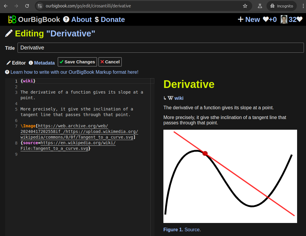
Figure 5. . You can also edit articles on the Web editor without installing anything locally. Video 3. Edit locally and publish demo. Source. This shows editing OurBigBook Markup and publishing it using the Visual Studio Code extension. 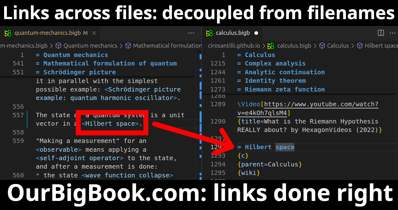
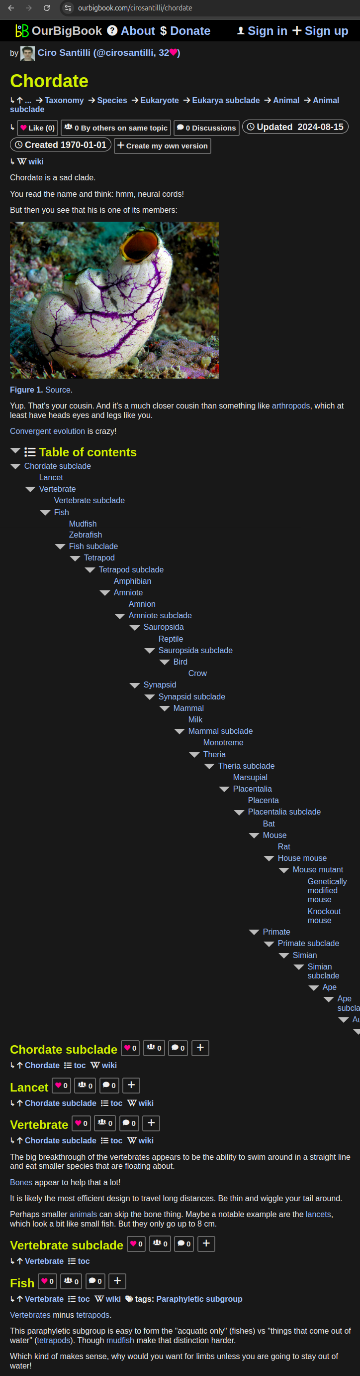
- Infinitely deep tables of contents:
All our software is open source and hosted at: github.com/ourbigbook/ourbigbook
Further documentation can be found at: docs.ourbigbook.com
Feel free to reach our to us for any help or suggestions: docs.ourbigbook.com/#contact