Topics (318k) Articles (329k) Users (396) Discussions (237) Comments (383) Files (10k) New article

The intertidal zone, also known as the tidal zone, is the area of the shore that lies between the high tide and low tide marks. It is a unique and dynamic ecosystem that experiences varying environmental conditions, including changes in water salinity, temperature, and exposure to air and sunlight, depending on the tidal cycle.
Internal tides are oscillations or waves that occur within the ocean's thermocline, which is the layer of water between the warmer surface layer and the colder deep water. Unlike surface tides, which are generated by the gravitational forces of the moon and the sun acting on the oceans, internal tides are typically generated by the interactions of tidal forces with underwater features such as continental shelves, seamounts, and other topography.
The Interdecadal Pacific Oscillation (IPO) is a long-term climate variability pattern in the Pacific Ocean that can influence climatic conditions across the globe. It is characterized by fluctuations in sea surface temperatures (SST) and atmospheric pressure across the Pacific Ocean on interdecadal timescales, typically spanning several decades. The IPO can switch between phases, similar to the El Niño Southern Oscillation (ENSO), but with much longer cycles.
Integrated Multi-Trophic Aquaculture (IMTA) is an innovative aquaculture production system that combines different species from various trophic levels in a single farming system. The main idea behind IMTA is to utilize the waste products generated by one species as a resource for another, thereby creating a more sustainable and efficient aquaculture practice.
The Indian Monsoon Current refers to the seasonal ocean currents that are influenced by the Indian monsoon, a significant weather phenomenon that affects the Indian subcontinent. The monsoon season, typically occurring from June to September, is characterized by heavy rainfall due to the southwest winds that carry moisture from the Indian Ocean. ### Key Features of the Indian Monsoon Current: 1. **Seasonal Variation**: The monsoon current is predominantly a summer phenomenon.
Hydrothermal circulation refers to the movement of water that is heated by geological processes within the Earth's crust, particularly in areas of volcanic activity or along mid-ocean ridges. This process plays a crucial role in the thermal and chemical dynamics of the Earth's crust and ocean floor. Here's how hydrothermal circulation typically works: 1. **Heat Source**: The circulation is usually driven by heat from magma or hot rocks below the Earth's surface. This heat causes water in the surrounding rock to become heated.
The "hundred-year wave" typically refers to a concept in hydrology and civil engineering related to the statistical analysis of water level fluctuations, particularly in the context of floods. It denotes a flood event with a probability of occurring once every hundred years, also known as the "100-year flood." This measure is used to help design infrastructure, such as bridges, dams, and levees, to withstand extreme weather events.
The Hawaiian–Emperor seamount chain is a prominent underwater mountain range in the Pacific Ocean, known for its linear arrangement of volcanic islands and seamounts. It stretches over 3,700 miles (about 6,000 kilometers) and includes the Hawaiian Islands, as well as the Emperor Seamounts, which are submerged mountains formed by volcanic activity.
The Hawaiian Islands are a volcanic archipelago located in the central Pacific Ocean. They consist of 137 islands, atolls, and islets, with 8 main islands that are the most well-known and inhabited. These main islands are: 1. **Hawaii (The Big Island)** - The largest island, home to Mauna Kea and Mauna Loa, two of the world's most active volcanoes.
The Hawaii Ocean Time-series (HOT) is a long-term oceanographic research program that focuses on studying the physical, chemical, biological, and geological characteristics of the open ocean around Hawaii, particularly in the North Pacific Ocean. Established in 1988, the HOT program is primarily based at the University of Hawaii at Manoa and is associated with the Hawaii Institute of Marine Biology.
Halothermal circulation refers to the movement of water masses in oceans or large bodies of water that is driven by variations in temperature (thermal) and salinity (haline) — a process often described in the context of thermohaline circulation. This type of circulation influences global climate, ocean stratification, and the distribution of marine life. In halothermal circulation, the interaction between temperature and salinity affects water density, with denser water sinking and less dense water rising, creating a circulation pattern.
A halocline is a layer in a body of water where there is a rapid change in salinity with depth. This phenomenon typically occurs in oceanic and large freshwater environments, such as lakes. The halocline acts as a barrier that can separate different water masses with varying salinity, affecting water density and, consequently, mixing patterns and circulation in the water body.
A "Guyot" refers to a specific type of underwater geological feature that is characterized by a flat-topped mountain or hill, typically found on the ocean floor. These formations are submerged and often have steep sides, with their flat tops corresponding to sea level at some point in geological history. Guyots are formed from volcanic activity and represent the eroded remnants of once-active volcanoes that have subsided due to tectonic activity.
The Gulf Trough, also known as the Gulf of Mexico Trough or Gulf Trough system, is a geological feature in the Gulf of Mexico area. It represents a significant structural depression or an area of subsidence, primarily formed by tectonic processes, sediment deposition, and erosion over millions of years. The Gulf Trough is part of the larger Gulf of Mexico basin and plays a vital role in the region's geology, marine ecology, and hydrocarbon deposits.
The Global Ocean Data Analysis Project (GLODAP) is a collaborative scientific initiative aimed at collecting, processing, and distributing high-quality oceanographic data related to the carbon cycle and biogeochemistry of the world's oceans. The project focuses on the analysis and synthesis of data from various oceanographic research cruises, particularly those that measure essential variables such as nutrients, carbon dioxide, oxygen, and other tracers relevant to ocean health and climate change.
Glacio-geological databases are specialized collections of geological and glaciological data that focus on the study of glaciers, ice sheets, and their interactions with the Earth's geology. These databases may include a wide range of information, such as: 1. **Geological Mapping**: Data on rock types, mineral compositions, and geological structures in regions affected by glacial processes.
Geophysical fluid dynamics (GFD) is a branch of fluid dynamics that focuses on the behavior of fluids in the Earth's atmosphere and oceans, as well as in other planetary environments. It combines principles from fluid mechanics, geophysics, and applied mathematics to study the motion of large-scale fluid systems influenced by the Earth's rotation, gravity, and other geophysical forces.
The Geochemical Ocean Sections Study (GEOSECS) is a significant scientific initiative aimed at understanding the chemical composition and properties of the ocean and how they relate to global biogeochemical cycles. Conducted from the mid-1970s to the early 1980s, GEOSECS focused on collecting and analyzing oceanographic data to investigate various aspects of the ocean's chemistry, including the distribution of nutrients, trace elements, and isotopes.
The Gas Hydrate Stability Zone (GHSZ) is a region in the geological environment where gas hydrates can form and remain stable. Gas hydrates are crystalline structures made up of water and gas molecules, typically methane, that form under specific temperature and pressure conditions. The stability of gas hydrates is primarily influenced by three factors: 1. **Pressure**: Gas hydrates are stable at high pressures.
In oceanography, a "front" refers to a boundary or transition zone between two different water masses that have distinct physical properties, such as temperature, salinity, or density. These differences can lead to variations in water characteristics and can significantly influence marine ecosystems, weather patterns, and ocean circulation. There are several types of fronts in oceanography: 1. **Temperature Fronts**: These occur where there is a sharp change in water temperature, often associated with currents or upwelling zones.
Pinned article: Introduction to the OurBigBook Project
Welcome to the OurBigBook Project! Our goal is to create the perfect publishing platform for STEM subjects, and get university-level students to write the best free STEM tutorials ever.
Everyone is welcome to create an account and play with the site: ourbigbook.com/go/register. We belive that students themselves can write amazing tutorials, but teachers are welcome too. You can write about anything you want, it doesn't have to be STEM or even educational. Silly test content is very welcome and you won't be penalized in any way. Just keep it legal!
Intro to OurBigBook
. Source. We have two killer features:
- topics: topics group articles by different users with the same title, e.g. here is the topic for the "Fundamental Theorem of Calculus" ourbigbook.com/go/topic/fundamental-theorem-of-calculusArticles of different users are sorted by upvote within each article page. This feature is a bit like:
- a Wikipedia where each user can have their own version of each article
- a Q&A website like Stack Overflow, where multiple people can give their views on a given topic, and the best ones are sorted by upvote. Except you don't need to wait for someone to ask first, and any topic goes, no matter how narrow or broad
This feature makes it possible for readers to find better explanations of any topic created by other writers. And it allows writers to create an explanation in a place that readers might actually find it.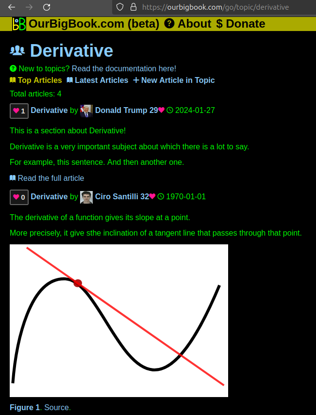
Figure 1. Screenshot of the "Derivative" topic page. View it live at: ourbigbook.com/go/topic/derivativeVideo 2. OurBigBook Web topics demo. Source. - local editing: you can store all your personal knowledge base content locally in a plaintext markup format that can be edited locally and published either:This way you can be sure that even if OurBigBook.com were to go down one day (which we have no plans to do as it is quite cheap to host!), your content will still be perfectly readable as a static site.
- to OurBigBook.com to get awesome multi-user features like topics and likes
- as HTML files to a static website, which you can host yourself for free on many external providers like GitHub Pages, and remain in full control

Figure 2. You can publish local OurBigBook lightweight markup files to either OurBigBook.com or as a static website.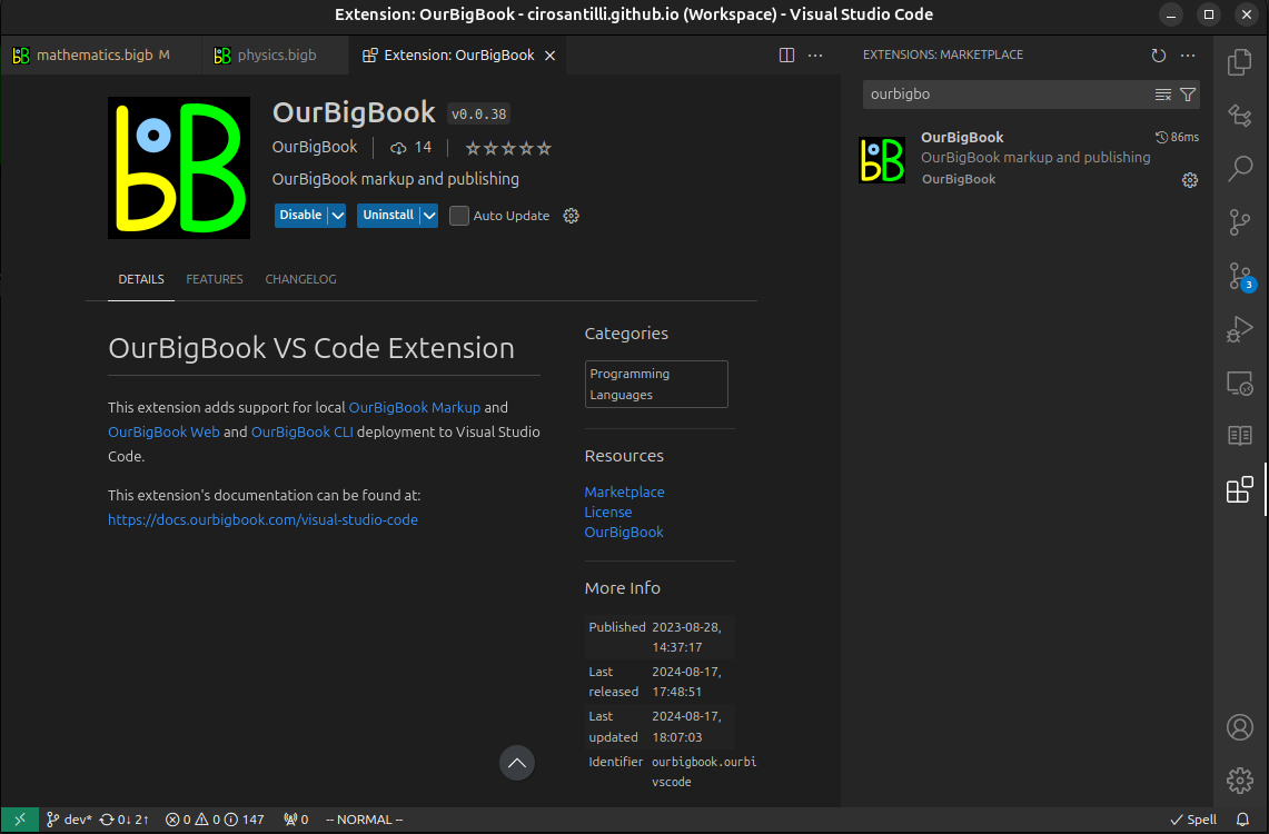
Figure 3. Visual Studio Code extension installation.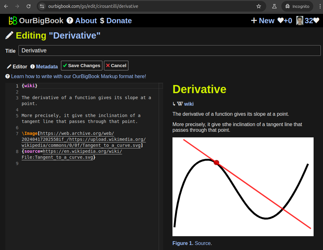
Figure 5. . You can also edit articles on the Web editor without installing anything locally. Video 3. Edit locally and publish demo. Source. This shows editing OurBigBook Markup and publishing it using the Visual Studio Code extension. 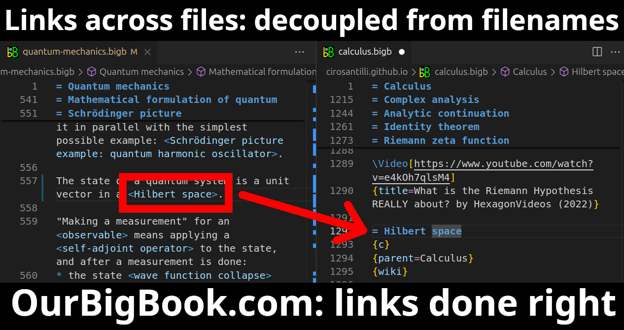
- Infinitely deep tables of contents:
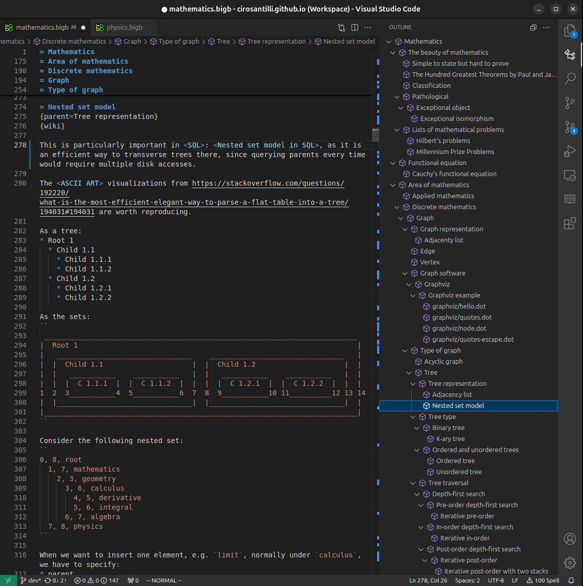
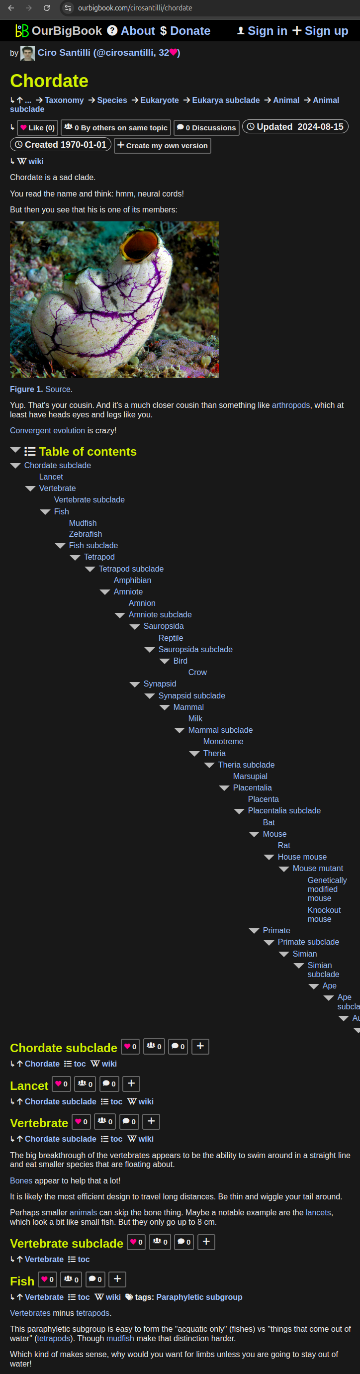
All our software is open source and hosted at: github.com/ourbigbook/ourbigbook
Further documentation can be found at: docs.ourbigbook.com
Feel free to reach our to us for any help or suggestions: docs.ourbigbook.com/#contact