Topics (349k) Articles (361k) Users (399) Discussions (237) Comments (383) Files (12k) New article

The Universal Transverse Mercator (UTM) is a global map projection system used for cartography, spatial analysis, and navigation. It is a type of cylindrical map projection that breaks the world into a series of zones, each of which is projected individually to minimize distortion. Here are some key features of the UTM coordinate system: 1. **Zones**: The Earth is divided into 60 UTM zones, each covering 6 degrees of longitudinal extent.
True polar wander (TPW) refers to the phenomenon where the Earth's rotational axis shifts relative to its surface, resulting in a change in the position of the geographic poles. This movement occurs as the Earth's solid outer shell—including the crust and upper mantle—adjusts in response to changes in mass distribution within the Earth, such as continental drift, assimilation of tectonic plates, and the redistribution of water due to glacial melting or sea-level changes.
True-range multilateration (TRM) is a technique used to determine the position of an object or the location of a signal emitter by measuring the time it takes for a signal to travel to multiple receiving stations. This method is often employed in navigation and tracking systems, including aviation, maritime, and telecommunications. Here's how it works: 1. **Signal Emission**: An object emits a signal, such as a radio wave or acoustic signal.
In surveying, "traverse" refers to a method of surveying in which a series of connected points (or stations) are established at known distances and angles from one another. The primary purpose of a traverse is to determine the relative positions of these points in a defined coordinate system, typically for mapping or constructing boundaries, alignments, and territorial surveys.
A transit instrument, also known simply as a transit, is a surveying tool used for measuring angles in the horizontal and vertical planes. It combines features of both a theodolite and a telescope and is commonly used in land surveying, construction, and engineering applications. The main components of a transit instrument include: 1. **Telescope**: Used to sight objects and measure angles. It can be rotated in both horizontal and vertical directions.
A Total Station is a surveying instrument that combines the functions of an electronic theodolite and an electronic distance measuring (EDM) device. It is used to measure angles and distances in order to determine precise positions in three-dimensional space. Total stations are widely used in construction, civil engineering, and land surveying for tasks such as site surveys, mapping, and topographic surveys.
Tide can refer to several different things, depending on the context: 1. **Oceanography**: Tide refers to the regular rise and fall of sea levels caused by the gravitational forces exerted by the Moon and the Sun, combined with the Earth's rotation. Tides are typically observed in cycles of approximately 12 hours and can significantly influence coastal ecosystems and activities. 2. **Laundry Detergent**: Tide is a brand of laundry detergent produced by Procter & Gamble.
Tidal acceleration refers to the gradual increase in the rotational period of a celestial body, such as a planet or moon, due to the gravitational interaction with another nearby body. This phenomenon is primarily observed in the context of the Earth-Moon system and the Earth-Sun system. In the case of the Earth and Moon, the gravitational pull of the Moon creates tides in the Earth's oceans.
Theoretical gravity typically refers to the scientific efforts to understand and describe the force of gravity using mathematics and theoretical physics. It encompasses various models and theories that explain how gravity works at different scales, from everyday experiences to cosmological phenomena. The major theoretical frameworks for gravity include: 1. **Newtonian Gravity**: Sir Isaac Newton formulated the law of universal gravitation in the 17th century, which describes gravity as a force that acts at a distance between two masses.
A theodolite is a precision optical instrument used for measuring angles in both horizontal and vertical planes. It is commonly utilized in surveying, engineering, construction, and various fields of geospatial science. ### Key Components of a Theodolite: 1. **Telescope**: Allows for line-of-sight measurements. 2. **Horizontal and Vertical Circles**: Graduated scales that measure angles.
The Terrestrial Reference Frame (TRF) is a geodetic framework that provides a consistent and stable coordinate system to define the positions of points on the Earth's surface. It allows for accurate measurements and representations of spatial positions over time and is essential for various applications, including geodesy, navigation, satellite positioning, and mapping.
"Summit" can refer to several different things depending on the context: 1. **Geographical Feature**: In a geographical context, a summit refers to the highest point of a hill or mountain. It's often used in hiking and climbing terminology. 2. **Conference or Meeting**: Summit can also refer to a high-level meeting or conference where leaders, experts, or representatives gather to discuss important issues. For example, the G7 Summit or climate change summits like COP.
Stellar triangulation is a method used in astronomy to determine the distances to stars and other celestial objects by utilizing the principles of triangulation, which involves measuring angles from two or more observation points. The technique involves observing a star from two different locations on Earth's surface and measuring the angle between the star and a baseline line that connects the two observation points.
A spot height is a specific point on a map that indicates the elevation or altitude of that particular location above sea level. It is often represented by a dot or a symbol, accompanied by a numerical value that indicates the height in meters or feet. Spot heights are commonly used in topographic maps to provide vital information about the terrain, allowing users to understand the varying elevations across a landscape. They help in activities such as hiking, planning construction, and understanding drainage patterns, among other applications.
A spirit level is a tool used to determine whether a surface is horizontal (level) or vertical (plumb). It typically consists of a sealed tube filled with a liquid, usually colored alcohol or water, and an air bubble. The tube is mounted in a frame, often made of wood or metal. When the spirit level is placed on a surface, the bubble will move within the tube. If the surface is perfectly level, the bubble will center itself between two marked lines on the tube.
As of my last knowledge update in October 2023, "Spatiomap" does not refer to a well-known concept, product, or service in widely recognized literature or technology. The term could potentially relate to spatial mapping, GIS (Geographic Information Systems), or a specific application or tool for visualizing or analyzing spatial data.
A Spatial Reference System (SRS), also known as a Coordinate Reference System (CRS), is a system that provides a framework for spatial data to be identified, measured, and analyzed. It defines how geographic data is represented in a coordinate system and relates it to real-world locations. Here are some key components and concepts related to spatial reference systems: 1. **Coordinate System**: A spatial reference system uses a coordinate system to specify how points in space are represented.
Space geodesy is a branch of geodesy that uses satellite and space-based technologies to measure and monitor the Earth's shape, orientation, gravity field, and other geophysical phenomena. This field employs various techniques, including: 1. **Very Long Baseline Interferometry (VLBI)**: This method uses radio telescopes to measure the time it takes for signals from distant quasars to reach Earth.
Snake Projection is a method used in cartography to represent geographic areas in a way that minimizes distortion, typically for the purpose of creating maps that help visualize spatial relationships more accurately. The technique involves creating a map projection that distorts the areas of shapes (like continents and countries) less than traditional projections. The idea is to “snake” the shapes across the map surface to ensure that their relative sizes remain more consistent with their true sizes on the globe.
Pinned article: Introduction to the OurBigBook Project
Welcome to the OurBigBook Project! Our goal is to create the perfect publishing platform for STEM subjects, and get university-level students to write the best free STEM tutorials ever.
Everyone is welcome to create an account and play with the site: ourbigbook.com/go/register. We belive that students themselves can write amazing tutorials, but teachers are welcome too. You can write about anything you want, it doesn't have to be STEM or even educational. Silly test content is very welcome and you won't be penalized in any way. Just keep it legal!
Intro to OurBigBook
. Source. We have two killer features:
- topics: topics group articles by different users with the same title, e.g. here is the topic for the "Fundamental Theorem of Calculus" ourbigbook.com/go/topic/fundamental-theorem-of-calculusArticles of different users are sorted by upvote within each article page. This feature is a bit like:
- a Wikipedia where each user can have their own version of each article
- a Q&A website like Stack Overflow, where multiple people can give their views on a given topic, and the best ones are sorted by upvote. Except you don't need to wait for someone to ask first, and any topic goes, no matter how narrow or broad
This feature makes it possible for readers to find better explanations of any topic created by other writers. And it allows writers to create an explanation in a place that readers might actually find it.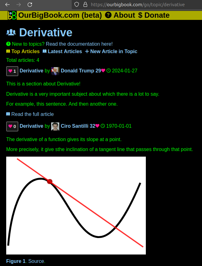
Figure 1. Screenshot of the "Derivative" topic page. View it live at: ourbigbook.com/go/topic/derivativeVideo 2. OurBigBook Web topics demo. Source. - local editing: you can store all your personal knowledge base content locally in a plaintext markup format that can be edited locally and published either:This way you can be sure that even if OurBigBook.com were to go down one day (which we have no plans to do as it is quite cheap to host!), your content will still be perfectly readable as a static site.
- to OurBigBook.com to get awesome multi-user features like topics and likes
- as HTML files to a static website, which you can host yourself for free on many external providers like GitHub Pages, and remain in full control

Figure 2. You can publish local OurBigBook lightweight markup files to either OurBigBook.com or as a static website.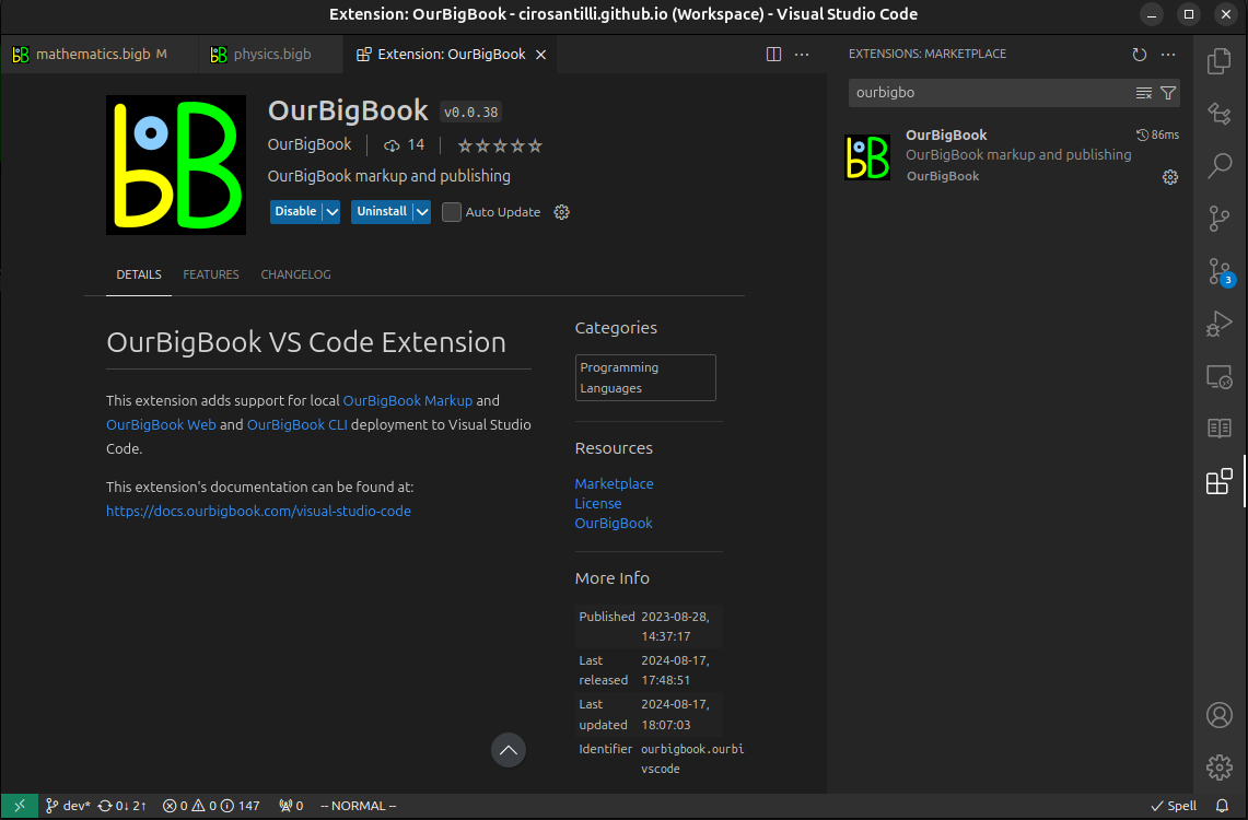
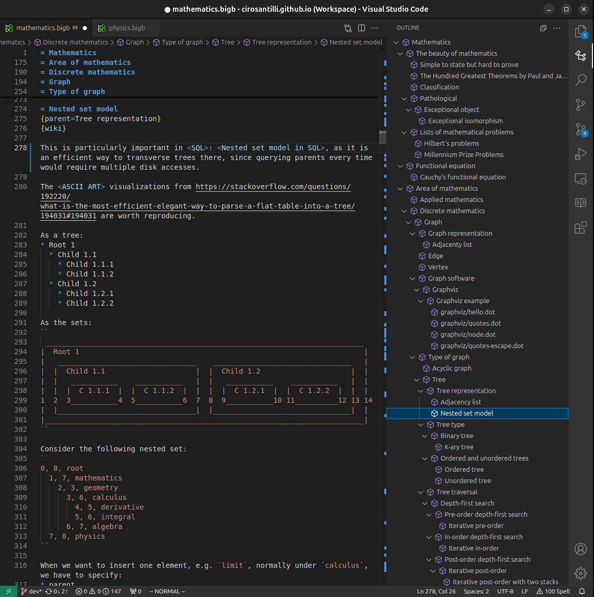
Figure 3. Visual Studio Code extension installation.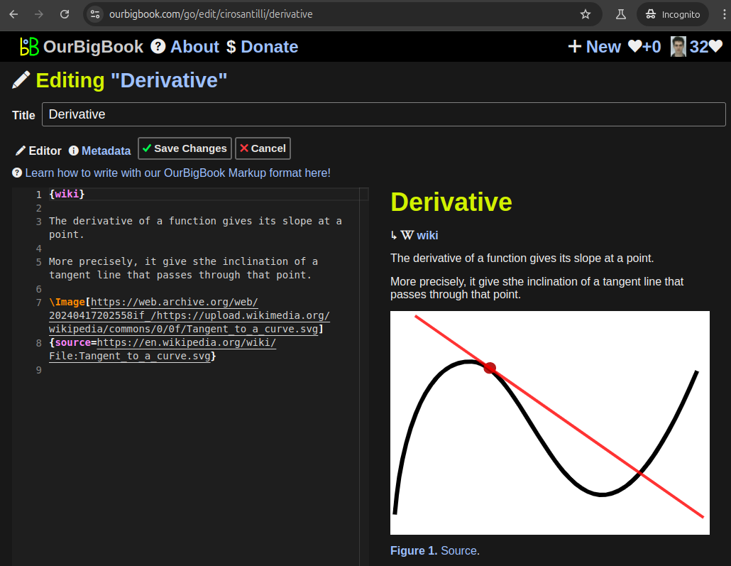
Figure 5. . You can also edit articles on the Web editor without installing anything locally. Video 3. Edit locally and publish demo. Source. This shows editing OurBigBook Markup and publishing it using the Visual Studio Code extension. 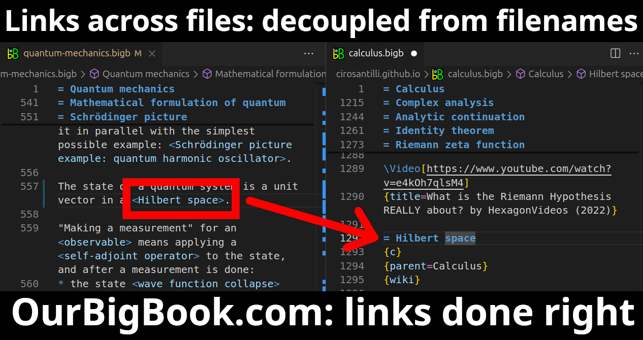
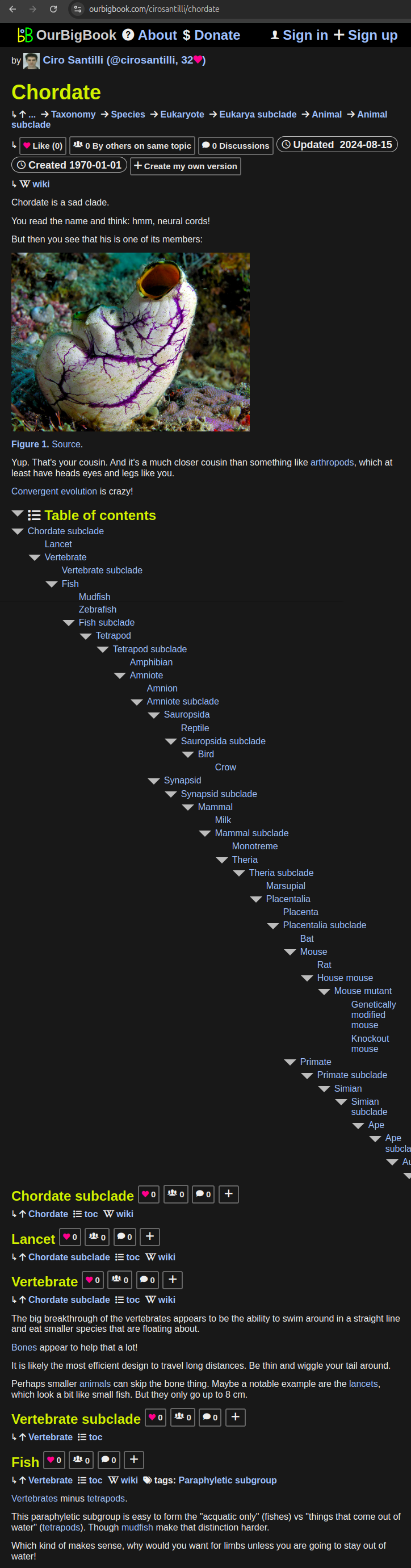
- Infinitely deep tables of contents:
All our software is open source and hosted at: github.com/ourbigbook/ourbigbook
Further documentation can be found at: docs.ourbigbook.com
Feel free to reach our to us for any help or suggestions: docs.ourbigbook.com/#contact