Topics (349k) Articles (361k) Users (402) Discussions (237) Comments (383) Files (12k) New article

As of my last knowledge update in October 2023, "Spatiomap" does not refer to a well-known concept, product, or service in widely recognized literature or technology. The term could potentially relate to spatial mapping, GIS (Geographic Information Systems), or a specific application or tool for visualizing or analyzing spatial data.
A Spatial Reference System (SRS), also known as a Coordinate Reference System (CRS), is a system that provides a framework for spatial data to be identified, measured, and analyzed. It defines how geographic data is represented in a coordinate system and relates it to real-world locations. Here are some key components and concepts related to spatial reference systems: 1. **Coordinate System**: A spatial reference system uses a coordinate system to specify how points in space are represented.
Space geodesy is a branch of geodesy that uses satellite and space-based technologies to measure and monitor the Earth's shape, orientation, gravity field, and other geophysical phenomena. This field employs various techniques, including: 1. **Very Long Baseline Interferometry (VLBI)**: This method uses radio telescopes to measure the time it takes for signals from distant quasars to reach Earth.
Snake Projection is a method used in cartography to represent geographic areas in a way that minimizes distortion, typically for the purpose of creating maps that help visualize spatial relationships more accurately. The technique involves creating a map projection that distorts the areas of shapes (like continents and countries) less than traditional projections. The idea is to “snake” the shapes across the map surface to ensure that their relative sizes remain more consistent with their true sizes on the globe.
Selenography is the scientific study of the Moon's surface and features. The term is derived from "Selene," the Greek goddess of the Moon, and "graphy," which means writing or description. This branch of astronomy involves the mapping and characterization of the Moon's physical characteristics, including its craters, mountains, valleys, and other geological features.
The Schiehallion experiment, conducted in the late 18th century, was a notable geodetic survey designed to measure the gravitational attraction of a mountain, specifically Schiehallion in Scotland. Initiated by the mathematicians Nevil Maskelyne and his assistant, the experiment aimed to determine Earth's density and provide insights into gravitational measurements.
The SK-42 reference system, also known as the "Soviet Calendar" or "Soviet Era," is a calendar system that was used in the Soviet Union. The SK-42 system is based on the Gregorian calendar but has a few modifications specific to the Soviet context. One of the notable features is that it emphasizes the Soviet era, starting from the year 1917, which is marked by the Bolshevik Revolution.
A rhumb line, or loxodrome, is a path on the surface of a sphere (such as Earth) that crosses all meridians at the same angle. In simpler terms, it's a curved line that maintains a constant compass bearing, allowing a navigator to steer a constant angle relative to true north. Rhumb lines are significant in navigation because they provide a means to plot a course that simplifies travel over long distances.
Remote sensing is the science and technology of obtaining information about objects or areas from a distance, typically using satellite or aerial sensor technologies. It involves collecting data about the Earth's surface and atmosphere without physical contact, allowing for the study of various phenomena, such as land use, vegetation cover, climate change, and natural disasters. The process of remote sensing can be broken down into several key components: 1. **Sensors**: Remote sensing devices can be passive or active.
Rauenberg is a district located in the borough of Treptow-Köpenick in Berlin, Germany. It is primarily a residential area with a mix of housing, green spaces, and local amenities. The district is characterized by its suburban feel, offering a quieter environment compared to the more densely populated areas of central Berlin. It is often appreciated for its community atmosphere and accessibility to natural landscapes, such as parks and rivers nearby.
RINEX, which stands for Receiver Independent Exchange Format, is a standard data format used for the exchange of satellite navigation system data. It was developed to allow different types of GNSS (Global Navigation Satellite Systems) receivers to share data, ensuring compatibility and interoperability among various manufacturers and systems. The RINEX format is primarily used for storing observations and navigation messages from GNSS satellites, including GPS, GLONASS, Galileo, and BeiDou.
Pseudorange is a term used in satellite-based positioning systems, such as Global Positioning System (GPS), to describe the calculated distance between the satellite and the receiver. It is called "pseudorange" because it is not an exact distance; rather, it is an estimate that accounts for several factors. The pseudorange is determined by measuring the time it takes for a signal to travel from the satellite to the receiver and then multiplying that time by the speed of light.
The Prime Meridian is an imaginary line that is defined as 0 degrees longitude. It serves as the reference point for measuring longitude and divides the Earth into the Eastern and Western Hemispheres. The Prime Meridian runs from the North Pole to the South Pole and passes through several countries, with its most commonly recognized location being at the Royal Observatory in Greenwich, London, England. The establishment of the Prime Meridian at Greenwich occurred in 1884 during an international conference in Washington, D.C.
A positioning system is a technological system designed to determine the location of an object in a particular space. These systems can be used in a variety of applications, including navigation, mapping, and tracking. ### Key Components and Types of Positioning Systems: 1. **Global Positioning System (GPS)**: The most well-known positioning system that uses a network of satellites to provide location and time information to a GPS receiver anywhere on Earth.
Polar wander refers to the movement of the Earth's magnetic poles over time, which is different from the movement of the geographic poles. This phenomenon can occur due to changes in the Earth's mantle and crust, which can cause shifts in tectonic plates and changes in the distribution of mass within the Earth. As a result, the position of the magnetic poles can shift significantly over geological timescales.
Polar motion refers to the movement of the Earth's rotation axis in relation to its crust, specifically the shifting position of the North and South Poles. This phenomenon is primarily influenced by various geophysical factors, including changes in atmospheric pressure, ocean currents, and how mass is distributed on and within the Earth. The Earth's rotation axis does not remain fixed; it experiences small oscillations and shifts over time.
A planetary coordinate system is a method used to specify locations on the surface of a celestial body, such as a planet, moon, or asteroid. Similar to how geographic coordinates (latitude and longitude) specify locations on Earth, planetary coordinate systems provide a framework for identifying positions on other celestial objects. ### Key Features of Planetary Coordinate Systems: 1. **Coordinate Types**: - **Planetocentric Coordinates**: These use the center of the planet as the origin.
Pierre Peytier refers to a French geologist and engineer, known for his contributions to the study of geology in the 19th century. He is particularly noted for his work in the fields of geology and mining, as well as for his research on the geological structures and resources in France, particularly in the region of the Pyrenees.
Pinned article: Introduction to the OurBigBook Project
Welcome to the OurBigBook Project! Our goal is to create the perfect publishing platform for STEM subjects, and get university-level students to write the best free STEM tutorials ever.
Everyone is welcome to create an account and play with the site: ourbigbook.com/go/register. We belive that students themselves can write amazing tutorials, but teachers are welcome too. You can write about anything you want, it doesn't have to be STEM or even educational. Silly test content is very welcome and you won't be penalized in any way. Just keep it legal!
Intro to OurBigBook
. Source. We have two killer features:
- topics: topics group articles by different users with the same title, e.g. here is the topic for the "Fundamental Theorem of Calculus" ourbigbook.com/go/topic/fundamental-theorem-of-calculusArticles of different users are sorted by upvote within each article page. This feature is a bit like:
- a Wikipedia where each user can have their own version of each article
- a Q&A website like Stack Overflow, where multiple people can give their views on a given topic, and the best ones are sorted by upvote. Except you don't need to wait for someone to ask first, and any topic goes, no matter how narrow or broad
This feature makes it possible for readers to find better explanations of any topic created by other writers. And it allows writers to create an explanation in a place that readers might actually find it.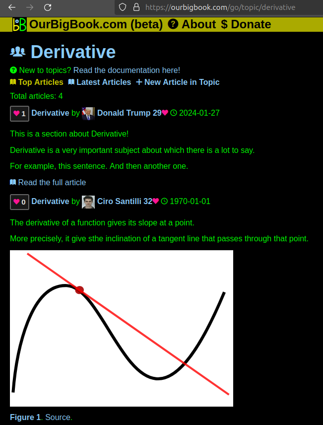
Figure 1. Screenshot of the "Derivative" topic page. View it live at: ourbigbook.com/go/topic/derivativeVideo 2. OurBigBook Web topics demo. Source. - local editing: you can store all your personal knowledge base content locally in a plaintext markup format that can be edited locally and published either:This way you can be sure that even if OurBigBook.com were to go down one day (which we have no plans to do as it is quite cheap to host!), your content will still be perfectly readable as a static site.
- to OurBigBook.com to get awesome multi-user features like topics and likes
- as HTML files to a static website, which you can host yourself for free on many external providers like GitHub Pages, and remain in full control

Figure 2. You can publish local OurBigBook lightweight markup files to either OurBigBook.com or as a static website.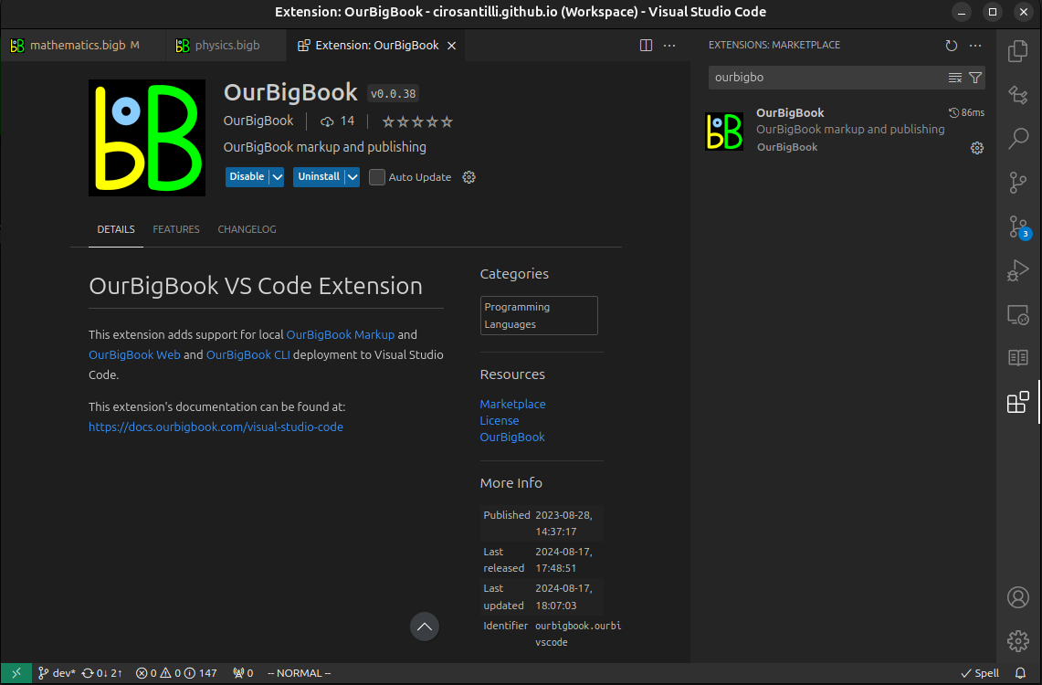
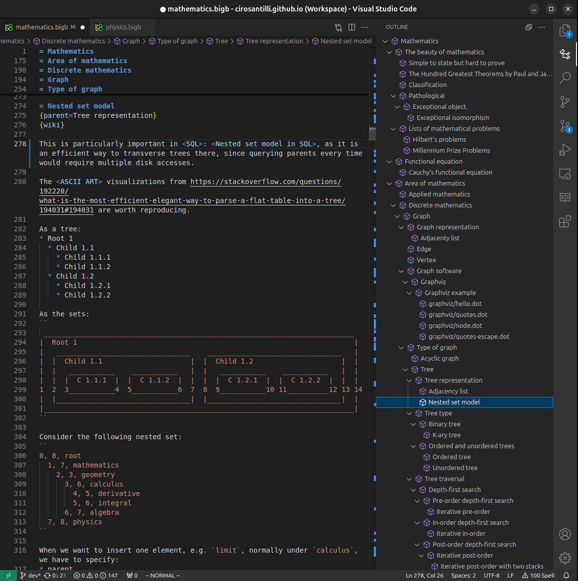
Figure 3. Visual Studio Code extension installation.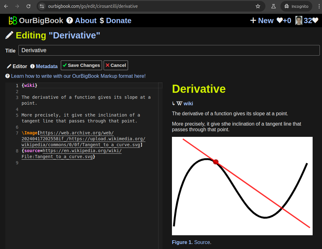
Figure 5. . You can also edit articles on the Web editor without installing anything locally. Video 3. Edit locally and publish demo. Source. This shows editing OurBigBook Markup and publishing it using the Visual Studio Code extension. 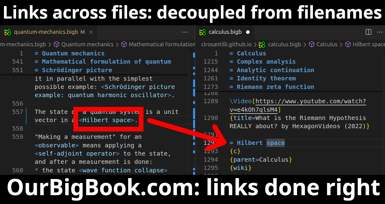
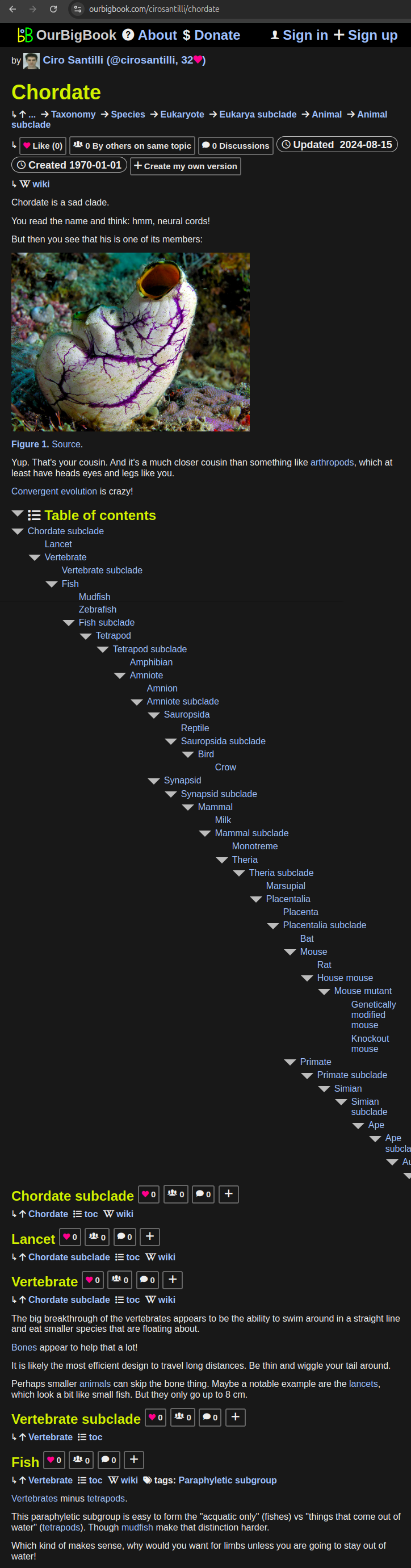
- Infinitely deep tables of contents:
All our software is open source and hosted at: github.com/ourbigbook/ourbigbook
Further documentation can be found at: docs.ourbigbook.com
Feel free to reach our to us for any help or suggestions: docs.ourbigbook.com/#contact