Topics (349k) Articles (361k) Users (403) Discussions (237) Comments (383) Files (12k) New article

Pierre Peytier refers to a French geologist and engineer, known for his contributions to the study of geology in the 19th century. He is particularly noted for his work in the fields of geology and mining, as well as for his research on the geological structures and resources in France, particularly in the region of the Pyrenees.
Physical geodesy is a branch of geodesy that focuses on understanding the Earth's shape, orientation in space, and gravitational field. It involves the measurement and interpretation of physical properties of the Earth to generate models that describe its size, shape, and gravitational influences.
Photogrammetry is a technique that involves capturing and interpreting photographic images to measure and analyze objects and landscapes in three dimensions. It uses photographs taken from different angles and positions to create accurate representations of the physical world, allowing for the extraction of spatial information. Key aspects of photogrammetry include: 1. **Data Acquisition**: Photogrammetry typically utilizes digital cameras, drones, or aerial platforms to capture images. The images should overlap to ensure accurate measurement.
The Paris Meridian is a historical meridian line that was used as the primary reference for the measurement of longitude in France and parts of Europe before the adoption of the Greenwich Meridian. It runs through Paris, specifically passing through the Paris Observatory. Historically, the Paris Meridian was significant for mapping and celestial navigation. The line was defined by the measurements made by astronomers and geographers in the 17th and 18th centuries.
The Palestine grid, often referred to more broadly as the "Palestine grid system," is a geographic coordinate system used to map locations in the West Bank and Gaza Strip. It has roots in the British Mandatory mapping systems used during the early 20th century and has been adapted over time. The grid typically employs a system of coordinates to define specific locations within Palestinian territories, aligning with the Universal Transverse Mercator (UTM) zone projections.
Orthometric height is the height of a point on the Earth's surface above the geoid, which is an equipotential surface that represents mean sea level. In simpler terms, it is the vertical distance from a point on the Earth's surface to the geoid. Orthometric heights are important in various fields such as geodesy, surveying, and engineering, as they provide a more accurate representation of height that takes into account the gravitational variations across the Earth's surface.
The Ordnance Survey National Grid is a system used in Great Britain for mapping and geographical referencing. Developed by Ordnance Survey (OS), the national mapping agency for Great Britain, the National Grid provides a standardized method of identifying locations across the country. **Key features of the Ordnance Survey National Grid include:** 1. **Grid System**: The National Grid is based on a series of grid squares, each identified by a combination of letters and numbers.
Ocean surface topography refers to the variations and features of the ocean's surface, which are primarily influenced by factors such as gravitational forces, ocean currents, sea level changes, and atmospheric conditions. This concept encompasses the height and shape of the ocean surface relative to a geoid, which is an equipotential surface representing mean sea level across the world. Key aspects of ocean surface topography include: 1. **Geoid vs.
"Normal height" can refer to the average or typical height range for individuals within a specific population, such as a country or demographic group. This average can vary significantly based on factors like genetics, nutrition, and environmental influences. For instance, in the United States, the average height for adult men is approximately 5 feet 9 inches (175 cm), and for adult women, it is around 5 feet 4 inches (162 cm).
The National Spatial Reference System (NSRS) is a framework in the United States that provides a consistent and accurate geospatial foundation for mapping and surveying activities. It is managed by the National Oceanic and Atmospheric Administration (NOAA), specifically through the National Geodetic Survey (NGS). The NSRS includes a set of geodetic control points, data, and standards that ensure the accurate representation of the Earth's geographic features for various applications, including engineering, construction, and environmental monitoring.
In topography, the term "nadir" refers to the lowest point or position in a particular setting. It can denote the lowest elevation point in a geographical area, often used in contrast to "zenith," which represents the highest point. In a broader context, nadir might be used to describe the lowest point in a landscape, such as a valley or depression.
An N-vector, often referred to in mathematical or computational contexts, typically represents an ordered collection of numbers or values that can be used in various applications such as physics, engineering, computer science, and statistics. The term "N" typically denotes the number of dimensions or components in the vector.
The Military Grid Reference System (MGRS) is a geocoordinate standard used by NATO militaries for locating points on the Earth's surface. It combines the features of the Universal Transverse Mercator (UTM) coordinate system and the British National Grid (BNG), enabling users to reference locations accurately using a grid-based system. MGRS coordinates consist of a combination of a grid zone designation, a grid square identifier, and an easting and northing value.
The Meridian arc is a term used primarily in geodesy and cartography to refer to a segment of a meridian, which is a line of longitude that runs from the North Pole to the South Pole. The concept is often associated with the measurement of large distances on the Earth's surface. In historical contexts, the measurement of a meridian arc has been crucial for determining the size and shape of the Earth.
The term "map" can refer to several different concepts depending on the context. Below are some of the most common definitions: 1. **Geographical Map**: A visual representation of an area, showing physical features like mountains, rivers, and lakes, or political boundaries such as countries, states, and cities. Maps can be physical (printed on paper) or digital (viewed on a computer or mobile device).
Maclear's Beacon is a prominent geographical feature located in the Drakensberg mountain range of South Africa. It is known for its distinctive shape and is one of the most recognized peaks in the area. The beacon itself is a rock formation that reaches an elevation of about 3,200 meters (10,500 feet) above sea level.
Pinned article: Introduction to the OurBigBook Project
Welcome to the OurBigBook Project! Our goal is to create the perfect publishing platform for STEM subjects, and get university-level students to write the best free STEM tutorials ever.
Everyone is welcome to create an account and play with the site: ourbigbook.com/go/register. We belive that students themselves can write amazing tutorials, but teachers are welcome too. You can write about anything you want, it doesn't have to be STEM or even educational. Silly test content is very welcome and you won't be penalized in any way. Just keep it legal!
Intro to OurBigBook
. Source. We have two killer features:
- topics: topics group articles by different users with the same title, e.g. here is the topic for the "Fundamental Theorem of Calculus" ourbigbook.com/go/topic/fundamental-theorem-of-calculusArticles of different users are sorted by upvote within each article page. This feature is a bit like:
- a Wikipedia where each user can have their own version of each article
- a Q&A website like Stack Overflow, where multiple people can give their views on a given topic, and the best ones are sorted by upvote. Except you don't need to wait for someone to ask first, and any topic goes, no matter how narrow or broad
This feature makes it possible for readers to find better explanations of any topic created by other writers. And it allows writers to create an explanation in a place that readers might actually find it.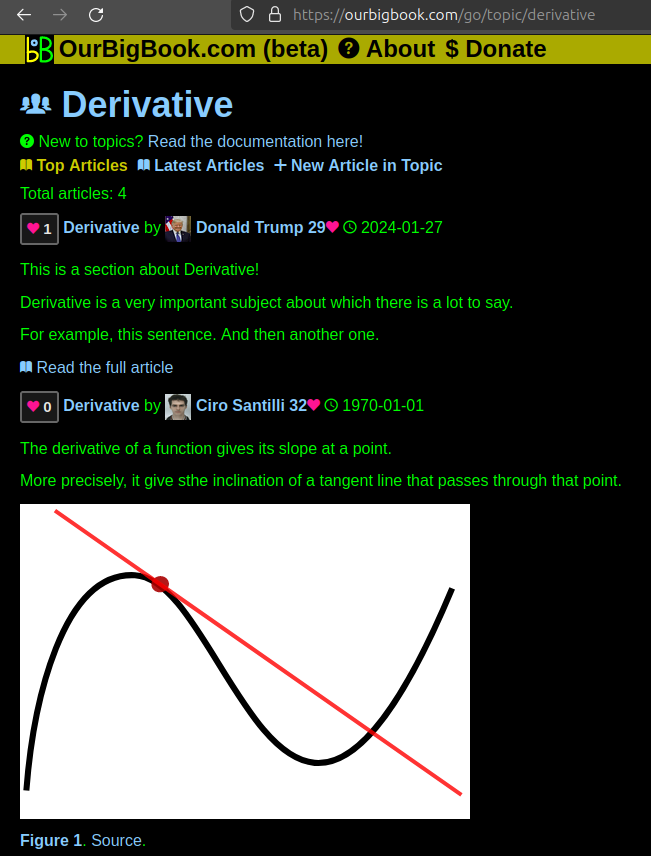
Figure 1. Screenshot of the "Derivative" topic page. View it live at: ourbigbook.com/go/topic/derivativeVideo 2. OurBigBook Web topics demo. Source. - local editing: you can store all your personal knowledge base content locally in a plaintext markup format that can be edited locally and published either:This way you can be sure that even if OurBigBook.com were to go down one day (which we have no plans to do as it is quite cheap to host!), your content will still be perfectly readable as a static site.
- to OurBigBook.com to get awesome multi-user features like topics and likes
- as HTML files to a static website, which you can host yourself for free on many external providers like GitHub Pages, and remain in full control

Figure 2. You can publish local OurBigBook lightweight markup files to either OurBigBook.com or as a static website.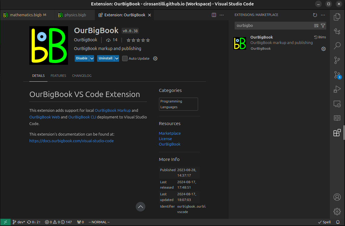
Figure 3. Visual Studio Code extension installation.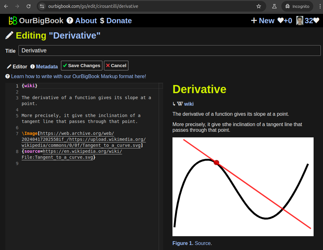
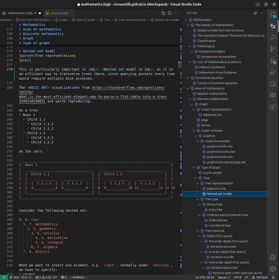
Figure 5. . You can also edit articles on the Web editor without installing anything locally. Video 3. Edit locally and publish demo. Source. This shows editing OurBigBook Markup and publishing it using the Visual Studio Code extension. 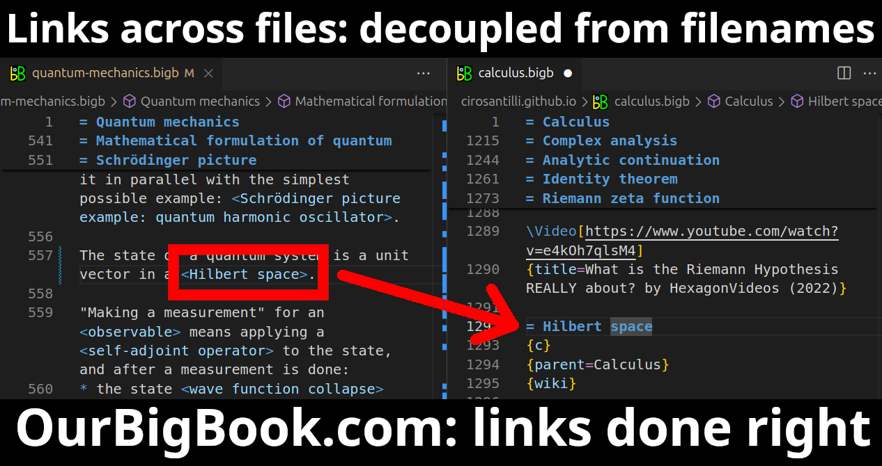
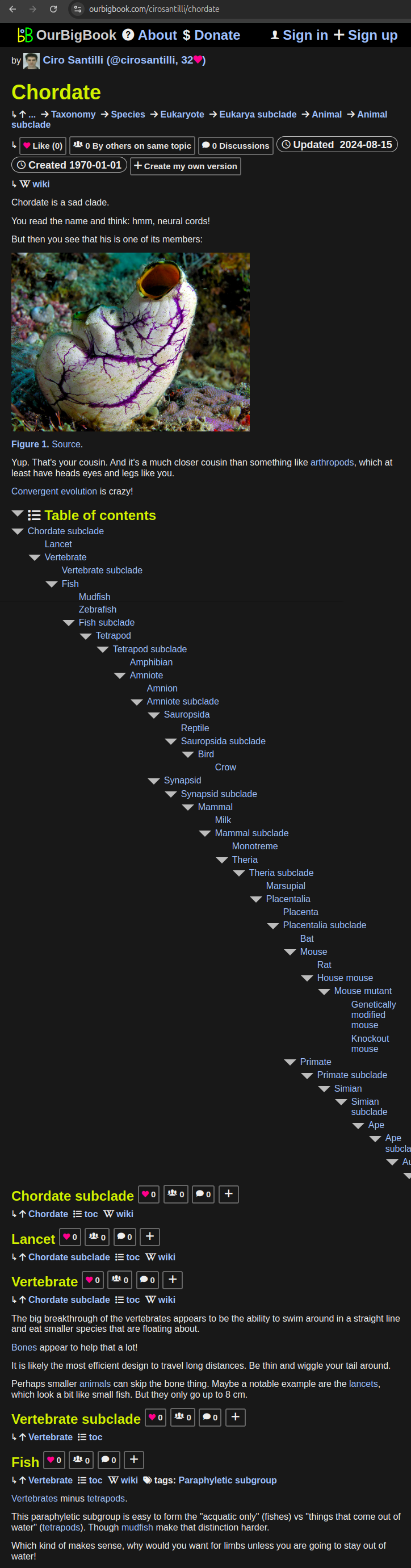
- Infinitely deep tables of contents:
All our software is open source and hosted at: github.com/ourbigbook/ourbigbook
Further documentation can be found at: docs.ourbigbook.com
Feel free to reach our to us for any help or suggestions: docs.ourbigbook.com/#contact