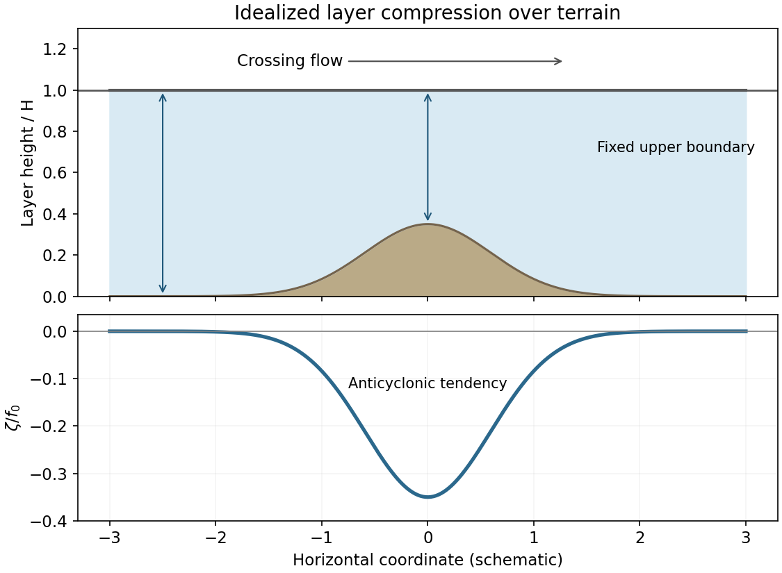
In an idealized crossing flow, take a layer between a mountain and an approximately fixed upper boundary. If its upstream depth is H and the terrain height is , climbing reduces its depth to . Conservation of shallow-water potential vorticity givesAt nearly fixed northern latitude, with negligible upstream relative vorticity, : compression produces an anticyclonic tendency. For an eastward flow this corresponds to a rightward/equatorward turning tendency. On the descending side, re-expansion restores cyclonic vorticity relative to that compressed state. Meridional displacement also changes f and participates in the balance.
The corresponding mountain-crossing isentropic PV balance uses rather than geometric depth: reduced isentropic mass thickness requires reduced absolute vorticity, and increased thickness the reverse. The geometric cartoon assumes an upper boundary that does not simply rise with the terrain. A real mountain can displace isentropes, block low-level flow or generate a downstream Rossby-wave pattern; friction and latent heating can change PV. Thus the local compression sign is a model tendency, not a universal map of every orographic circulation.

Articles by others on the same topic
There are currently no matching articles.