Aratu Week 2024 Talk by Ciro Santilli: My Best Random Projects Germany Created 2024-09-06 Updated 2025-07-16
Aratu Week 2024 Talk by Ciro Santilli: My Best Random Projects Brazil Created 2024-09-06 Updated 2025-07-16
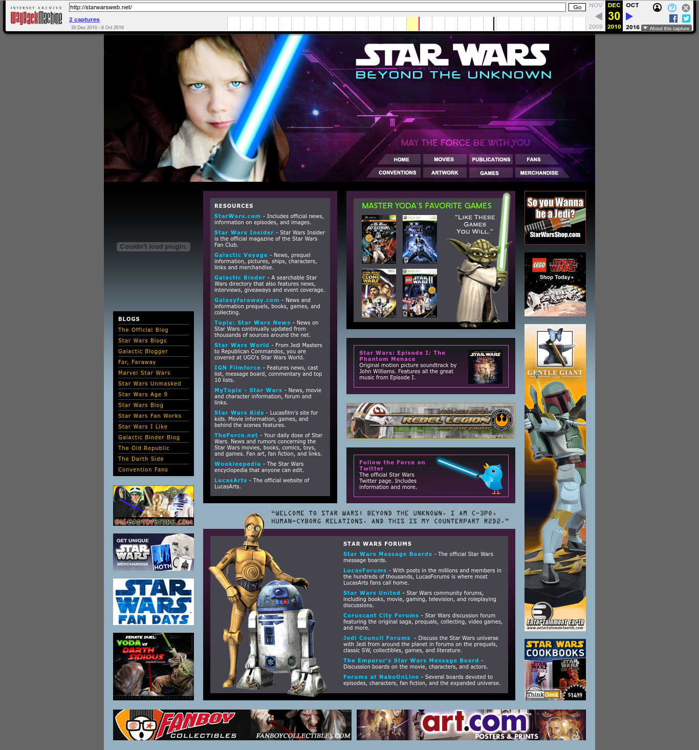
Aratu Week 2024 Talk by Ciro Santilli: My Best Random Projects The Star Wars website Created 2024-09-06 Updated 2025-07-16
History of the laser Created 2024-09-06 Updated 2025-07-16
Aratu Week 2024 Talk by Ciro Santilli: My Best Random Projects One mega article tree for each user Created 2024-09-06 Updated 2025-07-16
User home page on OurBigBook.com
. Live URL: ourbigbook.com/cirosantilli Aratu Week 2024 Talk by Ciro Santilli: My Best Random Projects Promotional material Created 2024-09-06 Updated 2025-07-16
@@@@@@@@@@@@@@@@@@@@@@@@YOUR@FREE@GRRCON@TICKET@CODE@@@@@@@@@@@@@@@@@@@@@@@@@@@
@@@@@@@@@@@@@@@@@@@@@@@@@@@@@@@@@@,          *@@@@@@@@@@@@@@@@@@@@@@@@@@@@@@@@@
@@@@@@@@@@@@@@@@@@@@@@@@@@%                          @@@@@@@@@@@@@@@@@@@@@@@@@@
@@@@@@@@@@@@@@@@@@@@@@                                   .@@@@@@@@@@@@@@@@@@@@@
@@@@@@@@@@@@@@@@@@@          *@@@@@@@@@@@@@@@@@@@,           @@@@@@@@@@@@@@@@@@
@@@@@@@@@@@@@@@@         @@@@(                   %@@@@          @@@@@@@@@@@@@@@
@@@@@@@@@@@@@@       @@@@                             @@@&        @@@@@@@@@@@@@
@@@@@@@@@@@@       @@@        @@@@@@@@@@@@@,@.           @@@        @@@@@@@@@@@
@@@@@@@@@@      %@@       .&@@@@@@&%@@@@@&&&@@@@@#          @@/      /@@@@@@@@@
@@@@@@@@@      @@       @@@&@@O@@@@@@@@@@@@@@@@(@@@@&         @@       @@@@@@@@
@@@@@@@@     @@.      .@@@,%&@@P@@@@@(,*&*@@@@@@@@#(#.@        (@@      @@@@@@@
@@@@@@*     @@       @@(@%@@@@@&R@@@@&@@@@@@@&@@@@@@/ @@@        @@      @@@@@@
@@@@@#     @@       @@@@@@@@,,@%@E@%@@@@@@@@@@@%@@@@@.@@@@        @@      @@@@@
@@@@@     @@        @.@@@@@,@@@(@,T@@@@@@@@@@@@@@@@@@@@@@@@        @@      @@@@
@@@@     @@        @&@@@@@@/@#@(@&@U@@@@@@@@(@@@@@@., #@@@@@        @@      @@@
@@@*    @@         @@@@&@@&@    #@@@R@.@@@@@.@@@@@@@%@@(@@@@@        @@     @@@
@@@     @@         /@@*@@        @@@/N/@,@@@@@@@@@    @@@@@@,        @@      @@
@@@    @@          @@@@@          @@.@I@@,@@@@@@@@    @@@@&@@         @@     @@
@@/    @@           @@@,           (#@/S@@@@@@.,@     **@@&,@         @@     @@
@@     @@           %((           @#@@@@M@@@@@&@    #./%&@@*          @@     %@
@@     @@           #&&@          @@@@&@@Y@@@@@     &@,@@@.(          @@     %@
@@,    @@           @@@@@@        *(@@%@@@F&@.      @@&%@@            @@     @@
@@@    @@           @#@%@/@         @@@*@@@R(      @@@&@              @@     @@
@@@     @@         @@@@@@@@@%@@@%%@@@@@@@%%/I@  @@@@, @              @@      @@
@@@.    @@         @@@@@@@*@&@@@@# @(@@@@@@@@E@@@@@@@&               @@     @@@
@@@@     @@         @@@@&@@(@@@@@@.@# @@@ @@@@N@@@@,@(              @@      @@@
@@@@@     @@            @@@*@@&@@*(@  @@@&@@&@@D@@@@&              @@      @@@@
@@@@@.     @@                  @/@,@@@@@@@@@@@@@@%                @@      @@@@@
@@@@@@      @@                 @@@@@@@@@@@@@,@@@@                @@      %@@@@@
@@@@@@@,     @@/             @&@@(@@@@ @@@@@@@@@               &@@      @@@@@@@
@@@@@@@@@      @@          #%@(,&,@@@@ @(&  @/,@              @@       @@@@@@@@
@@@@@@@@@@      /@@        @@&@@@@@,*  @@&  @@@@@@         .@@.       @@@@@@@@@
@@@@@@@@@@@@       @@@        @(@@@@@@ @@@  .@(@@,       @@@        @@@@@@@@@@@
@@@@@@@@@@@@@@       &@@@                             @@@#        @@@@@@@@@@@@@
@@@@@@@@@@@@@@@@         @@@@@                   @@@@@          @@@@@@@@@@@@@@@
@@@@@@@@@@@@@@@@@@#          .@@@@@@@@@@@@@@@@@@@            @@@@@@@@@@@@@@@@@@
@@@@@@@@@@@@@@@@@@@@@@         @  ,        .  @           @@@@@@@@@@@@@@@@@@@@@
@@@@@@@@@@@@@@@@@@@@@@@@@@     @ @   @#   @  *, @     @@@@@@@@@@@@@@@@@@@@@@@@@
@@@@@@@@@@@@@@@@@@@@@@@@@@@@@@@@&              @@@@@@@@@@@@@@@@@@@@@@@@@@@@@@@@
Removing the
@ signs: YOUR FREE GRRCON TICKET CODE
, *
%
.
* ,
( %
&
, .
% .& &% &&& # / /
& O ( &
. . ,%& P (,*&* #(#. (
* ( % &R & & /
# ,, % E % % .
. , ( ,T
& / # ( & U ( ., #
* & & # R . . % (
/ * /N/ , ,
. I , &
/ , (# /S ., ** &,
%(( # M & #./%& * %
#&& & Y & , .( %
, *( % F& . &%
# % / * R( &
% %% %%/I ,
. * & # ( E &
& ( . # N , (
* & *( & & D &
. / , %
, %
, / & ( &
#% (,&, (& /,
/ & ,* & . .
( . ( ,
& #
# .
, .
# *,
& Aratu Week 2024 Talk by Ciro Santilli: My Best Random Projects Love declaration Created 2024-09-06 Updated 2025-07-16
Chinese wedding (2016)
Aratu Week 2024 Talk by Ciro Santilli: My Best Random Projects Memes Created 2024-09-06 Updated 2025-07-16
Water Deer
. 2016 from badtaxidermy.com Visible at: web.archive.org/web/20200527070011/http://www.badtaxidermy.com/?page=3. Uploaded with: cryptograffiti.info. Aratu Week 2024 Talk by Ciro Santilli: My Best Random Projects Art Created 2024-09-06 Updated 2025-07-16
YellowRobot.jpg Aratu Week 2024 Talk by Ciro Santilli: My Best Random Projects Social media Created 2024-09-06 Updated 2025-07-16
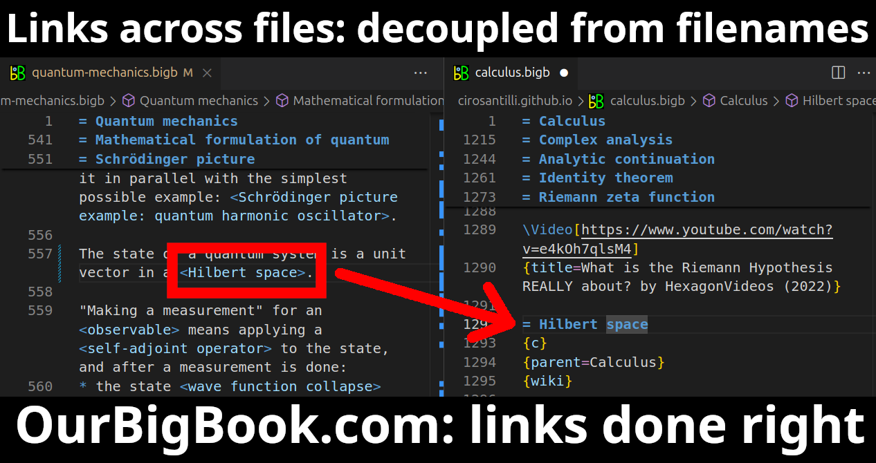
Aratu Week 2024 Talk by Ciro Santilli: My Best Random Projects Internal cross file references done right Created 2024-09-06 Updated 2025-07-16
Aratu Week 2024 Talk by Ciro Santilli: My Best Random Projects Examples of USA spying on its "allies" Created 2024-09-06 Updated 2025-07-16
Aratu Week 2024 Talk by Ciro Santilli: My Best Random Projects OurBigBook.com vs X Created 2024-09-06 Updated 2025-07-16
Other personal knowledge bases (Obsidian, static site generators, etc.), blogs, PDFs:
- no way to merge brains of multiple users
- some of them are not focused on publishing, only personal/internal company usage
Aratu Week 2024 Talk by Ciro Santilli: My Best Random Projects Edit and publish Created 2024-09-06 Updated 2025-07-16
Aratu Week 2024 Talk by Ciro Santilli: My Best Random Projects Topics: the best version of an article by other users (the killer feature) Created 2024-09-06 Updated 2025-07-16
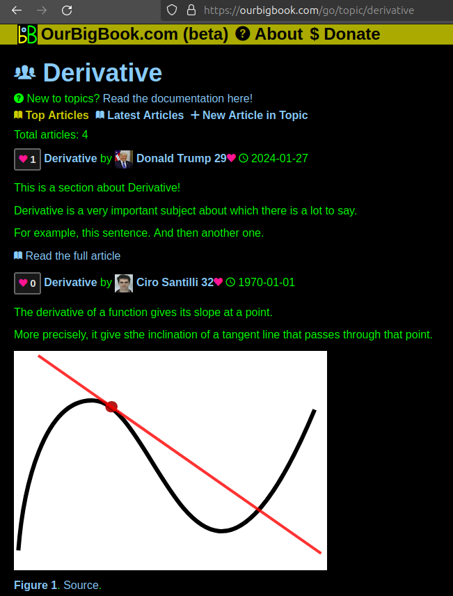
The topics feature allows you to find the best version of a subject written by other users user
. Live demo: derivative. Aratu Week 2024 Talk by Ciro Santilli: My Best Random Projects What you get Created 2024-09-06 Updated 2025-07-16
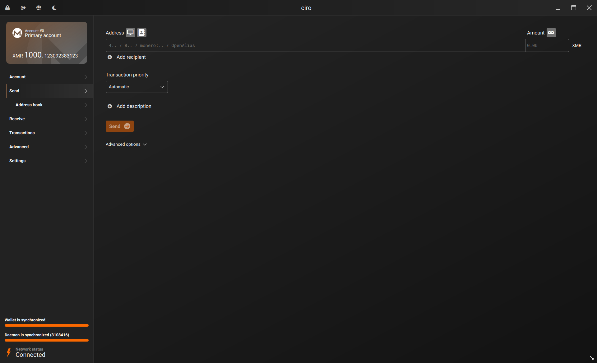
Aratu Week 2024 Talk by Ciro Santilli: My Best Random Projects An anonymous donor gave me 1000 Monero (~126,000 USD) on March 2024 to work on this for one year Created 2024-09-06 Updated 2025-07-16
Aratu Week 2024 Talk by Ciro Santilli: My Best Random Projects Motivation: university sucks real bad right now Created 2024-09-06 Updated 2025-07-16
The ultimate goal: create an university:
- without entry exams
- without course requirements
- where all material is free and available online: lecture notes, problem sheets, past exam papers
- where you only pay to take certification exams for the courses that you care about
The technical goal:
Get university students to write what they learn. All university material should be amazing and free!
The how:
Create the ultimate personal knowledge base software with multi-user mind-melding features.
Aratu Week 2024 Talk by Ciro Santilli: My Best Random Projects I'm not a professional hacker, I did some very occasional OSINT just for fun Created 2024-09-06 Updated 2025-07-16
Aratu Week 2024 Talk by Ciro Santilli: My Best Random Projects Creative Commons CC By-SA Created 2024-09-06 Updated 2025-07-16
There are unlisted articles, also show them or only show them.
