Cartography, the art and science of map-making, varies across different continents due to differences in geography, cultural significance, and historical contexts. Here’s an overview of cartography by continent: ### North America - **Historical Context**: Early maps were created by Indigenous peoples, often focusing on natural landmarks and travel routes. European explorers later charted the continent, leading to significant but often Eurocentric maps.
Cave surveying, also known as cave mapping or speleometry, is the process of measuring and documenting the geometry and features of a cave system. This involves gathering data about the cave's size, shape, and layout, as well as its geological features, passage configurations, and any notable formations such as stalactites, stalagmites, and pools.
Circles of latitude, also known simply as latitudes, are imaginary horizontal lines that encircle the Earth parallel to the Equator. They are used to specify the north-south position of a point on the Earth's surface. Each circle of latitude is expressed in degrees, ranging from 0° at the Equator to 90° at the poles (90°N at the North Pole and 90°S at the South Pole).
The history of cartography is the study of the creation and use of maps throughout human history. It reflects the development of human understanding of geography, technology, and society. Here’s an overview of key periods and milestones in the history of cartography: ### Ancient Mapmaking - **Prehistoric Maps:** Early human societies created rudimentary maps (e.g., cave drawings) to depict their surroundings and hunting territories.
The Coastline Paradox refers to the counterintuitive observation that the measured length of a coastline can vary significantly depending on the scale of the measurement tool used. This phenomenon arises from the fractal nature of coastlines and the complexity of their shapes.
Wikis about geography are collaborative online platforms that allow users to create, edit, and share information related to various geographical topics. These wikis can cover a wide range of subjects, including: 1. **Geographical Features**: Information about mountains, rivers, lakes, valleys, and other physical features of the Earth. 2. **Countries and Regions**: Detailed entries on different countries, states, and regions, including their geography, culture, history, and demographics.
Argus Coastal Monitoring is a system used for monitoring coastal areas using advanced remote sensing technologies. Developed by the University of Southern California, Argus consists of a network of video cameras and other sensors strategically placed along coastlines. These systems capture high-resolution images and video of the ocean and coastal environments, typically focusing on aspects like wave conditions, shoreline changes, and beach erosion.
An Augmented Reality (AR) Sandtable is an interactive system that combines traditional sand table modeling with augmented reality technology to enhance the visualization and interaction of geographic or topographic data. Here's a breakdown of its components and functionalities: 1. **Physical Sandbox**: The setup typically consists of a physical tabletop sandbox filled with sand, where users can create and manipulate landscapes by shaping the sand terrain.
A bird's-eye view refers to a perspective that depicts a scene from high above, as though one were looking down from the sky, akin to how a bird might see the landscape from its flight. This viewpoint provides a wide-angle overview that includes a larger context of the area, allowing for a more comprehensive understanding of the layout and relationships of various elements within the scene.
Cartographic censorship refers to the practice of altering, omitting, or distorting geographical information on maps to control the dissemination of knowledge, influence public perception, or achieve political or ideological objectives. This can take various forms, including: 1. **Omission of Features**: Certain geographical features, such as borders, landmarks, or entire territories, may be deliberately left out or misrepresented. For instance, some maps may exclude disputed regions or territories claimed by a country.
The term "drying height" can refer to a few different concepts depending on the context, but it is most commonly associated with agriculture, horticulture, and food processing. Here are a couple of interpretations: 1. **Agricultural Context**: In agriculture, drying height may refer to the vertical height at which crops (especially grains or forage) are placed during the drying process to facilitate air circulation and moisture removal.
The term "Global Relief Model" doesn't refer to a widely recognized or standardized concept, but it can pertain to various frameworks and strategies used in humanitarian aid and disaster relief efforts on a global scale. In general, a global relief model is designed to optimize and coordinate the distribution of resources, support, and assistance in response to crises, natural disasters, or humanitarian needs across countries and regions.
Cartography of Latin America refers to the art and science of map-making specific to the countries and regions within Latin America. This encompasses a variety of maps that depict geographical, cultural, political, and economic features of Latin American countries. Key aspects of cartography in this context include: 1. **Geographical Features**: Maps that display physical geography, including mountains, rivers, forests, and climate zones.
In cartography, a cartouche is a decorative motif used to enclose a map's title, scale, legend, or other important information. It is often ornately designed, giving maps an artistic touch while also helping to highlight key textual information. The term "cartouche" originally comes from the French word for a scroll or a roll of paper, and it is sometimes associated with a frame that resembles an elongated oval or a shield shape.
D. R. Fraser Taylor is a prominent Canadian geographer and a recognized authority in the field of Geographic Information Systems (GIS), cartography, and digital mapping. He is known for his work in developing techniques and methodologies for spatial data analysis and visualization. Taylor has been involved in various academic and research endeavors, contributing to the understanding of geographical information science and its applications across different disciplines.
DTED stands for Digital Terrain Elevation Data. It is a format used for representing terrain elevation data, typically in a raster format, which consists of elevations above a defined reference level (usually sea level) at specific locations. DTED is primarily used by military and civilian applications for tasks such as terrain analysis, simulation, mission planning, and geospatial analysis. The data is organized into a grid of elevation points, with each point representing the elevation of the terrain at that location.
Tartary historically referred to a vast region in Asia and parts of Europe, primarily during the medieval and early modern periods. It encompassed areas inhabited by various Turkic and Mongolic peoples, including regions of present-day Mongolia, China, Russia, and Central Asia. The term was often used by Europeans to describe lands beyond their direct knowledge and control.
"Terra incognita" is a Latin phrase meaning "unknown land." Historically, it referred to regions that had not yet been mapped or explored, often depicted on ancient and medieval maps as blank spaces or labeled with the term "terra incognita." These areas were often associated with myths or speculations about what might lie within them.
Better Than Cash Alliance is a global partnership aimed at accelerating the transition from cash to digital payments. Launched in 2012, the initiative is managed by the United Nations Capital Development Fund (UNCDF) and involves a variety of stakeholders, including governments, international organizations, and private sector companies. The primary objective of the alliance is to promote digital payments as a way to enhance financial inclusion, reduce poverty, and improve the efficiency of money transfers.
Pinned article: Introduction to the OurBigBook Project
Welcome to the OurBigBook Project! Our goal is to create the perfect publishing platform for STEM subjects, and get university-level students to write the best free STEM tutorials ever.
Everyone is welcome to create an account and play with the site: ourbigbook.com/go/register. We belive that students themselves can write amazing tutorials, but teachers are welcome too. You can write about anything you want, it doesn't have to be STEM or even educational. Silly test content is very welcome and you won't be penalized in any way. Just keep it legal!
Intro to OurBigBook
. Source. We have two killer features:
- topics: topics group articles by different users with the same title, e.g. here is the topic for the "Fundamental Theorem of Calculus" ourbigbook.com/go/topic/fundamental-theorem-of-calculusArticles of different users are sorted by upvote within each article page. This feature is a bit like:
- a Wikipedia where each user can have their own version of each article
- a Q&A website like Stack Overflow, where multiple people can give their views on a given topic, and the best ones are sorted by upvote. Except you don't need to wait for someone to ask first, and any topic goes, no matter how narrow or broad
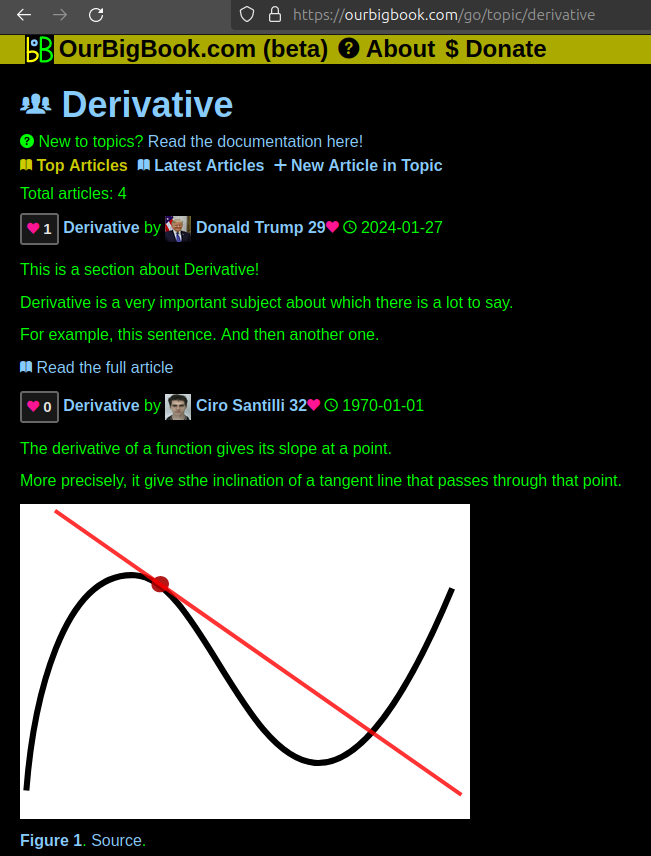
This feature makes it possible for readers to find better explanations of any topic created by other writers. And it allows writers to create an explanation in a place that readers might actually find it.Figure 1. Screenshot of the "Derivative" topic page. View it live at: ourbigbook.com/go/topic/derivativeVideo 2. OurBigBook Web topics demo. Source. - local editing: you can store all your personal knowledge base content locally in a plaintext markup format that can be edited locally and published either:This way you can be sure that even if OurBigBook.com were to go down one day (which we have no plans to do as it is quite cheap to host!), your content will still be perfectly readable as a static site.
- to OurBigBook.com to get awesome multi-user features like topics and likes
- as HTML files to a static website, which you can host yourself for free on many external providers like GitHub Pages, and remain in full control
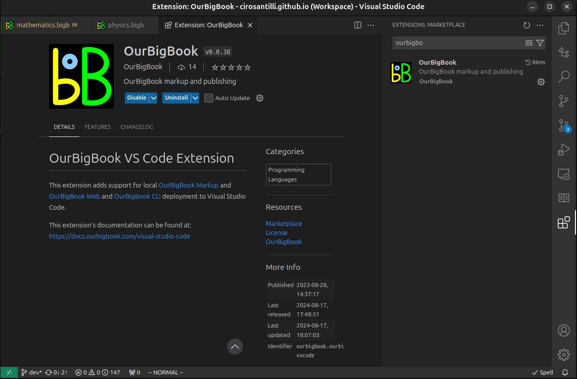
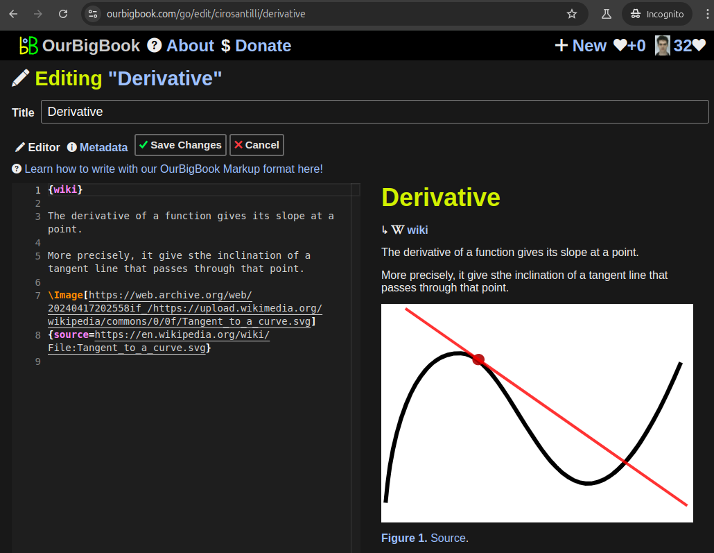
Figure 2. You can publish local OurBigBook lightweight markup files to either OurBigBook.com or as a static website.Figure 3. Visual Studio Code extension installation.Figure 5. . You can also edit articles on the Web editor without installing anything locally. Video 3. Edit locally and publish demo. Source. This shows editing OurBigBook Markup and publishing it using the Visual Studio Code extension. - Infinitely deep tables of contents:
All our software is open source and hosted at: github.com/ourbigbook/ourbigbook
Further documentation can be found at: docs.ourbigbook.com
Feel free to reach our to us for any help or suggestions: docs.ourbigbook.com/#contact


