The planning horizon refers to the length of time over which an organization plans its activities, strategies, and forecasts. It can vary significantly based on the context and the specific purpose of the planning. Here are some key points regarding the planning horizon: 1. **Time Frame**: The planning horizon can range from short-term (days or weeks) to long-term (months, years, or even decades). Common categorizations include: - **Short-term**: Typically up to one year.
The Process Theory of Composition is an approach to writing that emphasizes the cognitive and iterative processes involved in creating a text. Unlike traditional views that may treat writing as a linear sequence of stages (such as prewriting, drafting, revising, and editing), the Process Theory posits that writing is often more recursive, with writers moving back and forth between different stages as they develop their ideas.
The "calculus of broadcasting systems" is not a standard term or concept in the fields of mathematics or engineering as of my last knowledge update in October 2023. However, it may refer to mathematical or theoretical frameworks used to analyze and optimize broadcasting systems in communications, including radio, television, and data transmission. In general, broadcasting systems involve the transmission of information from a single source to multiple receivers.
Join-calculus is a programming language and formalism designed for concurrent and distributed programming. It was developed to provide a way to describe and reason about systems that involve multiple components interacting with each other. The key features of Join-calculus include: 1. **Concurrency**: Join-calculus is specifically built to manage concurrent processes. It allows for the specification of interactions between these processes in a clean and concise manner.
Unbounded nondeterminism is a concept from theoretical computer science, particularly in the context of computation and automata theory. It refers to a computational model where, at certain steps in a computation process, the machine can make multiple choices without any restrictions or bounds on the number of choices it can explore. In particular, let's break down the concept: 1. **Nondeterminism**: This is the quality of a computational system that allows multiple possible actions or transitions from a given state.
Process science is an interdisciplinary field that studies the systematic and structured description, modeling, analysis, and optimization of processes across various domains. These processes can be found in areas such as manufacturing, logistics, healthcare, services, and even in information technology. The aim of process science is to improve efficiency, effectiveness, and adaptability in the way processes are designed and executed.
"Fail-fast" is a concept primarily used in software development and project management that emphasizes the importance of quickly identifying and addressing failures or issues in a project, process, or system. The idea is to allow for immediate feedback and rapid learning instead of prolonging a problem and potentially exacerbating it. Key aspects of the fail-fast approach include: 1. **Early Detection**: Systems, processes, and products should be designed to quickly reveal errors or failures.
GRASP, which stands for General Responsibility Assignment Software Patterns, is a set of principles used in object-oriented design to guide the assignment of responsibilities to classes and objects in a software system. Developed by Craig Larman, GRASP includes nine fundamental principles that help developers create more maintainable, cohesive, and effective designs by promoting good object-oriented practices. Here are the nine GRASP principles: 1. **Information Expert**: Assign a responsibility to the class that has the information necessary to fulfill it.
As of my last knowledge update in October 2023, there is no widely recognized figure or topic known as "Jack Linnett." It's possible that Jack Linnett could refer to a private individual or someone who has gained relevance after that date.
Casio programmable calculators are a series of calculators produced by Casio, known for their ability to perform complex calculations, scientific functions, and programming capabilities. These calculators are popular among students, engineers, scientists, and professionals who require advanced mathematical and computational features. Key features of Casio programmable calculators include: 1. **Programmable Functions**: Users can write custom programs using built-in programming languages to automate calculations and solve specific problems.
Philippe Michel is a French mathematician known for his contributions to number theory, particularly in areas such as analytic number theory, L-functions, and automorphic forms. His work often involves deep connections between number theory and other areas of mathematics, including harmonic analysis and representation theory. He has made significant contributions to problems related to the distribution of prime numbers and has worked on results concerning the Riemann zeta function and its generalizations.
An S-brane, or "space-time brane," is a theoretical concept arising in string theory and related areas of high-energy physics. It extends the idea of branes, which are higher-dimensional objects that can exist within string theory. While typical branes (like D-branes) are objects with dimensions that are "static" in space but may evolve through time, S-branes are characterized by their time-dependent nature.
A whitelist is a concept used in various fields such as information security, networking, and software applications. It refers to a list of entities that are explicitly allowed or trusted to access certain resources, systems, or networks. The opposite of a whitelist is a blacklist, which contains entities that are explicitly denied access.
Robert Daniel Carmichael is not widely recognized in mainstream literature, history, or popular culture based on my last available information. If you are referring to a specific individual, topic, or context that has gained notoriety or relevance after October 2023, I may not have that information.
Takeshi Saito is a Japanese mathematician known for his contributions to several areas of mathematics, particularly in algebraic geometry, topology, and singularity theory. His work often involves the study of algebraic varieties, deformation of singularities, and the relationship between algebraic geometry and mathematical physics. In particular, Saito is well-known for his development of the theory of mixed Hodge structures and for contributions to the theory of D-modules and their applications in singularity theory.
Bauerian extension is a concept in the field of functional analysis and related areas of mathematics, particularly concerning the extension of linear operators or functionals from one space to another. It is named after the mathematician Friedrich Bauer. In a more specific context, consider the problem of extending bounded linear functionals defined on a subspace of a Banach space to the entire space.
An elementary number refers to a number that is part of basic arithmetic and number theory—specifically, it typically refers to the integers, rational numbers, or certain simple constructs in mathematics. The term can also refer to specific types of numbers, such as the natural numbers (1, 2, 3, ...), whole numbers (0, 1, 2, ...), negative integers, or even certain classes of rational numbers.
Ihara's lemma is a result in number theory, specifically in the study of zeta functions of curves over finite fields. The lemma relates the zeta function of a geometrically irreducible smooth projective curve over a finite field to the properties of its function field.
The Siegel G-function is a complex function that arises in the theory of analytic number theory, particularly in the area of modular forms and automorphic forms. It is named after the German mathematician Carl Ludwig Siegel, who made significant contributions to number theory and related fields. In a broad sense, the Siegel G-function can be viewed as a generalization of the classical gamma function and is associated with several variables.
Pinned article: Introduction to the OurBigBook Project
Welcome to the OurBigBook Project! Our goal is to create the perfect publishing platform for STEM subjects, and get university-level students to write the best free STEM tutorials ever.
Everyone is welcome to create an account and play with the site: ourbigbook.com/go/register. We belive that students themselves can write amazing tutorials, but teachers are welcome too. You can write about anything you want, it doesn't have to be STEM or even educational. Silly test content is very welcome and you won't be penalized in any way. Just keep it legal!
Intro to OurBigBook
. Source. We have two killer features:
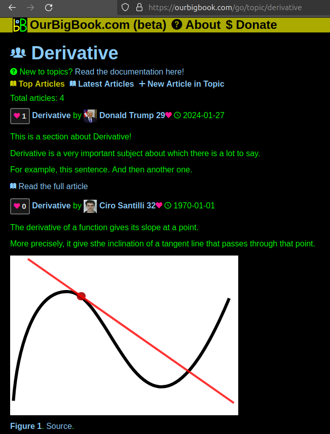
- topics: topics group articles by different users with the same title, e.g. here is the topic for the "Fundamental Theorem of Calculus" ourbigbook.com/go/topic/fundamental-theorem-of-calculusArticles of different users are sorted by upvote within each article page. This feature is a bit like:
- a Wikipedia where each user can have their own version of each article
- a Q&A website like Stack Overflow, where multiple people can give their views on a given topic, and the best ones are sorted by upvote. Except you don't need to wait for someone to ask first, and any topic goes, no matter how narrow or broad
This feature makes it possible for readers to find better explanations of any topic created by other writers. And it allows writers to create an explanation in a place that readers might actually find it.Figure 1. Screenshot of the "Derivative" topic page. View it live at: ourbigbook.com/go/topic/derivativeVideo 2. OurBigBook Web topics demo. Source. - local editing: you can store all your personal knowledge base content locally in a plaintext markup format that can be edited locally and published either:This way you can be sure that even if OurBigBook.com were to go down one day (which we have no plans to do as it is quite cheap to host!), your content will still be perfectly readable as a static site.
- to OurBigBook.com to get awesome multi-user features like topics and likes
- as HTML files to a static website, which you can host yourself for free on many external providers like GitHub Pages, and remain in full control
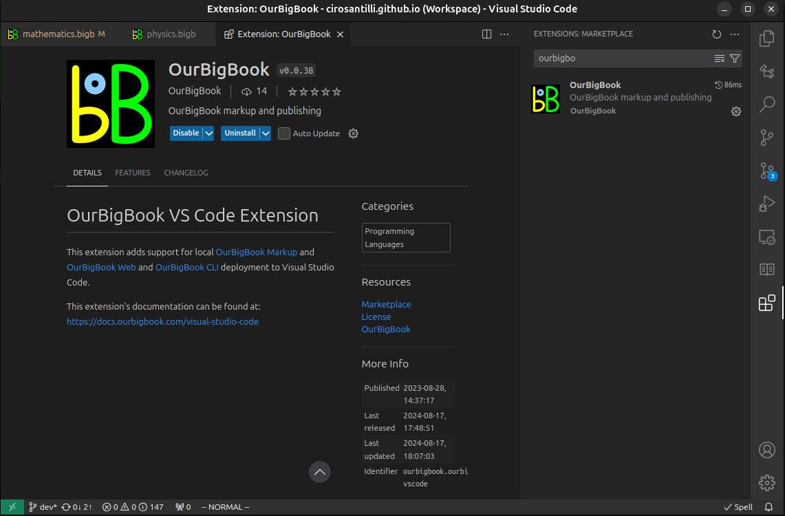
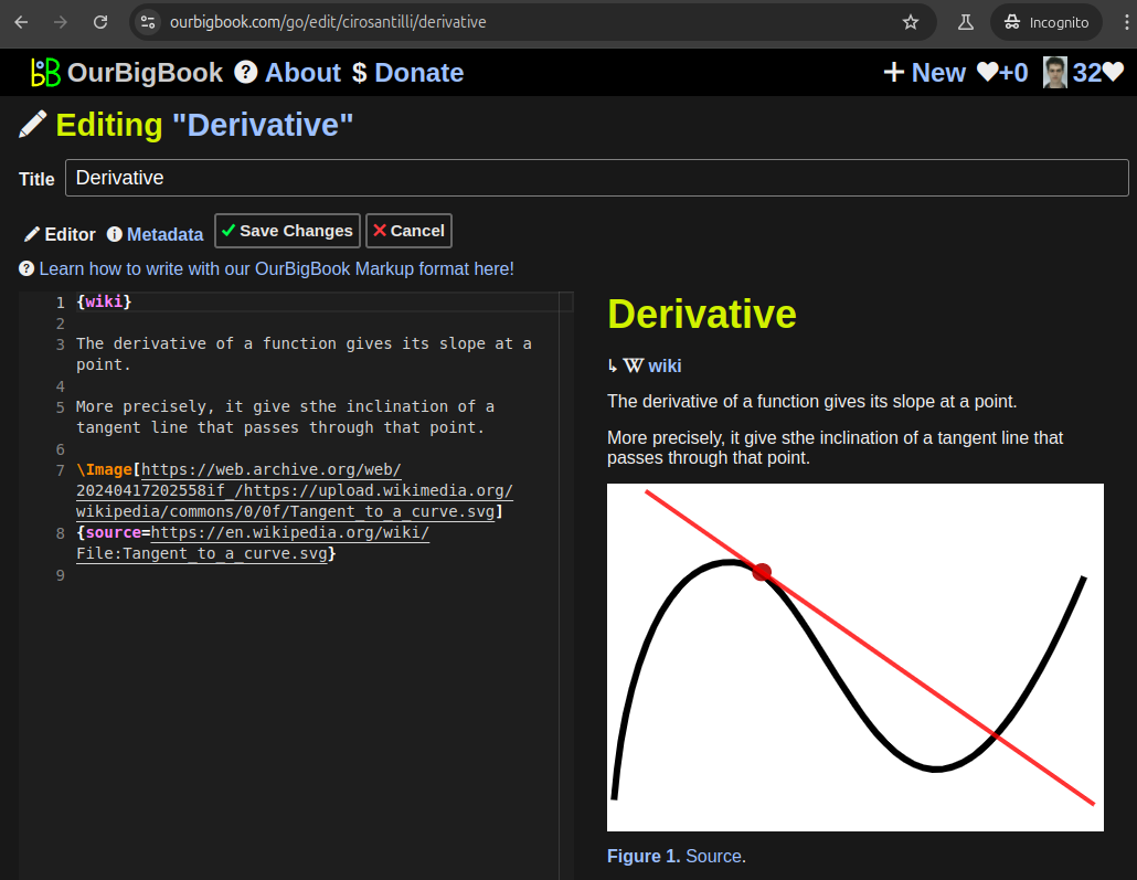
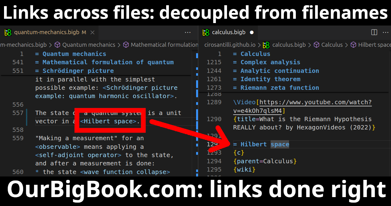
Figure 3. Visual Studio Code extension installation.Figure 4. Visual Studio Code extension tree navigation.Figure 5. Web editor. You can also edit articles on the Web editor without installing anything locally.Video 3. Edit locally and publish demo. Source. This shows editing OurBigBook Markup and publishing it using the Visual Studio Code extension.Video 4. OurBigBook Visual Studio Code extension editing and navigation demo. Source. - Infinitely deep tables of contents:
All our software is open source and hosted at: github.com/ourbigbook/ourbigbook
Further documentation can be found at: docs.ourbigbook.com
Feel free to reach our to us for any help or suggestions: docs.ourbigbook.com/#contact


