norm sequence convergence does not imply pointwise convergence by  Ciro Santilli 37 Updated 2025-07-16
Integrable functions to the power , usually and in this text assumed under the Lebesgue integral because: Lebesgue integral of is complete but Riemann isn't
is by far the most important of because it is quantum mechanics states live, because the total probability of being in any state has to be 1!
has some crucially important properties that other don't (TODO confirm and make those more precise):
- it is the only that is Hilbert space because it is the only one where an inner product compatible with the metric can be defined:
- Fourier basis is complete for , which is great for solving differential equation
Some sources say that this is just the part that says that the norm of a function is the same as the norm of its Fourier transform.
The comment at math.stackexchange.com/questions/446870/bijectiveness-injectiveness-and-surjectiveness-of-fourier-transformation-define/1235725#1235725 may be of interest, it says that the bijection statement is an easy consequence from the norm one, thus the confusion.
TODO does it require it to be in as well? Wikipedia en.wikipedia.org/w/index.php?title=Plancherel_theorem&oldid=987110841 says yes, but courses.maths.ox.ac.uk/node/view_material/53981 does not mention it.
As mentioned at Section "Plancherel theorem", some people call this part of Plancherel theorem, while others say it is just a corollary.
This is an important fact in quantum mechanics, since it is because of this that it makes sense to talk about position and momentum space as two dual representations of the wave function that contain the exact same amount of information.
Main motivation: Lebesgue integral.
The Bright Side Of Mathematics 2019 playlist: www.youtube.com/watch?v=xZ69KEg7ccU&list=PLBh2i93oe2qvMVqAzsX1Kuv6-4fjazZ8j
Solving partial differential equations with the Fourier series by  Ciro Santilli 37 Updated 2025-07-16
See: math.stackexchange.com/questions/579453/real-world-application-of-fourier-series/3729366#3729366 from heat equation solution with Fourier series.
Separation of variables of certain equations like the heat equation and wave equation are solved immediately by calculating the Fourier series of initial conditions!
See sections: "Example 1 - N even", "Example 2 - N odd" and "Representation in terms of sines and cosines" of www.statlect.com/matrix-algebra/discrete-Fourier-transform-of-a-real-signal
The transform still has complex numbers.
Summary:Therefore, we only need about half of to represent the signal, as the other half can be derived by conjugation.
- is real
"Representation in terms of sines and cosines" from www.statlect.com/matrix-algebra/discrete-Fourier-transform-of-a-real-signal then gives explicit formulas in terms of .
NumPy for example has "Real FFTs" for this: numpy.org/doc/1.24/reference/routines.fft.html#real-ffts
DFT of with 25 points
. Source at: numpy/fft_plot.py. This plot illustrates how the DFT of a real signal is symmetric around the middle point, and so only half of the transform points are needed to reconstruct the original signal. We also see how the phase of the sinusoids determines if their DFT components are real or imaginary.There are actually two possible definitions for the DFT:
- 1/N, given as "the default" in many sources:
- , known as the "normalized DFT" by some sources: www.dsprelated.com/freebooks/mdft/Normalized_DFT.html, definition which we adopt:
An efficient algorithm to calculate the discrete Fourier transform.
Continuous version of the Fourier series.
Can be used to represent functions that are not periodic: math.stackexchange.com/questions/221137/what-is-the-difference-between-fourier-series-and-fourier-transformation while the Fourier series is only for periodic functions.
Therefore, the Fourier transform can be seen as a generalization of the Fourier series that can also decompose functions defined on the entire real line.
As a more concrete example, just like the Fourier series is how you solve the heat equation on a line segment with Dirichlet boundary conditions as shown at: Section "Solving partial differential equations with the Fourier series", the Fourier transform is what you need to solve the problem when the domain is the entire real line.
Lecture notes:
- www.robots.ox.ac.uk/~az/lectures/ia/lect2.pdf Lecture 2: 2D Fourier transforms and applications by A. Zisserman (2014)
How the 2D FFT works by Mike X Cohen (2017)
Source. Animations showing how the 2D Fourier transform looks like for simple inpuf functions.A set of theorems that prove under different conditions that the Fourier transform has an inverse for a given space, examples:
First published by Fourier in 1807 to solve the heat equation.
Pinned article: Introduction to the OurBigBook Project
Welcome to the OurBigBook Project! Our goal is to create the perfect publishing platform for STEM subjects, and get university-level students to write the best free STEM tutorials ever.
Everyone is welcome to create an account and play with the site: ourbigbook.com/go/register. We belive that students themselves can write amazing tutorials, but teachers are welcome too. You can write about anything you want, it doesn't have to be STEM or even educational. Silly test content is very welcome and you won't be penalized in any way. Just keep it legal!
Intro to OurBigBook
. Source. We have two killer features:
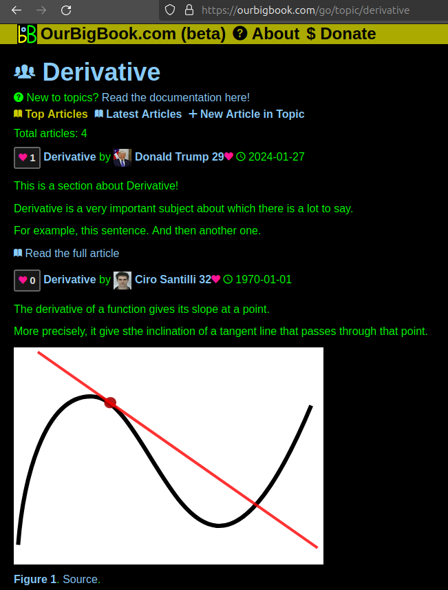
- topics: topics group articles by different users with the same title, e.g. here is the topic for the "Fundamental Theorem of Calculus" ourbigbook.com/go/topic/fundamental-theorem-of-calculusArticles of different users are sorted by upvote within each article page. This feature is a bit like:
- a Wikipedia where each user can have their own version of each article
- a Q&A website like Stack Overflow, where multiple people can give their views on a given topic, and the best ones are sorted by upvote. Except you don't need to wait for someone to ask first, and any topic goes, no matter how narrow or broad
This feature makes it possible for readers to find better explanations of any topic created by other writers. And it allows writers to create an explanation in a place that readers might actually find it.Figure 1. Screenshot of the "Derivative" topic page. View it live at: ourbigbook.com/go/topic/derivativeVideo 2. OurBigBook Web topics demo. Source. - local editing: you can store all your personal knowledge base content locally in a plaintext markup format that can be edited locally and published either:This way you can be sure that even if OurBigBook.com were to go down one day (which we have no plans to do as it is quite cheap to host!), your content will still be perfectly readable as a static site.
- to OurBigBook.com to get awesome multi-user features like topics and likes
- as HTML files to a static website, which you can host yourself for free on many external providers like GitHub Pages, and remain in full control
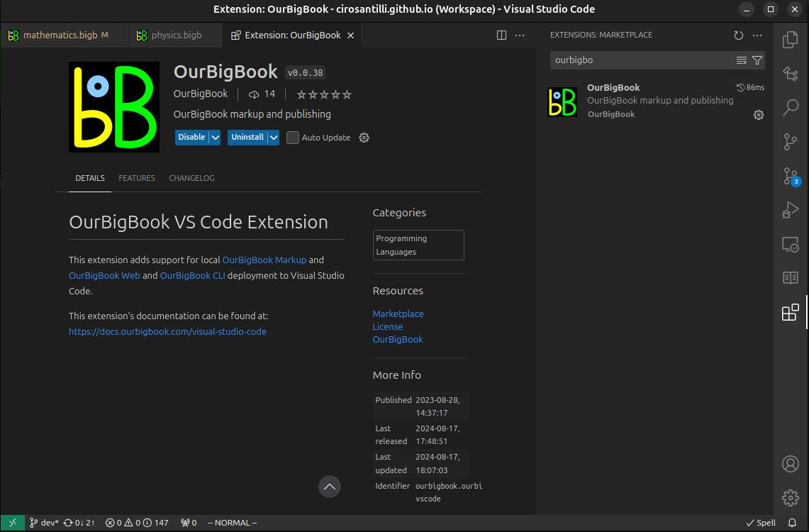
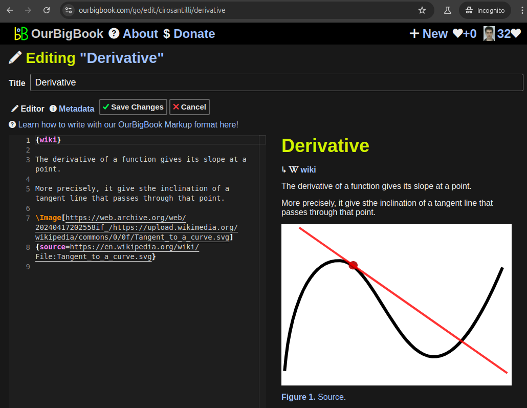
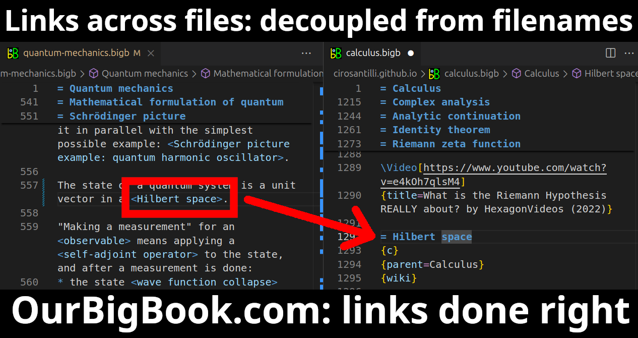
Figure 3. Visual Studio Code extension installation.Figure 4. Visual Studio Code extension tree navigation.Figure 5. Web editor. You can also edit articles on the Web editor without installing anything locally.Video 3. Edit locally and publish demo. Source. This shows editing OurBigBook Markup and publishing it using the Visual Studio Code extension.Video 4. OurBigBook Visual Studio Code extension editing and navigation demo. Source. - Infinitely deep tables of contents:
All our software is open source and hosted at: github.com/ourbigbook/ourbigbook
Further documentation can be found at: docs.ourbigbook.com
Feel free to reach our to us for any help or suggestions: docs.ourbigbook.com/#contact


