The vertical distribution of ice in Arctic clouds refers to how ice crystals are distributed within different layers of the atmosphere, particularly in cloud formations that contain ice in polar regions such as the Arctic. This distribution is important for understanding various atmospheric processes, including climate change, cloud dynamics, and precipitation patterns.
"Wind stubs" is not a widely recognized term in established contexts or industries. However, it might refer to several different concepts depending on the context. Here are a few possibilities: 1. **Wind Energy**: If "wind stubs" pertains to wind energy, it could refer to components or features associated with wind turbines, such as connection points, support structures, or base fittings where wind turbine blades and other parts are attached.
"Chubasco" is a term primarily used in meteorology to describe a sudden, intense rainstorm or squall associated with thunderstorms, especially in coastal regions like those found in Mexico and parts of the Southwestern United States. These storms can bring heavy rainfall, strong winds, and potentially even hail.
A fire warning is a notification or alert that indicates an increased risk of fire in a specific area or environment. This warning can come from various sources, including meteorological services, fire departments, or emergency management agencies. Fire warnings are typically issued during conditions that favor the ignition and spread of wildfires, such as high temperatures, low humidity, strong winds, and dry vegetation.
Demersal fish are species that live and feed near the bottom of the ocean, sea, or other bodies of water. They inhabit the benthic zone, which is the ecological region at the lowest level of a body of water, including the sediment surface and sub-surface layers. These fish often have adaptations that allow them to thrive in this environment, such as a flattened body shape for better maneuverability along the seabed.
Freezing drizzle is a type of winter precipitation that consists of supercooled liquid droplets of water that fall from the atmosphere and freeze upon contact with surfaces. This phenomenon usually occurs when there is a layer of warmer air aloft above a surface layer of cold air. The supercooled droplets can create a thin layer of ice on roads, sidewalks, trees, and other surfaces, leading to potentially hazardous conditions such as ice accumulation.
A law enforcement warning typically refers to a notification or advisory issued by police or other law enforcement agencies to alert the public about potential dangers, criminal activity, or safety concerns in a specific area. These warnings can take various forms, such as: 1. **Crime Alerts**: Notifications about recent criminal activity in a community, such as burglaries, assaults, or scams, often aimed at raising awareness and encouraging citizens to report suspicious behavior.
NSSL Doppler refers to the Doppler radar systems and technologies developed and utilized by the National Severe Storms Laboratory (NSSL) in the United States. NSSL is part of the National Oceanic and Atmospheric Administration (NOAA) and focuses on research related to severe weather and its impacts. Doppler radar technology is critical in meteorology for detecting and tracking precipitation, analyzing storm structures, and measuring wind patterns in the atmosphere.
Leptocephalus refers to a larval stage of certain types of fish, particularly those in the order Anguilliformes, which includes eels. The term is most commonly associated with the larvae of eels, such as the European eel (Anguilla anguilla) and the American eel (Anguilla rostrata).
The Ballantine Scale, also known as the Ballantine's Abbreviation-scale, is a scale used in the field of metallurgy to describe the toughness and resilience of metals and alloys. It is often referenced in engineering and materials science. The scale provides a way to evaluate the performance of materials under different stress conditions, helping engineers determine the suitability of materials for various applications, especially in construction and manufacturing.
The National Weather Service (NWS) office in Des Moines, Iowa, is a regional branch of the NWS, which is part of the National Oceanic and Atmospheric Administration (NOAA). The Des Moines office is responsible for providing weather forecasts, warnings, and other meteorological services to central and northern Iowa. This includes monitoring severe weather events such as thunderstorms, tornadoes, and winter storms, as well as issuing alerts to inform the public and local agencies.
The National Weather Service (NWS) Training Center is a facility that provides training and educational resources to personnel within the NWS and related meteorological fields. Located in Kansas City, Missouri, the center focuses on enhancing the skills and knowledge of NWS employees through various programs, including classroom instruction, hands-on training, and professional development. The Training Center offers a range of courses covering topics such as meteorology, hydrology, forecasting, weather service operations, and the use of technology in weather prediction.
The Nested Grid Model refers to a computational modeling approach used in various fields like meteorology, oceanography, and climate science. Its primary purpose is to provide a more detailed representation of physical processes occurring within different spatial scales. Here are some key characteristics of nested grid models: 1. **Hierarchical Grid Structures**: In a nested grid model, a coarse grid serves as the primary computational domain, while one or more finer grids (nested grids) are implemented within specific regions of interest.
Wind-induced surface heat exchange refers to the transfer of thermal energy between the atmosphere and the surface (such as water, land, or vegetation) that is influenced by wind. This process plays a crucial role in various environmental and climatic systems. There are two primary forms of heat exchange that wind can facilitate: 1. **Sensible Heat Exchange**: This occurs when the wind moves air that has a different temperature than the surface it encounters.
The Swedish Meteorological and Hydrological Institute (SMHI) is a government agency in Sweden responsible for monitoring and forecasting weather and climate, as well as managing hydrological data. Established in 1873, SMHI provides a range of services related to meteorology, hydrology, and oceanography. Its primary functions include: 1. **Weather Forecasting**: SMHI produces daily weather forecasts and warnings for various weather-related events, such as storms, floods, and heatwaves.
The Hero Fracture Zone is a significant geological feature located in the central northern part of the Atlantic Ocean, specifically within the North Atlantic Ocean. It is characterized by a series of faults and fractures on the ocean floor, which are indicative of tectonic activity. The zone is associated with the boundary between the North American Plate and the Eurasian Plate. This area is of interest to geologists and oceanographers because it provides insights into tectonic processes and the geological history of the Earth's crust.
The New Hebrides Trench, also known as the Vanuatu Trench, is an oceanic trench located in the South Pacific Ocean, off the northeastern coast of Australia and east of the island nation of Vanuatu. It is formed by the subduction of the Australian Plate beneath the Pacific Plate. The trench is part of a complex system of tectonic plate interactions in the region, which is known for its seismic activity, including the potential for earthquakes and volcanic eruptions.
Fisheries science is a multidisciplinary field that focuses on the study of fish populations, their habitats, and the ecosystems they inhabit. It integrates various scientific disciplines such as biology, ecology, marine science, environmental science, and economics to understand and manage fishery resources sustainably. Key areas of research and practice within fisheries science include: 1. **Fish Biology**: Understanding the life cycles, behavior, reproduction, and physiology of fish species.
Benthic-pelagic coupling refers to the interactions and exchanges of materials and energy between the benthic (sea floor) and pelagic (open water) zones of aquatic ecosystems. This concept is important in understanding nutrient dynamics, energy flow, and ecological interactions in marine and freshwater environments.
The Catlin Seaview Survey is a research project focused on assessing and documenting the health of coral reefs and marine environments, particularly in the context of climate change and ocean acidification. Launched in 2012, the survey employs advanced underwater photography and imaging technologies, including 360-degree cameras, to capture high-resolution panoramic images of coral reefs.
Pinned article: Introduction to the OurBigBook Project
Welcome to the OurBigBook Project! Our goal is to create the perfect publishing platform for STEM subjects, and get university-level students to write the best free STEM tutorials ever.
Everyone is welcome to create an account and play with the site: ourbigbook.com/go/register. We belive that students themselves can write amazing tutorials, but teachers are welcome too. You can write about anything you want, it doesn't have to be STEM or even educational. Silly test content is very welcome and you won't be penalized in any way. Just keep it legal!
Intro to OurBigBook
. Source. We have two killer features:
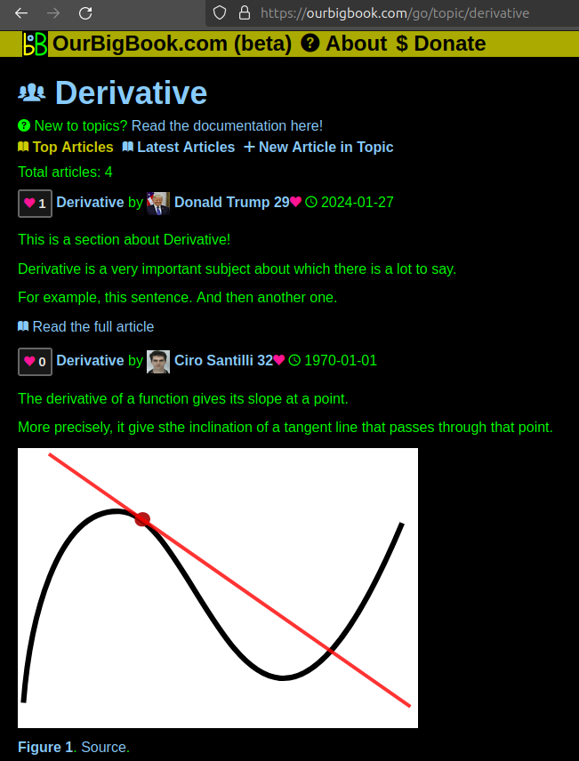
- topics: topics group articles by different users with the same title, e.g. here is the topic for the "Fundamental Theorem of Calculus" ourbigbook.com/go/topic/fundamental-theorem-of-calculusArticles of different users are sorted by upvote within each article page. This feature is a bit like:
- a Wikipedia where each user can have their own version of each article
- a Q&A website like Stack Overflow, where multiple people can give their views on a given topic, and the best ones are sorted by upvote. Except you don't need to wait for someone to ask first, and any topic goes, no matter how narrow or broad
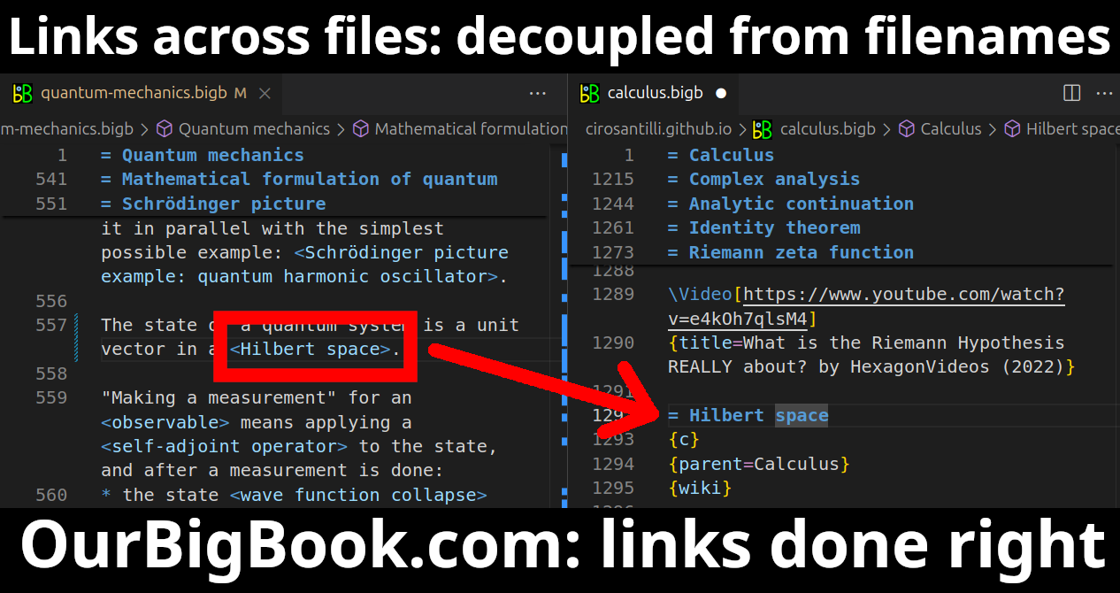
This feature makes it possible for readers to find better explanations of any topic created by other writers. And it allows writers to create an explanation in a place that readers might actually find it.Figure 1. Screenshot of the "Derivative" topic page. View it live at: ourbigbook.com/go/topic/derivativeVideo 2. OurBigBook Web topics demo. Source. - local editing: you can store all your personal knowledge base content locally in a plaintext markup format that can be edited locally and published either:This way you can be sure that even if OurBigBook.com were to go down one day (which we have no plans to do as it is quite cheap to host!), your content will still be perfectly readable as a static site.
- to OurBigBook.com to get awesome multi-user features like topics and likes
- as HTML files to a static website, which you can host yourself for free on many external providers like GitHub Pages, and remain in full control
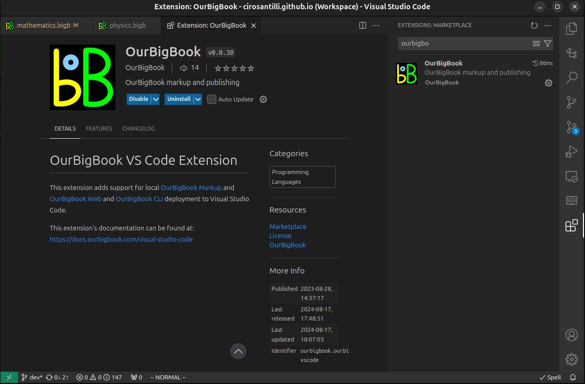
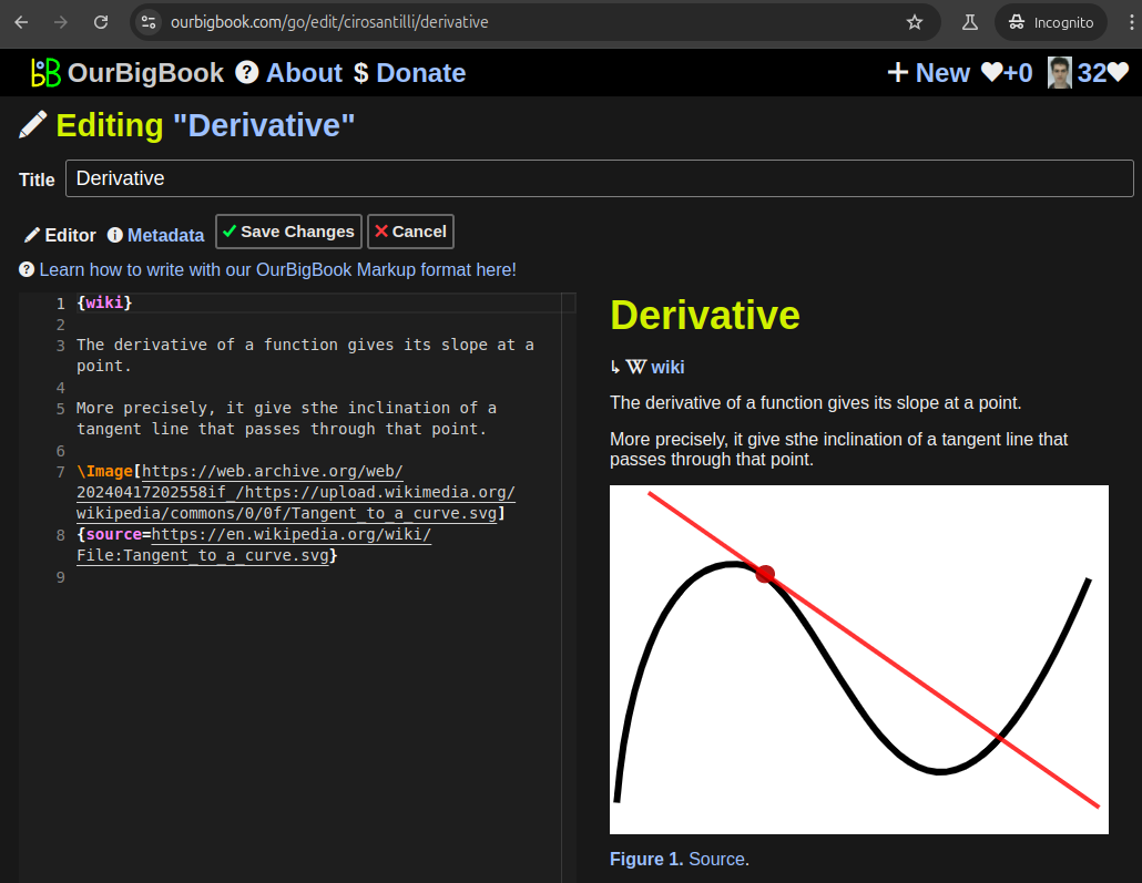
Figure 2. You can publish local OurBigBook lightweight markup files to either OurBigBook.com or as a static website.Figure 3. Visual Studio Code extension installation.Figure 5. . You can also edit articles on the Web editor without installing anything locally. Video 3. Edit locally and publish demo. Source. This shows editing OurBigBook Markup and publishing it using the Visual Studio Code extension. - Infinitely deep tables of contents:
All our software is open source and hosted at: github.com/ourbigbook/ourbigbook
Further documentation can be found at: docs.ourbigbook.com
Feel free to reach our to us for any help or suggestions: docs.ourbigbook.com/#contact


