Donald Kingsbury is an American author known primarily for his science fiction works. He gained attention for his novel "Courtship Rite," which was published in 1982 and won the Philip K. Dick Award. The book is notable for its intricate world-building and exploration of themes such as culture and social structures. Kingsbury's writing often delves into complex scientific concepts and their societal implications.
George A. Elliott is a name that could refer to several individuals, including scholars, authors, or professionals in various fields, such as literature, academia, or business. A notable figure with that name is George A. Elliott, an American mathematician known for his work in the field of mathematics, particularly in topology and algebra. However, if you are looking for information on a specific George A.
Jonathan Borwein (1951-2016) was a prominent Australian mathematician known for his contributions to several fields, including numerical analysis, optimization, and mathematical visualization. He was particularly recognized for his work in experimental mathematics, where he used computational tools to explore and discover new mathematical results. Borwein was also an advocate for the integration of computation with traditional mathematical methods and was involved in various research projects focused on the intersection of mathematics and computer science.
Parallel tempering, also known as replica exchange Monte Carlo (REMC), is a computational technique used primarily in statistical mechanics, molecular dynamics, and optimization problems. The method is designed to improve the sampling of systems with complex energy landscapes, making it particularly useful for systems that exhibit significant barriers between different states. ### Key Concepts: 1. **Simultaneous Simulations**: In parallel tempering, multiple replicas (copies) of the system are simulated simultaneously at different temperatures.
Particle statistics is a branch of statistical mechanics that deals with the distribution and behavior of particles in systems at the microscopic scale. This field is essential for understanding the properties of gases, liquids, and solids, as well as phenomena in fields such as condensed matter physics, quantum mechanics, and thermodynamics.
The Percus-Yevick approximation is a theoretical framework used in statistical mechanics to describe the behavior of hard spheres in fluids. Specifically, it provides an integral equation that relates the pair distribution function of a fluid (which describes the probability of finding a pair of particles at a certain distance apart) to the density of the particles and their interactions. Developed by Richard Percus and George J.
The Jury stability criterion is a method used in control theory to determine the stability of discrete-time linear systems represented in the z-domain. It is particularly relevant for systems described by polynomial equations, where the roots of the characteristic polynomial (the z-transformation of the system's difference equation) are analyzed to assess stability. According to the Jury's stability criterion, the system is stable if and only if all the roots (or poles) of the characteristic polynomial lie inside the unit circle in the z-plane.
Lagrange stability refers to a concept in the field of dynamical systems and control theory, specifically concerning the stability of equilibria in nonlinear systems. Named after the mathematician Joseph-Louis Lagrange, this stability concept is closely related to other stability notions such as Lyapunov stability. However, the term "Lagrange stability" is not as commonly referenced as others, and may sometimes lead to some confusion or misattribution.
Linear stability refers to the analysis of the stability of equilibrium points (also known as steady states or fixed points) in dynamical systems by examining the behavior of small perturbations around those points. It is a fundamental concept in various fields such as physics, engineering, biology, and economics. When considering a dynamical system described by equations (often ordinary differential equations), the stability of an equilibrium point can be assessed by performing a linearization of the system.
A decasyllabic quatrain is a stanza that consists of four lines (a quatrain) with each line containing ten syllables (decasyllabic). This structure is common in various forms of poetry and can adhere to specific rhyme schemes.
Orbital stability refers to the stability of the orbits of celestial bodies under the influence of gravitational forces. In astrodynamics and celestial mechanics, it is an important concept that describes whether an orbiting body will remain in a stable orbit or if it is likely to change its trajectory significantly over time, possibly leading to escape from a gravitational influence, collision with another body, or spiraling into a star or planet.
The "Bob and Wheel" is a poetic device used in Middle English literature, particularly in the alliterative poetry of the 14th century. It is most famously found in the poem "Sir Gawain and the Green Knight," attributed to the Pearl Poet. The structure of the Bob and Wheel consists of two main parts: 1. **The "Bob"**: This is a short line, typically consisting of two or three stressed syllables.
An "englyn" is a traditional Welsh form of poetry. It typically consists of a stanza of four lines, with a specific syllabic and rhyming structure. The most common form of englyn is the "englyn milwr" and consists of 10 syllables in the first line and 7 syllables in the second and third lines, followed by 6 syllables in the fourth line.
Fib, short for Fibonacci poem, is a type of poetic form inspired by the Fibonacci sequence, a mathematical sequence where each number is the sum of the two preceding ones, typically starting with 0 and 1 (e.g., 0, 1, 1, 2, 3, 5, 8, etc.). In a Fib poem, the number of syllables in each line corresponds to the Fibonacci numbers.
Ottava rima is a form of poetry that consists of eight-line stanzas (octaves) with a specific rhyme scheme of ABABABCC. This structure is typically written in iambic pentameter, meaning each line has ten syllables with an alternating pattern of unstressed and stressed syllables.
Rhyme is a literary and poetic device in which similar sounds are used at the ends of lines, usually involving the repetition of identical or similar sounding vowels and consonants. It often serves to create rhythm, enhance musicality, and add memorability to poetry and song lyrics. There are several types of rhyme, including: 1. **End Rhyme**: The most common type, where the last words of two or more lines have similar sounds (e.g.
Berkeley 86 is a significant historic project in the context of computer science and software development, particularly associated with the Berkeley Software Distribution (BSD) of the Unix operating system. In 1986, the University of California, Berkeley, released the 4.3BSD Unix version, which included various enhancements and new features over previous versions. Berkeley 86 specifically refers to the environment and software stack produced by researchers and developers at UC Berkeley during that era.
Pinned article: Introduction to the OurBigBook Project
Welcome to the OurBigBook Project! Our goal is to create the perfect publishing platform for STEM subjects, and get university-level students to write the best free STEM tutorials ever.
Everyone is welcome to create an account and play with the site: ourbigbook.com/go/register. We belive that students themselves can write amazing tutorials, but teachers are welcome too. You can write about anything you want, it doesn't have to be STEM or even educational. Silly test content is very welcome and you won't be penalized in any way. Just keep it legal!
Intro to OurBigBook
. Source. We have two killer features:
- topics: topics group articles by different users with the same title, e.g. here is the topic for the "Fundamental Theorem of Calculus" ourbigbook.com/go/topic/fundamental-theorem-of-calculusArticles of different users are sorted by upvote within each article page. This feature is a bit like:
- a Wikipedia where each user can have their own version of each article
- a Q&A website like Stack Overflow, where multiple people can give their views on a given topic, and the best ones are sorted by upvote. Except you don't need to wait for someone to ask first, and any topic goes, no matter how narrow or broad
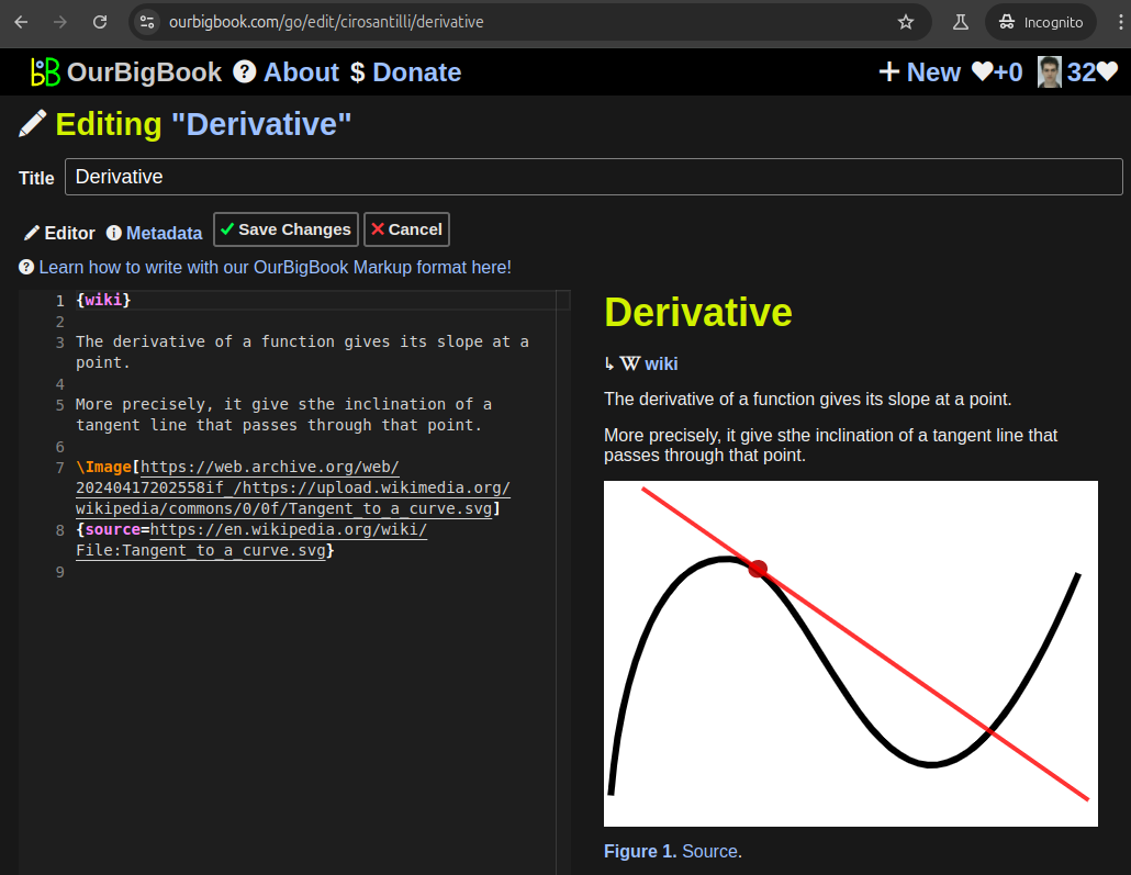
This feature makes it possible for readers to find better explanations of any topic created by other writers. And it allows writers to create an explanation in a place that readers might actually find it.Figure 1. Screenshot of the "Derivative" topic page. View it live at: ourbigbook.com/go/topic/derivativeVideo 2. OurBigBook Web topics demo. Source. - local editing: you can store all your personal knowledge base content locally in a plaintext markup format that can be edited locally and published either:This way you can be sure that even if OurBigBook.com were to go down one day (which we have no plans to do as it is quite cheap to host!), your content will still be perfectly readable as a static site.
- to OurBigBook.com to get awesome multi-user features like topics and likes
- as HTML files to a static website, which you can host yourself for free on many external providers like GitHub Pages, and remain in full control
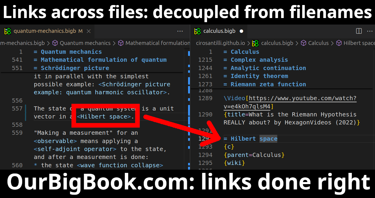
Figure 3. Visual Studio Code extension installation.Figure 4. Visual Studio Code extension tree navigation.Figure 5. Web editor. You can also edit articles on the Web editor without installing anything locally.Video 3. Edit locally and publish demo. Source. This shows editing OurBigBook Markup and publishing it using the Visual Studio Code extension.Video 4. OurBigBook Visual Studio Code extension editing and navigation demo. Source. - Infinitely deep tables of contents:
All our software is open source and hosted at: github.com/ourbigbook/ourbigbook
Further documentation can be found at: docs.ourbigbook.com
Feel free to reach our to us for any help or suggestions: docs.ourbigbook.com/#contact


