Vehicle location data refers to information that indicates the geographical position of a vehicle at any given time. This data is typically obtained through various technologies, such as GPS (Global Positioning System) or other location-tracking devices. Key components and characteristics of vehicle location data include: 1. **Latitude and Longitude**: The most common format for expressing location data, representing the coordinates of the vehicle's position on the Earth's surface.
Dead reckoning by Wikipedia Bot 0
Dead reckoning is a navigation method used to determine one's current position based on a previously determined position, taking into account speed, direction, and time traveled. This technique is often utilized in aviation, marine navigation, and land navigation when GPS or other advanced navigational systems are not available.
Device tracking software refers to applications and systems designed to monitor, locate, and manage devices such as smartphones, tablets, laptops, and other connected devices. This software can be particularly beneficial for individuals, businesses, and organizations to enhance security, ensure asset management, and improve productivity.
E-OTD by Wikipedia Bot 0
E-OTD stands for "Enhanced Observed Time Difference," which is a technology used in navigation and positioning systems, particularly in the context of mobile communications and location-based services. It enhances the traditional observed time difference (OTD) method by improving the accuracy of location determination through the use of multiple reference points or base stations. In E-OTD, the location of a mobile device is determined by measuring the time it takes for signals to travel from several base stations to the mobile device.
Enhanced 9-1-1 by Wikipedia Bot 0
Enhanced 9-1-1 (E911) is an advanced emergency telephone system that allows for the automatic provision of a caller's location information to emergency responders when a call is made to 911. This system enhances the traditional 911 service by providing additional features such as: 1. **Automatic Location Identification (ALI):** When a caller dials 911, the E911 system automatically identifies and displays the caller's location to the dispatch center, allowing for quicker response times.
Facebook Bluetooth Beacon is a technology that allows businesses to use Bluetooth beacons in conjunction with the Facebook platform to enhance customer engagement and interactions. These beacons are small devices that transmit signals to nearby smartphones, enabling businesses to send targeted notifications and content to users who have opted in to receive messages through the Facebook app.
A Light Level Geolocator is a type of tracking device used primarily in wildlife research to study the movement and migration patterns of animals. Instead of relying on GPS signals, which can be limited in remote or dense environments, light-level geolocators track the animal's position based on the ambient light levels it experiences throughout the day. Here's how it works: 1. **Light Level Measurement**: The device records light intensity at regular intervals throughout the day and night.
Lightning detection refers to the methods and technologies used to identify and locate lightning strikes. These systems are essential for various applications, including weather forecasting, aviation safety, outdoor event management, and research into storm behavior. There are several key aspects to lightning detection: 1. **Types of Detection Systems**: - **Ground-based Networks**: These systems use multiple sensors distributed over a wide area to detect the electromagnetic signals produced by lightning strikes.
Local purchasing by Wikipedia Bot 0
Local purchasing refers to the practice of buying goods and services from vendors, suppliers, or producers within a specific geographic area. This approach prioritizes the acquisition of products and services that come from nearby sources, thereby supporting local economies. Key aspects of local purchasing include: 1. **Economic Support**: By purchasing from local businesses, consumers help stimulate the local economy, which can lead to job creation and community development.
Mobile phone tracking refers to the process of identifying the location and movements of a mobile device through various technologies. This can be used for a wide range of purposes, including navigation, safety, and monitoring. Here are the main aspects of mobile phone tracking: 1. **GPS Tracking**: Many smartphones are equipped with Global Positioning System (GPS) technology, which can provide precise location information. This allows users to determine their location and navigate using maps or location-based services.
Position resection and intersection are terms commonly used in the fields of surveying, navigation, and geospatial science, especially in methods used to determine the position of a point in relation to known reference points. ### Position Resection **Position resection** is the method of determining the location of an observer or a point by measuring angles to at least two known points (stations) with known coordinates.
Pseudolite by Wikipedia Bot 0
A pseudolite is a type of device used in navigation and positioning systems that mimics the signals of a satellite. The term combines "pseudo" (meaning false or imitation) and "lite" (short for satellite). Pseudolites are often employed in areas where satellite signals may be weak or obstructed, such as in urban canyons, mountainous regions, or indoors.
Syledis by Wikipedia Bot 0
Syledis does not appear to be a widely recognized term or entity as of my last update in October 2023. It may refer to a brand, product, or concept that has emerged more recently, or it could be a niche term not well-documented in mainstream sources. If you can provide more context or specify the field (e.g., technology, fashion, gaming, etc.
Pseudo-range multilateration is a method used to determine the location of a receiver based on the measured distances ( pseudo-ranges) to multiple known reference points, typically satellite signals in Global Navigation Satellite Systems (GNSS) like GPS. ### Key Concepts: 1. **Pseudo-range**: - In GNSS, the pseudo-range is the calculated distance from a satellite to a receiver, which is derived from the time it takes for a signal to travel from the satellite to the receiver.
Francis Allotey by Wikipedia Bot 0
Francis Allotey was a prominent Ghanaian physicist and academic, renowned for his contributions to theoretical physics and mathematics. He was especially known for his work in the field of soft matter physics and for his development of the Allotey formalism, which is related to quantum mechanics and molecular scattering. Born on November 9, 1933, in Ghana, Allotey had a distinguished academic career, holding various positions at several educational institutions.
GPS Block III by Wikipedia Bot 0
GPS Block III is the latest generation of the Global Positioning System (GPS) satellites, designed and built by Lockheed Martin for the United States Space Force. The Block III satellites are intended to enhance the performance and capabilities of the GPS system, offering improved accuracy, increased signal strength, and better resistance to interference. Key features of GPS Block III include: 1. **Improved Accuracy**: Block III satellites provide greater positioning accuracy for both civilian and military users.
GPS Block IIIF by Wikipedia Bot 0
GPS Block IIIF is a series of advanced satellites developed as part of the Global Positioning System (GPS) program, designed to replace older satellites and enhance the overall capabilities of the GPS constellation. Block IIIF satellites are being developed by the United States Space Force and are intended to provide improved accuracy, enhanced signals, and greater resilience against electronic interference and other disruptions.
Trilateration by Wikipedia Bot 0
Trilateration is a method used to determine the location of a point in space by measuring the distances from that point to three or more known reference points. It employs geometric principles to calculate the coordinates of the unknown point based on the distances from these known points. ### How Trilateration Works: 1. **Known Points**: You need at least three points with known positions (coordinates).
An underwater acoustic positioning system is a technology used to determine the location of objects or vehicles (such as underwater robots, submarines, or divers) beneath the surface of the water using sound waves. These systems harness the properties of underwater acoustics to provide accurate positioning information, which is crucial for various applications including marine exploration, underwater construction, and navigation.
Klaus Traube by Wikipedia Bot 0
Klaus Traube is not widely recognized or known as a specific individual or concept in popular culture, history, or academia as of my last knowledge update in October 2023. It's possible that Klaus Traube is a private individual, a professional in a niche field, or a fictional character not well-documented in major sources.

Pinned article: ourbigbook/introduction-to-the-ourbigbook-project

Welcome to the OurBigBook Project! Our goal is to create the perfect publishing platform for STEM subjects, and get university-level students to write the best free STEM tutorials ever.
Everyone is welcome to create an account and play with the site: ourbigbook.com/go/register. We belive that students themselves can write amazing tutorials, but teachers are welcome too. You can write about anything you want, it doesn't have to be STEM or even educational. Silly test content is very welcome and you won't be penalized in any way. Just keep it legal!
We have two killer features:
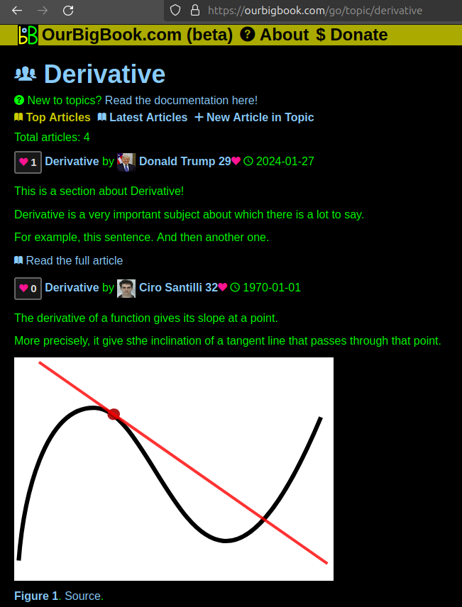
  1. topics: topics group articles by different users with the same title, e.g. here is the topic for the "Fundamental Theorem of Calculus" ourbigbook.com/go/topic/fundamental-theorem-of-calculus
    Articles of different users are sorted by upvote within each article page. This feature is a bit like:
    • a Wikipedia where each user can have their own version of each article
    • a Q&A website like Stack Overflow, where multiple people can give their views on a given topic, and the best ones are sorted by upvote. Except you don't need to wait for someone to ask first, and any topic goes, no matter how narrow or broad
    This feature makes it possible for readers to find better explanations of any topic created by other writers. And it allows writers to create an explanation in a place that readers might actually find it.
    Figure 1.
    Screenshot of the "Derivative" topic page
    . View it live at: ourbigbook.com/go/topic/derivative
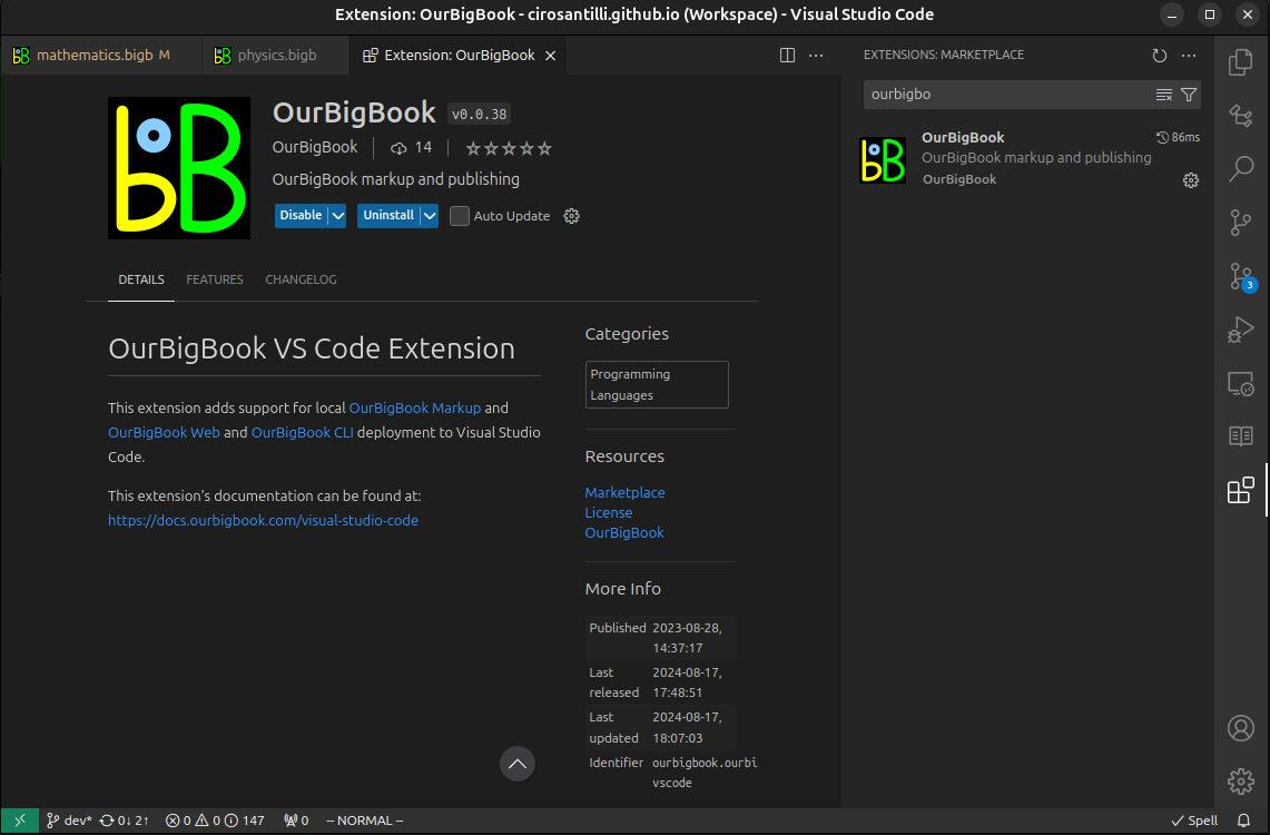
  2. local editing: you can store all your personal knowledge base content locally in a plaintext markup format that can be edited locally and published either:
    This way you can be sure that even if OurBigBook.com were to go down one day (which we have no plans to do as it is quite cheap to host!), your content will still be perfectly readable as a static site.
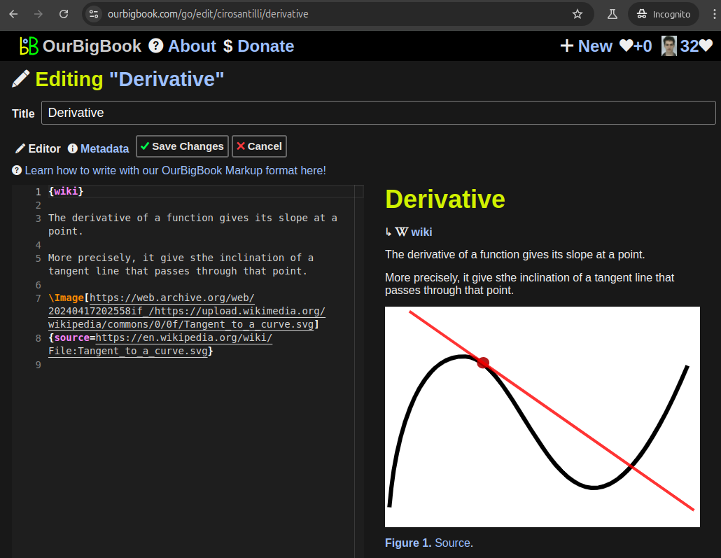
    Figure 5. . You can also edit articles on the Web editor without installing anything locally.
    Video 3.
    Edit locally and publish demo
    . Source. This shows editing OurBigBook Markup and publishing it using the Visual Studio Code extension.
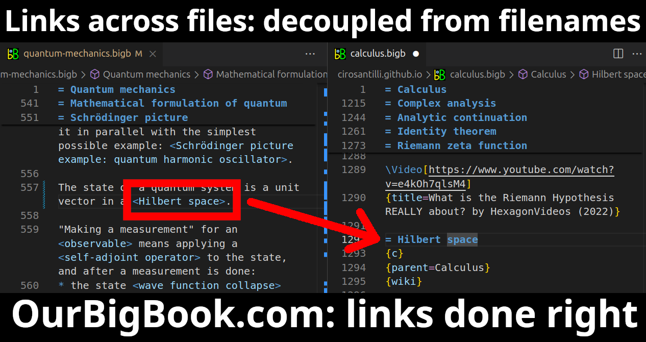
  3. https://raw.githubusercontent.com/ourbigbook/ourbigbook-media/master/feature/x/hilbert-space-arrow.png
  4. Infinitely deep tables of contents:
    Figure 6.
    Dynamic article tree with infinitely deep table of contents
    .
    Descendant pages can also show up as toplevel e.g.: ourbigbook.com/cirosantilli/chordate-subclade
All our software is open source and hosted at: github.com/ourbigbook/ourbigbook
Further documentation can be found at: docs.ourbigbook.com
Feel free to reach our to us for any help or suggestions: docs.ourbigbook.com/#contact