The Voigt effect is a phenomenon observed in the field of magneto-optics and materials science. It refers to the change in the absorption and refractive index of a material in the presence of a magnetic field. Specifically, the Voigt effect describes the alteration of the polarization state of light as it passes through a magnetized material.
Incremental deformations refer to a concept in mechanics and material science where changes in shape or position of a material or structure occur gradually over time, rather than all at once. This approach is particularly important in analyzing and understanding the behavior of materials under various loading conditions, especially when the materials exhibit non-linear or time-dependent behavior. In incremental analysis, the total deformation is broken down into small, manageable increments.
The Michell solution is a specific analytical solution to the problem of elasticity in two-dimensional linear elasticity, particularly used to describe the stress and displacement fields in a linear elastic medium under the influence of point forces or concentrated loads. Named after the Australian engineer A. E. H. Michell, the solution is applied to study problems involving singularities such as cracks or points of load application in materials.
The P-wave modulus, often referred to as the P-wave velocity or compressional wave modulus, is a measure of the elastic response of a material to compressional waves (also known as P-waves or primary waves), which are a type of seismic wave. P-waves are the fastest seismic waves and travel through solids, liquids, and gases by compressing and expanding the material in the direction of wave propagation.
The Poynting effect refers to the phenomenon where electromagnetic radiation causes forces to act on charged particles, leading to effects such as the motion of those particles or changes in their energy states. This effect is particularly connected to the flow of electromagnetic energy as described by the Poynting vector, which represents the directional energy flux (the amount of energy passing through a unit area per unit time) of an electromagnetic field.
The Zener ratio refers to the relationship between the output voltage (V_out) and the Zener voltage (V_z) of a Zener diode, particularly in voltage regulation applications. It is often used in the context of Zener diode-based voltage regulation circuits, where the Zener diode is utilized to maintain a constant output voltage across a load.
The term "General Coordinates Network" (GCN) may refer to concepts related to geolocation, navigation systems, or data structures used in mapping and spatial analysis. However, as of my last update in October 2023, there is no widely recognized or standard definition explicitly labeled as "General Coordinates Network" in mainstream scientific literature or technological contexts.
A state of emergency is a government declaration that temporarily enhances state powers to respond to a crisis or significant threat, such as natural disasters, civil unrest, or national security threats. This declaration allows for measures that may overrule or bypass regular laws and regulations to ensure safety and order. Key aspects of a state of emergency may include: 1. **Increased Government Powers**: Authorities may have the ability to impose curfews, restrict movement, or take control of resources.
Gadolinium is a chemical element with the symbol Gd and atomic number 64. It is a silvery-white metal that is part of the lanthanide series in the periodic table. Gadolinium is known for its high magnetic susceptibility and is used in various applications, including: 1. **Magnetic Resonance Imaging (MRI)**: Gadolinium-based contrast agents are commonly used in medical imaging to enhance the quality of MRI scans.
Iron is a chemical element with the symbol Fe (from the Latin "ferrum") and atomic number 26. It is a metal in the first transition series and is one of the most abundant elements in the universe, making up about 5% of the Earth's crust. Here are some key points about iron: 1. **Physical Properties**: Iron is a dense, malleable, ductile metal that has a silvery-gray appearance.
Mu-metal is a nickel-iron alloy known for its high magnetic permeability, which makes it particularly effective in shielding sensitive electronic equipment from magnetic fields. Typically composed of about 77% nickel, 16% iron, and 7% other elements (like copper and molybdenum), mu-metal is used in various applications that require protection from electromagnetic interference (EMI).
Mictomagnetism appears to be a typographical error or a misunderstanding. It is possible that you are referring to "micromagnetism," which is a branch of magnetism in condensed matter physics that deals with the magnetic properties of small-scale materials, typically at the micrometer or nanometer scale. Micromagnetism focuses on the behavior of magnetic domains, magnetic anisotropy, and hysteresis in ferromagnetic and ferrimagnetic materials.
BS 5839 Part 1 is a British Standard that provides guidelines and recommendations for the design, installation, and maintenance of fire detection and alarm systems in non-domestic buildings. Part of the broader BS 5839 series, which covers various aspects of fire safety systems, Part 1 specifically focuses on systems installed in commercial and public premises.
IEC 62061 is an international standard that pertains to the safety of machinery and the functional safety of safety-related control systems. It was developed by the International Electrotechnical Commission (IEC) and provides requirements and guidelines for the design and implementation of systems that ensure safety in machinery applications. The standard specifically addresses the safety-related control systems that are required to reduce risks associated with machinery operation.
TIA-607-B is a standard published by the Telecommunications Industry Association (TIA) that provides guidelines for the grounding and bonding of telecommunication equipment and cabling. This standard is part of the larger TIA-568 family of standards, which govern telecommunications cabling systems. The TIA-607-B standard specifically outlines best practices for the following: 1. **Grounding and Bonding**: It establishes requirements for the grounding and bonding of telecommunications equipment to ensure safety and performance.
A bus duct, also known as a busway, is an electrical distribution system used to conduct electricity from one point to another, primarily in industrial and commercial facilities. It consists of a metal enclosure containing one or more insulated bus bars, which are conductive materials that carry electric current. Bus ducts are often employed to distribute power from transformers to switchgear, panelboards, or other distribution equipment.
The Canadian Electrical Code (CEC) is a standard that governs the installation and maintenance of electrical equipment and systems in Canada. It is developed and maintained by the Canadian Standards Association (CSA) and is essential for ensuring electrical safety across the country. The CEC outlines the minimum requirements for the design, construction, and installation of electrical systems, aiming to protect people and property from electrical hazards.
A **circuit breaker** is an electrical device designed to protect an electrical circuit from damage caused by overloads or short circuits. It automatically interrupts the flow of electricity when a fault is detected, preventing potential hazards like electrical fires or equipment damage. Key functions and characteristics of circuit breakers include: 1. **Overload Protection**: Circuit breakers monitor the current flowing through the circuit. If the current exceeds a predetermined level, indicating an overload, the breaker will trip to cut off the power.
Home wiring refers to the electrical systems and installations that supply power throughout a residential building. It includes the arrangement of electrical circuits, outlets, switches, and the connections to the main electrical service panel. Proper home wiring ensures the safe and efficient distribution of electricity for lighting, appliances, heating, and other electrical devices.
Star quad cable is a type of audio cable commonly used in professional audio applications. It is designed specifically to reduce electromagnetic interference (EMI) and radio frequency interference (RFI), making it ideal for high-quality sound transmission in environments where these types of interference are present. The cable is constructed with four conductors arranged in a specific configuration that resembles a star (hence the name "star quad"). Typically, two pairs of conductors are twisted together.
Pinned article: Introduction to the OurBigBook Project
Welcome to the OurBigBook Project! Our goal is to create the perfect publishing platform for STEM subjects, and get university-level students to write the best free STEM tutorials ever.
Everyone is welcome to create an account and play with the site: ourbigbook.com/go/register. We belive that students themselves can write amazing tutorials, but teachers are welcome too. You can write about anything you want, it doesn't have to be STEM or even educational. Silly test content is very welcome and you won't be penalized in any way. Just keep it legal!
Intro to OurBigBook
. Source. We have two killer features:
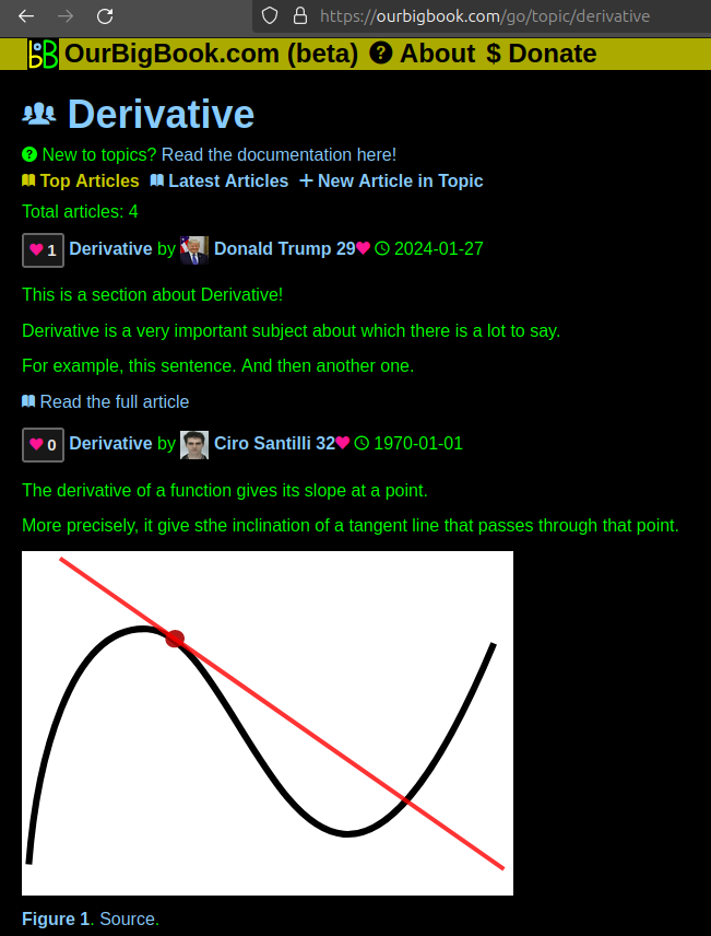
- topics: topics group articles by different users with the same title, e.g. here is the topic for the "Fundamental Theorem of Calculus" ourbigbook.com/go/topic/fundamental-theorem-of-calculusArticles of different users are sorted by upvote within each article page. This feature is a bit like:
- a Wikipedia where each user can have their own version of each article
- a Q&A website like Stack Overflow, where multiple people can give their views on a given topic, and the best ones are sorted by upvote. Except you don't need to wait for someone to ask first, and any topic goes, no matter how narrow or broad
This feature makes it possible for readers to find better explanations of any topic created by other writers. And it allows writers to create an explanation in a place that readers might actually find it.Figure 1. Screenshot of the "Derivative" topic page. View it live at: ourbigbook.com/go/topic/derivativeVideo 2. OurBigBook Web topics demo. Source. - local editing: you can store all your personal knowledge base content locally in a plaintext markup format that can be edited locally and published either:This way you can be sure that even if OurBigBook.com were to go down one day (which we have no plans to do as it is quite cheap to host!), your content will still be perfectly readable as a static site.
- to OurBigBook.com to get awesome multi-user features like topics and likes
- as HTML files to a static website, which you can host yourself for free on many external providers like GitHub Pages, and remain in full control
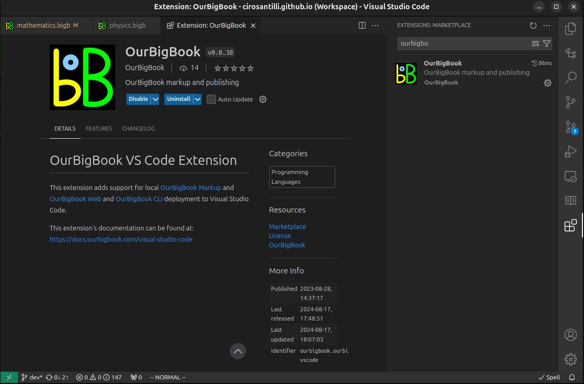
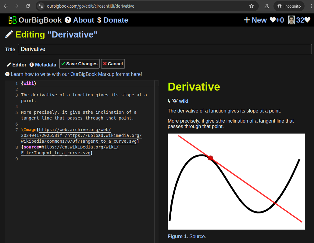
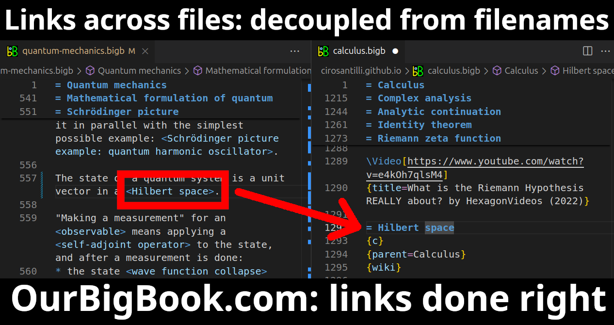
Figure 3. Visual Studio Code extension installation.Figure 4. Visual Studio Code extension tree navigation.Figure 5. Web editor. You can also edit articles on the Web editor without installing anything locally.Video 3. Edit locally and publish demo. Source. This shows editing OurBigBook Markup and publishing it using the Visual Studio Code extension.Video 4. OurBigBook Visual Studio Code extension editing and navigation demo. Source. - Infinitely deep tables of contents:
All our software is open source and hosted at: github.com/ourbigbook/ourbigbook
Further documentation can be found at: docs.ourbigbook.com
Feel free to reach our to us for any help or suggestions: docs.ourbigbook.com/#contact


