The Kirkhill Astronomical Pillar, also known as the Kirkhill Observatory or Kirkhill Pillar, is an astronomical structure located near Kirkhill in Scotland. It was built in the early 19th century, around 1824, by the Reverend Robert A. Smith, who was a notable astronomer of his time. The pillar served as a sundial and was designed to assist in astronomical observations and provide a means to measure time using the sun's position.
The Monument to the Sun, also known as "Monument to the Sun" or "Pozdrav Suncu" in Croatian, is a large, circular solar-powered installation located in Zadar, Croatia. It was designed by the architect Nikola Bašić and completed in 2008. The monument is situated on the waterfront and comprises a series of photovoltaic solar panels arranged in a circular shape. The installation serves both as an art piece and a functional source of renewable energy.
The Anti-Spam Research Group (ASRG) is an organization focused on the study and dissemination of research related to spam and anti-spam technologies. It is typically made up of researchers, industry experts, and individuals interested in combating spam, which is the unsolicited and often unwanted electronic communication that clutters email inboxes and other messaging systems. The group works to address the challenges posed by spam through collaboration, sharing findings, and providing solutions that can help improve filtering techniques and overall email security.
"Brazilians physicists" generally refers to physicists from Brazil or those who are associated with Brazilian institutions and contributions to the field of physics. Brazil has a rich history in the physical sciences and has produced many notable physicists, who have made significant contributions in various areas such as condensed matter physics, astrophysics, particle physics, and more.
The term "Chilean physicists" refers to physicists from Chile or those who have significant ties to Chile, whether through their education, research, or professional activities. Chile has produced many notable physicists who have made important contributions to various fields of physics, including astrophysics, condensed matter physics, and particle physics, among others. Some prominent Chilean physicists include: 1. **Mariano Sáchez** - Noteworthy for his contributions to theoretical physics.
"Peruvian physicists" refers to individuals from Peru who specialize in the field of physics. These scientists may work in various areas of physics, including theoretical physics, experimental physics, applied physics, and interdisciplinary fields involving physics and other disciplines. Peru has a growing community of physicists who contribute to both local and international research. Some notable Peruvian physicists include: 1. **Jorge A. A. Verde** - Known for his work in climate physics and related environmental studies.
A clock is a device used to measure and display time. It indicates the passage of hours, minutes, and seconds, allowing individuals to coordinate activities, plan schedules, and maintain a sense of temporal awareness. There are various types of clocks, including: 1. **Analog Clocks**: These display time using a dial with hour and minute hands that rotate around a numbered face. 2. **Digital Clocks**: These show time using numerical digits, often with LED or LCD displays.
The magnetopause is the boundary that separates a planet's magnetosphere from the solar wind, which is a stream of charged particles (mostly electrons and protons) emitted by the sun. For Earth, the magnetopause marks the outer edge of the magnetosphere, where the pressure of the solar wind is balanced by the magnetic pressure of the Earth's magnetic field. In simpler terms, the magnetopause is the region where the influence of the Earth's magnetic field ends and the solar wind begins.
A list of historical maps refers to a compilation of maps that represent geographical regions, important historical events, or significant changes in territorial boundaries at various points in time. These maps can be valuable for understanding the social, political, and economic contexts of different eras.
Location refers to a specific point or area in physical space, defined by geographic coordinates, boundaries, or other identifying features. It can be described in various ways, depending on the context: 1. **Geographic Location**: This is often defined by coordinates, such as latitude and longitude. For example, the geographic location of the Eiffel Tower in Paris can be specified as approximately 48.8584° N, 2.2945° E.
MacChoro is a Japanese music game application that combines elements of rhythm and puzzle gameplay. It encourages players to tap along to rhythm patterns, usually involving colorful visuals and catchy music. The game typically involves matching taps or swipes on the screen to the beat of the music. Players often have to navigate through increasingly complex levels, which can include various challenges and obstacles.
GeoPlanet is a data platform developed by Yahoo (formerly part of Oath and Verizon Media) that provides a comprehensive database of geographical and location-based information. It offers a wide range of geospatial data, including details about places, neighborhoods, landmarks, and geographical features across the globe. The platform is designed to allow developers to incorporate location-based services into their applications, enabling features such as place search, geocoding, and geographic data analysis.
Geospatial topology refers to the study and representation of spatial relationships between geographic features in a spatial dataset. It focuses on the properties of space that remain invariant under transformations, such as the relationships and connections between different spatial entities—even when their positions or shapes change. In geospatial contexts, topology is essential for understanding how geographic features interact with each other.
Geovisualization is the process of using visual representations to explore, analyze, and communicate geographical information and spatial data. It integrates geographic information systems (GIS) with visualization techniques to help users understand complex datasets and spatial relationships more effectively. Key components of geovisualization include: 1. **Data Representation**: Using maps, charts, graphs, and 3D models to represent spatial data clearly and effectively.
The German Cartographic Society, known as "Deutsche Gesellschaft für Kartographie" (DGfK), is a professional organization dedicated to the field of cartography in Germany. Established in 1952, the society aims to promote the science and art of map-making, geographic information systems (GIS), and related disciplines.
Jenks Natural Breaks Optimization, often referred to simply as "Jenks optimization," is a spatial data classification method used in statistics and cartography for grouping data into classes. The primary objective of this technique is to maximize the variance between classes while minimizing the variance within each class. This results in the best possible representation of the inherent natural grouping present in the data.
The Maximum Elevation Figure (MEF) is a term used in aviation to refer to the highest elevation, in feet or meters, of terrain, obstacles, or other features in a particular area, taking into account a specified vertical clearance. This figure is typically used in aviation charts, especially in the context of en route navigation and obstacle clearance. The MEF is important for pilots to ensure safe flight operations by providing information about the tallest structures and terrain in the vicinity.
In the context of a business or marketing segment, "Gore" usually refers to the Gore-Tex brand, which is associated with high-performance outdoor gear and clothing that incorporates waterproof and breathable materials. Gore-Tex is well-known for its innovative fabric technology that allows moisture to escape while keeping water out, making it popular among outdoor enthusiasts.
In cartography, a graticule is a network of latitude and longitude lines that create a coordinate system on a map or globe. These lines help to define locations on the Earth's surface by providing a reference framework for geographic coordinates. ### Key Features of Graticules: 1. **Latitude Lines (Parallels)**: These are horizontal lines that run east-west and measure the distance north or south of the Equator, which is at 0 degrees latitude.
Indigenous mapping refers to the practices and methodologies used by Indigenous communities to represent their knowledge, culture, and territories through various mapping techniques and technologies. This form of mapping is not just a geographical representation; it encompasses the cultural, historical, spiritual, and social aspects of Indigenous peoples and their relationships to the land.
Pinned article: Introduction to the OurBigBook Project
Welcome to the OurBigBook Project! Our goal is to create the perfect publishing platform for STEM subjects, and get university-level students to write the best free STEM tutorials ever.
Everyone is welcome to create an account and play with the site: ourbigbook.com/go/register. We belive that students themselves can write amazing tutorials, but teachers are welcome too. You can write about anything you want, it doesn't have to be STEM or even educational. Silly test content is very welcome and you won't be penalized in any way. Just keep it legal!
Intro to OurBigBook
. Source. We have two killer features:
- topics: topics group articles by different users with the same title, e.g. here is the topic for the "Fundamental Theorem of Calculus" ourbigbook.com/go/topic/fundamental-theorem-of-calculusArticles of different users are sorted by upvote within each article page. This feature is a bit like:
- a Wikipedia where each user can have their own version of each article
- a Q&A website like Stack Overflow, where multiple people can give their views on a given topic, and the best ones are sorted by upvote. Except you don't need to wait for someone to ask first, and any topic goes, no matter how narrow or broad
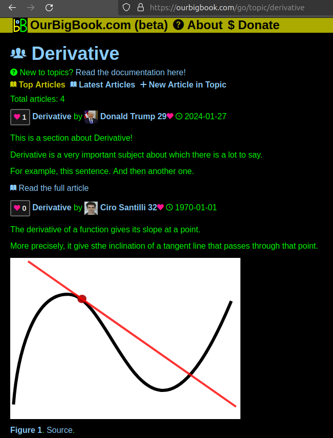
This feature makes it possible for readers to find better explanations of any topic created by other writers. And it allows writers to create an explanation in a place that readers might actually find it.Figure 1. Screenshot of the "Derivative" topic page. View it live at: ourbigbook.com/go/topic/derivativeVideo 2. OurBigBook Web topics demo. Source. - local editing: you can store all your personal knowledge base content locally in a plaintext markup format that can be edited locally and published either:This way you can be sure that even if OurBigBook.com were to go down one day (which we have no plans to do as it is quite cheap to host!), your content will still be perfectly readable as a static site.
- to OurBigBook.com to get awesome multi-user features like topics and likes
- as HTML files to a static website, which you can host yourself for free on many external providers like GitHub Pages, and remain in full control
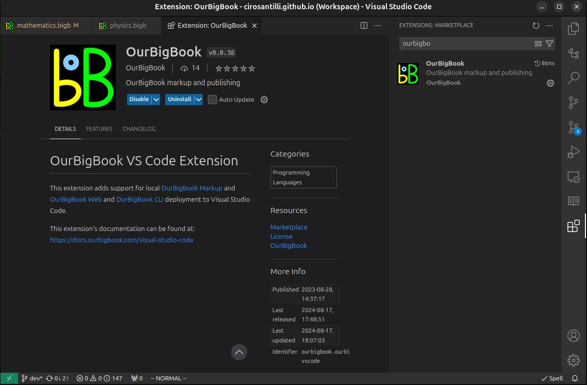
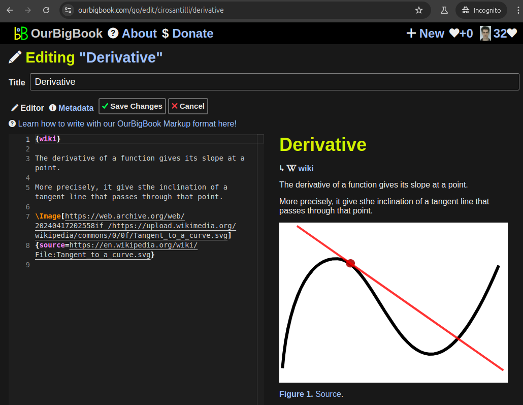
Figure 2. You can publish local OurBigBook lightweight markup files to either OurBigBook.com or as a static website.Figure 3. Visual Studio Code extension installation.Figure 5. . You can also edit articles on the Web editor without installing anything locally. Video 3. Edit locally and publish demo. Source. This shows editing OurBigBook Markup and publishing it using the Visual Studio Code extension. - Infinitely deep tables of contents:
All our software is open source and hosted at: github.com/ourbigbook/ourbigbook
Further documentation can be found at: docs.ourbigbook.com
Feel free to reach our to us for any help or suggestions: docs.ourbigbook.com/#contact