S/MIME (Secure/Multipurpose Internet Mail Extensions) is a standard for public key encryption and signing of MIME data (such as email messages). It is used to ensure the confidentiality, integrity, and authenticity of email communications. Here are the key components of S/MIME: 1. **Encryption**: S/MIME allows users to encrypt their email messages, ensuring that only the intended recipient can read the content.
In cryptography, a "salt" is a random value added to password hashes to enhance security. Its primary purpose is to protect against certain types of attacks, particularly pre-computed attacks like rainbow tables, where attackers use pre-computed hashes of common passwords to quickly crack them. Here's how salting works: 1. **Random Generation**: When a user creates an account or changes their password, a unique random value (the salt) is generated for that password.
Security through obscurity is a concept in cybersecurity and information security that involves hiding the details of a system, design, or implementation to protect it from unauthorized access or exploitation. The underlying idea is that if the inner workings of a system are not known to potential attackers, it becomes more difficult for them to exploit vulnerabilities or weaknesses.
Signals intelligence (SIGINT) refers to the collection, analysis, and exploitation of signals emitted by a variety of sources, primarily for the purpose of intelligence and national security. SIGINT encompasses a wide range of activities related to the interception and interpretation of communications and electronic signals. It is typically divided into three main categories: 1. **Communications Intelligence (COMINT)**: This involves the interception and analysis of communications between individuals or organizations.
A symmetric Boolean function is a type of Boolean function that exhibits symmetry in its variable inputs. Specifically, these functions produce the same output regardless of the ordering of their input variables. In other words, if you permute or swap the input variables, the output of the function remains unchanged. For example, consider a Boolean function \( f(x_1, x_2, \ldots, x_n) \).
The "Tableau de Concordance" (or Concordance Table) is a tool often used in the fields of linguistics, translation, and academic writing to provide a systematic comparison or alignment between different sets of data, texts, or documents. It is commonly employed in bilingual dictionaries, glossaries, or educational materials to aid in understanding how terms or concepts correlate across languages.
Transmission security (TRANSEC) refers to the measures and practices designed to protect information as it is transmitted over communication channels from interception, exploitation, or unauthorized access. It encompasses a variety of techniques and technologies that ensure the confidentiality, integrity, and availability of data while in transit. Key aspects of transmission security include: 1. **Encryption**: The process of converting plaintext into encoded information (ciphertext) so that it can only be read by someone who has the appropriate decryption key.
Geographic coordinate systems (GCS) are systems used to identify locations on the Earth's surface using a coordinate system. These systems express the position of a point as a set of numerical coordinates, typically in the form of latitude and longitude. Each point on the Earth's surface can be described using these coordinates, which represent angular measurements: 1. **Latitude**: This measures how far north or south a point is from the Equator.
The concept of Hollow Earth refers to a theoretical idea that suggests the Earth is entirely or largely hollow and may contain subterranean civilizations or vast internal spaces. Historical beliefs about Hollow Earth varied, with some ancient cultures proposing that the Earth had internal cavities or tunnels.
The Bedford Level Experiment refers to a series of investigations conducted in the 19th century to measure the curvature of the Earth. The most famous of these experiments was carried out by the British scientist Samuel Rowbotham in 1865, who was a proponent of the flat Earth theory. The experiment took place in the Bedford Level, a series of drainage channels in the Fenlands of England.
Cartographic errors refer to inaccuracies or mistakes found in maps. These errors can arise from various sources and can affect different aspects of the mapping process, including the representation of geographic features, scales, distances, and navigation guidance. Cartographic errors can be categorized into several types: 1. **Projection Errors**: Different map projections can distort shapes, sizes, distances, and directions. A projection that preserves one aspect (like area) may distort another (like shape).
Celestial cartography is the practice of mapping the positions and movements of celestial bodies, such as stars, planets, moons, and other astronomical objects. This field of study combines elements of astronomy and cartography to create visual representations of the night sky, allowing astronomers and navigators to understand the locations and movements of celestial objects over time.
Cartifact is a company that specializes in creating custom maps and geographic data visualization solutions. They offer services that allow users to easily integrate maps into their web applications or print materials, enabling businesses and organizations to communicate geographical information more effectively. By using Cartifact, clients can tailor maps to their specific needs, whether for marketing, data analysis, or enhancing user engagement. Their offerings often include interactive features, various data overlays, and options for personalization to meet diverse mapping requirements.
Cartographic expeditions to Greenland refer to the series of mapping and exploration missions undertaken to chart the geography, topography, and resources of Greenland over the centuries. These expeditions have played a crucial role in understanding the island's landscape, climate, and indigenous cultures, as well as its potential for resource development. ### Historical Context 1.
Chorography is a branch of geography that focuses on the description and mapping of particular regions or areas. It involves the study of the physical and cultural characteristics of specific places, emphasizing their spatial relationships, landforms, climate, vegetation, and human activities. Chorographers produce detailed accounts of landscapes, often combining cartography, environmental studies, and local history to provide a comprehensive view of a region.
Pinned article: Introduction to the OurBigBook Project
Welcome to the OurBigBook Project! Our goal is to create the perfect publishing platform for STEM subjects, and get university-level students to write the best free STEM tutorials ever.
Everyone is welcome to create an account and play with the site: ourbigbook.com/go/register. We belive that students themselves can write amazing tutorials, but teachers are welcome too. You can write about anything you want, it doesn't have to be STEM or even educational. Silly test content is very welcome and you won't be penalized in any way. Just keep it legal!
Intro to OurBigBook
. Source. We have two killer features:
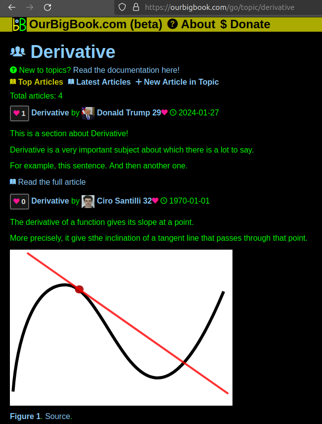
- topics: topics group articles by different users with the same title, e.g. here is the topic for the "Fundamental Theorem of Calculus" ourbigbook.com/go/topic/fundamental-theorem-of-calculusArticles of different users are sorted by upvote within each article page. This feature is a bit like:
- a Wikipedia where each user can have their own version of each article
- a Q&A website like Stack Overflow, where multiple people can give their views on a given topic, and the best ones are sorted by upvote. Except you don't need to wait for someone to ask first, and any topic goes, no matter how narrow or broad
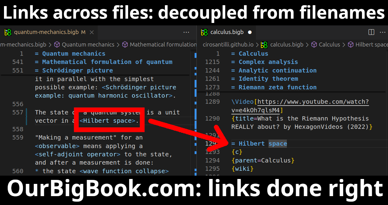
This feature makes it possible for readers to find better explanations of any topic created by other writers. And it allows writers to create an explanation in a place that readers might actually find it.Figure 1. Screenshot of the "Derivative" topic page. View it live at: ourbigbook.com/go/topic/derivativeVideo 2. OurBigBook Web topics demo. Source. - local editing: you can store all your personal knowledge base content locally in a plaintext markup format that can be edited locally and published either:This way you can be sure that even if OurBigBook.com were to go down one day (which we have no plans to do as it is quite cheap to host!), your content will still be perfectly readable as a static site.
- to OurBigBook.com to get awesome multi-user features like topics and likes
- as HTML files to a static website, which you can host yourself for free on many external providers like GitHub Pages, and remain in full control
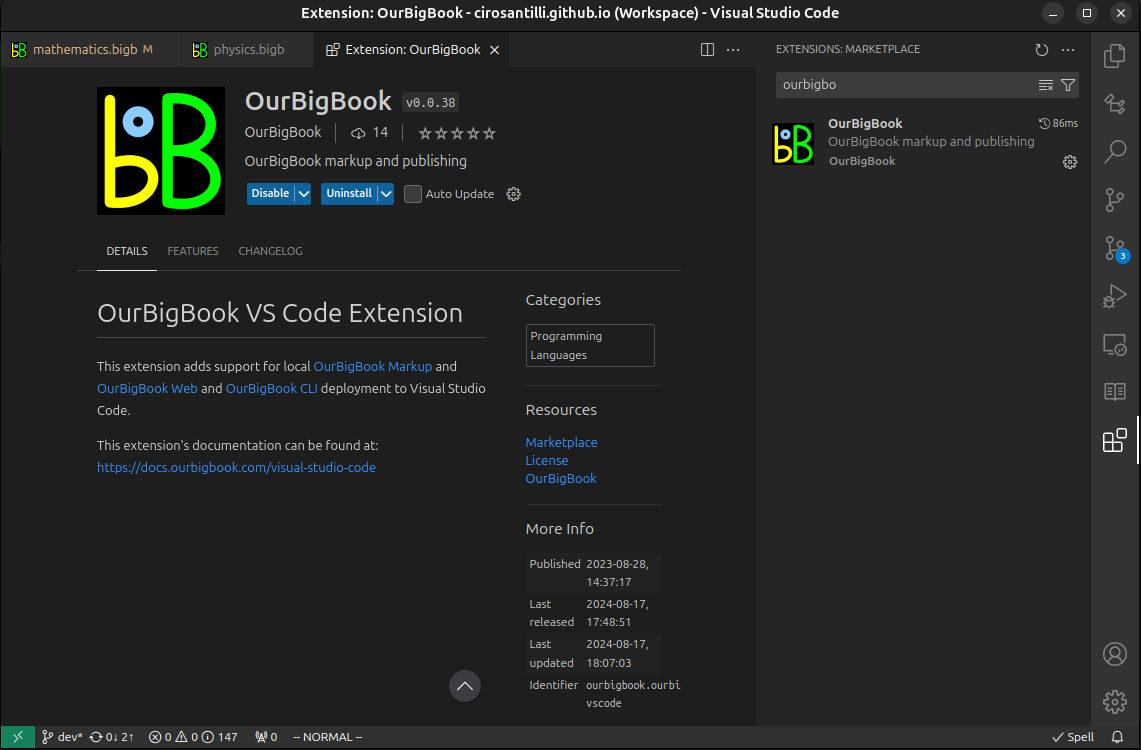
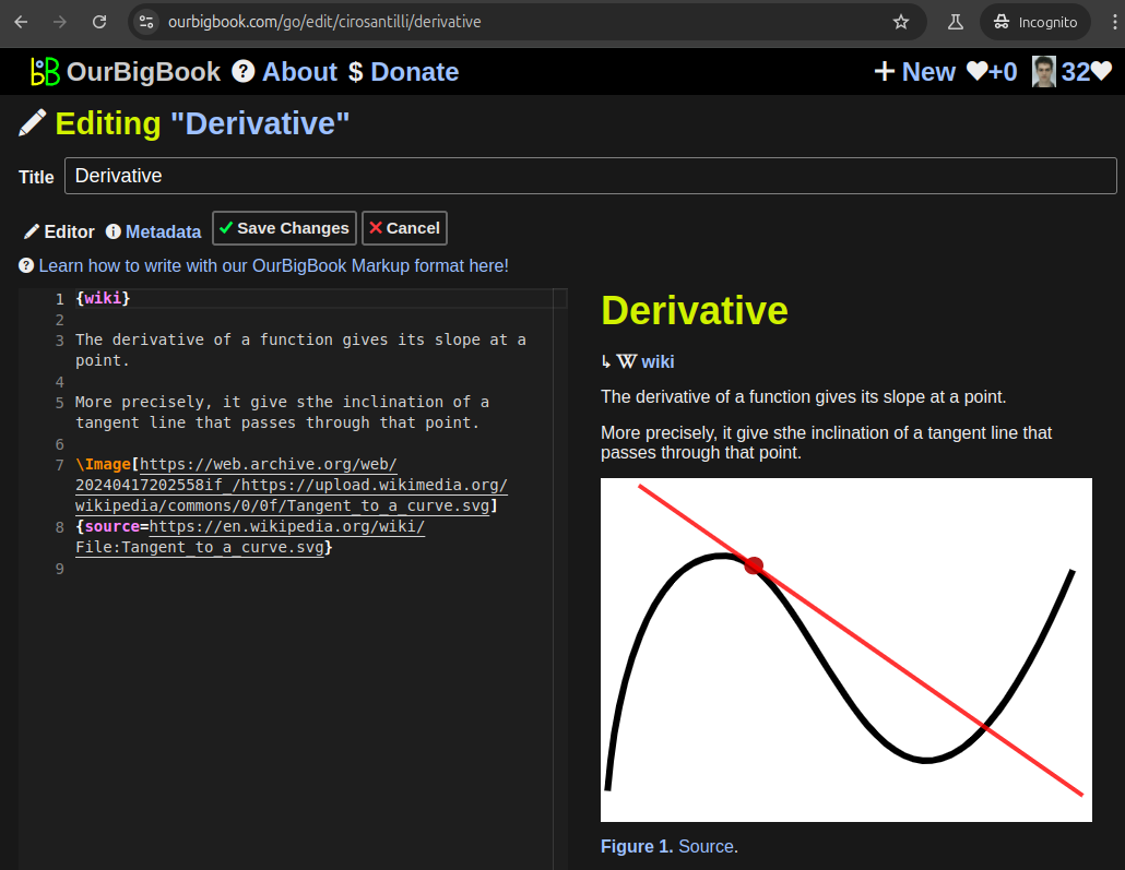
Figure 2. You can publish local OurBigBook lightweight markup files to either OurBigBook.com or as a static website.Figure 3. Visual Studio Code extension installation.Figure 5. . You can also edit articles on the Web editor without installing anything locally. Video 3. Edit locally and publish demo. Source. This shows editing OurBigBook Markup and publishing it using the Visual Studio Code extension. - Infinitely deep tables of contents:
All our software is open source and hosted at: github.com/ourbigbook/ourbigbook
Further documentation can be found at: docs.ourbigbook.com
Feel free to reach our to us for any help or suggestions: docs.ourbigbook.com/#contact


