Norman Steenrod (1910-1971) was a prominent American mathematician known for his contributions to algebraic topology. He is particularly famous for his work on homology and cohomology theories, as well as the Steenrod operations, which are a set of cohomological operations that play a significant role in the study of topological spaces. Steenrod's work helped to formalize many concepts in topology and laid the groundwork for later developments in the field.
Peter Landweber is a mathematician known for his work in the field of mathematical biology, particularly in the areas of evolutionary theory and computational biology. His research often involves the use of mathematical models to better understand biological processes and evolutionary dynamics.
Richard Lashof is an American scientist and professor known for his work in the field of environmental science, particularly focusing on the impacts of climate change and air quality. He has been involved with various organizations and initiatives aimed at addressing issues related to environmental sustainability and public health.
Robert Lee Moore (1882–1974) was an American mathematician known for his significant contributions to topology and the foundations of mathematics. He is perhaps best known for his work in point-set topology and for being one of the pioneers in the development of homotopy theory. Moore was a professor at the University of Texas at Austin, where he influenced many students and researchers in the field.
Solomon Lefschetz (1884–1972) was a prominent mathematician known for his contributions to various fields, including algebraic topology, algebraic geometry, and differential equations. He is particularly famous for developing what is now known as Lefschetz duality, which relates the topological properties of a space to its cohomology.
Vladimir Antonovich Kovalevsky was a notable Russian biologist and paleontologist, best known for his work in the early 20th century. He made significant contributions to the fields of evolutionary biology, paleontology, and systematic zoology. Kovalevsky's research often focused on the study of ancient organisms and their evolutionary relationships. He is also known for his work related to the history of paleontology and for his efforts in publicizing scientific knowledge in Russia.
William Floyd is a mathematician known for his contributions to computer science, particularly in the areas of algorithms and combinatorial optimization. He is perhaps best known for the Floyd-Warshall algorithm, which is an efficient method for finding shortest paths in a weighted graph with positive or negative edge weights (but no negative cycles). This algorithm is widely used in various applications, including network routing and urban traffic planning.
The Atiyah-Bott formula is a significant result in the field of geometry and topology, particularly in the context of mathematical physics and the theory of characteristic classes. Specifically, it provides a formula for the integral of a certain cohomology class over the moduli space of complex structures on a manifold. At its core, the Atiyah-Bott formula gives a way to compute the Euler characteristic of the space of sections of a certain vector bundle.
In category theory and algebraic topology, the concept of *fibration* is a generalization of the notion of a fiber bundle. When we speak of a fibration of simplicial sets, we are referring to a specific type of fibration within the context of simplicial sets, which serve as a combinatorial model for topological spaces. ### Simplicial Sets A **simplicial set** is a combinatorial structure that encodes information about topological spaces.
The Vietoris–Béguin mapping theorem, often simply referred to as the Vietoris theorem, is a result in algebraic topology that pertains to the relationship between homology groups of topological spaces and continuous functions between them. The theorem provides conditions under which the homology of a space can be computed from the homology of a subspace and the mapping properties of a continuous function defined on it.
Mind-body dualism is a philosophical concept that posits the existence of two distinct and separate substances: the mind (or soul) and the body. This dualistic view suggests that mental phenomena are non-physical and that consciousness, thoughts, and emotions exist independently of the physical body. The most famous proponent of mind-body dualism is René Descartes, a 17th-century philosopher who argued that the mind and body are fundamentally different in nature.
The Segre cubic refers to a specific type of algebraic variety in projective space, and it is often denoted as \( S \). Specifically, it is a hypersurface of degree 3 in the projective space \( \mathbb{P}^4 \).
The Bott residue formula is a result in the field of differential topology and algebraic topology that relates the topology of smooth manifolds with specific types of mappings. It is particularly associated with the study of smooth maps between manifolds and the properties of their critical points. The formula is named after Raoul Bott, and it generalizes the classical concept of residues from complex analysis into the realm of differential forms and manifolds.
In the context of Jordan algebras, a **mutation** refers to a particular process or operation that alters the elements of the algebra in a structured way. Jordan algebras are a class of non-associative algebras that arise in various areas of mathematics, particularly in the study of symmetries, physics, and quantum mechanics.
The Kosmann lift is an example of a construction in the realm of mathematics, specifically in the field of topology and homotopy theory. It's related to the study of vector spaces and can be viewed as a method to construct new spaces from existing ones. Named after the mathematician K. Kosmann, the Kosmann lift is often discussed in the context of differential geometry or in the analysis of various types of fiber bundles.
The Jech–Kunen tree is a specific type of tree used in set theory, particularly in the context of analyzing and demonstrating properties of model theory, forcing, and the structure of certain sets. Named after the mathematicians Thomas Jech and Kenneth Kunen, the tree is often discussed within the framework of large cardinals, set-theoretic forcing, and consistency results in mathematics. A Jech–Kunen tree is defined as an infinite tree that possesses specific properties.
Pinned article: Introduction to the OurBigBook Project
Welcome to the OurBigBook Project! Our goal is to create the perfect publishing platform for STEM subjects, and get university-level students to write the best free STEM tutorials ever.
Everyone is welcome to create an account and play with the site: ourbigbook.com/go/register. We belive that students themselves can write amazing tutorials, but teachers are welcome too. You can write about anything you want, it doesn't have to be STEM or even educational. Silly test content is very welcome and you won't be penalized in any way. Just keep it legal!
Intro to OurBigBook
. Source. We have two killer features:
- topics: topics group articles by different users with the same title, e.g. here is the topic for the "Fundamental Theorem of Calculus" ourbigbook.com/go/topic/fundamental-theorem-of-calculusArticles of different users are sorted by upvote within each article page. This feature is a bit like:
- a Wikipedia where each user can have their own version of each article
- a Q&A website like Stack Overflow, where multiple people can give their views on a given topic, and the best ones are sorted by upvote. Except you don't need to wait for someone to ask first, and any topic goes, no matter how narrow or broad
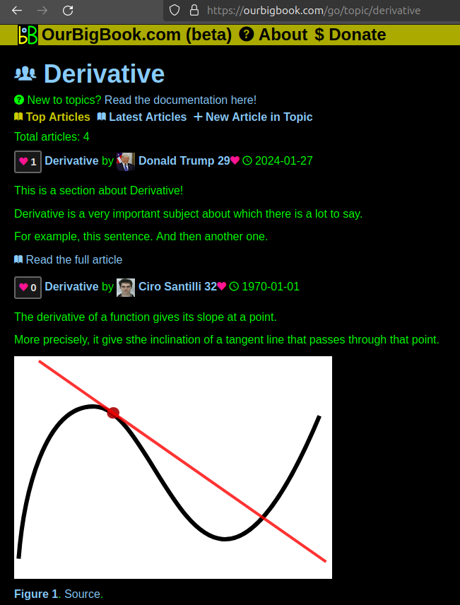
This feature makes it possible for readers to find better explanations of any topic created by other writers. And it allows writers to create an explanation in a place that readers might actually find it.Figure 1. Screenshot of the "Derivative" topic page. View it live at: ourbigbook.com/go/topic/derivativeVideo 2. OurBigBook Web topics demo. Source. - local editing: you can store all your personal knowledge base content locally in a plaintext markup format that can be edited locally and published either:This way you can be sure that even if OurBigBook.com were to go down one day (which we have no plans to do as it is quite cheap to host!), your content will still be perfectly readable as a static site.
- to OurBigBook.com to get awesome multi-user features like topics and likes
- as HTML files to a static website, which you can host yourself for free on many external providers like GitHub Pages, and remain in full control
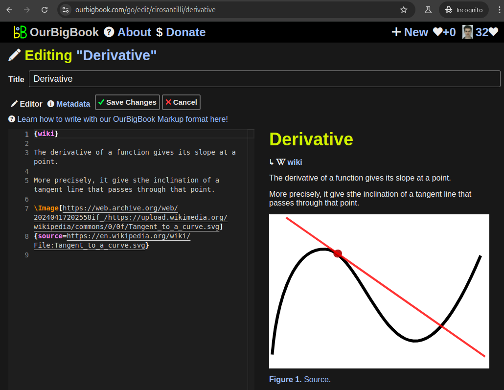
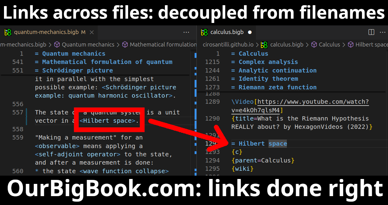
Figure 3. Visual Studio Code extension installation.Figure 4. Visual Studio Code extension tree navigation.Figure 5. Web editor. You can also edit articles on the Web editor without installing anything locally.Video 3. Edit locally and publish demo. Source. This shows editing OurBigBook Markup and publishing it using the Visual Studio Code extension.Video 4. OurBigBook Visual Studio Code extension editing and navigation demo. Source. - Infinitely deep tables of contents:
All our software is open source and hosted at: github.com/ourbigbook/ourbigbook
Further documentation can be found at: docs.ourbigbook.com
Feel free to reach our to us for any help or suggestions: docs.ourbigbook.com/#contact


