CFS Alert, or the Community Feedback System Alert, typically refers to a system or platform used by organizations, particularly in the context of public health, to gather and analyze feedback from community members. This can be especially relevant in health-related issues, where community input is essential for understanding public concerns, assessing the impact of health policies, or implementing interventions.
The Foreign Intelligence Surveillance Act (FISA) is a United States federal law that was enacted in 1978 to authorize and regulate the collection of foreign intelligence information. The act primarily focuses on electronic surveillance and physical searches conducted for national security purposes. Key aspects of FISA include: 1. **Purpose**: The law allows the U.S. government to surveil foreign powers and agents of foreign powers for the purposes of gathering foreign intelligence.
The Lockheed P-3 Orion is a four-engine, turboprop maritime patrol aircraft originally developed by Lockheed for the United States Navy. Designed during the late 1950s, the P-3 entered service in 1962 and was primarily used for anti-submarine warfare (ASW), but its capabilities have expanded over the years to include roles in anti-surface warfare, reconnaissance, and intelligence-gathering missions.
The National Precursor Log Exchange (NPLEx) is a system in the United States designed to monitor the sale of precursor chemicals that are used in the illicit production of methamphetamine and other drugs. NPLEx allows pharmacies and retailers to report the sale of products containing pseudoephedrine and other regulated substances to a centralized database in real time.
Operation RAFTER is a collaborative initiative between the United States and Mexico aimed at combating drug trafficking and organized crime along the U.S.-Mexico border. The operation focuses on enhancing law enforcement's ability to share intelligence, conduct joint operations, and improve coordination between agencies to effectively disrupt the flow of illegal drugs, weapons, and human trafficking across the border. The operation leverages technology, including aerial surveillance and intelligence gathering, to monitor and respond to illicit activities more effectively.
The Titan Traffic Database refers to a specialized database or data repository that collects, stores, and analyzes traffic-related data, often used for urban planning, traffic management, and transportation research. However, the term "Titan Traffic Database" may not refer to a widely recognized, specific database; rather, it could be a proprietary system developed by a company, organization, or research institution focused on managing traffic data.
Signal processing filters are essential tools in digital signal processing (DSP) used to manipulate or modify signals. These filters allow for the separation, enhancement, or suppression of specific frequency components of a signal, making them invaluable in various applications, including audio processing, communications, and image processing. ### Types of Filters 1. **Linear Filters**: - **FIR (Finite Impulse Response) Filters**: These filters have a finite duration impulse response.
Surveying instruments are tools used by surveyors to measure distances, angles, and elevations for various applications, including land surveying, construction, and mapping. Here’s a list of commonly used surveying instruments: 1. **Total Station**: A combination of an electronic theodolite and an electronic distance measurement (EDM) device, used for measuring angles and distances. 2. **Theodolite**: An instrument for measuring angles in the horizontal and vertical planes.
Statistical signal processing is a field that combines principles of statistics and signal processing to analyze and interpret signals that are subject to noise and uncertainty. It focuses on developing algorithms and methodologies to extract meaningful information from noisy or incomplete data. Here are some key aspects of statistical signal processing: 1. **Modeling Signals and Noise**: In statistical signal processing, signals are often modeled as random processes.
An autocorrelator is a mathematical tool used to measure the correlation of a signal with itself at different time lags. It helps in identifying repeating patterns or periodic signals within a dataset or a time series. The process involves comparing the signal at one point in time with the same signal offset by a certain time interval (the lag).
Analog signal processing refers to the manipulation of signals that are represented in continuous time and amplitude. Unlike digital signal processing, which deals with discrete signals and operates using binary values, analog signal processing involves handling real-world signals that vary smoothly over time. These signals can include audio, video, radar signals, and sensor outputs. Key aspects of analog signal processing include: 1. **Continuous Signals**: Analog signals are defined at every instance of time and can take on any value within a given range.
An analytic signal is a complex signal that is derived from a real-valued signal. It is particularly useful in the field of signal processing and communications because it allows for the separation of a signal into its amplitude and phase components. The analytic signal provides a way to represent a real signal using complex numbers, which can simplify many mathematical operations.
In complex analysis, the term "argument" refers to a specific property of complex numbers. The argument of a complex number is the angle that the line representing the complex number in the complex plane makes with the positive real axis.
Autocorrelation, also known as serial correlation, is a statistical measure that assesses the correlation of a signal with a delayed copy of itself as a function of the delay (or time lag). It essentially quantifies how similar a time series is with a lagged version of itself over different time periods. In the context of time series data, autocorrelation can help identify patterns over time, such as seasonality or cyclic behaviors.
Bit banging is a technique used in digital communication to manually control the timing and state of signals over a serial interface using software rather than dedicated hardware. It is commonly used for simple protocol implementations or for interfacing with devices when dedicated hardware support (like UART, SPI, or I2C peripherals) is not available or practical.
The Biot–Tolstoy–Medwin (BTM) diffraction model is a mathematical framework used to describe the sound propagation in underwater acoustics, particularly in shallow water environments. The model incorporates aspects of both geometrical and wave diffraction theories to analyze how sound waves interact with both the ocean surface and the seabed, as well as the boundaries of the water column. ### Key Features of the BTM Model 1.
The term "block transform" can refer to various concepts depending on the context in which it is used, particularly in fields like signal processing, image processing, and data communication. Below are a couple of interpretations: 1. **Signal and Image Processing**: In these domains, a block transform is often used to process data in fixed-size blocks or segments.
In signal processing, **coherence** is a measure of the correlation or relationship between two signals as a function of frequency. It quantifies the degree to which two signals are linearly related in the frequency domain. Coherence is particularly useful in the analysis of time series and signals where one wants to assess the extent to which different signals share a common frequency component. **Key Aspects of Coherence:** 1.
Random Pulse Width Modulation (RPWM) is a technique used in signal processing and control systems, particularly for applications such as power control in electrical systems, motor control, and audio signal processing. The basic idea behind pulse width modulation (PWM) is to vary the width of the pulses in a signal to control the average power delivered to a load.
Pinned article: Introduction to the OurBigBook Project
Welcome to the OurBigBook Project! Our goal is to create the perfect publishing platform for STEM subjects, and get university-level students to write the best free STEM tutorials ever.
Everyone is welcome to create an account and play with the site: ourbigbook.com/go/register. We belive that students themselves can write amazing tutorials, but teachers are welcome too. You can write about anything you want, it doesn't have to be STEM or even educational. Silly test content is very welcome and you won't be penalized in any way. Just keep it legal!
Intro to OurBigBook
. Source. We have two killer features:
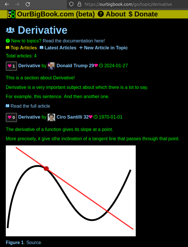
- topics: topics group articles by different users with the same title, e.g. here is the topic for the "Fundamental Theorem of Calculus" ourbigbook.com/go/topic/fundamental-theorem-of-calculusArticles of different users are sorted by upvote within each article page. This feature is a bit like:
- a Wikipedia where each user can have their own version of each article
- a Q&A website like Stack Overflow, where multiple people can give their views on a given topic, and the best ones are sorted by upvote. Except you don't need to wait for someone to ask first, and any topic goes, no matter how narrow or broad
This feature makes it possible for readers to find better explanations of any topic created by other writers. And it allows writers to create an explanation in a place that readers might actually find it.Figure 1. Screenshot of the "Derivative" topic page. View it live at: ourbigbook.com/go/topic/derivativeVideo 2. OurBigBook Web topics demo. Source. - local editing: you can store all your personal knowledge base content locally in a plaintext markup format that can be edited locally and published either:This way you can be sure that even if OurBigBook.com were to go down one day (which we have no plans to do as it is quite cheap to host!), your content will still be perfectly readable as a static site.
- to OurBigBook.com to get awesome multi-user features like topics and likes
- as HTML files to a static website, which you can host yourself for free on many external providers like GitHub Pages, and remain in full control
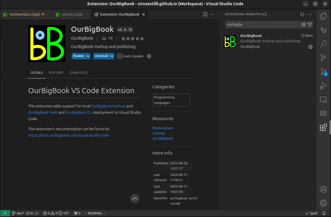
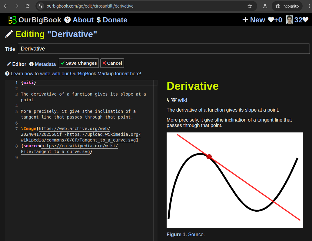
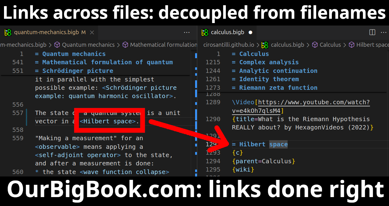
Figure 3. Visual Studio Code extension installation.Figure 4. Visual Studio Code extension tree navigation.Figure 5. Web editor. You can also edit articles on the Web editor without installing anything locally.Video 3. Edit locally and publish demo. Source. This shows editing OurBigBook Markup and publishing it using the Visual Studio Code extension.Video 4. OurBigBook Visual Studio Code extension editing and navigation demo. Source. - Infinitely deep tables of contents:
All our software is open source and hosted at: github.com/ourbigbook/ourbigbook
Further documentation can be found at: docs.ourbigbook.com
Feel free to reach our to us for any help or suggestions: docs.ourbigbook.com/#contact


