As of 2020, there are no known eukaryotes which have never had mitochondria.
Known eukaryotes without mitochondria, which are very rare, have lost mitochondria they previously had.
Having mitochondria appears to be a requisite for being an eukaryote. This is one of the central thesis of Power, Sex, Suicide by Nick Lane (2006).
Miriam Solomon is an influential philosopher known for her work in the philosophy of science, feminist philosophy, and the philosophy of medicine. She is particularly recognized for her contributions to discussions about the social dimensions of scientific inquiry, the role of values in science, and the intersections of gender and science. Solomon's work often explores how scientific practices can be understood through a social lens and how gender and other social factors influence scientific research and knowledge production.
An incandescent light bulb is a type of electric light source that produces light by heating a filament made of tungsten until it glows. When electric current passes through the filament, it heats up to a high temperature (typically around 2,200 to 3,000 degrees Fahrenheit or 1,200 to 1,600 degrees Celsius), causing it to emit visible light.
Notably, it does not undergo crossover.
It has to swim fast, right!
So how is it that mitochondria are not inherited from the father?
- 2016 www.sciencedaily.com/releases/2016/06/160623145932.htm It appears that the exact mechanism hadn't been elucidated
The process that imports proteins encoded in the nuclear DNA and made in the cytosol into the mitochondria.
Power, Sex, Suicide by Nick Lane (2006) suggests that proteins are somehow tagged with extra amino acids for this.
Mitochondria have DNA because they need to be controlled individually by  Ciro Santilli 40 Updated 2025-07-16
Argued at Power, Sex, Suicide by Nick Lane (2006) page 212.
Basically, energy supply has to be modulated rather quickly, because we spend a lot sometimes, and very little other times.
Even not turning it off quickly enough is a problem, as it starts to generate free radicals which fuck you up.
If control came from the nucleus, it has no way to address different mitochondria. But it might be that only one of the mitochondria needs the change. If the nucleus tells all mitochondria to stop producing when only one is full, the others are going to say: "nope, I'm not full, continue producing!" and the one that need to stop will have its signal overridden by the others.
Wikipedia mentions "Since animal mtDNA evolves faster than nuclear genetic markers" with a few sources.
Some sources:
- Power, Sex, Suicide by Nick Lane (2006) page 361 mentions:so this property is also important for the human mitochondrial molecular clock.
While nuclear DNA can barely distinguish between chimps and humans, the mitochondrial clock ticks fast enough to reveal differences accumulating over tens of thousands of years
- www.ncbi.nlm.nih.gov/pmc/articles/PMC3350313 says it for metazoans
- www.quora.com/Why-does-mitochondrial-DNA-mutate-faster
Serial Analysis of Gene Expression (SAGE) is a technique used to measure the expression levels of genes in a given sample. It provides a quantitative assessment of gene expression by capturing short sequences of DNA tags that correspond to different genes. Here’s a brief overview of how SAGE works and its significance: ### Overview of the SAGE Process: 1. **Sample Preparation**: Total RNA is isolated from a biological sample, such as tissue or cells.
Single-molecule magnetic sequencing is an advanced technique for DNA sequencing that leverages the properties of magnetic fields to manipulate and analyze individual molecules of DNA or RNA. Unlike traditional sequencing methods, which often require amplification of DNA samples, this approach is capable of directly sequencing single molecules, which can provide significant advantages in terms of accuracy, speed, and the ability to analyze complex genomes.
Site-specific recombination is a process by which DNA strands are rearranged at particular sites within the genome, allowing for the integration, excision, or rearrangement of genetic material. This mechanism is characterized by the specific recognition of short DNA sequences by recombinase enzymes, which mediate the recombination events.
Spiroligomer is a type of synthetic oligomer that has been designed to mimic the structure and function of natural nucleic acids, such as DNA and RNA. These oligomers are characterized by their unique backbone structure, which allows them to form stable and specific interactions with complementary nucleic acid sequences. The primary applications of spiroligomers are in molecular biology and biotechnology.
Structural biology is a branch of molecular biology, biochemistry, and biophysics that focuses on the study of the molecular structure of biological macromolecules, particularly proteins, nucleic acids (like DNA and RNA), and complex assemblies they form. This field aims to understand the relationship between the structure of these biomolecules and their function in biological processes.
TA cloning is a molecular biology technique used to clone DNA fragments. The name "TA" refers to the base pairs that form the sticky ends on the vector (plasmid) used in the process. Here’s how it works: 1. **Preparation of the DNA Insert**: The DNA fragment that you want to clone is amplified using polymerase chain reaction (PCR). The PCR process can be designed to add thymidine (T) residues at the 3’ ends of the PCR products.
Pinned article: Introduction to the OurBigBook Project
Welcome to the OurBigBook Project! Our goal is to create the perfect publishing platform for STEM subjects, and get university-level students to write the best free STEM tutorials ever.
Everyone is welcome to create an account and play with the site: ourbigbook.com/go/register. We belive that students themselves can write amazing tutorials, but teachers are welcome too. You can write about anything you want, it doesn't have to be STEM or even educational. Silly test content is very welcome and you won't be penalized in any way. Just keep it legal!
Intro to OurBigBook
. Source. We have two killer features:
- topics: topics group articles by different users with the same title, e.g. here is the topic for the "Fundamental Theorem of Calculus" ourbigbook.com/go/topic/fundamental-theorem-of-calculusArticles of different users are sorted by upvote within each article page. This feature is a bit like:
- a Wikipedia where each user can have their own version of each article
- a Q&A website like Stack Overflow, where multiple people can give their views on a given topic, and the best ones are sorted by upvote. Except you don't need to wait for someone to ask first, and any topic goes, no matter how narrow or broad
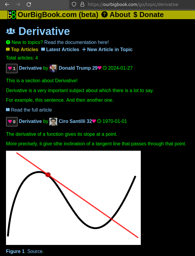
This feature makes it possible for readers to find better explanations of any topic created by other writers. And it allows writers to create an explanation in a place that readers might actually find it.Figure 1. Screenshot of the "Derivative" topic page. View it live at: ourbigbook.com/go/topic/derivativeVideo 2. OurBigBook Web topics demo. Source. - local editing: you can store all your personal knowledge base content locally in a plaintext markup format that can be edited locally and published either:This way you can be sure that even if OurBigBook.com were to go down one day (which we have no plans to do as it is quite cheap to host!), your content will still be perfectly readable as a static site.
- to OurBigBook.com to get awesome multi-user features like topics and likes
- as HTML files to a static website, which you can host yourself for free on many external providers like GitHub Pages, and remain in full control
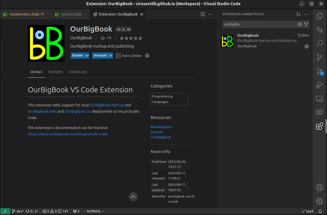
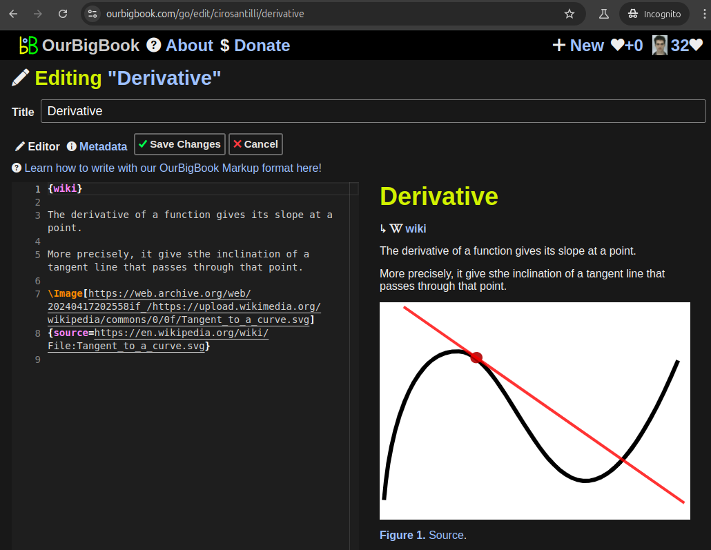
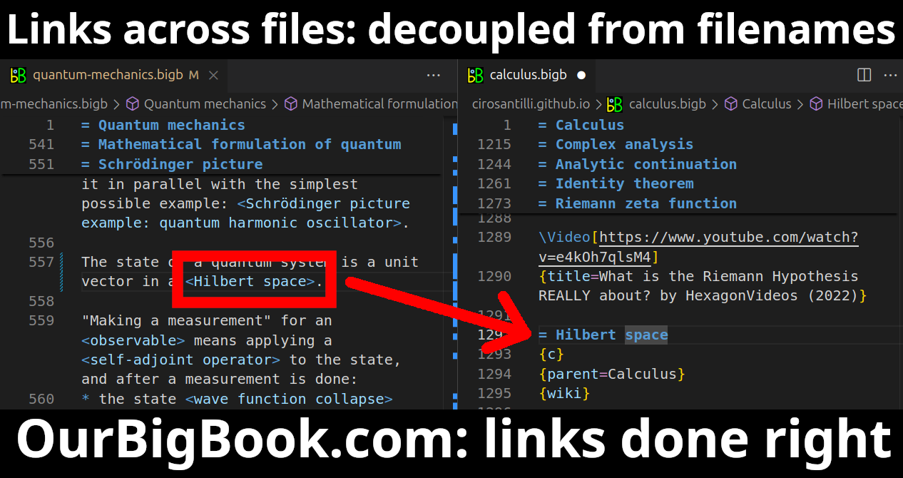
Figure 3. Visual Studio Code extension installation.Figure 4. Visual Studio Code extension tree navigation.Figure 5. Web editor. You can also edit articles on the Web editor without installing anything locally.Video 3. Edit locally and publish demo. Source. This shows editing OurBigBook Markup and publishing it using the Visual Studio Code extension.Video 4. OurBigBook Visual Studio Code extension editing and navigation demo. Source. - Infinitely deep tables of contents:
All our software is open source and hosted at: github.com/ourbigbook/ourbigbook
Further documentation can be found at: docs.ourbigbook.com
Feel free to reach our to us for any help or suggestions: docs.ourbigbook.com/#contact


