Pyrophosphate, also known as diphosphate, is a chemical compound with the formula \( \text{P}_2\text{O}_7^{4-} \) or \( \text{PPi} \). It consists of two phosphate groups linked by a high-energy bond. Pyrophosphate plays a crucial role in biochemistry, particularly in energy metabolism and the synthesis of nucleotides.
Ernest Esclangon (1876-1954) was a French astronomer and mathematician known for his work in the field of celestial mechanics and astrophysics. He made significant contributions to the study of lunar and planetary motion, and he is also recognized for his role in improving astronomical observations and methods during his time. One notable achievement of Esclangon is his involvement with the observation of stars and their movements, which helped refine existing models in astronomy.
The Merkle Signature Scheme (MSS) is a digital signature scheme that is based on Merkle trees, a type of cryptographic structure that enables efficient verification of data. It was proposed by Ralph Merkle in 1979, and it is notable for its ability to provide signatures that can be verified very quickly, even for larger sets of data. ### Key Features of the Merkle Signature Scheme 1.
Ernest Gellner (1925–1995) was a British philosopher, anthropologist, and social theorist, known for his work on nationalism, philosophy of history, and the relationship between culture and society. He was born in Prague and later became a prominent intellectual figure in the fields of sociology and anthropology.
Evgeny Moiseev is a well-known Russian mathematician, particularly recognized for his contributions to various fields within mathematics. He has worked on areas such as functional analysis, approximation theory, and mathematical physics. However, there could be other individuals with the same name in different contexts.
Classical compass winds refer to a traditional system of naming and describing the directions of the wind based on a compass rose, which divides the horizon into various cardinal and intercardinal (or ordinal) points. This system has been used for navigation, meteorology, and various maritime practices throughout history. The primary cardinal directions are: 1. **North (N)** - 0° or 360° 2. **East (E)** - 90° 3.
Cleanroom suitability refers to the assessment of whether a specific environment meets the criteria necessary for it to be classified as a cleanroom. Cleanrooms are controlled environments that minimize the introduction, generation, and retention of airborne particles, as well as controlling other environmental contaminants such as temperature, humidity, and pressure. They are typically used in industries like pharmaceuticals, biotechnology, semiconductor manufacturing, and aerospace, where even minute levels of contamination can affect product quality and safety.
Clifford A. Pickover is an American author, artist, and researcher known for his work at the intersection of science, mathematics, and technology. He is recognized for his contributions to popular science literature, having written numerous books on topics ranging from mathematics and computer graphics to theoretical physics and the nature of consciousness. His work often explores intricate concepts in a way that is accessible to a general audience, combining elements of creativity and science.
Climate-based daylight modeling (CBDM) is a methodological approach used to assess and predict daylight availability in indoor environments based on historical weather data and climatic conditions. Unlike traditional daylight modeling methods that may rely on idealized assumptions or static inputs, CBDM considers the variability of natural light due to changing weather patterns throughout the year.
Warren Teitelman was a prominent figure known for his contributions in computer science, particularly in programming languages and artificial intelligence. He is best recognized for his work at the intersection of these fields, including his involvement in early programming environments and systems. His contributions have been influential in the development of technologies and methodologies used in software engineering and AI research.
Clinical study design refers to the systematic planning and structuring of a clinical trial, which is a research study conducted with human participants to evaluate the efficacy, safety, and overall impact of medical interventions (such as drugs, devices, or therapies). Effective study design is crucial to ensuring that the results of the trial are valid, reliable, and applicable to real-world settings.
Fascism is a political ideology and movement characterized by authoritarian nationalism, centralized control of the government, and the suppression of political dissent. It emerged in the early 20th century, primarily in Europe, and is often associated with regimes like those led by Benito Mussolini in Italy and Adolf Hitler in Germany.
Clock synchronization is the process of coordinating the timing of clocks in a distributed system to ensure that they provide a consistent view of time. This is crucial in computing and telecommunications, as many applications depend on a consistent time reference to function correctly. In distributed systems, different devices (like computers, sensors, and network devices) may have their own independent clocks, which can drift apart due to various factors, including differing clock rates and environmental conditions. Clock synchronization helps address discrepancies in time across these devices.
The 1st meridian west, also known as the Prime Meridian West, is a line of longitude that is located 1 degree west of the Prime Meridian, which is defined as 0 degrees longitude. The Prime Meridian runs through Greenwich, London, and serves as the reference point for defining other longitudes. The 1st meridian west is part of the system of geographic coordinates used to specify locations on Earth.
Cnidariology is the scientific study of cnidarians, a diverse group of aquatic animals that includes jellyfish, corals, sea anemones, and hydras. Cnidarians are characterized by the presence of specialized cells called cnidocytes, which contain stinging structures known as nematocysts. These cells are primarily used for defense and capturing prey. Cnidariology encompasses various aspects of the biology, ecology, evolution, and behavior of these organisms.
Coats of arms with firearms refer to heraldic representations that include guns or other firearms as part of their design. In heraldry, the coat of arms symbolizes an individual's, family's, or institution's identity and values, and various elements within the coat of arms can represent specific traits or historical significance. The inclusion of firearms in a coat of arms may signify military valor, service, or the protection of a territory or community.
Co-channel interference (CCI) is a phenomenon in telecommunications and wireless communications that occurs when multiple transmitters operate on the same frequency channel. This leads to the overlapping of signals received by a device from different transmitters, causing a degradation in the quality of the communication. ### Key Points: 1. **Common in Wireless Networks**: Co-channel interference is particularly prevalent in environments with multiple access points or base stations, such as cell networks, Wi-Fi networks, and broadcast towers.
Ramform Titan is a seismic research vessel operated by the Norwegian company PGS (Petroleum Geo-Services). Launched in 2013, it is one of the most advanced seismic survey ships in the world and is specifically designed for conducting 3D and 4D seismic surveys in the oil and gas industry.
The Chan–Karolyi–Longstaff–Sanders (CKLS) process is a popular class of affine term structure models used in finance to describe the evolution of interest rates. Specifically, it provides a framework for modeling the dynamics of interest rates over time, capturing their stochastic nature and allowing for the consideration of multiple factors that can affect rate movements. The CKLS model is characterized by a specific formulation of the stochastic differential equations governing the behavior of interest rates.
Pinned article: Introduction to the OurBigBook Project
Welcome to the OurBigBook Project! Our goal is to create the perfect publishing platform for STEM subjects, and get university-level students to write the best free STEM tutorials ever.
Everyone is welcome to create an account and play with the site: ourbigbook.com/go/register. We belive that students themselves can write amazing tutorials, but teachers are welcome too. You can write about anything you want, it doesn't have to be STEM or even educational. Silly test content is very welcome and you won't be penalized in any way. Just keep it legal!
Intro to OurBigBook
. Source. We have two killer features:
- topics: topics group articles by different users with the same title, e.g. here is the topic for the "Fundamental Theorem of Calculus" ourbigbook.com/go/topic/fundamental-theorem-of-calculusArticles of different users are sorted by upvote within each article page. This feature is a bit like:
- a Wikipedia where each user can have their own version of each article
- a Q&A website like Stack Overflow, where multiple people can give their views on a given topic, and the best ones are sorted by upvote. Except you don't need to wait for someone to ask first, and any topic goes, no matter how narrow or broad
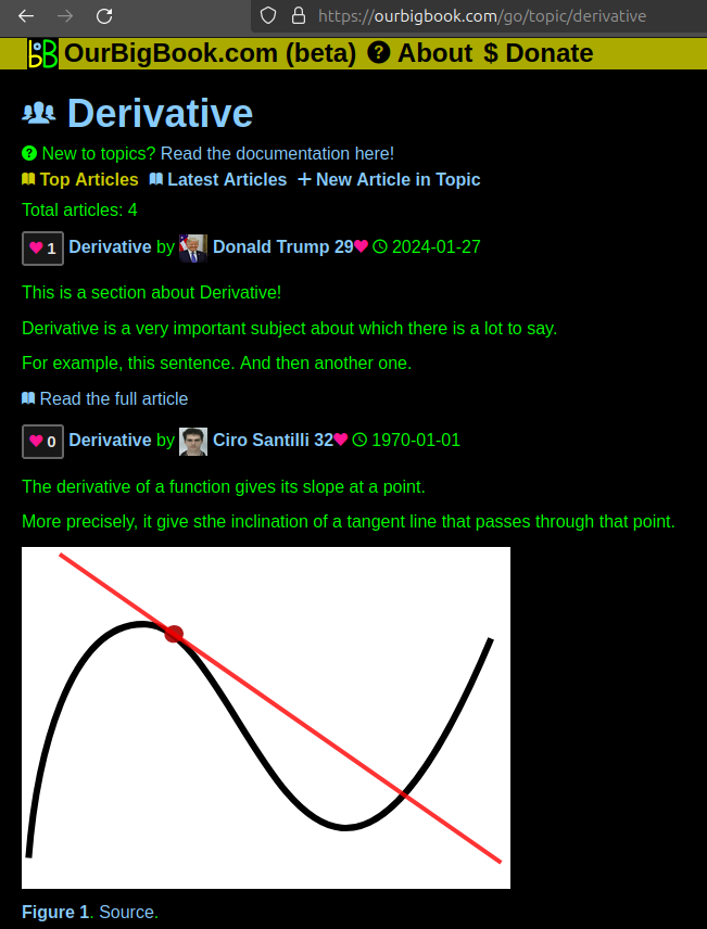
This feature makes it possible for readers to find better explanations of any topic created by other writers. And it allows writers to create an explanation in a place that readers might actually find it.Figure 1. Screenshot of the "Derivative" topic page. View it live at: ourbigbook.com/go/topic/derivativeVideo 2. OurBigBook Web topics demo. Source. - local editing: you can store all your personal knowledge base content locally in a plaintext markup format that can be edited locally and published either:This way you can be sure that even if OurBigBook.com were to go down one day (which we have no plans to do as it is quite cheap to host!), your content will still be perfectly readable as a static site.
- to OurBigBook.com to get awesome multi-user features like topics and likes
- as HTML files to a static website, which you can host yourself for free on many external providers like GitHub Pages, and remain in full control
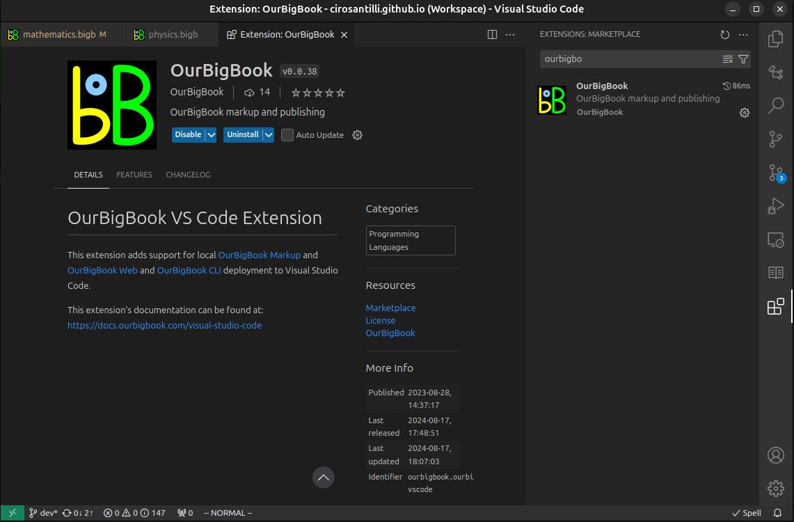
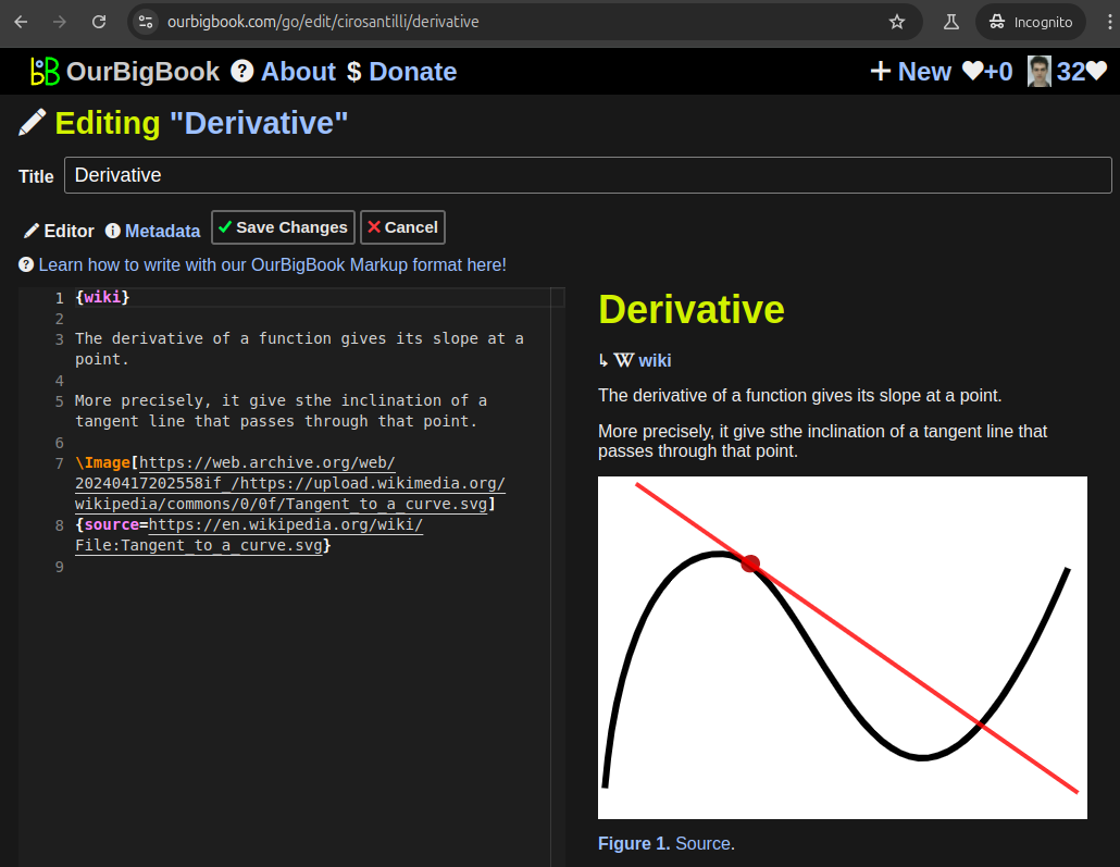
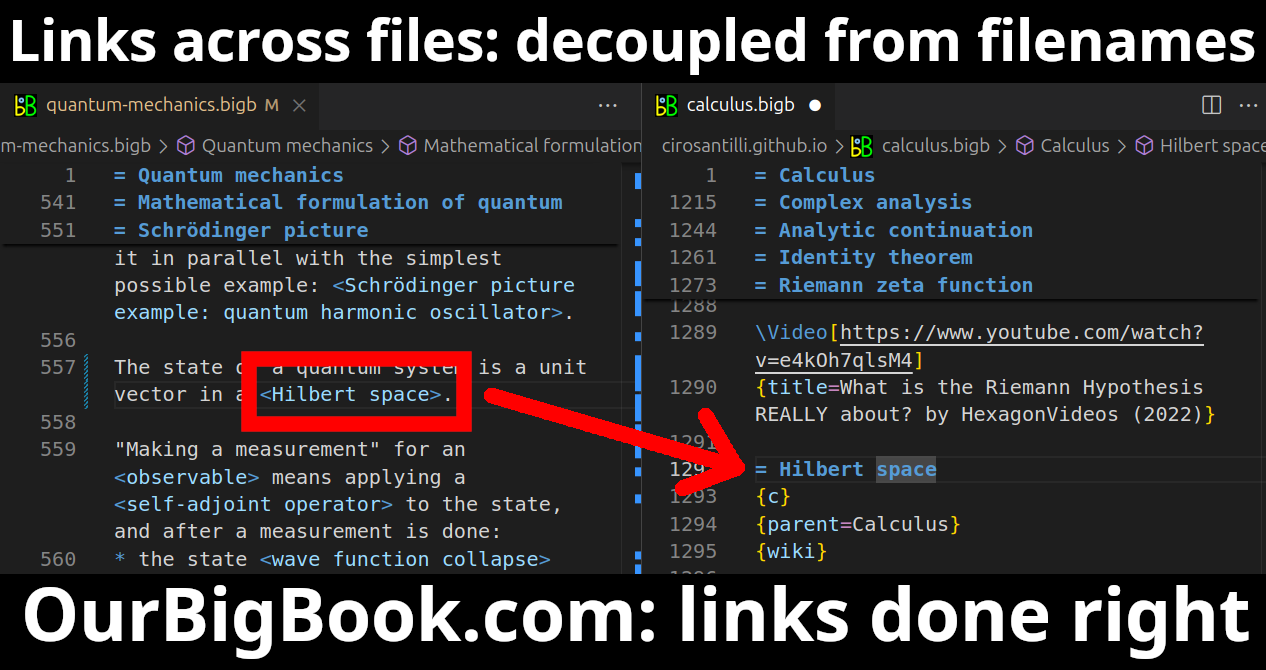
Figure 3. Visual Studio Code extension installation.Figure 4. Visual Studio Code extension tree navigation.Figure 5. Web editor. You can also edit articles on the Web editor without installing anything locally.Video 3. Edit locally and publish demo. Source. This shows editing OurBigBook Markup and publishing it using the Visual Studio Code extension.Video 4. OurBigBook Visual Studio Code extension editing and navigation demo. Source. - Infinitely deep tables of contents:
All our software is open source and hosted at: github.com/ourbigbook/ourbigbook
Further documentation can be found at: docs.ourbigbook.com
Feel free to reach our to us for any help or suggestions: docs.ourbigbook.com/#contact


