Nigel Scrutton is not widely recognized in public discourse, so there may not be specific or notable information about him. It’s also possible that he could be a private individual or a professional in a field that does not have significant public exposure.
Hafnium-tungsten dating is a radiometric dating method used to determine the ages of geological materials, particularly in the context of studying ancient rocks and meteorites. This method is based on the decay of tungsten-182 (¹⁸²W) to hafnium-182 (¹⁸²Hf). Here's a brief overview of how it works: 1. **Decay Process**: Tungsten-182 is a radioactive isotope that decays into hafnium-182.
An isotopic signature refers to the distinct ratios of different isotopes of an element found in a sample. Isotopes are variations of an element that have the same number of protons but different numbers of neutrons, resulting in differing atomic masses. For example, carbon has stable isotopes such as Carbon-12 (^12C) and Carbon-13 (^13C), while its radioactive isotope is Carbon-14 (^14C).
Lutetium–hafnium (Lu-Hf) dating is a radiometric dating technique used primarily to date geological materials, particularly zircon minerals found in igneous and metamorphic rocks. This method is based on the decay of the radioactive isotope lutetium-176 (Lu-176) into hafnium-176 (Hf-176).
Uranium-thorium dating is a radiometric dating technique used to determine the age of calcium carbonates, such as speleothems (stalactites and stalagmites), corals, and other geological and archaeological materials. This method is based on the radioactive decay of uranium isotopes into thorium isotopes.
Seismic history refers to the record of past seismic events, particularly earthquakes, in a specific region or globally. This history is significant for understanding seismic hazards, assessing risks, and establishing building codes and safety measures. Seismic history encompasses several aspects: 1. **Historical Earthquake Records**: These include documented accounts of significant earthquakes, their magnitudes, epicenters, and impacts on populations and infrastructure. Historical records can extend back centuries or millennia and may include archaeological evidence or folklore.
Seismology in fiction refers to the portrayal of earthquakes and seismic activity within literature, movies, video games, and other narrative forms. It often involves the scientific study of seismic events, such as earthquakes, tsunamis, or volcanic eruptions, and the impact these natural disasters have on characters, societies, or the environment.
Rekuhkara is a term from the anime and manga series "Fire Force" (also known as "Enen no Shouboutai"), created by Atsushi Ōkubo. In the series, Rekuhkara refers to a specific type of fire-based phenomenon or entity. The term and its significance are part of the show's exploration of themes related to combustion, powers associated with fire, and the overarching conflict between humans and various fire-related entities.
The Bulletin of the Seismological Society of America (BSSA) is a peer-reviewed scientific journal dedicated to the study of seismology and related fields. It publishes original research articles, reviews, and technical notes that contribute to the understanding of seismic processes, earthquake occurrence, and seismic wave propagation.
A coal mine bump, also known as a "bump" or "coal bump," refers to a sudden collapse or movement of rock strata in a coal mine. This phenomenon occurs when there is a rapid release of built-up stress in the rock, often caused by the extraction of coal. The term is commonly used in the context of underground mining operations.
In earth science, ductility refers to the ability of a material, particularly rocks and minerals, to deform under stress without breaking. It is a measure of the material's capacity to undergo significant plastic deformation when subjected to tensile or compressive forces. This property is crucial in understanding geological processes, such as the behavior of Earth's crust during tectonic movements. Ductile materials can bend, stretch, or flow over time when subjected to sustained pressure, rather than fracturing.
Epicentral distance is the distance measured from the epicenter of an earthquake to a specific point, usually a seismic station or observation point on the Earth's surface. The epicenter is the point on the Earth's surface directly above the focus (or hypocenter), where the earthquake originates. Epicentral distance is typically expressed in kilometers or miles.
Geco, or Geophysical Company of Norway, is a company that specializes in providing geophysical services and solutions, particularly in the oil and gas sector. It primarily focuses on seismic data acquisition and processing, which are critical for exploring and developing hydrocarbon resources. Geco has been involved in various aspects of geophysical surveying, including land, marine, and high-resolution imaging studies.
Global Geo Services (GGS) refers to a company or organization that typically provides a range of services related to geospatial data, geographic information systems (GIS), and related technology. These services may include geospatial analysis, mapping, surveying, remote sensing, and data management for various industries such as environmental monitoring, urban planning, natural resource management, and more.
Microseism refers to a type of very low-frequency seismic activity that is typically caused by natural phenomena, such as ocean waves, earthquakes, and other geological processes. These seismic vibrations occur at frequencies usually between 0.1 Hz and 0.5 Hz and are often too weak to be felt by humans but can be detected using sensitive seismic instruments. Microseisms are primarily generated by the interaction of ocean waves with the seafloor, particularly in regions with significant wave activity.
Induced seismicity refers to earthquakes that are triggered by human activities rather than natural geological processes. This phenomenon can occur in various contexts, including but not limited to: 1. **Hydraulic fracturing (fracking)**: The injection of high-pressure fluids into underground rock formations to extract oil or gas can create fractures, and in some cases, this process can lead to the reactivation of existing faults and induce seismic events.
A P wave, or primary wave, is a type of seismic wave that is the first to be recorded by seismographs following an earthquake. Here are some key characteristics of P waves: 1. **Nature**: P waves are longitudinal waves, meaning that they cause particles in the material through which they travel to oscillate back and forth in the same direction as the wave is moving. This results in areas of compression and rarefaction.
A sand boil, also known as a sand boil-out or sand vent, is a geological phenomenon that occurs during a flooding event or when groundwater pressure is high. It happens when water forces its way to the surface through a layer of sand or other loose sediment. Typically, this occurs when water saturates the soil, causing increased pore pressure that cannot be supported by the overlying material.
Seismic communication refers to the use of seismic waves to transmit information. Seismic waves are generated by various sources, such as earthquakes, explosions, or even human-made vibrations, and they travel through the Earth's subsurface. This method of communication can be employed in various fields, including geophysics, environmental monitoring, and military operations.
Pinned article: Introduction to the OurBigBook Project
Welcome to the OurBigBook Project! Our goal is to create the perfect publishing platform for STEM subjects, and get university-level students to write the best free STEM tutorials ever.
Everyone is welcome to create an account and play with the site: ourbigbook.com/go/register. We belive that students themselves can write amazing tutorials, but teachers are welcome too. You can write about anything you want, it doesn't have to be STEM or even educational. Silly test content is very welcome and you won't be penalized in any way. Just keep it legal!
Intro to OurBigBook
. Source. We have two killer features:
- topics: topics group articles by different users with the same title, e.g. here is the topic for the "Fundamental Theorem of Calculus" ourbigbook.com/go/topic/fundamental-theorem-of-calculusArticles of different users are sorted by upvote within each article page. This feature is a bit like:
- a Wikipedia where each user can have their own version of each article
- a Q&A website like Stack Overflow, where multiple people can give their views on a given topic, and the best ones are sorted by upvote. Except you don't need to wait for someone to ask first, and any topic goes, no matter how narrow or broad
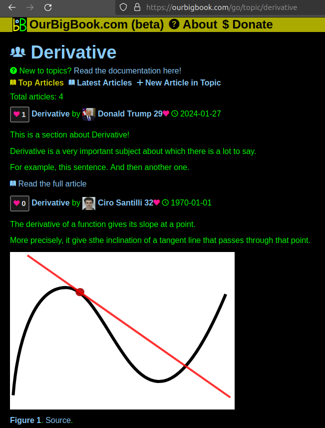
This feature makes it possible for readers to find better explanations of any topic created by other writers. And it allows writers to create an explanation in a place that readers might actually find it.Figure 1. Screenshot of the "Derivative" topic page. View it live at: ourbigbook.com/go/topic/derivativeVideo 2. OurBigBook Web topics demo. Source. - local editing: you can store all your personal knowledge base content locally in a plaintext markup format that can be edited locally and published either:This way you can be sure that even if OurBigBook.com were to go down one day (which we have no plans to do as it is quite cheap to host!), your content will still be perfectly readable as a static site.
- to OurBigBook.com to get awesome multi-user features like topics and likes
- as HTML files to a static website, which you can host yourself for free on many external providers like GitHub Pages, and remain in full control
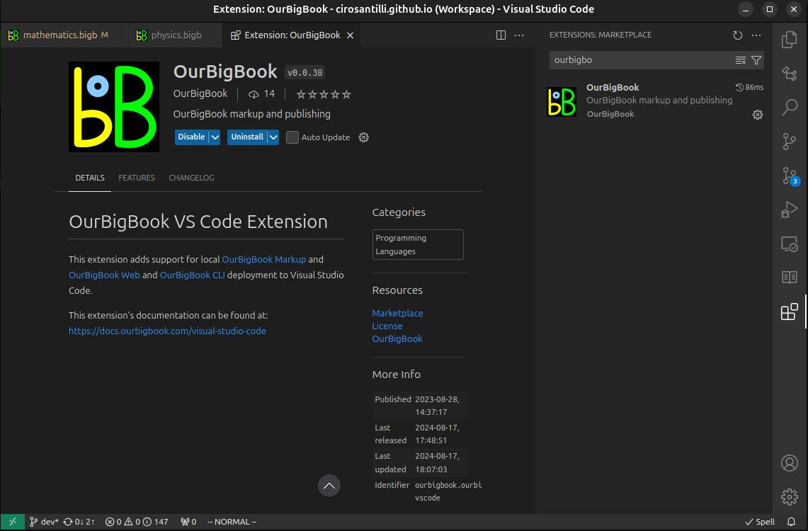
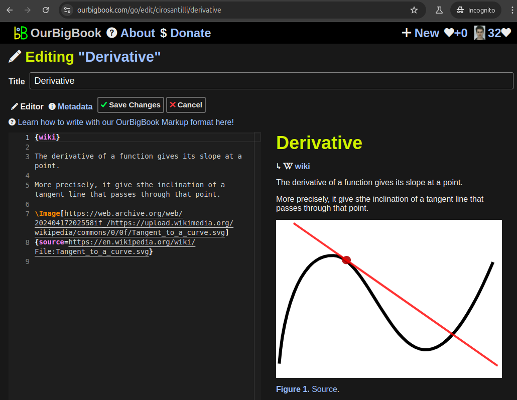
Figure 2. You can publish local OurBigBook lightweight markup files to either OurBigBook.com or as a static website.Figure 3. Visual Studio Code extension installation.Figure 5. . You can also edit articles on the Web editor without installing anything locally. Video 3. Edit locally and publish demo. Source. This shows editing OurBigBook Markup and publishing it using the Visual Studio Code extension. - Infinitely deep tables of contents:
All our software is open source and hosted at: github.com/ourbigbook/ourbigbook
Further documentation can be found at: docs.ourbigbook.com
Feel free to reach our to us for any help or suggestions: docs.ourbigbook.com/#contact


