Medical robots are specialized robotic systems designed to assist in various aspects of medical and healthcare practices. These robots can perform a range of tasks, from surgical procedures to rehabilitation, patient care, and logistics within a medical facility. Here are some key aspects of medical robots: 1. **Surgical Robots**: These devices assist surgeons in performing minimally invasive surgeries with high precision. Notable examples include the da Vinci Surgical System, which allows surgeons to control robotic arms equipped with surgical instruments via a console.
The BionicKangaroo is a robotic kangaroo developed by a research team in Germany, primarily aiming to study and replicate the unique jumping abilities of real kangaroos. This robot is designed to mimic the biomechanics of kangaroo locomotion, which is highly efficient and energy-conserving due to the way kangaroos use elastic energy in their tendons while jumping.
Genghis is a type of robot that has been developed by a company called **Tutherland Technologies** in Australia. It is designed as a fully autonomous agricultural robot particularly aimed at conducting tasks such as weeding, planting, and crop monitoring. Genghis utilizes advanced machine learning and computer vision technology to identify plants and weeds, enabling it to perform its functions accurately and efficiently.
A "table of bases" typically refers to a table that lists the bases of different number systems or mathematical structures. This table can serve various purposes, such as providing a quick reference for converting between number bases or for understanding how numbers are represented in different numeral systems. For example, the most common number systems are: 1. **Base 10 (Decimal)**: The standard system for everyday counting, which uses digits 0-9.
A leading zero is a zero (0) that appears at the beginning of a number, typically to provide a specific format or to ensure that the number reaches a certain length. Leading zeros are often used in various contexts, such as: 1. **Digital Representation:** In computer programming and digital electronics, leading zeros can help maintain consistent formatting, such as in binary numbers or when displaying numbers in a designated field length.
A mechanical counter is a device used to count events or objects in a mechanical manner, often employing a system of gears and levers. These counters operate without electronic components and are typically characterized by a series of numbered dials that rotate to display the counted number. Mechanical counters can be found in various applications, such as: 1. **Industrial Machinery**: Used to count the number of items produced or processed. 2. **Timers**: In devices that track elapsed time through mechanical means.
Suzhou numerals are a traditional system of representing numbers used in Suzhou, a city in Jiangsu province, China. This numeral system is known for its unique characters that are distinct from standard Chinese numerals. Suzhou numerals were historically used for accounting and tallying in commerce, particularly for merchants and traders. The system is composed of a set of symbols that represent numbers from 1 to 9, along with symbols for larger values.
Alfréd Rényi (1921–1970) was a Hungarian mathematician known for his contributions to various areas of mathematics, particularly in probability theory, set theory, information theory, and combinatorics. He is best known for the Rényi entropy, which generalizes the concept of entropy in information theory, providing a more flexible framework for measuring the uncertainty associated with random variables.
André Sainte-Laguë was a French mathematician and engineer, best known for developing the Sainte-Laguë method, which is a voting system used for proportional representation in elections. The method was first introduced by him in 1899 and is designed to allocate seats in a legislature in a way that reflects the overall vote distribution among parties or candidates. The Sainte-Laguë method employs a specific divisor to determine how many seats each party receives based on the number of votes they garner.
Charles Colbourn is a mathematician known for his work in the field of combinatorics, particularly in graph theory and its applications. He has made significant contributions to topics such as network design, extremal graph theory, and combinatorial designs. Colbourn has co-authored several books and numerous research papers, and he has been involved in various educational and academic activities.
H. B. Walikar refers to a prominent figure in the field of academia, specifically known for contributions in the areas of research and higher education. However, without additional context, it is difficult to determine the exact nature of H. B. Walikar's work or achievements, as there may be specific contributions or roles in various fields.
Judith Q. Longyear is an American author known for her work in the genre of science fiction and fantasy, particularly for her contributions to the field of speculative fiction. She has written multiple short stories and novels, often exploring themes related to science, society, and the implications of technology. Longyear is also recognized for her involvement in the writing community, including participation in workshops and conventions.
Katalin Vesztergombi is a mathematician known for her contributions to various areas of mathematics, particularly in the fields of topology and the theory of semigroups. She has published numerous research papers and has been involved in mathematical education and outreach.
A coil tap is a method used in electric guitar pickups, particularly in humbucker pickups, to switch between different configurations of the coils. Humbuckers typically consist of two coils wound around magnets. A coil tap allows players to “tap” into one of the coils, effectively transforming the humbucker into a single-coil pickup. This can create a brighter, sharper tone commonly associated with single-coil pickups.
A Hohlraum is a device used in physics, particularly in the field of high-energy density physics and inertial confinement fusion experiments. The term "Hohlraum" is German for "cavity" or "empty space," and it refers to a cavity or chamber that is designed to create an environment for studying the behavior of matter under extreme conditions.
Paul Seymour is a prominent American mathematician known for his contributions to the fields of graph theory and combinatorial optimization. He has worked extensively on topics such as network flows, matroids, and the theory of perfect graphs. Seymour is particularly recognized for his collaborations with other mathematicians, including work with his colleague Neil Robertson, which has significantly advanced the understanding of graph minor theory.
Varga K. Kalantarov does not seem to be a widely recognized figure in publicly available information as of my last knowledge update in October 2023. It's possible that he could be a private individual, a professional in a specific field, or someone whose prominence has emerged after my last training cut-off.
Vehicle design is a multidisciplinary process that involves the conceptualization, creation, and refinement of vehicles, including cars, trucks, buses, motorcycles, and other forms of transportation. This process encompasses various aspects, including: 1. **Aerodynamics**: Understanding how air interacts with the vehicle body to minimize drag and improve fuel efficiency. 2. **Structural Engineering**: Designing the vehicle's frame and body to ensure safety, durability, and performance under various conditions.
Vehicle operation refers to the processes and actions involved in the use and management of a vehicle. This can encompass a wide range of activities, including but not limited to: 1. **Driving**: The physical act of controlling a vehicle, which includes steering, acceleration, braking, and maneuvering. 2. **Vehicle Maintenance**: Regular checks and servicing to ensure a vehicle is safe and functioning properly, such as oil changes, tire rotations, and brake inspections.
"Kathekon" is a term derived from the Greek word "καθέκον," which can be translated as "that which restrains" or "that which holds back." In various philosophical and theological contexts, particularly in the works of St. Augustine and later in discussions of the Christian eschatological framework, the term refers to an entity or principle that restrains evil or chaos in the world.
Pinned article: Introduction to the OurBigBook Project
Welcome to the OurBigBook Project! Our goal is to create the perfect publishing platform for STEM subjects, and get university-level students to write the best free STEM tutorials ever.
Everyone is welcome to create an account and play with the site: ourbigbook.com/go/register. We belive that students themselves can write amazing tutorials, but teachers are welcome too. You can write about anything you want, it doesn't have to be STEM or even educational. Silly test content is very welcome and you won't be penalized in any way. Just keep it legal!
Intro to OurBigBook
. Source. We have two killer features:
- topics: topics group articles by different users with the same title, e.g. here is the topic for the "Fundamental Theorem of Calculus" ourbigbook.com/go/topic/fundamental-theorem-of-calculusArticles of different users are sorted by upvote within each article page. This feature is a bit like:
- a Wikipedia where each user can have their own version of each article
- a Q&A website like Stack Overflow, where multiple people can give their views on a given topic, and the best ones are sorted by upvote. Except you don't need to wait for someone to ask first, and any topic goes, no matter how narrow or broad
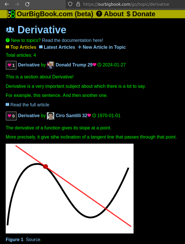
This feature makes it possible for readers to find better explanations of any topic created by other writers. And it allows writers to create an explanation in a place that readers might actually find it.Figure 1. Screenshot of the "Derivative" topic page. View it live at: ourbigbook.com/go/topic/derivativeVideo 2. OurBigBook Web topics demo. Source. - local editing: you can store all your personal knowledge base content locally in a plaintext markup format that can be edited locally and published either:This way you can be sure that even if OurBigBook.com were to go down one day (which we have no plans to do as it is quite cheap to host!), your content will still be perfectly readable as a static site.
- to OurBigBook.com to get awesome multi-user features like topics and likes
- as HTML files to a static website, which you can host yourself for free on many external providers like GitHub Pages, and remain in full control
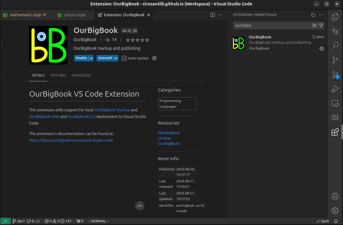
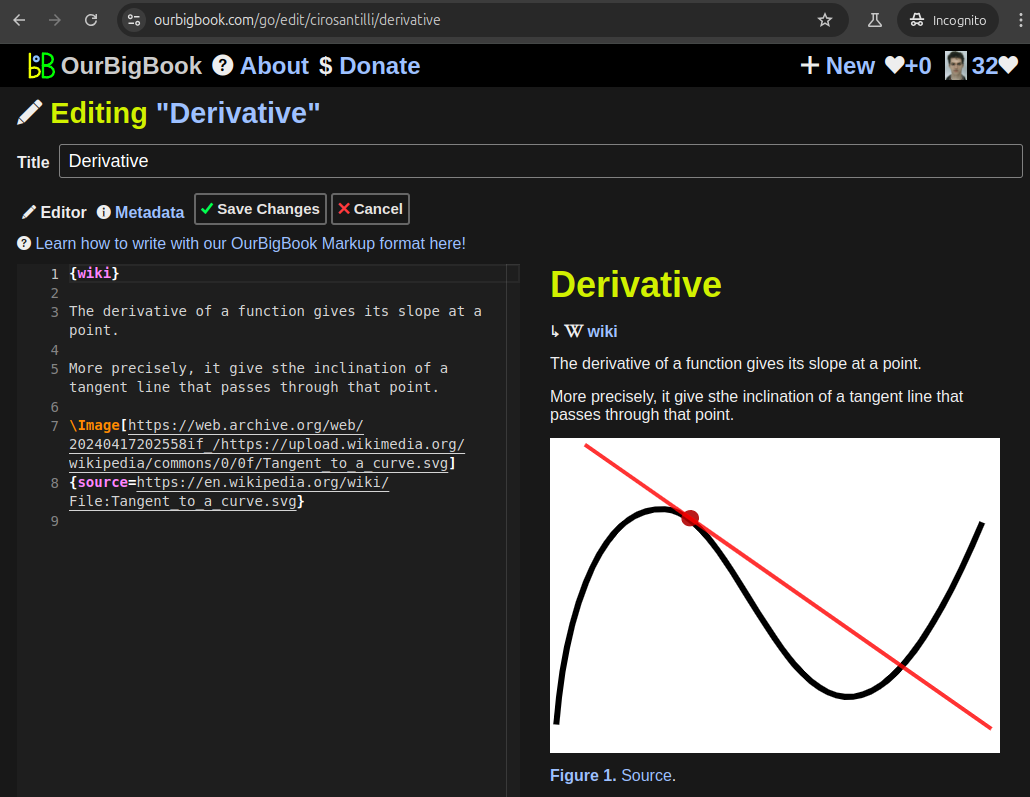
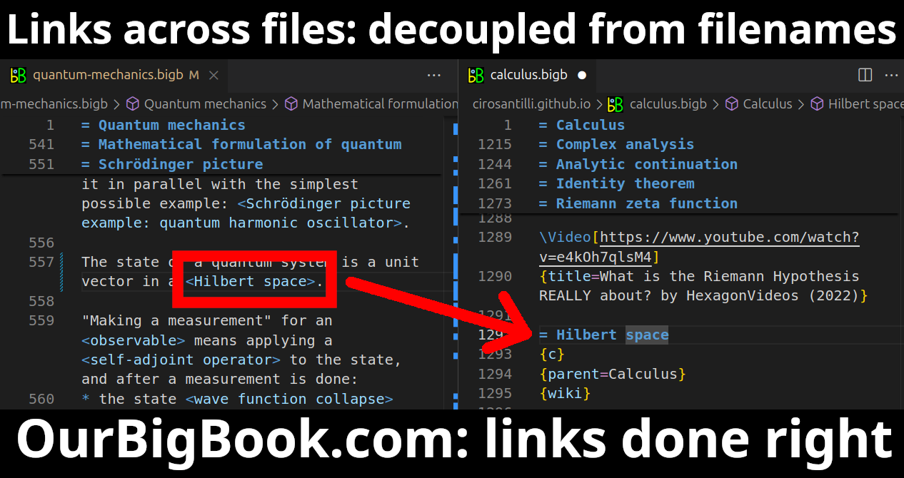
Figure 3. Visual Studio Code extension installation.Figure 4. Visual Studio Code extension tree navigation.Figure 5. Web editor. You can also edit articles on the Web editor without installing anything locally.Video 3. Edit locally and publish demo. Source. This shows editing OurBigBook Markup and publishing it using the Visual Studio Code extension.Video 4. OurBigBook Visual Studio Code extension editing and navigation demo. Source. - Infinitely deep tables of contents:
All our software is open source and hosted at: github.com/ourbigbook/ourbigbook
Further documentation can be found at: docs.ourbigbook.com
Feel free to reach our to us for any help or suggestions: docs.ourbigbook.com/#contact


