Stargroves is primarily known as the former residence of Mick Jagger, the lead singer of The Rolling Stones. Located in the village of Sussex, England, it has historical significance and has been associated with various notable figures over the years. The estate is known not just for its connection to Jagger but also for its architectural features and surrounding landscape.
"Nuclear space" can refer to different concepts depending on the context. Here are a couple of interpretations: 1. **Mathematical Context (Nuclear Spaces in Functional Analysis)**: In functional analysis, a "nuclear space" is a type of topological vector space that has certain properties making it "nice" for various mathematical analyses, particularly in relation to nuclear operators and nuclear norms.
Tamatebako, often referred to as the "jewel box" or "treasure box," is a traditional Japanese origami design. It is known for its beautiful and intricate folding technique, allowing the paper to create a 3D box that can be opened. The design is typically made from a single square piece of paper and is folded in such a way that it can hold small items, resembling a treasure trove or a decorative container.
First-order reduction, in general terms, refers to the process of simplifying a problem or a mathematical expression by reducing it to a first-order form, meaning that it involves only first-order terms. This concept appears in various fields, including physics, mathematics, and computer science, although its specific meaning can differ depending on the context. Below are a few interpretations: 1. **Mathematics**: In calculus, reducing a higher-order differential equation to a first-order equation can help in solving it.
Technoscience is a term that refers to the interconnectedness of technology and science, emphasizing their mutual influence and the ways in which they co-evolve. It recognizes that scientific advancements often lead to new technologies, while technological developments can, in turn, guide scientific research and discovery. Key characteristics of technoscience include: 1. **Interdisciplinary Approach**: Technoscience often draws from multiple fields, integrating knowledge from science, engineering, humanities, and social sciences to address complex problems.
Fisher's equation describes the relationship between nominal interest rates, real interest rates, and the rate of inflation.
Tetrahedron packing refers to the arrangement of tetrahedral shapes (the three-dimensional counterparts of triangles, with four triangular faces) in a space-efficient manner. This concept can be applied in various contexts, including materials science, chemistry, and mathematical optimization. In materials science, tetrahedron packing can describe the arrangement of atoms or molecules in a crystal lattice where the most efficient packing configurations can lead to the understanding of material properties.
As of my last update in October 2023, "The Meta Network" can refer to a few different concepts depending on the context, particularly within technology, social networks, and the broader metaverse discussions. Here are a few interpretations: 1. **Meta Platforms, Inc.**: Originally known as Facebook, Meta is the parent company of social media platforms like Facebook, Instagram, and WhatsApp.
Philip Mirowski is an American economist and a prominent figure in the field of economic philosophy and the critique of mainstream economic thinking. He is known for his research on the history and philosophy of economics, as well as for his critiques of neoliberalism and the role of economics in shaping public policy. Mirowski has written extensively on topics such as the relationship between economics and science, the social and political implications of economic theories, and the development of economic thought over time.
The philosophical interpretation of classical physics involves examining the conceptual foundations, implications, and metaphysical assumptions of classical physical theories, particularly those emerging from the works of figures such as Isaac Newton, Galileo Galilei, and later classical mechanics as formalized by Joseph-Louis Lagrange and others. Here are several key themes and ideas within the philosophical interpretation of classical physics: 1. **Nature of Space and Time**: Classical physics, particularly through Newton's work, treats space and time as absolute entities.
Phosphaethynolate is an anion with the chemical formula \( \text{CPO}^- \). It consists of carbon (C), phosphorus (P), and oxygen (O) atoms, where the phosphorus atom is bonded to both carbon and oxygen. Phosphaethynolate is notable for being a form of a phosphorus-containing compound, and it has attracted interest in the field of chemistry due to its unique properties and reactivity.
"Sweep and prune" is an optimization technique commonly used in computational geometry, particularly in the context of collision detection and physics simulations in computer graphics and game development. The goal of the sweep and prune algorithm is to efficiently identify pairs of overlapping objects that need further testing for collisions. ### Overview of the Sweep and Prune Algorithm: 1. **Data Structures**: - Objects are usually represented by their bounding volumes (like Axis-Aligned Bounding Boxes or AABBs).
GABRB2 is a gene that encodes the beta-2 subunit of the gamma-aminobutyric acid (GABA) receptor, which is a major inhibitory neurotransmitter receptor in the central nervous system. GABA receptors are integral in regulating neuronal excitability and play a key role in reducing neuronal excitability throughout the nervous system. The GABA receptor is a pentameric complex, meaning it is composed of five subunits.
The term "Schnorr group" typically refers to a specific type of mathematical structure used in the context of efficient digital signature schemes, namely the Schnorr signature scheme. Introduced by Claus-Peter Schnorr in the 1980s, Schnorr signatures are based on the hardness of the discrete logarithm problem in certain groups, particularly cyclic groups.
Francesco Bonatelli could refer to a specific individual, but as of my last update in October 2023, there isn't any widely recognized or prominent figure by that name in public domains such as politics, arts, science, or other notable fields. It’s possible that he may be a private individual or a lesser-known figure, so additional context would be necessary for a more precise identification.
A triaugmented hexagonal prism is a type of geometric solid that belongs to the family of solids known as "augmented prisms." This specific prism is obtained by taking a standard hexagonal prism and augmenting it with additional pyramid-like shapes (called "augmented" shapes) on each of the two hexagonal bases.
The Truncated Newton method, also known as the Newton-CG (Change of Variable) method, is an optimization algorithm that combines aspects of the Newton method with techniques from conjugate gradient methods. It is particularly useful for optimizing large-scale problems where the direct computation and storage of the Hessian matrix (the matrix of second derivatives) is impractical.
The piezoelectrochemical transducer effect refers to the phenomenon where mechanical stress on a piezoelectric material induces a change in its electrochemical properties. This effect combines principles from both piezoelectricity and electrochemistry, making it particularly relevant in areas like sensors, actuators, and energy harvesting devices.
Pinned article: Introduction to the OurBigBook Project
Welcome to the OurBigBook Project! Our goal is to create the perfect publishing platform for STEM subjects, and get university-level students to write the best free STEM tutorials ever.
Everyone is welcome to create an account and play with the site: ourbigbook.com/go/register. We belive that students themselves can write amazing tutorials, but teachers are welcome too. You can write about anything you want, it doesn't have to be STEM or even educational. Silly test content is very welcome and you won't be penalized in any way. Just keep it legal!
Intro to OurBigBook
. Source. We have two killer features:
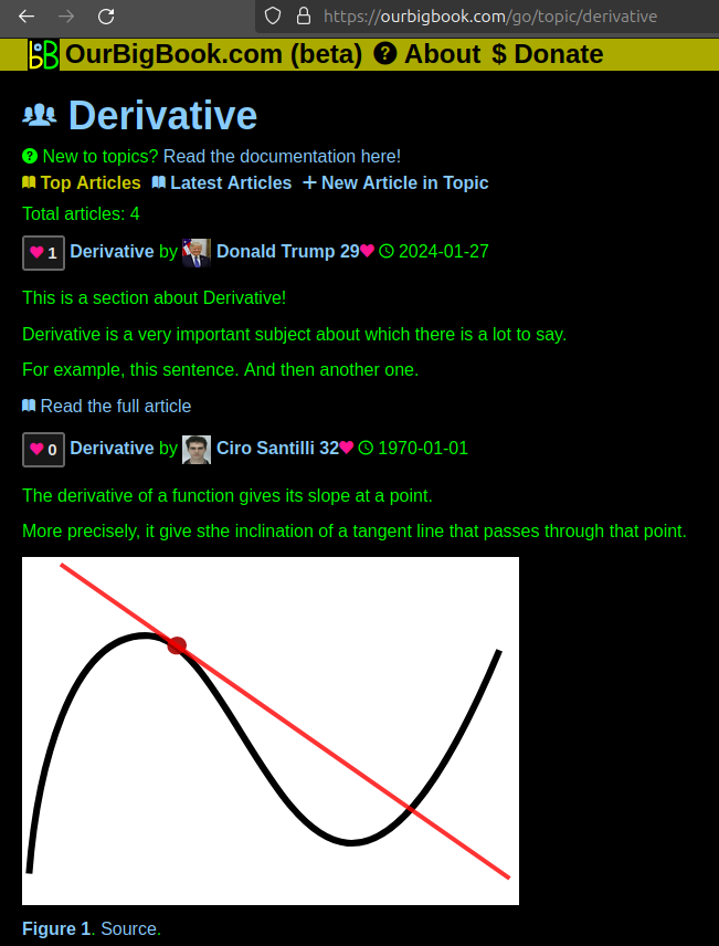
- topics: topics group articles by different users with the same title, e.g. here is the topic for the "Fundamental Theorem of Calculus" ourbigbook.com/go/topic/fundamental-theorem-of-calculusArticles of different users are sorted by upvote within each article page. This feature is a bit like:
- a Wikipedia where each user can have their own version of each article
- a Q&A website like Stack Overflow, where multiple people can give their views on a given topic, and the best ones are sorted by upvote. Except you don't need to wait for someone to ask first, and any topic goes, no matter how narrow or broad
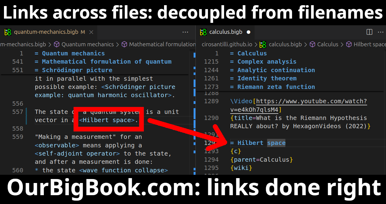
This feature makes it possible for readers to find better explanations of any topic created by other writers. And it allows writers to create an explanation in a place that readers might actually find it.Figure 1. Screenshot of the "Derivative" topic page. View it live at: ourbigbook.com/go/topic/derivativeVideo 2. OurBigBook Web topics demo. Source. - local editing: you can store all your personal knowledge base content locally in a plaintext markup format that can be edited locally and published either:This way you can be sure that even if OurBigBook.com were to go down one day (which we have no plans to do as it is quite cheap to host!), your content will still be perfectly readable as a static site.
- to OurBigBook.com to get awesome multi-user features like topics and likes
- as HTML files to a static website, which you can host yourself for free on many external providers like GitHub Pages, and remain in full control
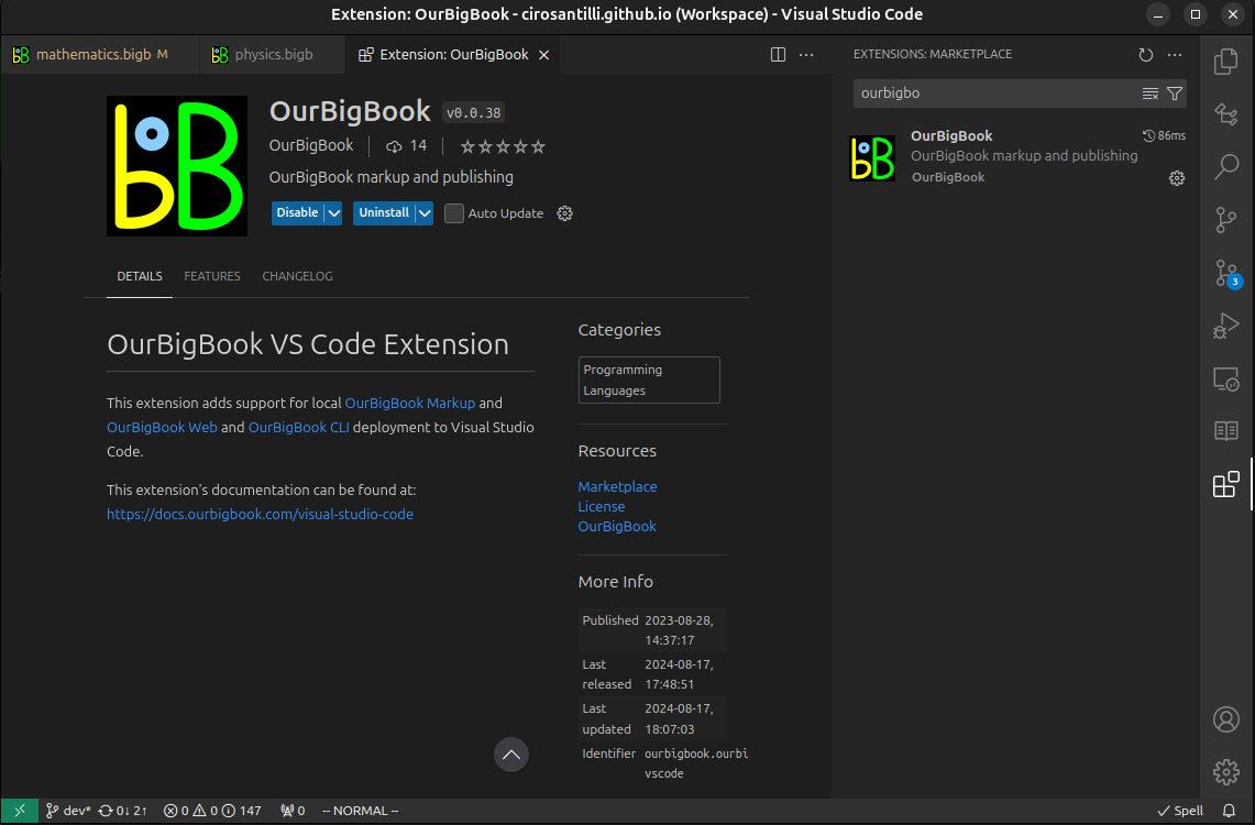
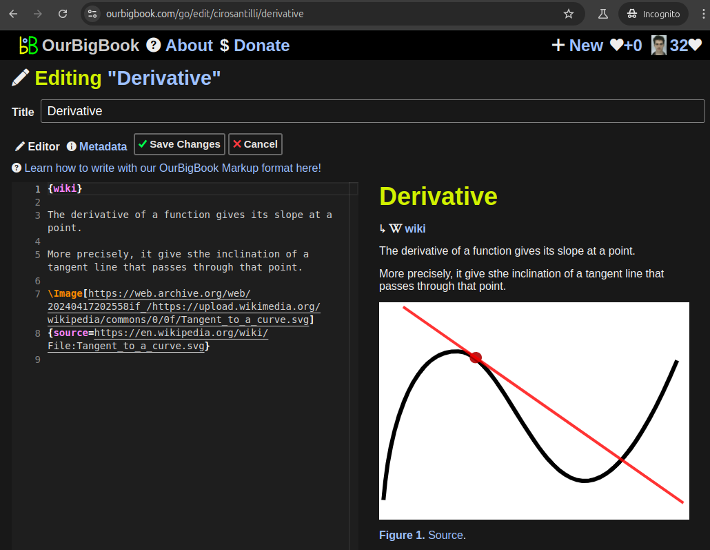
Figure 3. Visual Studio Code extension installation.Figure 4. Visual Studio Code extension tree navigation.Figure 5. Web editor. You can also edit articles on the Web editor without installing anything locally.Video 3. Edit locally and publish demo. Source. This shows editing OurBigBook Markup and publishing it using the Visual Studio Code extension.Video 4. OurBigBook Visual Studio Code extension editing and navigation demo. Source. - Infinitely deep tables of contents:
All our software is open source and hosted at: github.com/ourbigbook/ourbigbook
Further documentation can be found at: docs.ourbigbook.com
Feel free to reach our to us for any help or suggestions: docs.ourbigbook.com/#contact


