The term "intercept method" can refer to different concepts depending on the context, such as statistics, mathematics, or software development. Here are a few interpretations of the term: 1. **Statistical Intercept**: In statistics, particularly in regression analysis, the intercept is the value of the dependent variable when all independent variables are equal to zero. The "intercept method" can refer to ways of estimating this intercept, for example through Ordinary Least Squares (OLS) regression.
The International Ice Patrol (IIP) is an organization established to monitor and provide information about icebergs in the North Atlantic Ocean, particularly in areas where shipping lanes intersect with potential iceberg hazards. It was formed in 1914 in response to the sinking of the RMS Titanic in 1912, which highlighted the dangers posed by icebergs to maritime safety.
"Landmarks" can refer to several different concepts depending on the context: 1. **Geographical Landmarks**: These are notable physical features or structures that are easily recognizable and often serve as guides for navigation or points of interest. Examples include the Eiffel Tower in Paris, the Statue of Liberty in New York, or natural features like mountains and rivers.
Nautical terminology refers to the specialized language and vocabulary used in maritime contexts, particularly in navigation, sailing, and ship operations. This terminology helps in communication among sailors, ship operators, and maritime professionals to ensure safety and efficiency on the water. Here are some common categories and terms within nautical terminology: ### 1. **Directional Terms** - **Bow**: The front of a vessel. - **Stern**: The rear of a vessel.
The Q-Vandermonde identity is a generalization of the classical Vandermonde identity, which relates sums of binomial coefficients to the coefficients of a polynomial expansion. The Q-Vandermonde identity specifically introduces the concept of q-binomial coefficients (also known as Gaussian coefficients) and q-series.
Public Interest Registry (PIR) is a nonprofit organization that manages the .ORG top-level domain (TLD). Established in 2002, PIR is responsible for the administration of the .ORG domain, which is widely used by nonprofit organizations, foundations, and other groups that benefit the public interest. The organization's mission is to promote a stable and secure global Internet, provide support to the nonprofit sector, and foster community development and trust online.
The term "Northern pole stars" typically refers to stars that are located near the North Celestial Pole, the point in the sky directly above the Earth's North Pole. The most prominent star associated with this designation is Polaris, also known as the North Star. Polaris is notable for being almost directly aligned with the Earth's rotational axis, making it a key point of reference for navigation in the Northern Hemisphere.
The term "Periplus" refers to an ancient navigational manual that provides detailed descriptions of coastlines, ports, and navigational routes. The most famous example is the "Periplus of the Erythraean Sea," a Greek text from the first century CE that describes trade routes along the Red Sea, the coasts of East Africa, and parts of the Indian Ocean.
Route planning software is a type of application designed to help users determine the most efficient or optimal routes for travel or transportation. It's commonly used in logistics, delivery services, transportation industries, and personal travel planning. The software typically uses algorithms and geographic information systems (GIS) to analyze various factors, such as: 1. **Distance**: Calculating the shortest or fastest path from one point to another.
Direction determination refers to the process of identifying the orientation or path of an object or point in a specific reference frame. This can occur in various contexts, such as navigation, robotics, geolocation, and more. The term can encompass various methods and technologies, including: 1. **Navigation and Geolocation**: In GPS and navigational systems, direction determination helps users to find their bearings and navigate from one point to another.
An Admiralty chart is a type of nautical chart published by an official hydrographic office, often referred to as the "Admiralty" in various countries, including the United Kingdom. These charts are used for maritime navigation and provide detailed information about water bodies, including depths, underwater features, landmarks, navigational aids, hazards, and shoreline configurations. Admiralty charts are specifically designed to meet the needs of mariners, ensuring safe navigation by displaying essential information accurately and clearly.
The Age of Sail refers to a period in history, approximately from the 16th to the mid-19th century, during which sailing ships dominated maritime trade, exploration, and naval warfare. This era is characterized by the development and use of sailing vessels, propelled by wind, for various purposes, including exploration, trade, military engagements, and colonization.
The Atlantis Expedition typically refers to an exploration effort aimed at locating the legendary lost city of Atlantis, which has been a subject of myth and speculation for centuries. The concept of Atlantis originates from the writings of the ancient Greek philosopher Plato, who described it as a powerful and advanced civilization that eventually sank into the ocean. Various expeditions have attempted to find evidence of Atlantis, exploring different locations around the world, including the Mediterranean, the Caribbean, and Antarctica.
Balasore Roads likely refers to the roadways and transport infrastructure in and around Balasore, a city in the state of Odisha, India. Balasore is known for its strategic location along the East Coast of India and serves as a significant transportation hub. The roads in Balasore connect it to various nearby cities and regions, facilitating trade, travel, and commerce.
Pinned article: ourbigbook/introduction-to-the-ourbigbook-project
Welcome to the OurBigBook Project! Our goal is to create the perfect publishing platform for STEM subjects, and get university-level students to write the best free STEM tutorials ever.
Everyone is welcome to create an account and play with the site: ourbigbook.com/go/register. We belive that students themselves can write amazing tutorials, but teachers are welcome too. You can write about anything you want, it doesn't have to be STEM or even educational. Silly test content is very welcome and you won't be penalized in any way. Just keep it legal!
Intro to OurBigBook
. Source. We have two killer features:
- topics: topics group articles by different users with the same title, e.g. here is the topic for the "Fundamental Theorem of Calculus" ourbigbook.com/go/topic/fundamental-theorem-of-calculusArticles of different users are sorted by upvote within each article page. This feature is a bit like:
- a Wikipedia where each user can have their own version of each article
- a Q&A website like Stack Overflow, where multiple people can give their views on a given topic, and the best ones are sorted by upvote. Except you don't need to wait for someone to ask first, and any topic goes, no matter how narrow or broad
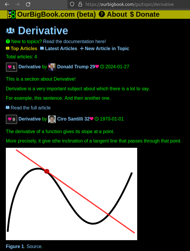
This feature makes it possible for readers to find better explanations of any topic created by other writers. And it allows writers to create an explanation in a place that readers might actually find it.Figure 1. Screenshot of the "Derivative" topic page. View it live at: ourbigbook.com/go/topic/derivativeVideo 2. OurBigBook Web topics demo. Source. - local editing: you can store all your personal knowledge base content locally in a plaintext markup format that can be edited locally and published either:This way you can be sure that even if OurBigBook.com were to go down one day (which we have no plans to do as it is quite cheap to host!), your content will still be perfectly readable as a static site.
- to OurBigBook.com to get awesome multi-user features like topics and likes
- as HTML files to a static website, which you can host yourself for free on many external providers like GitHub Pages, and remain in full control
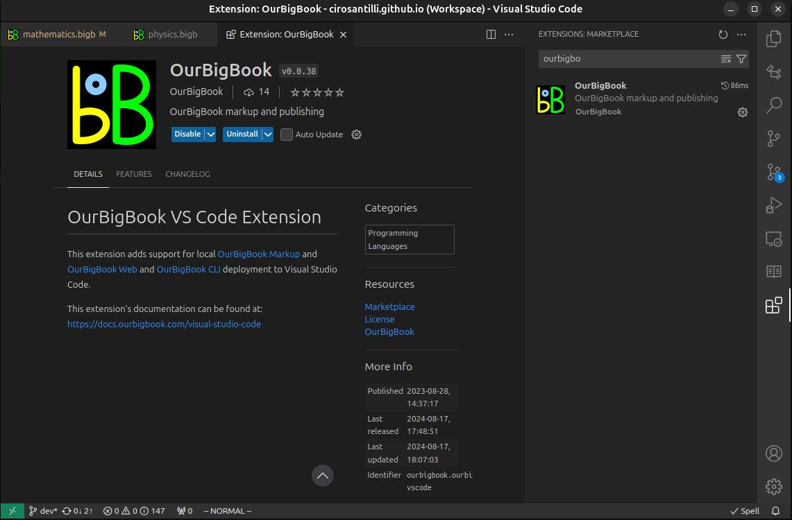
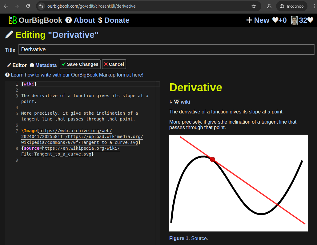
Figure 2. You can publish local OurBigBook lightweight markup files to either OurBigBook.com or as a static website.Figure 3. Visual Studio Code extension installation.Figure 5. . You can also edit articles on the Web editor without installing anything locally. Video 3. Edit locally and publish demo. Source. This shows editing OurBigBook Markup and publishing it using the Visual Studio Code extension. - Infinitely deep tables of contents:
All our software is open source and hosted at: github.com/ourbigbook/ourbigbook
Further documentation can be found at: docs.ourbigbook.com
Feel free to reach our to us for any help or suggestions: docs.ourbigbook.com/#contact


