The unit of magnetic induction, also known as the magnetic flux density, is the tesla (symbol: T) in the International System of Units (SI). One tesla is defined as one weber per square meter (1 T = 1 Wb/m²). Another commonly used unit, especially in electromagnetic contexts, is the gauss (G), where 1 tesla is equal to 10,000 gauss (1 T = 10,000 G).
"Groatland" is not a widely recognized term or name in common usage. It may refer to a specific location, fictional setting, or concept depending on the context. For instance, it could be a name for a business, community, or creative work. Without further context, it’s difficult to provide a precise description.
The Baumé scale is a density-based scale used to measure the specific gravity of liquids, particularly in industrial and chemical applications. There are two versions of the Baumé scale, one for fluids lighter than water (typically used for liquids like alcohol) and one for fluids heavier than water (typically used for liquids such as acids and syrup). 1. **For liquids lighter than water:** A higher Baumé reading indicates a lower specific gravity.
A horsepower-hour (hph) is a unit of energy that represents the amount of work done by a horse using one horsepower over one hour. Horsepower is a unit of power that typically denotes the rate at which work is done. Specifically, one horsepower is commonly defined as equivalent to 550 foot-pounds of work done per second, or approximately 746 watts.
The miner's inch is a unit of measurement used primarily in the context of water flow and irrigation, particularly in the Western United States. It represents the flow of water through an opening or a pipeline, specifically how much water flows from a mine or irrigation ditch given a certain cross-sectional area. The term is derived from historical mining practices where water was crucial for certain mining operations.
IOPS, or Input/Output Operations Per Second, is a performance measurement used to evaluate the speed at which a storage device, such as a hard disk drive (HDD), solid-state drive (SSD), or storage area network (SAN), can read and write data. IOPS indicates how many read and write operations a storage device can handle in one second. This metric is especially important in environments where high-speed data access is required, such as databases, virtualization, and cloud computing.
"Per annum" is a Latin term that means "per year." It is often used in financial and economic contexts to describe an annual rate, such as interest rates, salaries, or other yearly calculations. For example, if someone earns a salary of $50,000 per annum, it means they earn that amount each year. Similarly, if a loan has an interest rate of 5% per annum, it means that 5% interest will be charged on the principal amount each year.
"Day's Journey" typically refers to "Long Day's Journey Into Night," a play written by American playwright Eugene O'Neill. It was written in 1941 but was not published or performed until after O'Neill's death in 1956. The play is a semi-autobiographical story that depicts the struggles of the Tyrone family, which is based on O'Neill's own family experiences.
A light-second is a unit of distance that measures how far light travels in one second in a vacuum. Since the speed of light is approximately \(299,792,458\) meters per second, a light-second is equivalent to about \(299,792,458\) meters, or approximately \(300,000\) kilometers (or about \(186,282\) miles).
The rayleigh (symbol: R or ray) is a unit of measurement used in optics and physics to quantify the intensity of light, specifically for the measurement of the brightness of astronomical objects or the scattering of light. 1 rayleigh is defined as the amount of light scattered by a molecule of gas that results in a change of intensity of 1 photon per square meter per second.
Kendrick mass, also known as "Kendrick mass number," is a term used in astrodynamics, particularly in the context of space missions. It refers to the mass of a spacecraft as it is expressed in terms of Earth's gravitational influence, taking into account the spacecraft's velocity and its position in a gravitational field.
A Solar Flux Unit (SFU) is a measure of solar radio flux, specifically at a frequency of 2800 MHz (or 2.8 GHz). It is commonly used in solar and astrophysical research to quantify the intensity of solar radiation, particularly from the Sun's active regions such as sunspots and solar flares. 1 SFU is defined as a flux density of \(10^{-22}\) watts per square meter per hertz (W/m²/Hz).
Wind chill, also known as wind chill factor, is a measure that describes the combined effect of wind and cold temperatures on the human body. It quantifies how cold it feels to a person when wind is taken into account, as moving air increases the rate at which heat is lost from the body. When temperatures drop, the body loses heat more quickly, and when wind is present, this heat loss is accelerated.
Surface Feet Per Minute (SFPM or SFM) is a measurement commonly used in manufacturing and machining to indicate the speed at which the surface of a rotating tool or workpiece moves. It's expressed in feet per minute and helps determine the speed at which a cutting tool should operate for optimal performance. In machining applications, SFM is critical because it impacts the quality of the cut, the tool wear, and the overall efficiency of the machining process.
East Asian units of measurement refer to traditional measurement systems used in various East Asian countries, including China, Japan, Korea, and Vietnam. These systems often have historical roots and differ significantly from the metric system. Here are some notable units from these countries: ### China 1. **Length** - **Chi (尺)**: A traditional unit often translated as "foot," approximately 1/3 of a meter.
Metre sea water (msw or mS) is a unit of measurement used to express the density of seawater, particularly in the context of oceanography. It is defined as the equivalent depth of seawater that exerts a specific pressure at a given depth. The term is often used when dealing with hydrostatic pressure calculations or when discussing the buoyancy and density of water in marine environments.
A millimetre of mercury (mmHg) is a unit of pressure. It is defined as the pressure exerted at the base of a millimetre column of mercury under the acceleration of gravity. The unit is commonly used in various scientific and medical contexts, particularly in measuring blood pressure and atmospheric pressure. 1 mmHg is approximately equal to 133.322 pascals (Pa) or 0.001316 atmospheres (atm).
Units of temporal rate refer to the measurement of a change or occurrence per unit of time. These units allow us to quantify how quickly something happens, how often an event occurs, or how much of something is produced or consumed over a specific timeframe. The exact units can vary significantly depending on the context. Here are some common examples: 1. **Frequency**: Measured in Hertz (Hz), which indicates the number of occurrences of a repeating event per second.
Pinned article: Introduction to the OurBigBook Project
Welcome to the OurBigBook Project! Our goal is to create the perfect publishing platform for STEM subjects, and get university-level students to write the best free STEM tutorials ever.
Everyone is welcome to create an account and play with the site: ourbigbook.com/go/register. We belive that students themselves can write amazing tutorials, but teachers are welcome too. You can write about anything you want, it doesn't have to be STEM or even educational. Silly test content is very welcome and you won't be penalized in any way. Just keep it legal!
Intro to OurBigBook
. Source. We have two killer features:
- topics: topics group articles by different users with the same title, e.g. here is the topic for the "Fundamental Theorem of Calculus" ourbigbook.com/go/topic/fundamental-theorem-of-calculusArticles of different users are sorted by upvote within each article page. This feature is a bit like:
- a Wikipedia where each user can have their own version of each article
- a Q&A website like Stack Overflow, where multiple people can give their views on a given topic, and the best ones are sorted by upvote. Except you don't need to wait for someone to ask first, and any topic goes, no matter how narrow or broad
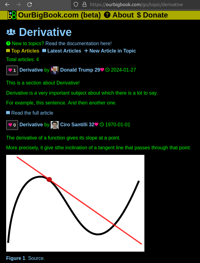
This feature makes it possible for readers to find better explanations of any topic created by other writers. And it allows writers to create an explanation in a place that readers might actually find it.Figure 1. Screenshot of the "Derivative" topic page. View it live at: ourbigbook.com/go/topic/derivativeVideo 2. OurBigBook Web topics demo. Source. - local editing: you can store all your personal knowledge base content locally in a plaintext markup format that can be edited locally and published either:This way you can be sure that even if OurBigBook.com were to go down one day (which we have no plans to do as it is quite cheap to host!), your content will still be perfectly readable as a static site.
- to OurBigBook.com to get awesome multi-user features like topics and likes
- as HTML files to a static website, which you can host yourself for free on many external providers like GitHub Pages, and remain in full control
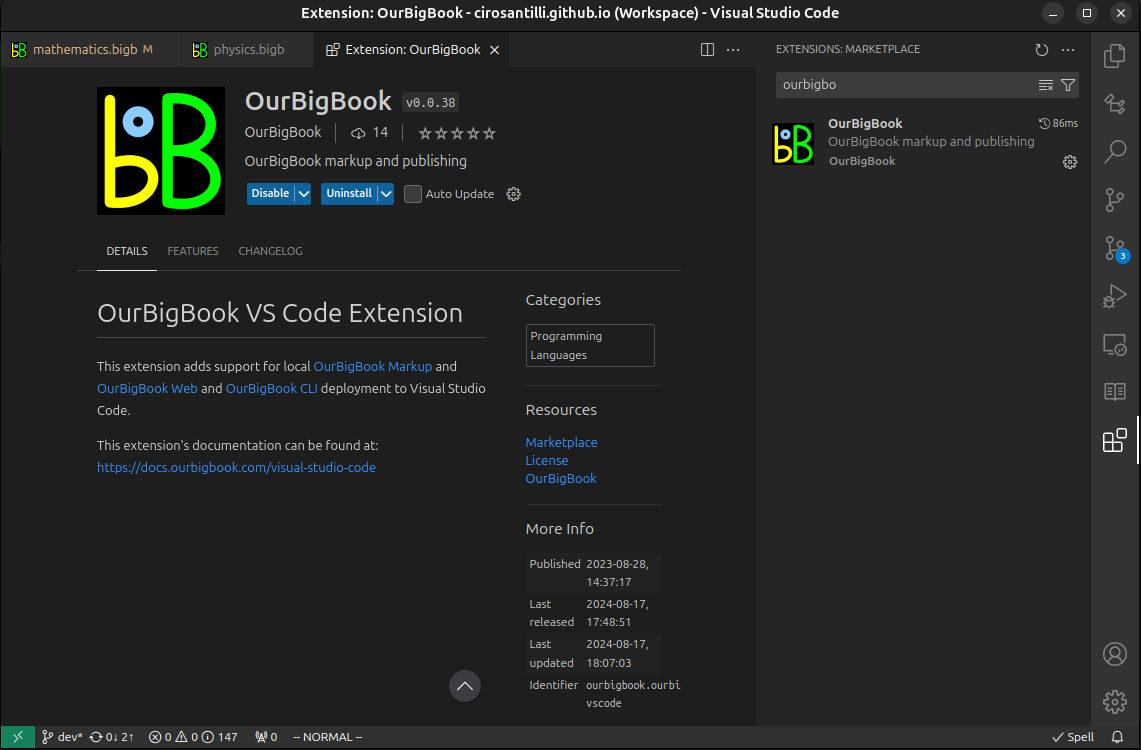
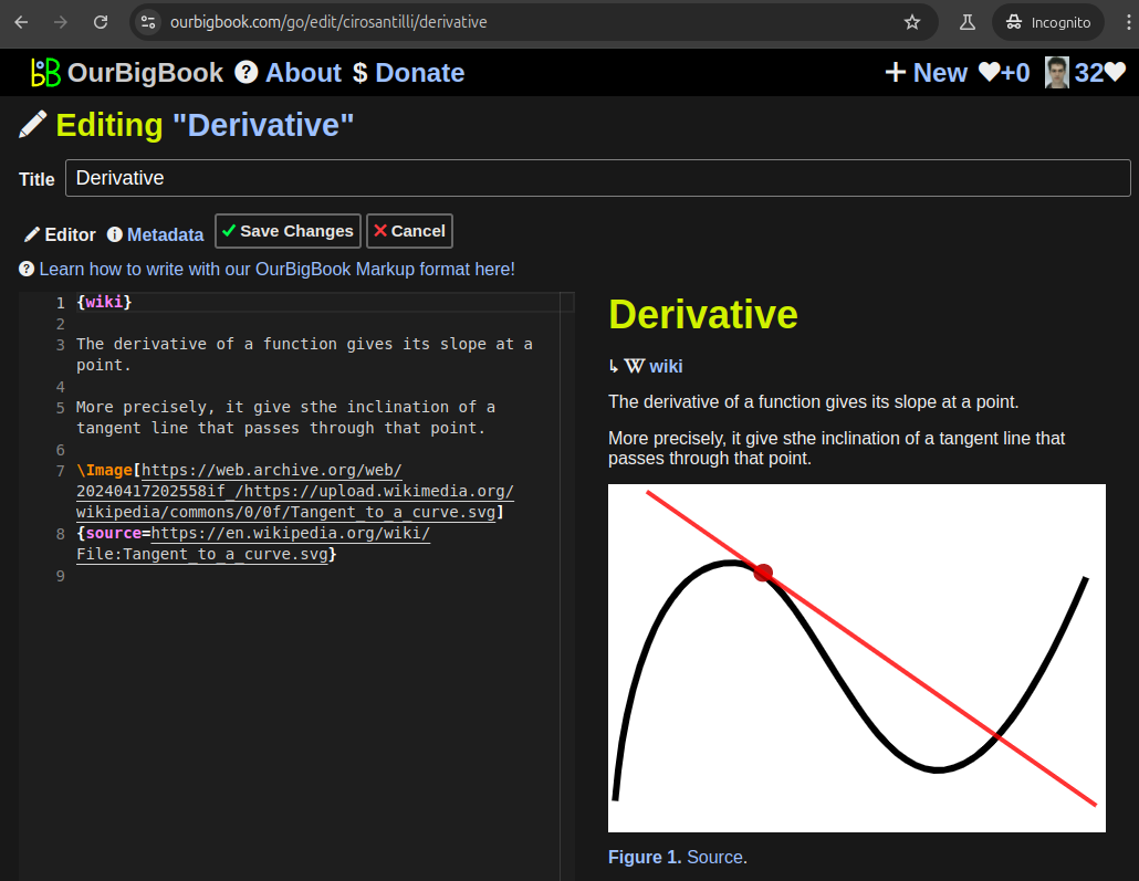
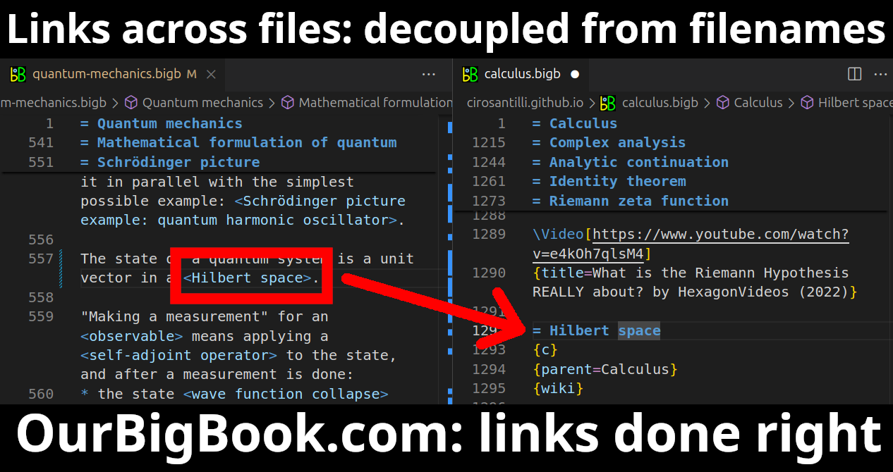
Figure 3. Visual Studio Code extension installation.Figure 4. Visual Studio Code extension tree navigation.Figure 5. Web editor. You can also edit articles on the Web editor without installing anything locally.Video 3. Edit locally and publish demo. Source. This shows editing OurBigBook Markup and publishing it using the Visual Studio Code extension.Video 4. OurBigBook Visual Studio Code extension editing and navigation demo. Source. - Infinitely deep tables of contents:
All our software is open source and hosted at: github.com/ourbigbook/ourbigbook
Further documentation can be found at: docs.ourbigbook.com
Feel free to reach our to us for any help or suggestions: docs.ourbigbook.com/#contact


