Charles Palache was an American mineralogist and geologist known for his contributions to the field of mineralogy and for his research on the mineralogical aspects of various geological formations. He played a significant role in the early 20th century in studying and describing new mineral species, and he was also involved in the classification and systematization of minerals. His work helped advance the understanding of mineral properties and their relationships to geological processes.
The vagueness doctrine is a constitutional principle in the United States law that requires laws to be written with sufficient clarity and specificity so that individuals can understand what is being prohibited or required. This doctrine is often invoked in cases involving the First and Fourteenth Amendments, especially regarding freedom of speech and due process.
Lewis Stephen Ramsdell (1862–1937) was an American botanist, best known for his work in the fields of plant taxonomy and mycology. He made significant contributions to the understanding of various plant species, including studies on the flora of the southeastern United States. Ramsdell's research and writings have influenced botanical science, particularly in the classification and identification of fungi and other plants.
American bioinformaticians are scientists or researchers based in the United States who specialize in the field of bioinformatics. Bioinformatics itself is an interdisciplinary field that merges biology, computer science, mathematics, and statistics to analyze and interpret biological data, particularly in the context of genomic and proteomic research.
American geodesists are professionals or researchers who specialize in geodesy, which is the scientific discipline that deals with the measurement and representation of the Earth’s shape, orientation in space, and gravitational field. This field includes understanding the Earth’s dimensions, the effects of gravity, and how these factors change over time.
"American mathematician stubs" refers to short or incomplete articles on American mathematicians that have been created on platforms like Wikipedia. These stub articles typically provide only basic information, such as the mathematician's name, a brief mention of their contributions, and perhaps a few personal details, but lack comprehensive coverage of their work, achievements, and impact on the field of mathematics.
Eugene P. Northrop is an American engineer and businessman, known for his contributions to the field of automotive engineering and technology. He has been involved in various innovative projects and has held several key positions in engineering firms and automotive companies.
Alexander Ramm is a notable figure in the field of mathematics, particularly known for his work in functional analysis, approximation theory, and operator theory. He has made significant contributions to the study of various mathematical problems and has published research in these areas. Additionally, Alexander Ramm is known for his educational efforts, including writing textbooks and papers aimed at helping students and researchers understand complex mathematical concepts.
As of my last knowledge update in October 2021, there is no widely known entity or concept specifically referred to as "Anna Skripka." It's possible that it could be the name of a person, creator, or artist who gained recognition after that date, or it could come from a specific cultural context or niche.
Dilip Madan is a scholar in the field of finance and is known for his contributions to financial mathematics and modeling. His research often focuses on areas such as asset pricing, risk management, and the mathematical underpinnings of finance. He has published papers and collaborated on various topics within quantitative finance. Additionally, he may be affiliated with academic institutions or industry organizations, contributing to education and research in finance.
Bharath Sriraman is an educator and researcher known for his work in mathematics education, particularly in the context of mathematical thinking, pedagogy, and curriculum development. He has contributed to discussions on how to improve mathematics teaching and learning, focusing on aspects such as the sociocultural dimensions of math education and the integration of technology in teaching. In addition to his educational work, he has engaged with issues related to the philosophy of mathematics and has published various articles and books in these areas.
Georgiy L. Stenchikov is a scientist known for his contributions in the field of atmospheric sciences, particularly in relation to climate modeling and atmospheric processes. He has been involved in research concerning the interaction of the atmosphere with climate factors, including the roles of aerosols, greenhouse gases, and natural and anthropogenic climate variability.
Lawrence Krauss is an American theoretical physicist, cosmologist, and popular science author. He is known for his contributions to the fields of cosmology and fundamental physics, particularly in areas such as dark energy and the early universe. Krauss has held academic positions at several institutions, including Arizona State University, where he was a professor in the School of Earth and Space Exploration and the Physics Department. In addition to his research, Krauss is also recognized for his efforts in science communication.
Günther Porod is an Austrian physicist known for his work in the field of condensed matter physics, particularly in the area of statistical mechanics and complex systems. He has made significant contributions to the understanding of disordered systems, fractals, and their applications in various scientific disciplines. Porod's research often combines theoretical insights with practical implications, influencing fields such as material science, biology, and nanotechnology.
Lester Skaggs does not appear to be a widely recognized figure or term as of my last update in October 2023. It is possible that Lester Skaggs refers to a private individual, a fictional character, or a less-publicized person or concept that has emerged after my last training data.
Pinned article: Introduction to the OurBigBook Project
Welcome to the OurBigBook Project! Our goal is to create the perfect publishing platform for STEM subjects, and get university-level students to write the best free STEM tutorials ever.
Everyone is welcome to create an account and play with the site: ourbigbook.com/go/register. We belive that students themselves can write amazing tutorials, but teachers are welcome too. You can write about anything you want, it doesn't have to be STEM or even educational. Silly test content is very welcome and you won't be penalized in any way. Just keep it legal!
Intro to OurBigBook
. Source. We have two killer features:
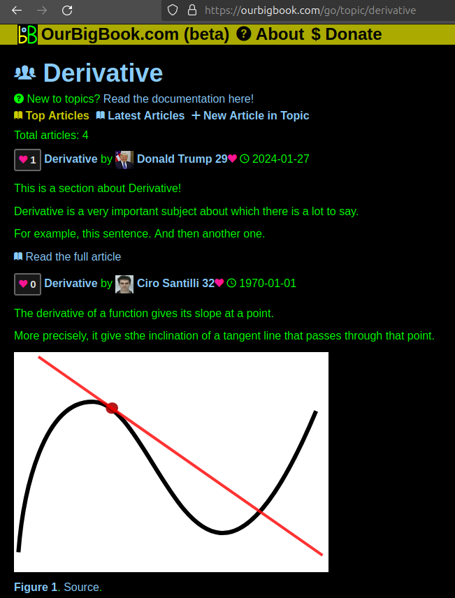
- topics: topics group articles by different users with the same title, e.g. here is the topic for the "Fundamental Theorem of Calculus" ourbigbook.com/go/topic/fundamental-theorem-of-calculusArticles of different users are sorted by upvote within each article page. This feature is a bit like:
- a Wikipedia where each user can have their own version of each article
- a Q&A website like Stack Overflow, where multiple people can give their views on a given topic, and the best ones are sorted by upvote. Except you don't need to wait for someone to ask first, and any topic goes, no matter how narrow or broad
This feature makes it possible for readers to find better explanations of any topic created by other writers. And it allows writers to create an explanation in a place that readers might actually find it.Figure 1. Screenshot of the "Derivative" topic page. View it live at: ourbigbook.com/go/topic/derivativeVideo 2. OurBigBook Web topics demo. Source. - local editing: you can store all your personal knowledge base content locally in a plaintext markup format that can be edited locally and published either:This way you can be sure that even if OurBigBook.com were to go down one day (which we have no plans to do as it is quite cheap to host!), your content will still be perfectly readable as a static site.
- to OurBigBook.com to get awesome multi-user features like topics and likes
- as HTML files to a static website, which you can host yourself for free on many external providers like GitHub Pages, and remain in full control
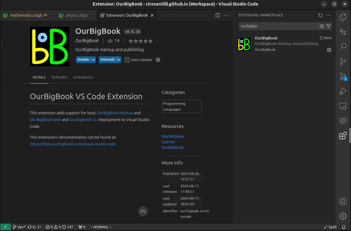
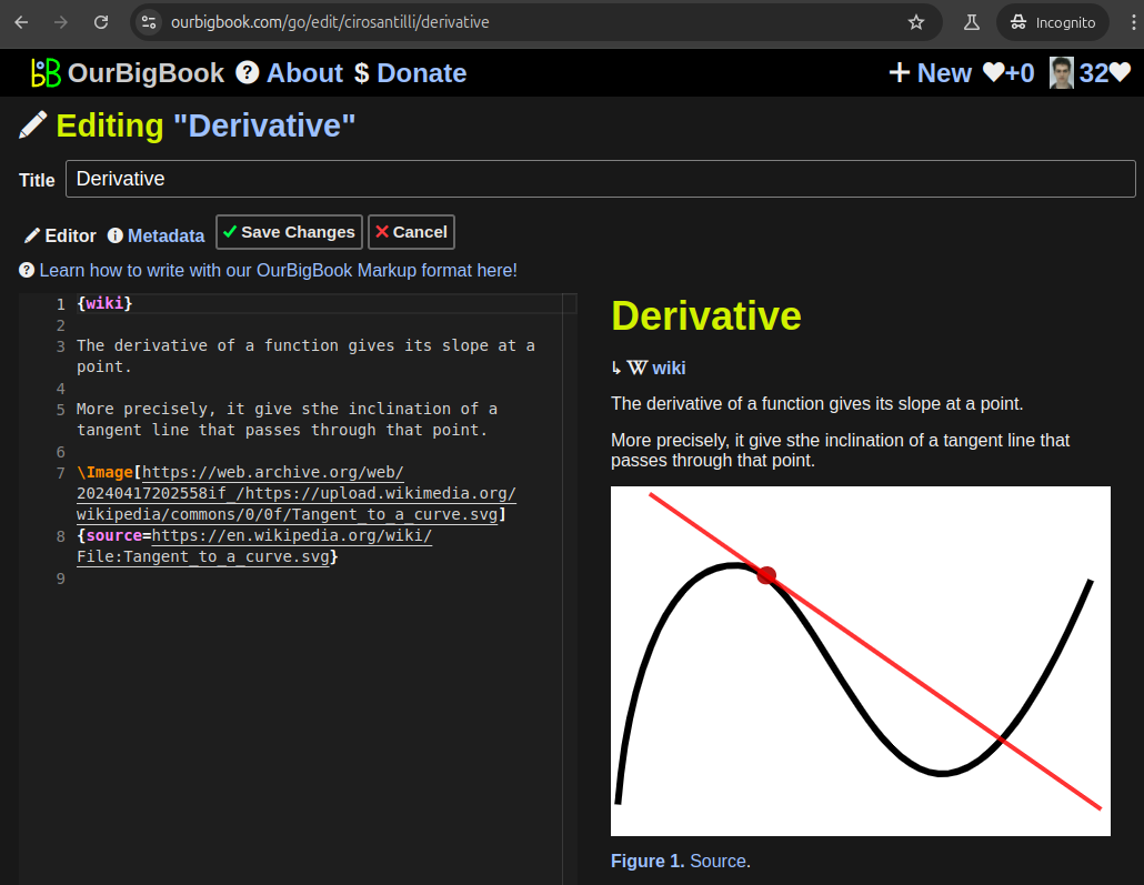
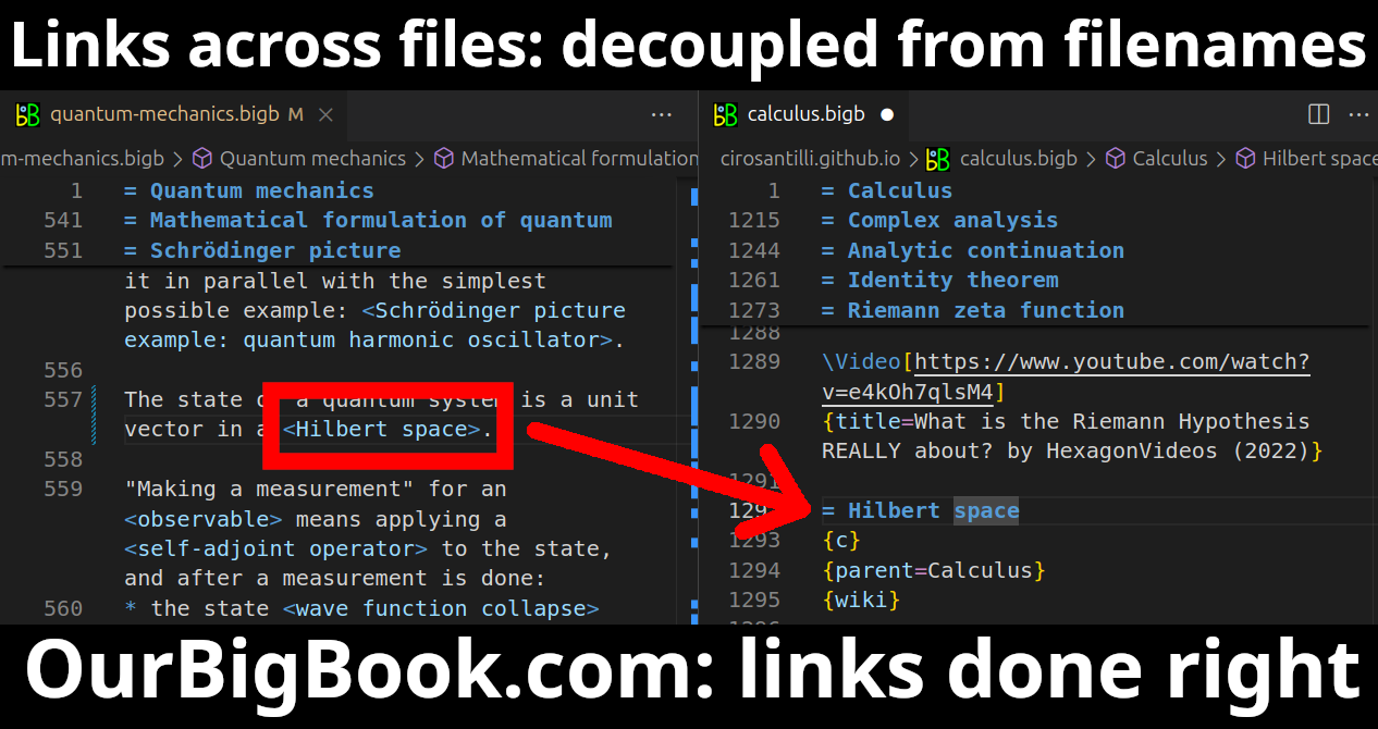
Figure 3. Visual Studio Code extension installation.Figure 4. Visual Studio Code extension tree navigation.Figure 5. Web editor. You can also edit articles on the Web editor without installing anything locally.Video 3. Edit locally and publish demo. Source. This shows editing OurBigBook Markup and publishing it using the Visual Studio Code extension.Video 4. OurBigBook Visual Studio Code extension editing and navigation demo. Source. - Infinitely deep tables of contents:
All our software is open source and hosted at: github.com/ourbigbook/ourbigbook
Further documentation can be found at: docs.ourbigbook.com
Feel free to reach our to us for any help or suggestions: docs.ourbigbook.com/#contact


