The Journal of Raman Spectroscopy is a scientific publication that focuses on research related to Raman spectroscopy and its applications. Raman spectroscopy is a spectroscopic technique used to observe vibrational, rotational, and other low-frequency modes in a system. This technique is widely used in chemistry, biology, materials science, and various fields for analyzing molecular structures, chemical compositions, and interactions. The journal publishes original research articles, reviews, and technical notes that contribute to the advancement of knowledge in Raman spectroscopy and related techniques.
Spin-polarized electron energy loss spectroscopy (SPEELS) is a sophisticated technique used to investigate the electronic and magnetic properties of materials at the nanoscale. This method combines aspects of traditional electron energy loss spectroscopy (EELS) and spin-polarized techniques to provide insights into the spin states of electrons in materials.
Dark current spectroscopy is a technique used in the field of spectroscopy to analyze the properties of materials and detect specific phenomena, often in the context of photodetectors and other devices that interact with light. The "dark current" refers to the electrical current that flows through a photodetector in the absence of light, which can arise from thermal excitation of charge carriers, defects, and other mechanisms.
Rovibronic coupling refers to the interactions that occur between rotational, vibrational, and electronic states of molecules. The term is a combination of three components: 1. **Rotational (ro-)**: This part pertains to the rotational motion of molecules. When a molecule rotates, it can occupy various rotational energy levels. 2. **Vibrational (vi-)**: This aspect deals with the vibrational motion of the atoms within a molecule.
"Speeches by type" typically refers to the classification of speeches based on their purpose, style, or context. Here are some common types of speeches: 1. **Informative Speeches**: Aim to educate the audience about a particular topic. They provide detailed information and are factual. 2. **Persuasive Speeches**: Intended to convince the audience to adopt a particular viewpoint or take action. These speeches often appeal to emotions, logic, or ethics.
Speechwriters are professionals who specialize in composing speeches for others, typically for public figures such as politicians, executives, or organizational leaders. Their role involves researching the subject matter, understanding the audience, and crafting persuasive and impactful messages that resonate with listeners. Key responsibilities of speechwriters include: 1. **Research:** Understanding the context of the speech, including key issues, the audience's interests, and the speaker's style and objectives.
"Friends, Romans, countrymen, lend me your ears" is a famous line from William Shakespeare's play *Julius Caesar*. It is the opening line of Mark Antony's speech in Act 3, Scene 2, in which he addresses the crowd after the assassination of Julius Caesar. In this speech, Antony seeks to sway public opinion against the conspirators who killed Caesar and to incite feelings of loyalty and mourning for Caesar.
An Oscar speech, also known as an acceptance speech, is a speech delivered by a winner at the Academy Awards (commonly referred to as the Oscars). These speeches are given by individuals who have received an Academy Award in various categories, such as Best Picture, Best Director, Best Actor, Best Actress, and others. Typically, the speech is a moment for winners to express gratitude to those who supported them, including family, friends, colleagues, and mentors.
The Prime Minister's New Year Message typically involves reflections on the past year and hopes for the upcoming year. It can include themes of unity, resilience, national progress, and aspirations for the future. The message often addresses citizens directly, encouraging them to face challenges together and highlighting government initiatives or policies that aim to improve the lives of the populace. The specific content can vary based on the current political, social, and economic context.
"Speech at the Politeama" refers to a notable oration made by Italian composer and conductor Arturo Toscanini. It was delivered at the Politeama Theatre in Palermo, Sicily. Toscanini is renowned for his passionate approach to conducting and his commitment to the integrity of the music he interpreted.
A pure spinor is a special type of mathematical object used in theoretical physics, particularly in the context of string theory and supersymmetry. It is a specific kind of spinor that has certain properties, making it particularly useful for describing the dynamics of fermions (particles with half-integer spin) and for formulating theories that are Lorentz invariant.
Extraordinary magnetoresistance (EMR) is a phenomenon observed in certain materials, particularly in materials that have a complex interplay between their electronic structure and magnetic properties. EMR is characterized by a large change in electrical resistance when exposed to an external magnetic field. This effect is particularly notable in materials with a layered structure, such as certain ferromagnets or half-metals.
The Pauli exclusion principle is a fundamental principle in quantum mechanics, formulated by physicist Wolfgang Pauli in 1925. It states that no two fermions (particles with half-integer spin, such as electrons, protons, and neutrons) can occupy the same quantum state within a quantum system simultaneously. In the context of atomic structure, this principle explains why electrons in an atom fill available energy levels in a specific way.
A superlattice is a periodic structure formed by alternating layers of two or more different materials, typically semiconductors, on a nanometer scale. These layers can be only a few nanometers thick and are engineered to create unique electronic, optical, or mechanical properties that differ from those of the individual materials. The properties of superlattices arise from quantum mechanical effects, specifically when the layer thickness approaches the electron mean free path or the de Broglie wavelength of electrons.
Allan Roth is a financial planner and wealth management expert known for his work in personal finance, investment strategies, and retirement planning. He is recognized for providing advice and insights on how individuals can manage their financial resources effectively. Roth is also known for his writings, articles, and appearances that focus on helping people understand complex financial concepts and make informed decisions regarding their investments and financial futures.
The Spin Hall Effect (SHE) is a physical phenomenon observed in certain materials, particularly in solid-state systems, where a transverse spin current is generated in response to an applied electric field. Unlike the conventional Hall effect, which produces a charge current that flows parallel to the applied electric field and results in a transverse voltage due to charge carriers deflecting, the Spin Hall Effect is concerned with the generation of spin polarization rather than charge separation.
Spinplasmonics is an interdisciplinary field that combines aspects of spintronics and plasmonics to manipulate both spin and charge at the nanoscale using light. In more detail: 1. **Plasmonics**: This refers to the study of surface plasmons, which are coherent delocalized electron oscillations that occur at the interface between a metal and dielectric material.
Ballooning instability is a phenomenon primarily observed in magnetically confined plasma, typically in the context of nuclear fusion research, specifically in tokamaks and stellarators. It refers to a type of instability that can arise in plasma due to pressure gradients and magnetic field topology. In a magnetic confinement system, plasma is held in place by magnetic fields, which are designed to keep the charged particles (ions and electrons) from escaping.
A comparison function is typically a function that helps in comparing two values or objects with respect to a certain criterion. In programming and algorithms, comparison functions are commonly used for sorting, searching, and determining order among data. ### Characteristics of Comparison Functions: 1. **Return Values:** - A comparison function usually returns: - A negative value if the first argument is less than the second argument. - Zero if both arguments are considered equal.
As of October 2023, Italy does not have any operational nuclear power stations. The country had a brief history of nuclear power, with the first nuclear reactor commissioned in the 1960s. However, following the Chernobyl disaster in 1986, public opinion turned against nuclear energy, leading to a national referendum in 1987 in which the majority of voters chose to phase out nuclear power.
Pinned article: Introduction to the OurBigBook Project
Welcome to the OurBigBook Project! Our goal is to create the perfect publishing platform for STEM subjects, and get university-level students to write the best free STEM tutorials ever.
Everyone is welcome to create an account and play with the site: ourbigbook.com/go/register. We belive that students themselves can write amazing tutorials, but teachers are welcome too. You can write about anything you want, it doesn't have to be STEM or even educational. Silly test content is very welcome and you won't be penalized in any way. Just keep it legal!
Intro to OurBigBook
. Source. We have two killer features:
- topics: topics group articles by different users with the same title, e.g. here is the topic for the "Fundamental Theorem of Calculus" ourbigbook.com/go/topic/fundamental-theorem-of-calculusArticles of different users are sorted by upvote within each article page. This feature is a bit like:
- a Wikipedia where each user can have their own version of each article
- a Q&A website like Stack Overflow, where multiple people can give their views on a given topic, and the best ones are sorted by upvote. Except you don't need to wait for someone to ask first, and any topic goes, no matter how narrow or broad
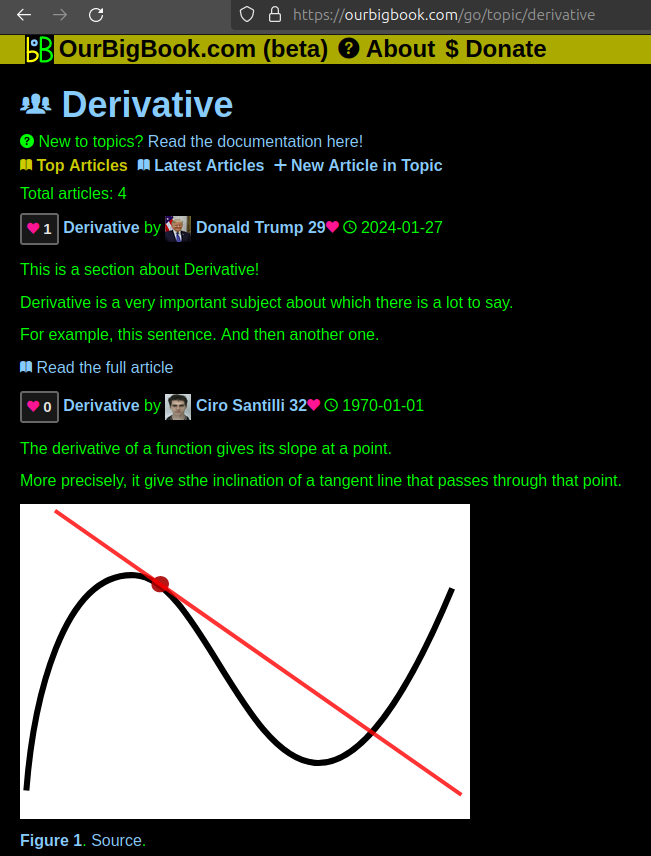
This feature makes it possible for readers to find better explanations of any topic created by other writers. And it allows writers to create an explanation in a place that readers might actually find it.Figure 1. Screenshot of the "Derivative" topic page. View it live at: ourbigbook.com/go/topic/derivativeVideo 2. OurBigBook Web topics demo. Source. - local editing: you can store all your personal knowledge base content locally in a plaintext markup format that can be edited locally and published either:This way you can be sure that even if OurBigBook.com were to go down one day (which we have no plans to do as it is quite cheap to host!), your content will still be perfectly readable as a static site.
- to OurBigBook.com to get awesome multi-user features like topics and likes
- as HTML files to a static website, which you can host yourself for free on many external providers like GitHub Pages, and remain in full control
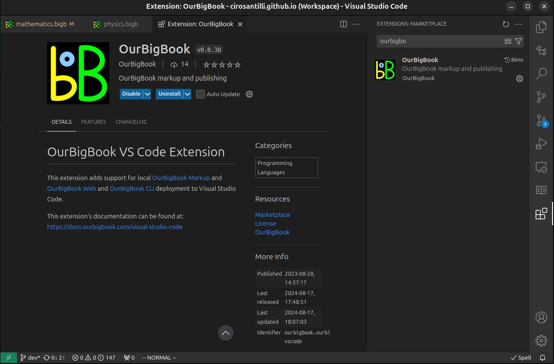
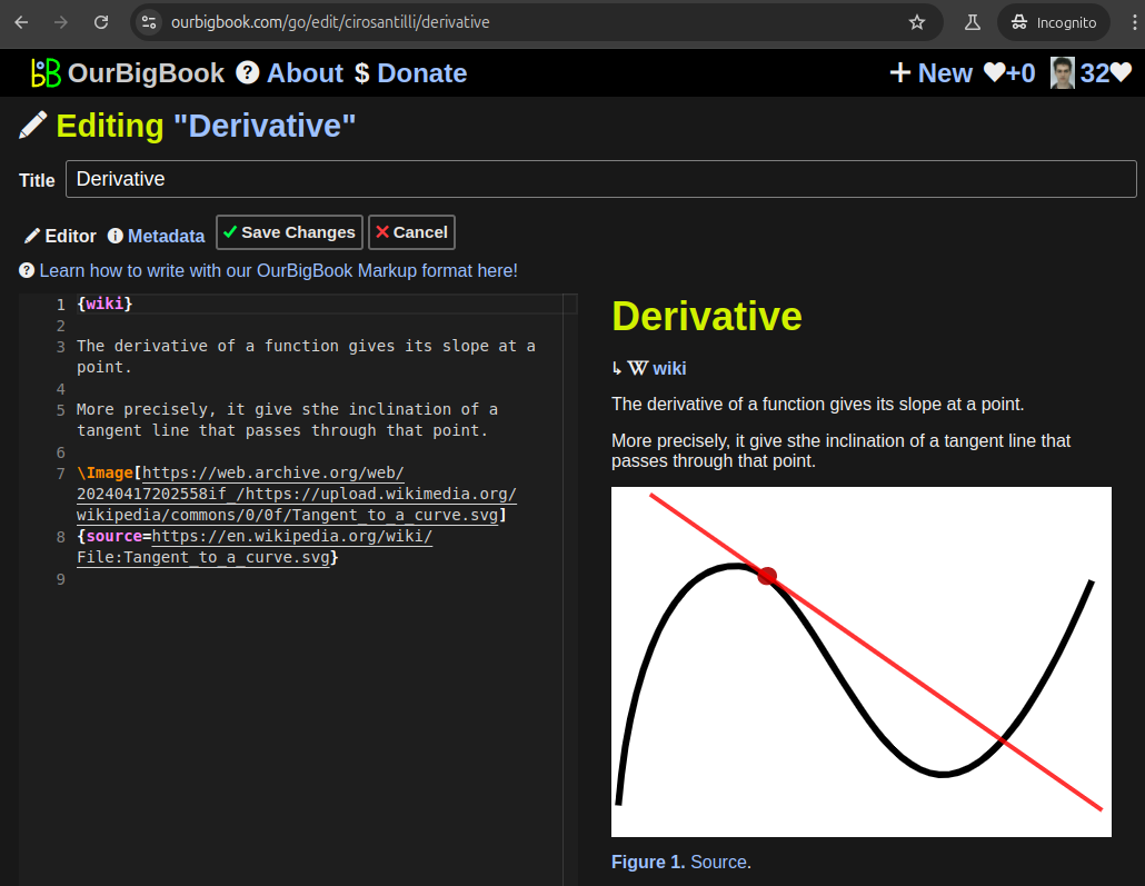
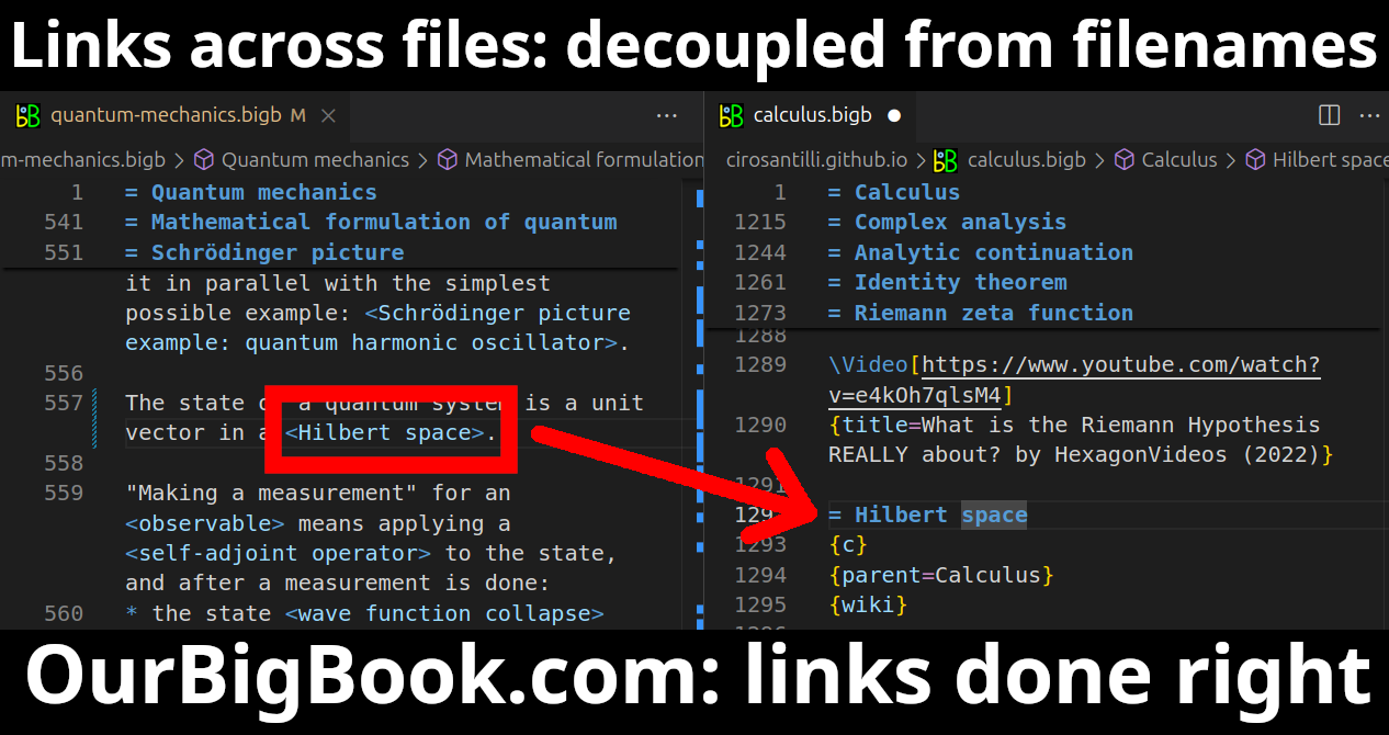
Figure 3. Visual Studio Code extension installation.Figure 4. Visual Studio Code extension tree navigation.Figure 5. Web editor. You can also edit articles on the Web editor without installing anything locally.Video 3. Edit locally and publish demo. Source. This shows editing OurBigBook Markup and publishing it using the Visual Studio Code extension.Video 4. OurBigBook Visual Studio Code extension editing and navigation demo. Source. - Infinitely deep tables of contents:
All our software is open source and hosted at: github.com/ourbigbook/ourbigbook
Further documentation can be found at: docs.ourbigbook.com
Feel free to reach our to us for any help or suggestions: docs.ourbigbook.com/#contact


