Jesse Beams, also known as "Beam's," is a type of whiskey produced in the United States, specifically associated with the Beam family, known for their long-standing tradition in distilling, particularly bourbon. The term might also refer to specific products or brands within the Beam portfolio, such as Jim Beam, which is one of the most recognized bourbon brands worldwide.
James Stone is an accomplished physicist known for his work in the field of astrophysics and cosmology. His research often focuses on issues related to dark matter, galaxy formation, and the large-scale structure of the universe. He has also contributed to studies involving numerical simulations to understand the dynamics of cosmic structures.
Air pollution measurement refers to the assessment and quantification of pollutants present in the atmosphere. This process is crucial for understanding air quality, identifying sources of pollution, and developing strategies to mitigate its impact on health and the environment. There are various methods and technologies used to measure different types of air pollutants, including: 1. **Types of Pollutants**: Common air pollutants include: - Particulate Matter (PM): PM2.
Cartographic censorship refers to the practice of altering, omitting, or distorting geographical information on maps to control the dissemination of knowledge, influence public perception, or achieve political or ideological objectives. This can take various forms, including: 1. **Omission of Features**: Certain geographical features, such as borders, landmarks, or entire territories, may be deliberately left out or misrepresented. For instance, some maps may exclude disputed regions or territories claimed by a country.
Cartography of Latin America refers to the art and science of map-making specific to the countries and regions within Latin America. This encompasses a variety of maps that depict geographical, cultural, political, and economic features of Latin American countries. Key aspects of cartography in this context include: 1. **Geographical Features**: Maps that display physical geography, including mountains, rivers, forests, and climate zones.
DTED stands for Digital Terrain Elevation Data. It is a format used for representing terrain elevation data, typically in a raster format, which consists of elevations above a defined reference level (usually sea level) at specific locations. DTED is primarily used by military and civilian applications for tasks such as terrain analysis, simulation, mission planning, and geospatial analysis. The data is organized into a grid of elevation points, with each point representing the elevation of the terrain at that location.
A list of historical maps refers to a compilation of maps that represent geographical regions, important historical events, or significant changes in territorial boundaries at various points in time. These maps can be valuable for understanding the social, political, and economic contexts of different eras.
Geovisualization is the process of using visual representations to explore, analyze, and communicate geographical information and spatial data. It integrates geographic information systems (GIS) with visualization techniques to help users understand complex datasets and spatial relationships more effectively. Key components of geovisualization include: 1. **Data Representation**: Using maps, charts, graphs, and 3D models to represent spatial data clearly and effectively.
Web Processing Service (WPS) is a standard protocol developed by the Open Geospatial Consortium (OGC) designed for the execution and sharing of geospatial processes over the web. WPS allows users to perform complex geospatial analyses and operations without needing to directly access or manipulate the underlying data or algorithms. ### Key Features of WPS: 1. **Standardized Communication**: WPS defines a standard way for clients to request and receive geospatial processing capabilities and results from a server.
Jacques Riguet is not widely recognized in popular culture or major historical contexts, so it's possible that he could be a less well-known individual or a fictional character. It's important to provide more context or specify if you're referring to a particular field, profession, or work associated with that name.
Multimedia cartography is an interdisciplinary field that combines traditional cartography with multimedia technologies to create dynamic, interactive, and engaging map representations. It involves the use of various media forms—such as text, images, audio, video, and animations—to enhance the communication of geographic information and to provide users with a richer, more immersive experience when interacting with spatial data.
The National Elevation Dataset (NED) is a collection of elevation data created and maintained by the U.S. Geological Survey (USGS). It provides a high-resolution, consistent, and seamless representation of the Earth's surface elevation across the United States. The NED is built from various data sources, including satellite imagery, lidar, and traditional topographic maps, and it is available in multiple formats and resolutions to meet different user needs.
"Places & Spaces: Mapping Science" is a collaborative project that aims to visualize the landscape of scientific research through innovative mapping techniques. This initiative is often associated with the work of researchers like Katy Börner, a prominent figure in the field of information visualization and science mapping. The project includes the creation of visualizations that map various aspects of scientific literature, including citation patterns, research topics, and the evolution of scientific fields over time.
The Spatial Data Transfer Standard (SDTS) is a standard developed by the U.S. federal government for the transfer of spatial data between different computer systems, primarily used in geographic information systems (GIS). It was created to enhance interoperability and facilitate the sharing of geospatial data among various users and applications. Key characteristics of SDTS include: 1. **Interoperability**: SDTS provides a standardized format that enables different systems to understand and process spatial data without the need for special translation mechanisms.
Cash-less Nigeria refers to an initiative launched by the Central Bank of Nigeria (CBN) aimed at reducing the reliance on cash transactions and promoting electronic payment systems in the country. The initiative is part of a broader effort to enhance financial inclusion, improve the efficiency of payment systems, and reduce the risks associated with cash handling.
Medial magmas generally fall within the classification of igneous rocks and can be divided into two primary categories based on their composition: **intermediate magmas** and **mafic magmas**. Here’s a brief overview of each: 1. **Intermediate Magmas**: These magmas have a silica content typically between 52% and 66%. They are characterized by a balanced mix of light and dark minerals, often resulting in rocks like andesite or dacite.
Pinned article: Introduction to the OurBigBook Project
Welcome to the OurBigBook Project! Our goal is to create the perfect publishing platform for STEM subjects, and get university-level students to write the best free STEM tutorials ever.
Everyone is welcome to create an account and play with the site: ourbigbook.com/go/register. We belive that students themselves can write amazing tutorials, but teachers are welcome too. You can write about anything you want, it doesn't have to be STEM or even educational. Silly test content is very welcome and you won't be penalized in any way. Just keep it legal!
Intro to OurBigBook
. Source. We have two killer features:
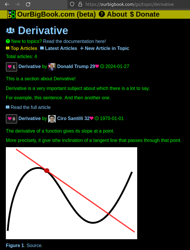
- topics: topics group articles by different users with the same title, e.g. here is the topic for the "Fundamental Theorem of Calculus" ourbigbook.com/go/topic/fundamental-theorem-of-calculusArticles of different users are sorted by upvote within each article page. This feature is a bit like:
- a Wikipedia where each user can have their own version of each article
- a Q&A website like Stack Overflow, where multiple people can give their views on a given topic, and the best ones are sorted by upvote. Except you don't need to wait for someone to ask first, and any topic goes, no matter how narrow or broad
This feature makes it possible for readers to find better explanations of any topic created by other writers. And it allows writers to create an explanation in a place that readers might actually find it.Figure 1. Screenshot of the "Derivative" topic page. View it live at: ourbigbook.com/go/topic/derivativeVideo 2. OurBigBook Web topics demo. Source. - local editing: you can store all your personal knowledge base content locally in a plaintext markup format that can be edited locally and published either:This way you can be sure that even if OurBigBook.com were to go down one day (which we have no plans to do as it is quite cheap to host!), your content will still be perfectly readable as a static site.
- to OurBigBook.com to get awesome multi-user features like topics and likes
- as HTML files to a static website, which you can host yourself for free on many external providers like GitHub Pages, and remain in full control
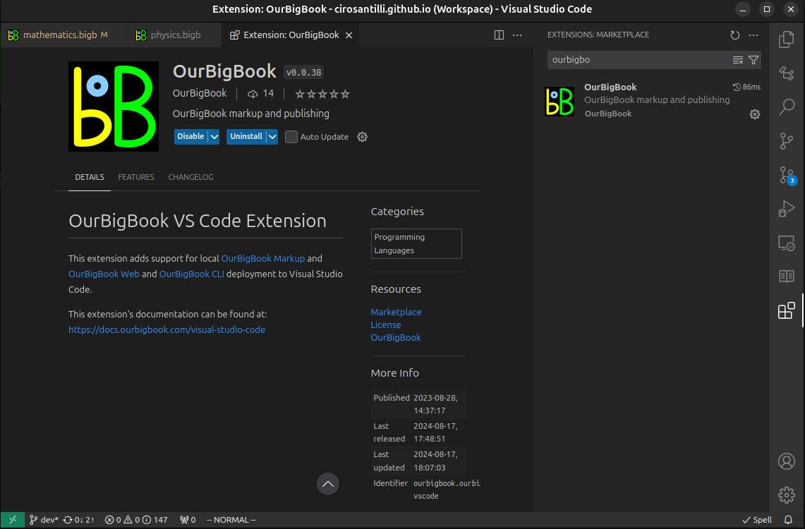
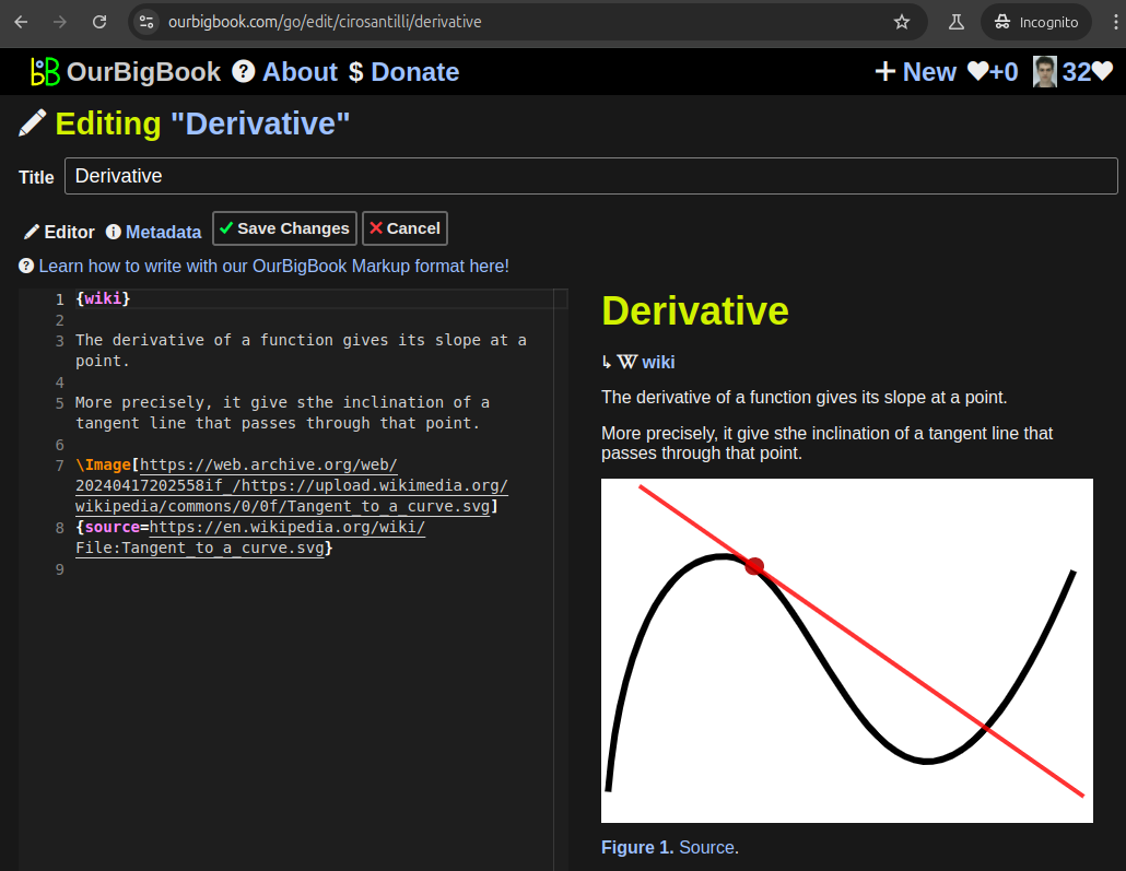
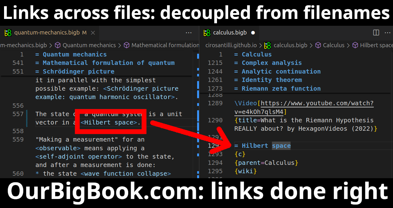
Figure 3. Visual Studio Code extension installation.Figure 4. Visual Studio Code extension tree navigation.Figure 5. Web editor. You can also edit articles on the Web editor without installing anything locally.Video 3. Edit locally and publish demo. Source. This shows editing OurBigBook Markup and publishing it using the Visual Studio Code extension.Video 4. OurBigBook Visual Studio Code extension editing and navigation demo. Source. - Infinitely deep tables of contents:
All our software is open source and hosted at: github.com/ourbigbook/ourbigbook
Further documentation can be found at: docs.ourbigbook.com
Feel free to reach our to us for any help or suggestions: docs.ourbigbook.com/#contact