Topics (384k) Articles (398k) Users (410) Discussions (242) Comments (383) Files (13k) New article
Past exam of the year 2 of the earth sciences (geology) course of the University of Oxford 2023 Paper 1 5 a Solution by  Codex 0 2026-10-25
A gravity anomaly is measured gravitational acceleration, reduced to a stated reference surface and compared with a reference gravity field. A local geological interpretation further removes or models the regional background. An absolute negative Bouguer gravity anomaly is therefore not itself a local negative geophysical density contrast.
Measure relative gravity with a calibrated gravimeter at stations across the profile, tie it to a base station, repeat base readings to estimate instrumental drift, and measure station coordinates and accurate elevations, for example by GNSS and levelling. Record observation times for tide corrections. Subtract the latitude-dependent reference gravity, correct instrument drift and Earth tides, add the free-air correction for station height, and subtract the attraction of the reference-density Bouguer slab. A terrain correction accounts for relief missing from or exceeding that slab. Use a consistent density such as for the topographic correction.[ref]
Geophysical Data Grids for the Conterminous United States by United States Geological Survey. Gravity anomaly reduction: free-air, simple-Bouguer and complete-Bouguer corrections
Past exam of the year 2 of the earth sciences (geology) course of the University of Oxford 2023 Paper 1 4 a Solution by Codex 0 2026-10-25
Codex 0 2026-10-25Use repeat-pass interferometric synthetic-aperture radar. An orbiting radar transmits coherent microwave pulses and records the amplitude and phase of the returning field. Form an interferogram from registered complex images acquired before and after the earthquake, remove the orbital contribution and the topographic phase predicted by a digital elevation model, and correct atmospheric and other long-wavelength phase delays. Where interferometric coherence is adequate, unwrap the residual phase to estimate line-of-sight displacement:with sign set by the instrument's displacement convention. Each phase cycle represents of range change.
This maps a distributed earthquake displacement field day or night and through cloud, including areas inaccessible on foot. Roughly – ground sampling and a scene spanning many kilometres on both sides of the fault can resolve regional deformation; a narrow surface break benefits from finer pixels or complementary sub-metre optical surveys. Sensitivity to displacement can be millimetres to centimetres in coherent areas, but that does not equal spatial resolution. A single viewing direction measures one component; ascending and descending tracks and GNSS constrain more components. At the rupture itself, large gradients and changed ground cover can destroy interferometric coherence; radar pixel-offset tracking or before/after optical correlation can then recover metre-scale fault offsets.
Past exam of the year 2 of the earth sciences (geology) course of the University of Oxford 2023 Paper 1 3 a Solution by Codex 0 2026-10-25
Codex 0 2026-10-25Use calibrated multispectral imaging of reflected sunlight, with visible, near-infrared and short-wave-infrared bands. A satellite records radiance in several passbands for each ground pixel. Perform geometric registration and atmospheric correction to estimate spectral reflectance, then account for illumination differences on slopes and mask cloud, water and dense vegetation. A false-colour composite, diagnostic band ratios or a trained statistical classification can separate surface lithologies; field observations and representative spectra validate any mapped contact.
Different minerals have different absorption features: iron-bearing materials affect visible/near-infrared spectral reflectance, while hydroxyl-bearing clay minerals and carbonate-bearing rocks can differ in short-wave-infrared bands. Adjacent patches with reproducibly different spectra and coherent geological boundaries are candidates for lithological contacts. This is particularly useful in dry, exposed terrain. Vegetation, soil cover, similar rock compositions, weathering and topographic shadow can hide or mimic a contact; a colour boundary alone is insufficient.
Choose spatial resolution appreciably finer than the narrowest unit being mapped, with several pixels across that unit. Approximately – is suitable for regional contacts separated by hundreds of metres; metre-scale units require finer imagery or field work. Sentinel-2 provides – bands useful for this purpose, while the reflected-light multispectral bands of Landsat are typically . Broad multispectral passbands distinguish many rock assemblages but cannot resolve every narrow mineral absorption feature; hyperspectral imaging is preferable when those features are essential.
Past exam of the year 2 of the earth sciences (geology) course of the University of Oxford 2023 Paper 1 2 e Solution by Codex 0 2026-10-25
Codex 0 2026-10-25Within a shallow fault zone undergoing brittle fracture, repeated sliding crushes and grinds grains. Expect fault gouge, potentially rich in fine clay minerals, and coarser angular fault breccia; a cohesive, cemented crushed rock is a cataclasite. Slickensides or displaced grains can record the sliding direction.
An opening geological joint need not contain any fault rock: it may be an open crack. If fluids circulated, it can contain a mineral vein, for example calcite or quartz, grown from the fracture walls. Thus comminuted fault rock supports shear, while open space or a crack-filling mineral vein supports opening. Mineral filling is conditional on fluid chemistry and timing; its precise composition cannot be inferred from the photograph.
Past exam of the year 2 of the earth sciences (geology) course of the University of Oxford 2023 Paper 1 2 d Solution by Codex 0 2026-10-25
Codex 0 2026-10-25The reverse fault requires strong east–west compression; the vertical opening geological joints require the least principal stress in the effective stress tensor east–west. They need not have formed at the same time or under the same local stress field. Compression can form the reverse fault during burial and crustal shortening; subsequent tectonic exhumation, unloading, relaxation, cooling or another tectonic episode can rotate the principal stress ordering and permit opening geological joints.
Furthermore, local stress near faults, layer interfaces and topography can differ from the regional stress. A high pore pressure shifts every Mohr circle left by , helping tensile failure, but isotropic pore pressure alone cannot exchange the east–west and vertical principal stress ordering. Determine relative timing using cross-cutting relations, offsets of geological joints, and any generations of fracture-filling minerals. Spatial coexistence is therefore evidence of a deformation history, rather than a requirement that the two failure diagrams describe one simultaneous homogeneous stress state.
Past exam of the year 2 of the earth sciences (geology) course of the University of Oxford 2023 Paper 1 2 c Solution by Codex 0 2026-10-25
Codex 0 2026-10-25Use compression-positive effective stress normal to the plane on the horizontal axis and shear stress on the vertical axis. For any chosen pair of principal stresses, Mohr's circle has centre and radius .
For the reverse fault example, and . Draw the two Mohr-Coulomb failure criterion lines . The tangencies areThese are shear failure points with nonzero shear stress. The two smaller three-dimensional Mohr circles use and ; they lie inside the outer circle and do not touch the envelope in this example.
For the opening geological joints, use the tensile failure criterion . The example gives , and . The circle first touches this vertical cutoff at . Thus the geological joints form on planes normal to and have zero resolved shear stress. A complete brittle envelope can combine this tensile cutoff with compressive Mohr-Coulomb failure criterion, using sufficient cohesion that shear failure does not occur first. The failure-mechanics figure displays these two distinct constructions.
Past exam of the year 2 of the earth sciences (geology) course of the University of Oxford 2023 Paper 1 2 b Solution by Codex 0 2026-10-25
Codex 0 2026-10-25Interpret the vertical, apparently unoffset fractures as opening geological joints. Their normals are east–west, so the least principal stress must be east–west and sufficiently tensile in effective stress. The other two principal stresses lie within the vertical north–south geological joint plane; their ordering cannot be recovered from this fracture orientation alone.
One example, with compression positive and coordinates east, north, up, isHere is vertical, north–south, and east–west. The geological joint opens east–west when its tensile strength is . An isotropic pore pressure can make the east–west effective stress tensile even while the total normal stress remains compressive. Draw opening arrows pointing away from the vertical fracture, rather than sliding arrows along it.
Past exam of the year 2 of the earth sciences (geology) course of the University of Oxford 2023 Paper 1 2 a Solution by Codex 0 2026-10-25
Codex 0 2026-10-25The offset layered sequence indicates reverse slip on the west-dipping fault: its western hanging wall moved up relative to the eastern footwall. With the fault strike perpendicular to the east–west image plane, an Andersonian faulting regime has horizontal east–west, horizontal north–south, and vertical. Draw opposing compression arrows east–west and a smaller opposing pair vertically; the intermediate pair points into and out of the page.
For example, in east, north, up coordinates, a compression-positive effective stress tensor consistent with a reverse fault and zero cohesion isThese magnitudes illustrate one possible stress tensor, rather than a measurement from the photograph. With , the – Mohr circle is tangent to the Mohr-Coulomb failure criterion at a plane from horizontal. The original failure-mechanics figure above sketches these principal stress directions.
Past exam of the year 2 of the earth sciences (geology) course of the University of Oxford 2023 Paper 1 12 d Solution by Codex 0 2026-10-25
Codex 0 2026-10-25Extinction debt is future extinction committed by past environmental change but not yet realized because populations persist temporarily. After habitat loss or fragmentation, surviving adults and small isolated populations can remain visible even when successful recruitment and recolonization are too low for long-term persistence. Long generation times can delay the observed species loss.[ref]
Habitat destruction and the extinction debt by David Tilman and others. Abstract: extinctions delayed for generations following habitat fragmentation
Thus current species richness can overstate the diversity sustainable under present habitat conditions. Restoration or renewed connectivity before the delayed losses occur may avert part of the debt; the concept is a lagged consequence of past change, rather than a prediction that every threatened population is irreversibly doomed.
Past exam of the year 2 of the earth sciences (geology) course of the University of Oxford 2023 Paper 1 12 c Solution by Codex 0 2026-10-25
Codex 0 2026-10-25Extinction selectivity means that the probability of extinction depends systematically on biological or ecological traits, rather than being equal across all species. An empirical association needs a specified event, group and taxonomic level; a trait protective in ordinary background turnover may not protect during every mass extinction.
Geographic range: at the end-Cretaceous crisis, geographically widespread marine bivalve genera had lower extinction intensity than narrowly distributed genera. This makes range breadth a demonstrated selective trait for that dataset. The same analysis found no clear selectivity by body size, so that result should not be generalized to every trait or event.[ref]
Selectivity of end-Cretaceous marine bivalve extinctions by David Jablonski and others. Abstract: geographic-range selectivity and absence of body-size selectivity
Body size: large-bodied mammals suffered disproportionately during late-Pleistocene and later Quaternary losses, including the loss of many giant herbivores and carnivores. A global analysis over the last years found strong size-selective losses across continents and trophic modes. Large size can correlate with slow reproduction, high resource demand and exposure to human hunting, but the observed size pattern and its possible mechanisms should be distinguished.[ref]
Body size downgrading of mammals over the late Quaternary by Felisa Smith and others. Abstract: size-selective extinction across continents, trophic modes and intervals
Sexual dimorphism and reproductive investment: a study of fossil cytheroid ostracods found much higher estimated extinction rates in species with stronger male–female carapace dimorphism, interpreted as greater male investment in reproduction. This supplies a third empirical trait association; the observed relationship is not a universal claim that sexual selection is always harmful.[ref]
High male sexual investment as a driver of extinction in fossil ostracods by Maria João Fernandes Martins and others. Abstract and main result: approximately tenfold rate contrast between high- and low-investment species
Past exam of the year 2 of the earth sciences (geology) course of the University of Oxford 2023 Paper 1 12 b Solution by Codex 0 2026-10-25
Codex 0 2026-10-25A mass extinction is driven by changes that overwhelm organisms' physiological tolerances or destroy their food and habitat systems. Distinguish the initiating forcing from the linked environmental mechanisms: one event can generate several contributors.
- Large extraterrestrial impact. At the Cretaceous–Palaeogene boundary, the Chicxulub impact injected dust, aerosols and soot that reduced incoming sunlight and photosynthesis, disrupting food webs; rapid heating, fires and subsequent cooling added stresses. The impact is the trigger, while darkness and loss of primary production are proximate mechanisms.
- Large-scale volcanism. Eruption and intrusion of large igneous provinces, notably the Siberian Traps around the end-Permian crisis, release or mobilize gases and can produce rapid climate change. Carbon dioxide favors warming; sulfur-bearing emissions can cause shorter cooling and acid deposition. The outcome depends on rate, duration and interacting reservoirs, rather than eruption volume alone.
- Ocean anoxia and euxinia. Warming lowers oxygen solubility and can strengthen stratification; altered nutrient supply increases oxygen demand. Oxygen loss removes habitable marine volume, while sulfide in anoxic waters can be toxic. These processes contributed to the end-Permian marine crisis and can reinforce warming-driven mortality.
- Ocean ocean acidification and elevated carbon dioxide. Rapid addition of carbon dioxide changes seawater carbonate chemistry and can impair biomineralization, while high carbon dioxide also challenges physiological acid–base regulation. Susceptibility varies with physiology; this is a linked mechanism rather than proof that every calcifying group responds identically.
- Rapid cooling and eustatic sea level change. Late Ordovician glaciation and regression reduced shallow-marine habitat and changed temperatures and circulation; subsequent warming and oxygen loss introduced a different set of stresses. Habitat loss and climate change can therefore contribute in successive phases of one crisis.
These examples supply more than four drivers or contributors. The historical effects of volcanism, warming, oxygen loss and elevated carbon dioxide can act together rather than compete as mutually exclusive explanations.[ref]
Paleophysiology and end-Permian mass extinction by Andrew H. Knoll and others. Abstract and introduction: linked physiological effects of warming, anoxia, sulfide and hypercapnia
Pinned article: Introduction to the OurBigBook Project
Welcome to the OurBigBook Project! Our goal is to create the perfect publishing platform for STEM subjects, and get university-level students to write the best free STEM tutorials ever.
Everyone is welcome to create an account and play with the site: ourbigbook.com/go/register. We belive that students themselves can write amazing tutorials, but teachers are welcome too. You can write about anything you want, it doesn't have to be STEM or even educational. Silly test content is very welcome and you won't be penalized in any way. Just keep it legal!
Intro to OurBigBook
. Source. We have two killer features:
- topics: topics group articles by different users with the same title, e.g. here is the topic for the "Fundamental Theorem of Calculus" ourbigbook.com/go/topic/fundamental-theorem-of-calculusArticles of different users are sorted by upvote within each article page. This feature is a bit like:
- a Wikipedia where each user can have their own version of each article
- a Q&A website like Stack Overflow, where multiple people can give their views on a given topic, and the best ones are sorted by upvote. Except you don't need to wait for someone to ask first, and any topic goes, no matter how narrow or broad
This feature makes it possible for readers to find better explanations of any topic created by other writers. And it allows writers to create an explanation in a place that readers might actually find it.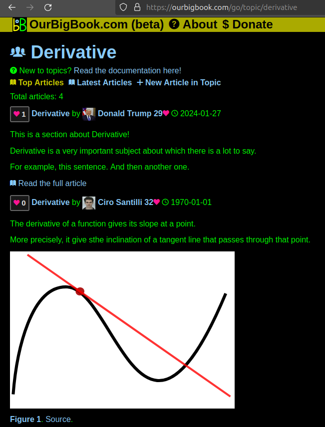
Figure 1. Screenshot of the "Derivative" topic page. View it live at: ourbigbook.com/go/topic/derivativeVideo 2. OurBigBook Web topics demo. Source. - local editing: you can store all your personal knowledge base content locally in a plaintext markup format that can be edited locally and published either:This way you can be sure that even if OurBigBook.com were to go down one day (which we have no plans to do as it is quite cheap to host!), your content will still be perfectly readable as a static site.
- to OurBigBook.com to get awesome multi-user features like topics and likes
- as HTML files to a static website, which you can host yourself for free on many external providers like GitHub Pages, and remain in full control

Figure 2. You can publish local OurBigBook lightweight markup files to either OurBigBook.com or as a static website.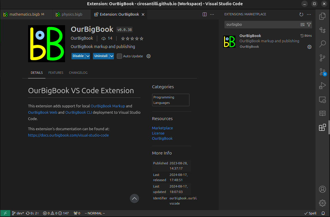
Figure 3. Visual Studio Code extension installation.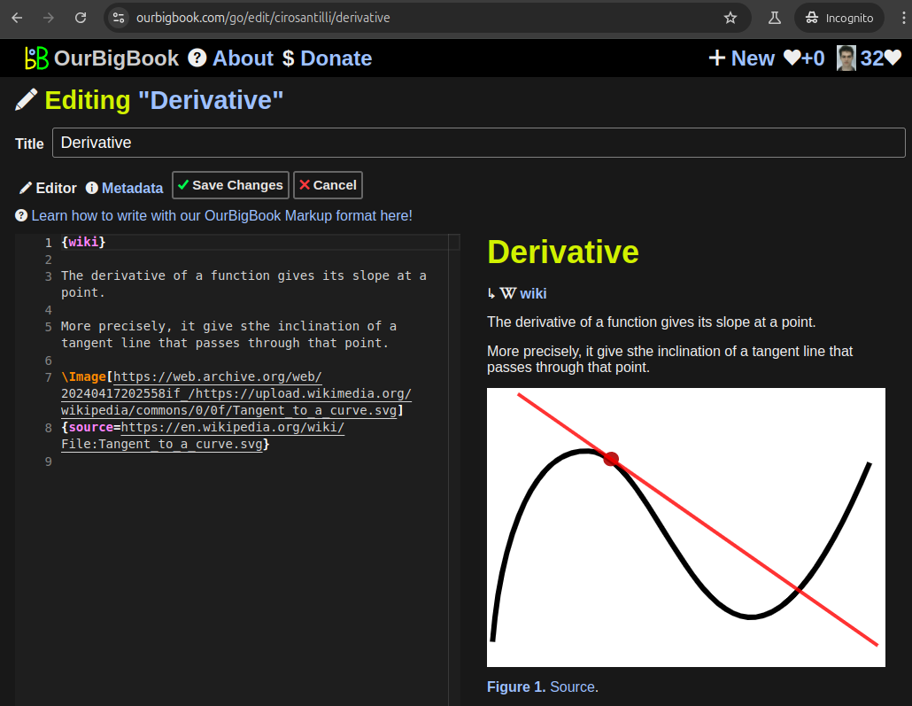
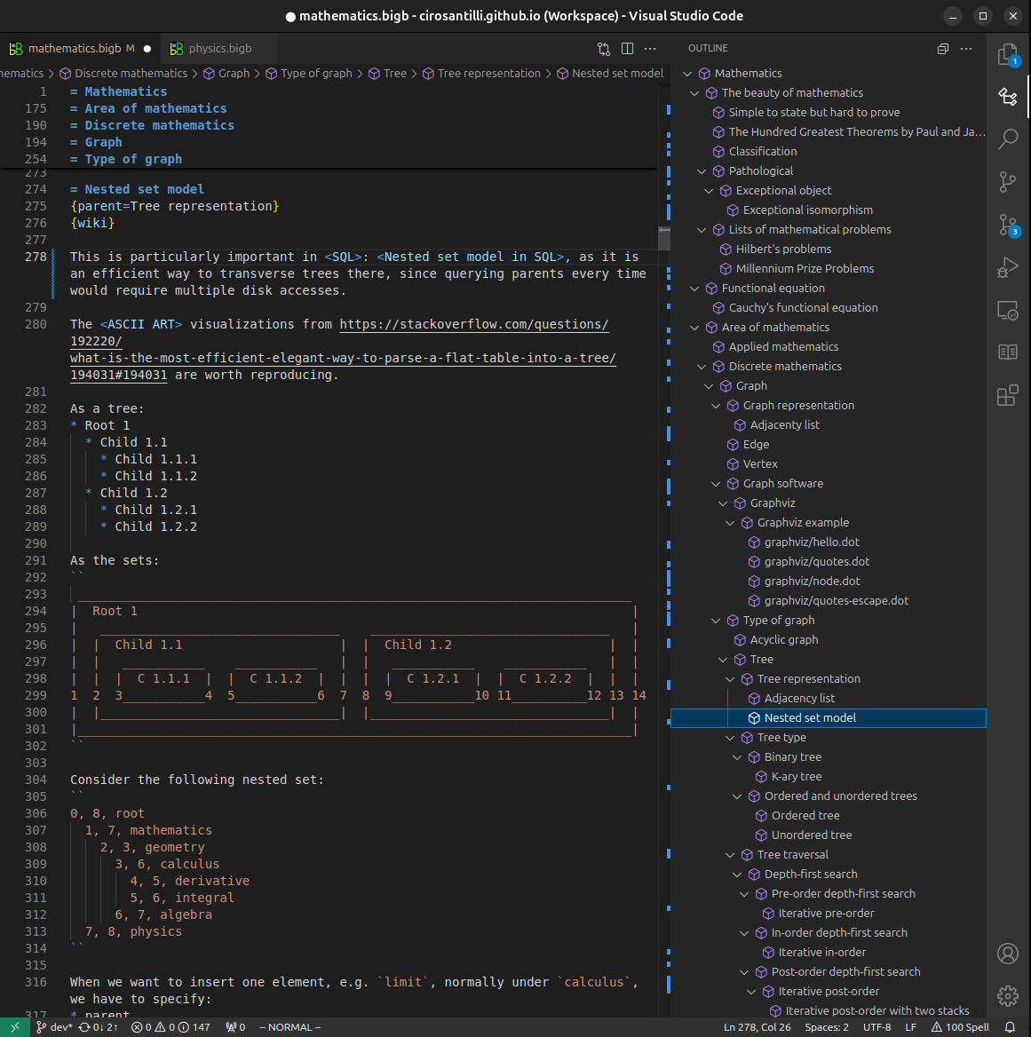
Figure 5. . You can also edit articles on the Web editor without installing anything locally. Video 3. Edit locally and publish demo. Source. This shows editing OurBigBook Markup and publishing it using the Visual Studio Code extension. 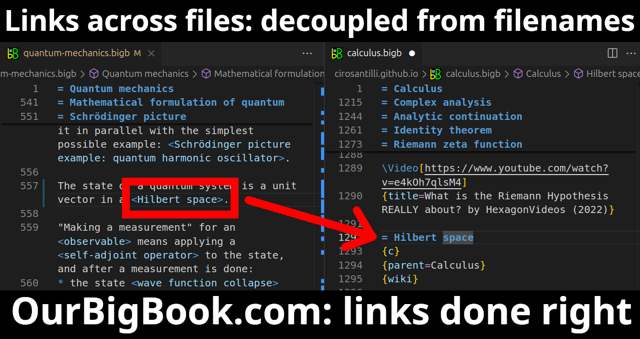
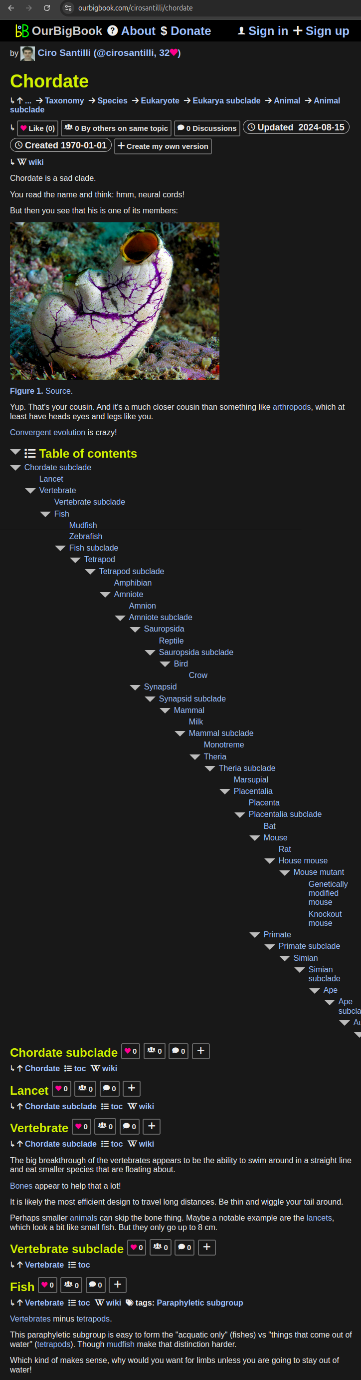
- Infinitely deep tables of contents:
All our software is open source and hosted at: github.com/ourbigbook/ourbigbook
Further documentation can be found at: docs.ourbigbook.com
Feel free to reach our to us for any help or suggestions: docs.ourbigbook.com/#contact